Parcel Fabric and Local Government Model - Data Migration Process
Explore the data migration process for Parcel Fabric in the Local Government Model, covering topics such as the WV Factor, geometry requirements, topology rules, staging data, and checking results for successful load. Understand the challenges, conversion factors, and tools essential for migrating data effectively to ensure accurate parcel management.

Download Presentation

Please find below an Image/Link to download the presentation.
The content on the website is provided AS IS for your information and personal use only. It may not be sold, licensed, or shared on other websites without obtaining consent from the author. Download presentation by click this link. If you encounter any issues during the download, it is possible that the publisher has removed the file from their server.
E N D
Presentation Transcript
Parcel Fabric and the Local Government Model September 2016 WV EPAN Conference
Topics to Cover Introduction 1. What is Parcel Fabric? 2. Migrating to Parcel Fabric 3. Advantages of using Parcel Fabric 4. Local Government Information Model 5.
What is Parcel Fabric ? Land Records Management System to maintain parcels and store associated information. Sets a standard model that can be used across all land records organizations. Part of the ESRI Local Government Information Model.
The WV Factor Recent conversions in Cabell and Monongalia Counties, both of approximately 50,000 parcels. Biggest Challenge of Parcel Fabric for WV is road Right-of-Ways and curves!
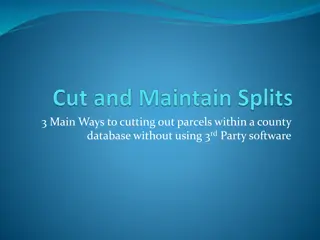
Data Migration Process lines to meet geometry requirements of the Parcel Fabric. Validate Parcel Fabric required topology rules. Stage your data for migration. Check results to correct parcels that may fail to load.
Data Migration Process lines using ESRI Curves and Lines tools. Convert mutli part curves to 2 point curves. Convert lines string curves to true curves. Reduce unnecessary vertices in line segments.
Data Migration Topology Rules for Migration Line Features must be covered by polygons Lines must not self-overlap Lines must not self intersect Lines must be single part Lines must not intersect or touch interior Polygons must be covered by lines
Data Migration Staging data for load to Parcel Fabric Give special consideration to attributes you want to bring into the Parcel Fabric. Migration of attributes is much easier when you match portions of your staging schema to that of the Parcel Fabric. However, avoid matching the schema exactly as this can cause problems with the load process.
Data Migration Check your results Some parcels WILL fail to load even with zero topology errors. Pay attention to load results and perform joins to ensure a complete migration. Use Check Fabric tool to run ESRI checks on the parcel fabric to identify possible errors.
Advantages of Parcel Fabric Polygons and Lines work together in a connected environment with built in topology. *To some extent Maintain an interactive history of change. Store original survey dimensions and geometry. ESRI supported tools, workflows, and applications. Use of control points and adjustments to improve accuracy.
Advantages of Parcel Fabric Built in topology in Parcel Fabric Polygons and lines work and move as one. Built in topology is not perfect. Consideration should be given to run an outside model checking for additional topology and geometry QC on a regular basis.
Advantages of Parcel Fabric Maintain History Best method to date for maintaining an archival and interactive history layer. Not only archives changes such as splits and combinations but also archives the legal date the change went into effect, date the change was made to the GIS, and the user who made the change. Can view history chronologically
Advantages of Parcel Fabric Store original survey information as entered from the legal document. Survey dimensions are stored even if a line must be altered to fit surrounding area. Can go back to original geometry by un-joining and re-joining the parcel.
Advantages of Parcel Fabric ESRI supported tools and workflows and apps. Tools for and processes specifically designed for to work within the parcel fabric. Parcel Editor Parcel Details Parcel Expolorer Parcel Workflows ESRI web map and application templates designed around the LGIM and Parcel Fabric
Advantages of Parcel Fabric Control and Adjustments Can better incorporate control points such as NGS monuments or other x,y locations and relate locations to parcel corners. Control can also be established from high confidence corners existing in data. Once control is established Least Squared Adjustments can be ran on those related parcels.
Local Government Information Model Database model designed to work across all matters of local government GIS related operations. Standardized database that can work for everyone. Works with a growing number of ESRI web services and applications. Makes it easier to share data across your organization and others.
Question and Answer Contact Me Tre Penegar 910-256-9892 tpenegar@atlasgeodata.com