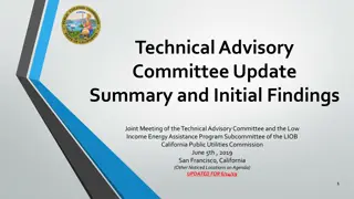
San Benito County Water District Groundwater Sustainability Agency Technical Advisory Committee Meeting Summary

The San Benito County Water District Groundwater Sustainability Agency Technical Advisory Committee met on August 26, 2020, to discuss various topics including update on GSP schedule, setting sustainability criteria, and monitoring for subsidence issues. The meeting highlighted the need for more systematic analysis and monitoring, especially in identifying areas prone to long-term subsidence. Ground surface vertical displacement, UNAVCO station data, and correlation between subsidence and groundwater levels were key points of discussion. Overall, the meeting emphasized the importance of continuous monitoring and management actions for sustainable groundwater use.
- Water District
- Groundwater Sustainability
- Technical Advisory Committee
- Meeting Summary
- San Benito County

Download Presentation

Please find below an Image/Link to download the presentation.
The content on the website is provided AS IS for your information and personal use only. It may not be sold, licensed, or shared on other websites without obtaining consent from the author. Download presentation by click this link. If you encounter any issues during the download, it is possible that the publisher has removed the file from their server.
E N D
Presentation Transcript
San Benito County Water District Groundwater Sustainability Agency Technical Advisory Committee Technical Advisory Committee August 26, 2020 2:00-4:00 Join Zoom Meeting Zoom Meeting https://zoom.us/j/92497853788?pwd=YnRVbU5MMWtvWWlRTkNQWXdmcjdRdz09 Meeting ID: 924 9785 3788 Passcode: 761145 Or, dial by your location: +1 669 900 9128 US (San Jose) Meeting ID: 924 9785 3788 Password: 761145 1
Agenda Agenda 1. 2. 3. Roll call Update on GSP Schedule and Progress Setting Sustainability Criteria for: Land Subsidence Depletion of Interconnected Surface Water Next steps for GSP Section 6, Sustainability Criteria Upcoming meetings 3. 4. 2
GSP Overview Adoption hearing Plan Development Draft GSP workshop Management Actions / Monitoring Round 3 Monitoring Wells MAR Evaluate actions workshop Management options workshop 2020 Sustainability Criteria TAC Meetings Sustainability criteria workshop Water Budget workshop Date TBA 2020 Management Areas / Water Budgets Hydrogeologic Conceptual Model / Groundwater 2019 GW Conditions workshop June 18 2019 Data Compilation / Data Management System Kickoff workshop Nov 14 2018 2018 Plan Area / Institutional Setting
Recap: Ground surface vertical displacement Recap: Ground surface vertical displacement from InSAR satellite from InSAR satellite Suggests differential subsidence Period of record is short Changes are relatively small Pattern is patchy More monitoring needed for systematic analysis to identify any specific areas that might be subject to long- term subsidence
Recap: UNAVCO stations track land surface Recap: UNAVCO stations track land surface changes around North San Benito changes around North San Benito 5
Monitoring for subsidence is needed Monitoring for subsidence is needed Seasonal elastic variability Linked to hydrologic conditions Long term small downward trend, about 2 inches over 15 years 6
Subsidence Subsidence correlated to correlated to groundwater groundwater levels levels 7
Minimum Threshold Minimum Threshold The Minimum Threshold for land subsidence is the rate and extent that interferes with surface land use Rate: a. Decline of more than 2 inches in any 5-year period b. Cumulative decline of more than 1 foot since 2015 (the SGMA start date) 8
Minimum Threshold Context Minimum Threshold Context One foot of elevation change: Is the freeboard typically required in drainage ditches Is the elevation that structures must be above the 100-year floodplain Would spread water an additional 1,800 feet out from the shoreline of San Felipe Lake and 2,400-2,900 feet out from either side of Miller Canal and sections of the Pajaro River during a flood event 9
Analysis of Analysis of InSAR information is InSAR information is needed to assess extent needed to assess extent Extent: InSAR mapping indicates ground surface changes 2015 to 2019 from about +0.1 feet to about -0.25 feet Error is about +/- 0.1 feet Annual download and screening of InSAR information Detailed analysis for Five-Year update 10
Measurable Objective Measurable Objective The Measurable Objective is to prevent subsidence. Management Action Management Action The management action is to maintain groundwater levels above historical lows; this should be achieved with the groundwater level Minimum Thresholds 11
Interconnected Surface Water and Interconnected Surface Water and Groundwater Dependent Ecosystems (GDEs) Groundwater Dependent Ecosystems (GDEs) 12
Where is groundwater Where is groundwater coupled to surface water? coupled to surface water? Hydraulically Coupled These are the textbook concepts, but how can you tell in practice? Decoupled 13
Well Water Levels are NOT the Water Table Vertical and horizontal water- level gradients are common near streams. DATA GAP: shallow monitoring wells in riparian areas are rare 14
Surface Water Depletion Impacts Downstream Flow and Water Rights GDEs Off-Channel Wetlands Seasonal Streams and Rivers Plants Animals (riparian vegetation) (fish, amphibians) Water Temperature Passage Flows
Downstream Water Users: PVWMA Downstream Water Users: PVWMA No significant impact on PVWMA supplies because: No plan to increase San Benito pumping San Benito needs outflow to maintain basin salt balance No impact of flow reduction when Pajaro River flows to the ocean. PVWMA planning studies do not place emphasis on Pajaro River flows. 16
Off-Channel Wetlands Nature Conservancy NCCAG map Many wetlands are not natural or not plausibly affected by pumping. This looks like a spring These look like stock ponds and have low habitat value
Riparian Vegetation Impacts For Stream Flow Depletion: Stream Bed Elevation For Riparian Vegetation: About 20 feet 18
Depth to Water <20 Feet in 1992 and 1998 October 1992 (end of drought) April 1998 (end of wet period) 19
The One Location The One Location where Tree Mortality where Tree Mortality was Found was Found Tres Tres Pinos Pinos Creek Creek Photo taken April 2019 Photo taken April 2019 New nearby well a possible New nearby well a possible contributing factor contributing factor 20
Little or No Observed Correlation between Water Levels and Vegetation Health 21
Little or No Observed Correlation between Water Levels and Vegetation Health 22
Impacts on Animals Impacts on Animals Focus on species of concern: Tiger salamander Red-legged frog Birds Steelhead trout--passage 23
Effects of Pumping on Pacheco Creek Flow Hypothetical 10% change in basin-wide pumping Simulated flow in Pacheco Creek above San Felipe Lake 24
San Benito River, June 1994 Steelhead Passage Opportunity: San Benito River 80 Paicines Valley 70 Simulated Monthly Flow (cfs) 60 Tres Pinos Cr Old Hwy 156 (San Juan Rd) 50 40 Flow profile for June 1994 Lucy Brown Rd 30 20 10 6 cfs difference in flow, but still dry near Lucy Brown Lane 0 0 10 20 30 40 50 60 Downstream Distance (miles) Future Baseline 10% Pumping Reduction 25
Definition of Minimum Threshold Definition of Minimum Threshold The Minimum Threshold for depletion of interconnected surface water is the amount of depletion associated with the lowest water levels during the 1987-1992 drought 26
Definition of Minimum Threshold, continued Definition of Minimum Threshold, continued Undesirable results if >25% of wells within 1 mile of a riparian reach have a static spring water level lower than lowest spring water level during 1987-1992. 27
Measurable Objective Measurable Objective The Measurable Objective is an amount of depletion that is less than the amount specified as the minimum threshold. 28
Future Baseline Simulation: Is Threshold Likely Future Baseline Simulation: Is Threshold Likely to be Exceeded? to be Exceeded? Only three of the 19 GDE compliance wells have simulated future baseline levels close to the MT: Two where levels are fairly constant (Paicines Valley and west end of San Juan Valley) One where future water levels similar to historical (near Casa de Fruta) 29
Management Actions if Threshold is Exceeded Management Actions if Threshold is Exceeded Recommended for consideration: Conservation easements to reduce ag pumping near critical riffle along San Benito River Decrease pumping near critical riffle along Pacheco Creek when flow recedes past minimum passage flow 30
Actions not Recommended at this Time Actions not Recommended at this Time Reoperate Hernandez Reservoir to increase releases in drought years Preferentially deliver CVP water to parcels near riparian areas during droughts Eradicate invasive vegetation Irrigate riparian vegetation that is on the verge of dying Groundwater recharge projects with habitat benefit in addition to water supply benefit 31
Next Steps Next Steps 1. Administrative Draft Section 6 will be sent to you for review and comment 2. We respond to comments, edit Admin Draft, prepare public Draft Topics for Next TAC meeting Monitoring Network Projects and Management Actions 32
Stay tuned Stay tuned SBCWD Board of Director s Meeting August 26, 2020 5:00pm Next TAC Meeting: Monitoring, Projects and Management Actions Public Workshop No. 3 Water Budget September ? 2020 TBA September 2020 33