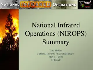
National Infrared Operations for Fire and Aviation Management

Infrared missions play a crucial role in fire operations, with four main mission areas identified: detection, large fire mapping, tactical incident awareness, and dashboard. The efforts to sustain National Infrared Operations in 2019 included a contract with five vendors providing surge capacity and deliverables such as NIROPS map products. The use of manned aircraft with commercial EO/IR systems and the regional IR platform for lower-priority fires were highlighted. The demand for NIROPS products and services is on the rise, calling for ways to increase capacity and sustain resources.

Download Presentation

Please find below an Image/Link to download the presentation.
The content on the website is provided AS IS for your information and personal use only. It may not be sold, licensed, or shared on other websites without obtaining consent from the author. Download presentation by click this link. If you encounter any issues during the download, it is possible that the publisher has removed the file from their server.
E N D
Presentation Transcript
National Infrared Operations USDA Forest Service Fire and Aviation Management
Infrared Missions for Fire Operations FAM-Operations has identified four mission areas IR is used: 1. Detection 2. Large Fire Mapping 3. Tactical Incident Awareness and Assessment 4. Dashboard Each mission has different requirements/capabilities. No silver bullet
Detection Mission Aircraft or satellite systems that can cover a large area Detect new fire starts (lightning and human caused) Early-warning to support rapid response and public safety Platforms Manned aircraft Ignition Point in EGP In addition to ground based detection systems
Detection Deliverables Lat/Long coordinates of new starts GIS-ready shapefiles Metadata Size up information Staffed or not Proximity to values Map perimeter if >10 acres Process to disseminate information
Large Fire Mapping Mission NIROPS fulfills the Large Fire Mapping mission Map 50-70 fires per night Nation-wide scope Provide pdf map, KMZ/KML, GIS-ready shapefiles, IRIN log NIROPS products and services are in high demand Demand is increasing 2 planes w/ AC3 surge: based on workload from the last decade Need ways to increase capacity Increase role of vendor aircraft (manned and unmanned) Sustain agency aircraft, sensors, and staffing
Efforts to Sustain NIROPS in 2019 2019 End Product Contract, July 2019 - July 2020 (Dec 2020 w/ 6 mos. Ext) Five vendors under BOA to provide surge capacity for NIROPS Deliverable: NIROPS map products to FTP site Manned aircraft w/ commercial step-stare EO/IR systems Assigned to cluster of fires in a 500 mile area Limited opportunity in 2019 to exercise all vendors Other IR Contracts: R4 IR Mapping Contract (2016-2021) Used in GB for lower priority timber fires (night) or desert fires (day time) Used as a regional IR platform (GACC ordered/assigned) Deliverables: NIROPS-like map products to FTP site Camera-ball system ~10,000 acres per hour
Sustaining NIROPS (Aircraft) Short Term (2019-2020): 2019 evaluated vendor capability to provide NIROPS-like service and products End Product and CWN contracts Market research of current gen technology Mix of aircraft capabilities and sensors National vs Regional model EPC vs EU Longer Term (2020-2025): Maintain organic capability Aircraft modernization Aircraft replacement schedule N149Z replacement Sensor modernization Re-engineer Phoenix miniaturize and automate or- Convert to commercial system Future role of vendors
Sustaining NIROPS (Satellites) National Systems: Agreements in place for surge capacity Analyst support is limiting factor Options? Additional analysts from partner agencies Considered surge, not primary Renew MOU for 2020-2025 Commercial / HDDS Systems: 2018-2019 evaluated use commercial imagery via HDDS sat systems for fire mapping Some commercial systems capable of providing hi-fidelity imagery Issues: Limited coverage Difficult to task satellites 12-24 hr latency Requires additional post-processing
Tactical Incident Awareness and Assessment Some fires have a need for additional imagery to support tactical operations Monitoring impingement of MAPS or trigger points Spot fire detection in real-time Provide over-watch of ground operations in reduced visibility or inversions Inform mop-up or amount of residual risk Provide real-time Situational Awareness Day and Night Deliverables FMV or live-stream imagery to ICP and/or ground personnel NIROPS-like map products
Tactical IAA Mission Tactical IAA and NIROPS are different missions Different missions, different requirements/capabilities (some overlap) Tactical IAA is more real-time application Persistent or Periodic Coverage Persistent: One platform assigned to one incident Large UAS or short-range manned aircraft Periodic: One platform that can be assigned to multiple incidents Manned aircraft (speed and range)
Right Tool for the Job Different missions, requirements/capabilities, and tools Goal is to select the right tool for the job Platform and sensor Products and delivery time frames Cost Minimize duplication of effort Get the end user what they need to accomplish their objectives
Example 1 Active Large Fire: Containment objective not met Fire actively spreading and increasing in size Primary control objectives are to contain/control the fire to protect Values at Risk (VAR) Products Needed: PDF map of perimeter and areas of intense/scattered/isolated heat GIS-ready shapefiles, KMZ/KML, IRIN Log Once per night is acceptable Recommend: NIROPS
Example 2 Very Active Large Fire, in close proximity to community(s): Containment objective not met Fire actively spreading and increasing in size Additional daytime updates needed to monitor spread Products Needed: PDF map of perimeter and areas of intense/scattered/isolated heat GIS-ready shapefiles, KMZ/KML, IRIN Log Persistent or Periodic coverage needed Recommend: NIROPS for night time updates Manned AC w/ EO/IR camera ball for periodic daytime updates / over watch Large UAS for persistent coverage (may eliminate need for NIROPS)
Example 3 Large Fire, not active: Containment objective close to being met Forward movement of fire has been halted Minimal spread or increase in size Primary operation is mop-up Products Needed: PDF map showing areas of residual heat GIS-ready shapefiles, KMZ/KML, IRIN Log Entire fire does not need to be mapped Recommend: IAA platform equipped with EO/IR camera ball Specify areas of interest for scanning (i.e. Div W, or hillside above XYZ subdivision)
Example 4 Large Fire, light fuels: IR sensors can only map detectable heat Fires in light fuels often have portions of cold black that are hard to distinguish at night Products Needed: PDF map of fire s perimeter, showing areas of intense/scattered/isolated heat GIS-ready shapefiles, KMZ/KML, IRIN Log Recommend: IAA platform equipped with EO/IR system, pre-dusk flight EO camera can distinguish cold black and assist with more accurate perimeter map
Example 5 Small Fire (<1,000 acres timber, <10,000 acres light fuels): Isolated fire or low activity in rest of GACC During busy season, small fires may be low priority NIROPS AC may be busy in other GACCs However fire is still actively spreading and containment objectives are not met Products Needed: PDF map of fire s perimeter, showing areas of intense/scattered/isolated heat GIS-ready shapefiles, KMZ/KML, IRIN Log Recommend: IAA platform equipped with EO/IR camera-ball More efficient if there are other fires within 200-300 miles
Example 6 Detection Post Lightning Storm Lightning data or forecast indicates widespread lightning event Concern of locating fires or hold-overs Products Needed: Day or night scan of affected area GIS-ready shapefiles (points) of new fires Basic size-up information (metadata) Perimeter if >10 acres Recommend: IAA platform equipped with EO/IR camera ball as day or night flight Size of area may dictate type of aircraft Identify single POC for dissemination


")
")