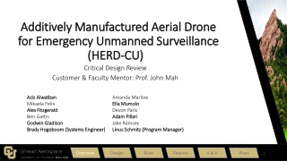
UWB Use Cases for Unmanned Aircraft Systems
May 2021
Card, individual
Slide 1
Project: IEEE P802.15 Working Group for Wireless Personal Area Networks (WPANs)
Project: IEEE P802.15 Working Group for Wireless Personal Area Networks (WPANs)
Submission Title:
[Some
UAS Use Cases
for
UWB
]
Date Submitted:
[
12 May, 2021
]
Source:
[
Stuart W. Card
] Company [multiple affiliations, this submission made individually]
Address [7417 S. Main Street, P.O. Box 61, Newport NY 13416 USA]
Voice:[+1 315-845-6249], FAX: [+1 315-845-6255], E-Mail:[stu.card@critical.com]
Re:
[revision of
15-21-0170-00-nuwb response to
Call for Contributions - IG UWB-NG, 5 March 2021]
Abstract:
[A brief introduction to some Unmanned Aircraft System (UAS) use cases for UWB]
Purpose:
[Consider UAS use cases in scoping NG-UWB and/or NS-UWB.]
Notice:
This document has been prepared to assist the IEEE P802.15. It is offered as a basis for
discussion and is not binding on the contributing individual(s) or organization(s). The material in this
document is subject to change in form and content after further study. The contributor(s) reserve(s) the right
to add, amend or withdraw material contained herein.
Release:
The contributor acknowledges and accepts that this contribution becomes the property of IEEE
and may be made publicly available by P802.15.
May 2021
Card, individual
Slide 2
Some Unmanned Aircraft System (UAS)
Use Cases for UWB
A hasty introduction to an
incomplete list of maybes, now
w/some guesses at requirements
May 2021
Card, individual
Slide 3
Potential UWB applications to UAS
(“drones”)
Indoor & Outdoor (latter more challenging):
•
Remote Identification & tracking (UAS RID)
•
Self-Separation & Collision Avoidance
•
Positioning, Navigation & Landing
–
Adjunct to GNSS for greater precision
–
Alternative when/where GNSS unavailable
•
Command & Control (C2)
•
Telemetry
May 2021
Card, individual
Slide 4
Remote Identification & tracking (UAS RID)
•
Mandated by Civil Aviation Authorities’ performance based rules
–
European Union Aviation Safety Agency (EASA), “Commission Delegated
Regulation (EU) 2020/1058...”
https://eur-lex.europa.eu/legal-
content/EN/TXT/?uri=CELEX%3A32020R1058
–
Federal Aviation Administration, “Remote Identification of Unmanned
Aircraft”
https://www.federalregister.gov/documents/2021/01/15/2020-
28948/remote-identification-of-unmanned-aircraft
•
Industry consensus technical standards
–
Primarily ASTM International F3411-19 “Standard Specification for Remote
ID and Tracking”
http://www.astm.org/cgi-bin/resolver.cgi?F3411
•
Currently Bluetooth & WiFi Aware/NAN (need >273m range)
–
Preferably 628 meters, see next use case for why
•
All data inc. position self-reported (~150 payload bytes/sec./UA)
•
Authentication optional & largely TBD
–
IETF Drone Remote Identification Protocol (DRIP)
https://datatracker.ietf.org/wg/drip
Ranging between UA & observer device could help
May 2021
Card, individual
Slide 5
Self-Separation & Collision Avoidance
•
Expected to be mandated by CAAs, also operator self-interest
–
Self-Separation is coordinating to stay “well clear”, avoiding risk of collision:
Sense And Avoid (SAA) now Detect And Avoid (DAA), w/ & w/o ground help
•
UWB almost certainly can’t achieve necessary range to coordinate staying well clear
–
When Self-Separation fails, Collision Avoidance initiates urgent maneuver
•
if well clear is violated, not only CA but also RID would be very useful (see previous use case)
–
RID or coordinated CA at edge of well clear implies a slant range of 628m
–
May include UAS avoiding collisions w/structures, trees, etc.
•
Industry consensus technical standards
–
RTCA, EUROCAE,
et al
•
Manned mature (e.g., TCAS), UAS emerging (e.g., ACAS X
u
)
•
Currently narrowband aviation spectrum
Ranging between UA & other aircraft could help
Precise positioning
could help avoid
known fixed obstacles
May 2021
Card, individual
Slide 6
Positioning, Navigation & Landing
•
Intrinsic to flight operations
•
No standards for small UAS at low altitudes – vendor innovation
•
Urban Air Mobility (UAM) / Advanced Air Mobility (AAM) will
transport humans (still no pilot onboard) in densely occupied
airspace volumes over other humans, so regulations likely
•
Currently based on [GIS terrain & structure data plus]
–
GNSS (dominates)
–
Radar (only on larger UA), lidar, optical machine vision
–
Laser or acoustic height finders
–
Magnetic compass (rare)
•
Dedicated spaces emerging (flying club parks, nets, indoors)
•
UAM expected to be based largely on many small “vertiports”
•
Small UAS hangar sorties suggest a required range of ~100m
Precise positioning obviously
could help greatly, especially with
[automatic] landing (I have watched landings w/height errors of
less than a meter wreck small multicopters)
May 2021
Card, individual
Slide 7
Command & Control (C2) and Telemetry
•
C2 intrinsic to flight operations, telemetry also very common
•
Some
de facto
protocol standards (e.g., MAVLink)
•
Currently uses mostly ISM & NII bands
–
incl. 433 MHz which is Amateur in US but much used illegally for long range
–
typically C2 on 915 or 2400 MHz & video streaming on 5 GHz
–
ranging (w/minimal data) to max usable 5 GHz 802.11 HD stream range?
•
UA “fly-away”, often causing loss of or damage to aircraft,
potentially causing harm to others, usually due to losing C2 link
Ranging between UA and Ground Control Station (GCS) could
help avoid exceeding C2 link & regulatory operating range limits
Ranging also provides context for telemetry
Interoperation with IEEE 1588 Precision Time Protocol (PTPv2)
would add value to telemetry, C2 & other apps by synchronizing
link layer clocks with network provided global consensus time
May 2021
Card, individual
Slide 8
Indoor/Outdoor issues
•
restrictions on use of UWB aboard aircraft
–
Regulatory relief likely for UAS, especially if not carrying human passengers
•
restrictions on use of UWB outdoors
–
Regulatory relief likely depends on demonstrating non-interference
•
What is “indoors” (to agencies such as the FAA & FCC)?
–
In a 90 dB Faraday cage?
–
In a typical metal roofed & sided aircraft hangar?
–
In a typical wood frame structure with many windows?
–
Under a pavilion? Inside a net? At a dedicated UAS flying park?
•
Operations may involve takeoff inside a GNSS-starved hangar,
exit, GNSS-enabled outdoor flight, hangar re-entry & landing.
•
Oneida County, at Griffiss International Airport (formerly AFB),
as an extension of the New York UAS Test Site, is constructing
a SkyDome facility for experimentation & testing w/all the above.
Despite hurdles, let’s scope UWB-NG for at least some of these.
May 2021
Card, individual
Slide 9
Initial Answers to some of Ben’s Questions
•
Range: depending on use case, 100 – 628 meter 3D slant range
•
#: in that range of center of “hockey puck” (w/ground below & no
emitting UA above) < (30 UA + 30 Ground Control Stations)
•
Data volume requirements: negligible
–
Maximum Transmission Unit (MTU) >225 B would avoid fragmentation
–
1 – 10 frames/second assuming no fragmentation
–
Multiplying these, under 20 kbps/node, under 660 kbps total in footprint
•
Latency: E2E mean <200 mS, prefer <100 mS (jitter irrelevant)
•
Reliability: high frame loss rates are tolerable if no fragmentation
•
Dynamics: depending on use case,1-10 position updates / sec.
•
Energy:
power
is no problem
iff
running from propulsion battery;
but
energy
is flight time thus range; recharge between flights
•
Topology: flat peer to peer LAN, sometimes w/Internet gateway
•
Timing/synch: error
vs
GNSS time < position update interval
•
Colocated radios: GNSS, Bluetooth, 802.11, 915 MHz, 433 MHz
Briefly introducing potential use cases of Ultra-Wideband (UWB) technology in Unmanned Aircraft Systems (UAS), focusing on applications like Remote Identification & tracking, Self-Separation & Collision Avoidance, Positioning, Navigation, Landing, and more. Exploring how UWB can enhance UAS operations in both indoor and outdoor settings.

Download Presentation

Please find below an Image/Link to download the presentation.
The content on the website is provided AS IS for your information and personal use only. It may not be sold, licensed, or shared on other websites without obtaining consent from the author.If you encounter any issues during the download, it is possible that the publisher has removed the file from their server.
You are allowed to download the files provided on this website for personal or commercial use, subject to the condition that they are used lawfully. All files are the property of their respective owners.
The content on the website is provided AS IS for your information and personal use only. It may not be sold, licensed, or shared on other websites without obtaining consent from the author.
E N D
Presentation Transcript
May 2021 Project: IEEE P802.15 Working Group for Wireless Personal Area Networks (WPANs) doc.: IEEE 802.15-21-0272-01-04ab Submission Title: [Some UAS Use Cases for UWB] Date Submitted: [12 May, 2021] Source: [Stuart W. Card] Company [multiple affiliations, this submission made individually] Address [7417 S. Main Street, P.O. Box 61, Newport NY 13416 USA] Voice:[+1 315-845-6249], FAX: [+1 315-845-6255], E-Mail:[stu.card@critical.com] Re: [revision of 15-21-0170-00-nuwb response to Call for Contributions - IG UWB-NG, 5 March 2021] Abstract: [A brief introduction to some Unmanned Aircraft System (UAS) use cases for UWB] Purpose: [Consider UAS use cases in scoping NG-UWB and/or NS-UWB.] Notice: This document has been prepared to assist the IEEE P802.15. It is offered as a basis for discussion and is not binding on the contributing individual(s) or organization(s). The material in this document is subject to change in form and content after further study. The contributor(s) reserve(s) the right to add, amend or withdraw material contained herein. Release: The contributor acknowledges and accepts that this contribution becomes the property of IEEE and may be made publicly available by P802.15. Submission Slide 1 Card, individual
May 2021 doc.: IEEE 802.15-21-0272-01-04ab Some Unmanned Aircraft System (UAS) Use Cases for UWB A hasty introduction to an incomplete list of maybes, now w/some guesses at requirements Submission Slide 2 Card, individual
May 2021 doc.: IEEE 802.15-21-0272-01-04ab Potential UWB applications to UAS ( drones ) Indoor & Outdoor (latter more challenging): Remote Identification & tracking (UAS RID) Self-Separation & Collision Avoidance Positioning, Navigation & Landing Adjunct to GNSS for greater precision Alternative when/where GNSS unavailable Command & Control (C2) Telemetry Submission Slide 3 Card, individual
May 2021 doc.: IEEE 802.15-21-0272-01-04ab Remote Identification & tracking (UAS RID) Mandated by Civil Aviation Authorities performance based rules European Union Aviation Safety Agency (EASA), Commission Delegated Regulation (EU) 2020/1058... https://eur-lex.europa.eu/legal- content/EN/TXT/?uri=CELEX%3A32020R1058 Federal Aviation Administration, Remote Identification of Unmanned Aircraft https://www.federalregister.gov/documents/2021/01/15/2020- 28948/remote-identification-of-unmanned-aircraft Industry consensus technical standards Primarily ASTM International F3411-19 Standard Specification for Remote ID and Tracking http://www.astm.org/cgi-bin/resolver.cgi?F3411 Currently Bluetooth & WiFi Aware/NAN (need >273m range) Preferably 628 meters, see next use case for why All data inc. position self-reported (~150 payload bytes/sec./UA) Authentication optional & largely TBD IETF Drone Remote Identification Protocol (DRIP) https://datatracker.ietf.org/wg/drip Ranging between UA & observer device could help Submission Slide 4 Card, individual
May 2021 doc.: IEEE 802.15-21-0272-01-04ab Self-Separation & Collision Avoidance Expected to be mandated by CAAs, also operator self-interest Self-Separation is coordinating to stay well clear , avoiding risk of collision: Sense And Avoid (SAA) now Detect And Avoid (DAA), w/ & w/o ground help UWB almost certainly can t achieve necessary range to coordinate staying well clear When Self-Separation fails, Collision Avoidance initiates urgent maneuver if well clear is violated, not only CA but also RID would be very useful (see previous use case) RID or coordinated CA at edge of well clear implies a slant range of 628m May include UAS avoiding collisions w/structures, trees, etc. Industry consensus technical standards RTCA, EUROCAE, et al Manned mature (e.g., TCAS), UAS emerging (e.g., ACAS Xu) Currently narrowband aviation spectrum Ranging between UA & other aircraft could help Precise positioning could help avoid known fixed obstacles Submission Slide 5 Card, individual
May 2021 doc.: IEEE 802.15-21-0272-01-04ab Positioning, Navigation & Landing Intrinsic to flight operations No standards for small UAS at low altitudes vendor innovation Urban Air Mobility (UAM) / Advanced Air Mobility (AAM) will transport humans (still no pilot onboard) in densely occupied airspace volumes over other humans, so regulations likely Currently based on [GIS terrain & structure data plus] GNSS (dominates) Radar (only on larger UA), lidar, optical machine vision Laser or acoustic height finders Magnetic compass (rare) Dedicated spaces emerging (flying club parks, nets, indoors) UAM expected to be based largely on many small vertiports Small UAS hangar sorties suggest a required range of ~100m Precise positioning obviously could help greatly, especially with [automatic] landing (I have watched landings w/height errors of less than a meter wreck small multicopters) Submission Slide 6 Card, individual
May 2021 doc.: IEEE 802.15-21-0272-01-04ab Command & Control (C2) and Telemetry C2 intrinsic to flight operations, telemetry also very common Some de facto protocol standards (e.g., MAVLink) Currently uses mostly ISM & NII bands incl. 433 MHz which is Amateur in US but much used illegally for long range typically C2 on 915 or 2400 MHz & video streaming on 5 GHz ranging (w/minimal data) to max usable 5 GHz 802.11 HD stream range? UA fly-away , often causing loss of or damage to aircraft, potentially causing harm to others, usually due to losing C2 link Ranging between UA and Ground Control Station (GCS) could help avoid exceeding C2 link & regulatory operating range limits Ranging also provides context for telemetry Interoperation with IEEE 1588 Precision Time Protocol (PTPv2) would add value to telemetry, C2 & other apps by synchronizing link layer clocks with network provided global consensus time Submission Slide 7 Card, individual
May 2021 doc.: IEEE 802.15-21-0272-01-04ab Indoor/Outdoor issues restrictions on use of UWB aboard aircraft Regulatory relief likely for UAS, especially if not carrying human passengers restrictions on use of UWB outdoors Regulatory relief likely depends on demonstrating non-interference What is indoors (to agencies such as the FAA & FCC)? In a 90 dB Faraday cage? In a typical metal roofed & sided aircraft hangar? In a typical wood frame structure with many windows? Under a pavilion? Inside a net? At a dedicated UAS flying park? Operations may involve takeoff inside a GNSS-starved hangar, exit, GNSS-enabled outdoor flight, hangar re-entry & landing. Oneida County, at Griffiss International Airport (formerly AFB), as an extension of the New York UAS Test Site, is constructing a SkyDome facility for experimentation & testing w/all the above. Despite hurdles, let s scope UWB-NG for at least some of these. Submission Slide 8 Card, individual
May 2021 Initial Answers to some of Ben s Questions Range: depending on use case, 100 628 meter 3D slant range #: in that range of center of hockey puck (w/ground below & no emitting UA above) < (30 UA + 30 Ground Control Stations) Data volume requirements: negligible Maximum Transmission Unit (MTU) >225 B would avoid fragmentation 1 10 frames/second assuming no fragmentation Multiplying these, under 20 kbps/node, under 660 kbps total in footprint Latency: E2E mean <200 mS, prefer <100 mS (jitter irrelevant) Reliability: high frame loss rates are tolerable if no fragmentation Dynamics: depending on use case,1-10 position updates / sec. Energy: power is no problem iff running from propulsion battery; but energy is flight time thus range; recharge between flights Topology: flat peer to peer LAN, sometimes w/Internet gateway Timing/synch: error vs GNSS time < position update interval Colocated radios: GNSS, Bluetooth, 802.11, 915 MHz, 433 MHz doc.: IEEE 802.15-21-0272-01-04ab Submission Slide 9 Card, individual