Twelfth Year Update on Soil Monitoring Study
Researchers from various institutions have been conducting a 200-year soil monitoring study since 2002 in different sites associated with the Vermont Monitoring Cooperative (VMC). The project aims to establish plots, sample at various intervals, analyze baseline values, and protect plots for future monitoring. The study has focused on sites like Mt. Mansfield Ranch Brook, Mt. Mansfield Forehead, Mt. Mansfield Underhill State Forest, Lye Brook Road, and Lye Brook Trail. Sampling schemes have evolved over the years, with attention to specific horizons and depth increments. Images of plot plans and sampling locations are provided for better visualization.
Download Presentation

Please find below an Image/Link to download the presentation.
The content on the website is provided AS IS for your information and personal use only. It may not be sold, licensed, or shared on other websites without obtaining consent from the author. Download presentation by click this link. If you encounter any issues during the download, it is possible that the publisher has removed the file from their server.
E N D
Presentation Transcript
Twelfth-Year Update on a 200-yr Soil Monitoring Study Don Ross, University of Vermont Thom Villars, USDA NRCS Scott Bailey, USFS Northern Res. Sta. Nancy Burt, Angie Quintana-Jones, USFS Sandy Wilmot, Vermont Dept. of Forest, Parks and Recreation Deane Wang, University of Vermont Jamie Shanley, USGS
Project Goals: 1. Establish five 50 x 50 m relatively uniform plots in sites associated with the VMC. 2. Sample plots at 0, 5, 10, 20, 50, 100, 150 and 200 years. Year 0 = 2002 3. Archive samples for later comparisons. 4. Analyze initial samples to determine baseline values. 5. Protect the plots for future monitoring.
Sites: Mt. Mansfield Ranch Brook northern hardwood Mt. Mansfield Forehead high elevation spruce/fir Mt. Mansfield Underhill State Forest transitional SCAN site Lye Brook Road northern hardwood SCAN site Lye Brook Trail transitional
Mansfield Forehead 50 m NW NE 5m A typical plot plan. 91 92 93 94 95 96 97 98 99 100 84 81 82 83 85 86 87 88 89 90 77 71 72 73 74 75 76 78 79 80 Plots with red numbers were sampled in 2002 (Year 0). 62 61 63 64 65 66 67 68 69 70 50 m 51 52 53 54 55 56 57 58 59 60 45 48 41 42 43 44 46 47 49 50 33 40 31 32 34 35 36 37 38 39 26 21 22 23 24 25 27 28 29 30 20 11 12 13 14 15 16 17 18 19 5 SW SE 1 2 3 4 6 7 8 9 10
Sampling Scheme 2002: All samples taken by horizon (no depth increments) 2007, 2012: 4 large samples from each pit Litter layer (Oi) Oa or A (near-surface humified horizon) Top 10 cm of B horizon 60-70 cm (usually C horizon) (Also small samples of each genetic horizon)
Ranch Brook 2002
Samples taken by horizon Horizon Oi Oi/Oe Oe Oa A E B BC C Total 2002 - - - 49 22 30 91 12 - 204 2007 39 9 36 48 21 30 129 - 28 340 2012 50 48 48 25 32 126 42 371 Samples taken by horizon or depth increment Sample type Oi/Oe Oa or A A E top 10 cm of B 60-70 cm Total 2007 50 50 - 8 44 40 192 2012 50 50 2 9 46 40 197
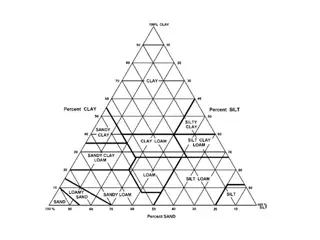
60-70 cm particle size from 2012 (only one sample from Forehead) All averages are fine sandy loam Clay % 1.6 2.9 5.6 5.8 7.3 Silt % 43.1 42.7 35.1 36.1 32.9 Sand % 55.3 54.4 59.3 58.1 59.8 LT LR RB PD FH
60-70 cm total elemental analysis 2012 (only one sample from Forehead) Ca Fe P Mn Sr Ti mg/kg 14572 16148 5684 5416 4105 mg/kg 21482 24658 38579 38980 50681 mg/kg 357 154 751 523 624 mg/kg 345 461 920 961 1399 mg/kg 311 337 110 110 90 mg/kg 3198 2963 6525 5739 6263 Lye Trail Lye Road Ranch Brk PolkaDot Forehead
Ranch exchangeable Ca in the uppermost B horizon red = 2002, blue = 2007, green = 2012 0.45 1.50 1.85 91 92 94 95 96 98 99 3.71 3.69 81 82 83 84 85 86 89 90 0.74 71 72 73 74 76 77 78 79 80 0.31 0.34 2.46 3.01 1.51 0.78 61 63 69 70 N 0.74 51 53 54 55 56 57 58 59 60 0.41 1.51 3.45 41 43 44 45 46 47 48 0.37 0.31 0.33 0.34 32 34 37 38 39 40 2.66 2.98 21 22 23 24 25 26 28 29 0.55 0.72 1.76 0.44 0.93 11 14 15 16 19 0.46 1.31 0.70 2 3 5 7 8 9 10
Challenges facing the project: Separating natural soil variation from actual long-term changes Developing a permanent archive plan Funding for lab work and unsupported personnel costs 200 years??? - Institutionalizing the program into agencies and passing on the project to a new generation of scientists
Power analysis Lye Road B 0-10 cm Exchangeable Ca cmolc/kg 0.114 0.118 0.119 0.157 0.140 0.118 0.160 0.179 0.184 0.216 n 10 std dev mean difference to detect P 0.05 P 0.10 0.0348 0.150 0.071 0.060
(Almost) everyone involved in 2012: Ashley Walker, UVM Ben Dillner, Vermont Forest, Parks and Rec Charlotte Ford, UVM Courtney Dyche, UVM Dana Andrews, UVM Deane Wang, UVM Don Ross, UVM Doug Morin, UVM Emily Piche, UVM Meghan Knowles, UVM Nancy Burt, US Forest Service Noah Ahles, UVM Rebecca Bourgault, UVM Ryan Melnichuk, UVM Ryan Morra, UVM Sandy Wilmot, Vermont Forest, Parks and Rec Scott Bailey, US Forest Service Thom Villars, NRCS Vermont Youth Conservation Corp Funding generousy provided by VMC and Green Mountain and Finger Lakes National Forests Thanks Carl Waite and Nancy Burt!
