Robust Real-time Multi-vehicle Collaboration on Asynchronous Sensors
A robust and real-time multi-vehicle collaboration system for asynchronous sensor data, addressing the synchronization problem and inaccurate blind spot estimation. The system leverages prediction algorithms for synchronization and enables on-demand data sharing for accurate blind spot estimation.

Download Presentation

Please find below an Image/Link to download the presentation.
The content on the website is provided AS IS for your information and personal use only. It may not be sold, licensed, or shared on other websites without obtaining consent from the author.If you encounter any issues during the download, it is possible that the publisher has removed the file from their server.
You are allowed to download the files provided on this website for personal or commercial use, subject to the condition that they are used lawfully. All files are the property of their respective owners.
The content on the website is provided AS IS for your information and personal use only. It may not be sold, licensed, or shared on other websites without obtaining consent from the author.
E N D
Presentation Transcript
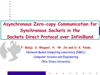
Robust Real-time Multi-vehicle Collaboration on Asynchronous Sensors Qingzhao Zhang *, Xumiao Zhang *, Ruiyang Zhu *, Fan Bai , Mohammad Naserian , Z. Morley Mao (*equal contributions) University of Michigan General Motors Oct. 3, 2023
Why cooperative perception? Limited sensing on occluded or far-away objects Occluded pedestrian Far-away obstacles 2
Motivation 1: synchronization problem In multi-vehicle collaboration, the LiDAR images to be merged is not captured on the same timestamp. Consumer is the vehicle receiving LiDAR data; provider is the vehicle providing LiDAR data. 3
Motivation 2: inaccurate blind spot estimation Existing systems trend to share sensor data about blind spots only. However, inaccurate blind spot estimation compromise the sharing efficiency e.g., AutoCast[1]estimate blind spots based on observed objects and naive ray casting. [1] Qiu, Hang, et al. "AutoCast: scalable infrastructure-less cooperative perception for distributed collaborative driving." Proceedings of the 20th Annual International Conference on Mobile Systems, Applications and Services. 2022. 4
Overview Q: Synchronization problem? A: Prediction Leverage prediction algorithms to synchronize LiDAR point clouds. Q: Accurate blind spot estimation? A: On-demand data sharing Let consumers proactively request data they need. 5
For all CAVs, share occupancy maps The map labels occupied, free, and occluded areas 6
For consumers, prepare data requests Make a plan of data sharing for the next LiDAR cycle i.e., which producer share which area Occupancy map prediction Producers occupancy maps Synced Data requests for next frame Data scheduling occupancy maps Local occupancy map Occupancy map prediction Occlusion-aware 7
For producers, share requested data Share the latest point cloud on the requested areas, and synchronize the point clouds to the requested timestamp. List of areas and a timestamp Data request Point cloud prediction Synced LiDAR point cloud LiDAR point cloud 8
Execute all processes in parallel Compared with single-CAV perception, the only delay is from data fusion. 9
RAO Perception Benefits and performance RAO achieves the best perception accuracy compared with EMP[1]and AutoCast[2]. We used various simulated and real-world datasets, We used PointPillars as the perception model. [1] Zhang, Xumiao, et al. "Emp: Edge-assisted multi-vehicle perception." Proceedings of the 27th Annual International Conference on Mobile Computing and Networking. 2021. [2] Qiu, Hang, et al. "AutoCast: scalable infrastructure-less cooperative perception for distributed collaborative driving." Proceedings of the 20th Annual International Conference on Mobile Systems, Applications and Services. 2022. 10
System Overhead - Latency & Data Volume The total avg latency of all the modules is 80.82 ms (14.40 ms variance) RAO can process LiDAR at regular full frame rate of 10 FPS RAO incurs similar data overhead compared to the STOA approach 11
Summary RAO is a real-time occlusion-aware cooperative perception system running on asynchronous sensors. RAO tackles two problems in existing cooperative perception. Use prediction methods to mitigate sensor asynchronization. Use on-demand data sharing to optimize data scheduling. Thank You! 12