Real-Time Mesoscale Analysis: Enhancements and Future Plans
 undefined


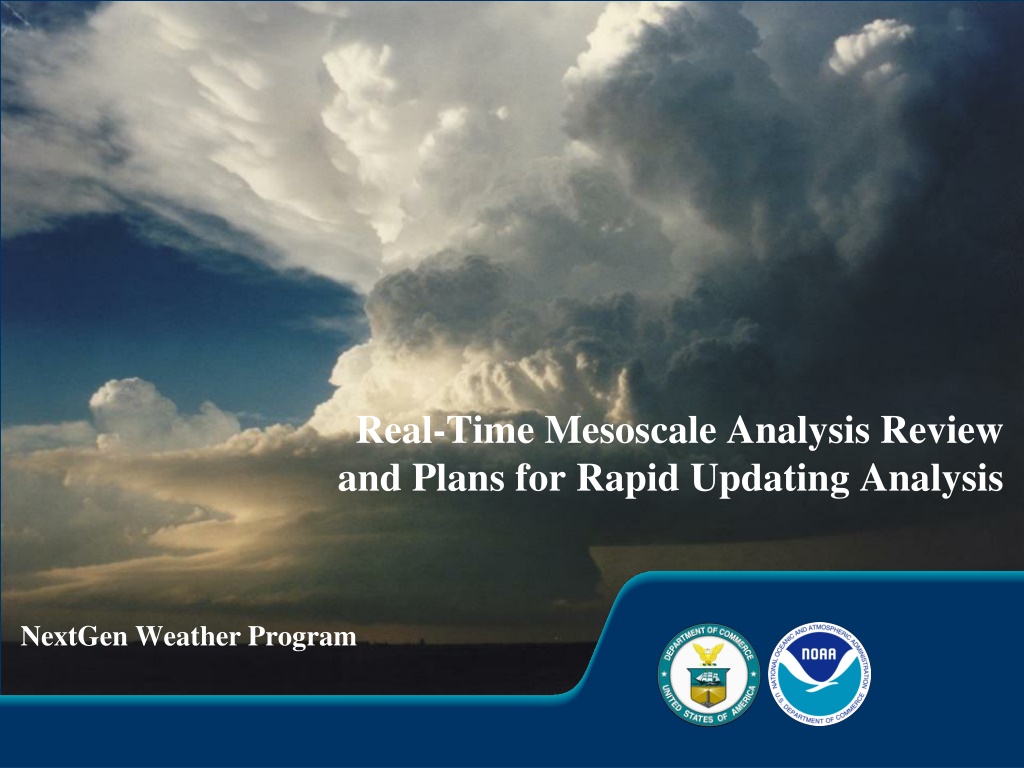
Real-Time Mesoscale Analysis Review
and Plans for Rapid Updating Analysis
NextGen Weather Program


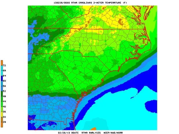
What is RTMA?
2
RTMA: Real-Time Mesoscale
Analysis
•
A 5 km to 2.5 km hourly
CONUS gridded weather
analysis
•
Provides gridded initial
conditions for local
forecasts for NWS field
offices
•
Also used as the “Analysis
of Record” (AOR) for
forecast verification and
case studies
RTMA Details
Analyses:
•
Wind Speed and Direction
•
Temperature
•
Dew Point Temperature
•
Surface Pressure
•
Effective Cloud Amount
•
Accumulated precipitation
Analysis Uncertainty:
•
Temperature
•
Dew Point Temperature
•
Wind Speed
•
Wind Direction
Model Terrain:
•
Fixed field
Hourly Domains:
•
CONUS (5 and 2.5 km)
•
Hawaii (2.5 km)
•
Alaska (6 km)
•
Puerto Rico (2.5km)
3 hourly Domain
:
•
Guam (2.5km)
3
2013 RTMA Enhancements
3 km Analysis upgrade for Alaska
1.5 KM Analysis domain for
Juneau
2.5 km Analyses for Northwest
RFC domain
Science and quality control
technique improvements:
•
Improved handling of
snowpack in RAP
•
Winds from Hurricane
WRF added to improve
analyses of tropical
cyclones
New analysis variables:
•
Wind gusts
•
Visibility
4
Next Steps for RTMA
Development
Explore potential for additional
Aviation impact analysis variables:
•
Total cloud cover
•
Cloud base heights
•
Mean sea level pressure
Continue to enhance quality control
of observations:
•
Real-time monitoring system
•
Real-time data mining
•
Add metadata into GSI
•
Improved Land sea mask
Unrestricted Mesoscale Analysis:
Run 4 hours after RTMA
Collects more complete set of
observations
Improved product verification
RTMA will continue to be available
Enables transition to Analysis of Record
capability
5
Transition to Rapid Updating
Analysis
•
Benefits:
–
Enhance forecaster and user situational awareness
–
Enable issuance of warnings and forecasts with greater lead time and accuracy
–
Provide a more accurate data set for model and forecast initialization and verification
•
Concepts:
–
Updated every five minutes
–
1km horizontal resolution
–
Expands coverage to 3D atmosphere
–
Uses satellite, radar and soundings (aircraft, etc.)
–
Multiple-Radar-Multiple-Sensor (MRMS) system serves as the initial backbone
•
VIL
•
Vertical wind shear
•
Precipitating species (hail)
•
Lightning
•
Reflectivity and radar quality
–
Products will execute on NCEP mainframe
•
At full capability, will generate the most state-of-the-art analyses of the atmosphere
currently possible, with the best scientific techniques
•
RUA data will serve as both a real-time analysis and eventually as initialization for
high resolution models
6
Presentation materials sourced from:
Ken Howard
HydroMet Research Group
NSSL Warning R&D Division
Multi Radar Multi Sensor
NextGen Weather Program
What is MRMS…
•
Multiple Radar Multi Sensor System (MRMS) is the world’
s
most
advanced
weather ‘research soon to be operational’ radar
processing system.
•
The MRMS system (formally known in the AWRP project plans as
NMQ) exists today as a result of FAA and NOAA R&D investments
leveraged over the last decade.
8
What is MRMS….
MRMS
-
Multiple-Radar / Multiple-Sensor
Multiple-Radar:
Exploits the overlapping coverage of
the WSR-88D, TDWR, Canadian networks and the base
level real-time data feeds to build a seamless rapidly-
updating high-resolution three-dimensional cube of
radar data (moments).
Multiple-Sensor:
Objectively blends data from the
multiple-radar 3D sources with surface, upper air,
lightning, satellite, rain gauges, and NWP
environmental data, to produce highly-robust decision
support products.
9
MRMS
NSSL MRMS System Briefing June 8, 2010
10
10
Integrated multiple sensor approach to high
resolution rendering of storms and weather
NSSL MRMS System Briefing June 8, 2010
11
11
InsertMRMS_Loop3
Integrated multiple sensor approach to high
resolution rendering of storms and weather
NSSL MRMS System Briefing June 8, 2010
12
12
Integrated multiple sensor approach to high
resolution rendering of storms and weather
13
MRMS
MRMS Domain
~140 WSR-88D
31 Canadian
15 TDWR 1 TV station radar
MRMS Usage
The weather and climate enterprise has been
utilizing MRMS products, in some form,
for well
over decade
.
NCEP uses the radar mosaics at the Storm
Prediction Center, the Aviation Weather Center,
and the Weather Prediction Center for
real‐time
hazardous weather forecasting and
post‐event data analysis.
MRMS 3D products are used to
initialize and
verify
high‐resolution storm‐scale models such
as the RR and HRRR.
The MRMS system is a component of a larger,
multi‐agency effort to create a new,
state‐of‐the‐art 3D storm‐scale analysis
capability.
14
MRMS
15
MRMS Transition to NWS
Operations
•
Approval of the MRMS as an
official
NOAA Line Office Transition Project
(
December 2010
)
•
Transition managed by NextGen Weather Program office (
May 2013
)
•
MRMS transition charter signed (
August 2013
)
MRMS
MRMS Operational
Transition Milestones
Program Phase/
Milestone End
•
Finalize plan for MRMS product dissemination
06/2014
•
Establish Subversion MRMS source code repository at NCEP
01/2014
•
Test MRMS on primary NCEP compute farm
01/2014
•
Install and test MRMS IOC products on WJHTC MRMS System
03/2014
•
Install and test MRMS IOC system on primary NCEP compute center
07/2014
•
Verify MRMS test products are received at remote test sites
08/2014
•
MRMS IOC at College Park with products available operationally
09/2014
•
Refine performance and make adjustments to product creation/dissemination
11/2014
•
MRMS FOC - Entails installing software on backup compute center (Boulder)
04/2015
16
MRMS
17
MRMS Web Page (nmq.ou.edu)
MRMS
18
•
Provides
, seamless, high resolution data sphere of integrated
radar and sensor data for multiple agencies
•
Improves depictions of convective initiation, structure, and
evolution for warnings, forecasts, air traffic routing
•
Provides
framework for research and development for aviation
related products via WJHTC MRMS system
•
Will provide an analysis of record to more robustly understand
severe weather and precipitation climatologies nationwide
•
Will strengthen existing and establish new partnerships with
multiple development and operational agencies
•
Will save lives, property, aviation delays/accidents
MRMS
MRMS Summary
Questions
19
MRMS
Back-up
20
MRMS
Current MRMS R&D
•
QC study of the Canadian radar and other candidate radar networks.
Data quality
issues associated with non-WSR-88D radar networks require continued research and
development for optimum quality assurance for the data to be fully integrated into the
seamless 3D mosaic and derivative products.
This effort benefits those forecast
capabilities that rely on high fidelity radar imagery as an input (HRRR, CIP, GTG, CoSPA).
•
Utilize polarimetric radar techniques to further improve radar data quality control.
The polarimetric radar variables have shown to provide more accurate identification of
anomalous propagation, sea clutter, biological scatterers, and chaff echoes than using
single-polarized radar variables.
Better identification and removal of non-weather
echoes will increase airspace capacity.
DELIVERED
•
Integrate polarimetric radar variables with atmospheric environmental data and
develop robust algorithms to identify different cloud and precipitation types
(e.g.,
liquid vs. frozen, supercooled water vs. ice crystals, etc.).
Accurate delineation of
different hydrometeor regions could be beneficial to the TAIWIS and In Flight Icing
PDTs.
21
MRMS
•
Evaluating performances of the polarimetric radar hydrometeor classification
algorithm (HCA) for different seasons and different geographical areas, and develop
strategies for seamless mosaicing of the HCA products for the CONUS domain
. A
high-resolution 3D national mosaic of cloud hydrometeor types (e.g., rain droplets,
hail, ice crystal, etc) will be very useful for en route air traffic controllers.
Further, the
3D HCA mosaic will be helpful for validation and improvements of various
microphysical schemes used in numerical weather prediction models.
•
Continue supporting the MRMS system at the WJHTC and develop new techniques
and products based on requirements from the aviation community.
Continue to
provide MRMS products to other AWRP PDTs and develop new techniques and
products based on requirements from other AWRP PDTs.
22
MRMS
Current MRMS R&D
RTMA provides detailed hourly weather analysis for different regions with a focus on improving accuracy and capabilities. Recent upgrades in analysis resolution and new variables aim to enhance forecast verification and operational efficiency. The future of RTMA involves further development for aviation impact and real-time monitoring, transitioning towards rapid updating analysis for better situational awareness and forecast accuracy using advanced scientific techniques and data sources.

Download Presentation

Please find below an Image/Link to download the presentation.
The content on the website is provided AS IS for your information and personal use only. It may not be sold, licensed, or shared on other websites without obtaining consent from the author.If you encounter any issues during the download, it is possible that the publisher has removed the file from their server.
You are allowed to download the files provided on this website for personal or commercial use, subject to the condition that they are used lawfully. All files are the property of their respective owners.
The content on the website is provided AS IS for your information and personal use only. It may not be sold, licensed, or shared on other websites without obtaining consent from the author.
E N D
Presentation Transcript
Real-Time Mesoscale Analysis Review and Plans for Rapid Updating Analysis NextGen Weather Program
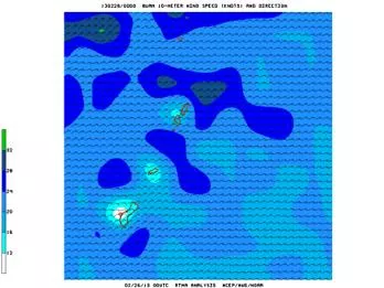
What is RTMA? RTMA: Real-Time Mesoscale Analysis A 5 km to 2.5 km hourly CONUS gridded weather analysis Provides gridded initial conditions for local forecasts for NWS field offices Also used as the Analysis of Record (AOR) for forecast verification and case studies 2
RTMA Details Model Terrain: Fixed field Analyses: Wind Speed and Direction Temperature Dew Point Temperature Surface Pressure Effective Cloud Amount Accumulated precipitation Hourly Domains: CONUS (5 and 2.5 km) Hawaii (2.5 km) Alaska (6 km) Puerto Rico (2.5km) Analysis Uncertainty: Temperature Dew Point Temperature Wind Speed Wind Direction 3 hourly Domain: Guam (2.5km) 3
2013 RTMA Enhancements 3 km Analysis upgrade for Alaska 1.5 KM Analysis domain for Juneau 2.5 km Analyses for Northwest RFC domain Science and quality control technique improvements: Improved handling of snowpack in RAP Winds from Hurricane WRF added to improve analyses of tropical cyclones New analysis variables: Wind gusts Visibility 4
Next Steps for RTMA Development Unrestricted Mesoscale Analysis: Explore potential for additional Aviation impact analysis variables: Run 4 hours after RTMA Total cloud cover Collects more complete set of observations Cloud base heights Mean sea level pressure Improved product verification RTMA will continue to be available Continue to enhance quality control of observations: Enables transition to Analysis of Record capability Real-time monitoring system Real-time data mining Add metadata into GSI Improved Land sea mask 5
Transition to Rapid Updating Analysis Benefits: Concepts: Enhance forecaster and user situational awareness Enable issuance of warnings and forecasts with greater lead time and accuracy Provide a more accurate data set for model and forecast initialization and verification Updated every five minutes 1km horizontal resolution Expands coverage to 3D atmosphere Uses satellite, radar and soundings (aircraft, etc.) Multiple-Radar-Multiple-Sensor (MRMS) system serves as the initial backbone VIL Vertical wind shear Precipitating species (hail) Lightning Reflectivity and radar quality Products will execute on NCEP mainframe At full capability, will generate the most state-of-the-art analyses of the atmosphere currently possible, with the best scientific techniques RUA data will serve as both a real-time analysis and eventually as initialization for high resolution models 6
Multi Radar Multi Sensor NextGen Weather Program Presentation materials sourced from: Ken Howard HydroMet Research Group NSSL Warning R&D Division
What is MRMS Multiple Radar Multi Sensor System (MRMS) is the world s most advanced weather research soon to be operational radar processing system. The MRMS system (formally known in the AWRP project plans as NMQ) exists today as a result of FAA and NOAA R&D investments leveraged over the last decade. 8
What is MRMS. MRMS - Multiple-Radar / Multiple-Sensor Multiple-Radar: Exploits the overlapping coverage of the WSR-88D, TDWR, Canadian networks and the base level real-time data feeds to build a seamless rapidly- updating high-resolution three-dimensional cube of radar data (moments). Multiple-Sensor: Objectively blends data from the multiple-radar 3D sources with surface, upper air, lightning, satellite, rain gauges, and NWP environmental data, to produce highly-robust decision support products. 9 MRMS
Integrated multiple sensor approach to high resolution rendering of storms and weather Lightning Radar Networks Upper Air Satellite Models Sfc Obs NSSL MRMS System Briefing June 8, 2010 10
Integrated multiple sensor approach to high resolution rendering of storms and weather Lightning Radar Networks Upper Air InsertMRMS_Loop3 Satellite Models Sfc Obs NSSL MRMS System Briefing June 8, 2010 11 11
Integrated multiple sensor approach to high resolution rendering of storms and weather Lightning Radar Networks Upper Air Satellite Models Sfc Obs NSSL MRMS System Briefing June 8, 2010 12 12
MRMS Domain ~140 WSR-88D 31 Canadian 15 TDWR 1 TV station radar 13 MRMS
MRMS Usage Volume 92 Number 9 September 2011 The weather and climate enterprise has been utilizing MRMS products, in some form, for well over decade. NCEP uses the radar mosaics at the Storm Prediction Center, the Aviation Weather Center, and the Weather Prediction Center for real time hazardous weather forecasting and post event data analysis. MRMS 3D products are used to initialize and verify high resolution storm scale models such as the RR and HRRR. The MRMS system is a component of a larger, multi agency effort to create a new, state of the art 3D storm scale analysis capability. 14 MRMS
MRMS Transition to NWS Operations Approval of the MRMS as an official NOAA Line Office Transition Project (December 2010) Transition managed by NextGen Weather Program office (May 2013) MRMS transition charter signed (August 2013) 15 MRMS
MRMS Operational Transition Milestones Program Phase/Milestone End Finalize plan for MRMS product dissemination 06/2014 Establish Subversion MRMS source code repository at NCEP 01/2014 Test MRMS on primary NCEP compute farm 01/2014 Install and test MRMS IOC products on WJHTC MRMS System 03/2014 Install and test MRMS IOC system on primary NCEP compute center 07/2014 Verify MRMS test products are received at remote test sites 08/2014 MRMS IOC at College Park with products available operationally 09/2014 Refine performance and make adjustments to product creation/dissemination 11/2014 MRMS FOC - Entails installing software on backup compute center (Boulder) 04/2015 16 MRMS
MRMS Web Page (nmq.ou.edu) 17 MRMS
MRMS Summary Provides, seamless, high resolution data sphere of integrated radar and sensor data for multiple agencies Improves depictions of convective initiation, structure, and evolution for warnings, forecasts, air traffic routing Provides framework for research and development for aviation related products via WJHTC MRMS system Will provide an analysis of record to more robustly understand severe weather and precipitation climatologies nationwide Will strengthen existing and establish new partnerships with multiple development and operational agencies Will save lives, property, aviation delays/accidents 18 MRMS
Questions 19 MRMS
Back-up 20 MRMS
Current MRMS R&D QC study of the Canadian radar and other candidate radar networks. Data quality issues associated with non-WSR-88D radar networks require continued research and development for optimum quality assurance for the data to be fully integrated into the seamless 3D mosaic and derivative products. This effort benefits those forecast capabilities that rely on high fidelity radar imagery as an input (HRRR, CIP, GTG, CoSPA). Utilize polarimetric radar techniques to further improve radar data quality control. The polarimetric radar variables have shown to provide more accurate identification of anomalous propagation, sea clutter, biological scatterers, and chaff echoes than using single-polarized radar variables. Better identification and removal of non-weather echoes will increase airspace capacity. DELIVERED Integrate polarimetric radar variables with atmospheric environmental data and develop robust algorithms to identify different cloud and precipitation types (e.g., liquid vs. frozen, supercooled water vs. ice crystals, etc.). Accurate delineation of different hydrometeor regions could be beneficial to the TAIWIS and In Flight Icing PDTs. 21 MRMS
Current MRMS R&D Evaluating performances of the polarimetric radar hydrometeor classification algorithm (HCA) for different seasons and different geographical areas, and develop strategies for seamless mosaicing of the HCA products for the CONUS domain. A high-resolution 3D national mosaic of cloud hydrometeor types (e.g., rain droplets, hail, ice crystal, etc) will be very useful for en route air traffic controllers. Further, the 3D HCA mosaic will be helpful for validation and improvements of various microphysical schemes used in numerical weather prediction models. Continue supporting the MRMS system at the WJHTC and develop new techniques and products based on requirements from the aviation community. Continue to provide MRMS products to other AWRP PDTs and develop new techniques and products based on requirements from other AWRP PDTs. 22 MRMS


")