New Challenges in Functional Geographies: Data Sources and Methodologies
Definition of Functional Geographies (FGs) faces new challenges post-Covid-19, with traditional census data no longer adequate. Research explores utilizing mobile phone data as a potential source, discussing limitations and comparisons with census data in measuring labor markets and commuting patterns.
Download Presentation

Please find below an Image/Link to download the presentation.
The content on the website is provided AS IS for your information and personal use only. It may not be sold, licensed, or shared on other websites without obtaining consent from the author.If you encounter any issues during the download, it is possible that the publisher has removed the file from their server.
You are allowed to download the files provided on this website for personal or commercial use, subject to the condition that they are used lawfully. All files are the property of their respective owners.
The content on the website is provided AS IS for your information and personal use only. It may not be sold, licensed, or shared on other websites without obtaining consent from the author.
E N D
Presentation Transcript
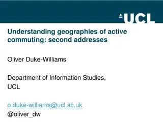
New challenges in the definition of functional geographies Mike Coombes (CURDS, Newcastle University), Lucas Mart nez-Bernabeu & Jos Manuel Casado-D az (IEI, Alicante University) mike.coombes@ncl.ac.uk
The definition of Functional Geographies (FGs) FGs long-established in many countries as official geographies (sets of areas), that a National Statistical Institute (NSI) uses for data on labour markets FG boundary definitions: Eurostat & OECD c.2020 research studies identified one standard method (based on the UK s method to define TTWAs ) for all to use in future continuing need is small zone data to capture locally-specific linkage patterns pre2020: Census journey-to-work (J2W) data the basis of most definitions ! Covid 19 radically affected J2W behaviour during the 2020/2021 Censuses so data from then unsuitable for FG definitions for mid-2020s and beyond New challenge for FG definitions is finding data on new normal labour markets
Leading candidate source is data from mobile phone use Dataset* here is from Spain 2021 but are the issues generic & persistent? Key process applied to each anonymised mobile phone s call records is the anchor point algorithm which uses call time/day to identify the most likely home location and workplace location the estimated J2W flow for that mobile [Annex A specifies the algorithm used for the data here] and thus inherently zones = polygons round masts frovide the geolocations in the dataset ! zones will have to be grouped to approximate official data areas Limitations of this (and any such?) dataset include: ! data sensitivity to algorithm ! 6% of mobiles had no identifiable workplace ? mostly working people with irregular work times/locations? * The raw data measures MOBILITY in general, it s tested here as proxy J2W
Overview comparison of Census & mobile phone data Potential issue Census J2W data Mobile phone data available mid-2020s labour supply measure unavailable in most countries does not include all jobs and thus not all commuting trips unknown so estimating the number of commuting trips not possible no. of days per week no problem because the data is in-house for NSIs NSIs have established methods to deal with low non-response some countries have declining Census response rates in certain sub-groups very high coverage should allow local patterns to be identifiable potential problems in negotiations to get appropriate data at low cost, and uncheckable data quality potential problem of correcting for limited coverage of provider(s), and any geographical bias in market share probable that not using a mobile phone is now rare dependence grossing-up selective under- coverage locally distinct linkages very high level of spatial precision of data output should be possible missing question of where commute started creates some implausible flows unproblematic not available in all countries high spatial precision of data output (reduced by best-fit to NSI s units and any problem of flicker ) minor issue of anchoring algorithm assumptions reverses commuting flows of night workers intrazonal flows not identified in large antenna zones anchoring algorithm assumptions in effect prevent their identification major issue of non-workers false commuting trips, with spatial bias to this over-estimation in the data granularity home location work location different workplace types only working people included normal text plain italic bold yes = no substantial problem of similarity and/or validity of the 2 types of dataset = minor issue for that dataset, minimal impact on similarity of datasets = major issue for that dataset, impacting on the similarity of datasets
Key issue with the data from mobile phones Mobile datasets are anonymized: unknowable which mobiles owned by workers J2W flows from anchoring algorithm include mobility of people not in work regular movements by people not in work probably shorter distance SO their inclusion in J2W data is not random but introduces bias FG definitions need accurate values of local flows, including intrazonal flows Innovative method to adjust Spanish dataset to mitigate this key problem: people not in work mostly move locally SO we assume local = intrazonal access data on numbers of people (not) working in each zone reduce the anchoring algorithm s count of intrazonal flows by the number of people in home location (zoneO) This creates a transformed J2W dataset possibly suited to defining FGs after additional zone grouping to create NSI-like zones for the analysis
Spanish FG definitions based on 2011 Census 2021 transformed MPF B B B: Barcelona example of highly fragmented metropolitan areas less urban areas show much more stability (eg. Mallorca)
FG test case of mobile phone data: result? Note that the FGs based on transformed mobile phone data here are from ongoing work SO are they sufficiently plausible to suggest that mobile phone data can be transformed to be taken as proxy J2W flows? !answer may depend on how far the increased fragmentation of FGs vis- -vis 2011 is due to the shift to home-working in the pandemic (nb. there is evidence the greatest shift to home-working was in the most urban areas, which is where these FGs are most fragmented) Full evaluation awaits the availability of J2W data from a Census (or some equivalent survey) for the same small zones covering the same period as robust analyzable mobile phone data
Acknowledgements Research on this dataset undertaken in IEI Alicante University as part of 2 research projects: PID2020-114896RB-I00 (funded by Agencia Estatal de Investigaci n, AEI / 10.13039/501100011033; Spanish State Plan for R&D&I 2017-2020) AICO/2021/062 (funded by Generalitat Valenciana, Dept. of Innovation, Universities, Science and Digital Society, R&D&I Programme of the Comunidad Valenciana).
Annex A mobile data & anchor point algorithm used here Background 2021 Spanish Census did not collect commuting data, unlike in 1991-2011 (some workplace data estimated using register data, but provincial capitals often used as zoneD due to high % of missing data, so data yields implausible TTWAs ) Spanish equivalent of ONS (INE) published a full population mobility dataset providing daily snapshots of mobile phone flows for all 2021 Sundays and Wednesdays > dataset covers over 80% of mobile phones, and is anonymized > each signal is timed and geo-located via the receiving mast Anchor point algorithm directly applied by the network provider to identify home location (zoneO): where the mobile spent more time in the previous night destination location (zoneD): where the mobile spent at least 4 hours between 10am and 4pm (if no such place, destination is unknown) This algorithm finds for each mobile a main daytime mobility destination: it is probably a workplace of people in work, and so that mobile s potential J2W (zoneO, zoneD) !mobile phones can flicker between masts, but this is only a low % and with only a localised impact (most of which is probably within cities or metropolitan areas)
