Mineralogy Overview and Resources
This overview covers an associate professor's lectures on mineralogy, grading breakdown, recommended textbooks, access to online books, mineralogy websites, and extraction methods. It also provides links to free courses and useful web resources. Explore the world of minerals with insightful information and recommendations for further study and exploration.

Download Presentation

Please find below an Image/Link to download the presentation.
The content on the website is provided AS IS for your information and personal use only. It may not be sold, licensed, or shared on other websites without obtaining consent from the author.If you encounter any issues during the download, it is possible that the publisher has removed the file from their server.
You are allowed to download the files provided on this website for personal or commercial use, subject to the condition that they are used lawfully. All files are the property of their respective owners.
The content on the website is provided AS IS for your information and personal use only. It may not be sold, licensed, or shared on other websites without obtaining consent from the author.
E N D
Presentation Transcript
LECTURES-1 and 2 JEO253 OVERVIEW ASSOC. PROF. MERAL DOGAN medogan@hacettepe.edu.tr Geology Building office #213
Grading 1-First midterm: 10% 2-Second midterm: 10% 3-Final: 40 % 4-Assigments: 20% 5-Lab: 20%
Recommended text books 1-Klein, Cornelius and Hurlbut, Manual of Mineralogy, John Wiley and Sons, Inc. 22 edition Klein and Dutrow (2008) ISBN 978-0471-72157), Manual of Mineral Science 23rd Edition 2-Perkins, Dexter, 3rdEdition Mineralogy, 2011 3-Blatt, Tracy and Owens, Petrology, 2006 4-Nesse, William D., Introduction to mineralogy, Oxford Press, 2000
access to on-line book is available at: http://coursesmart.com/ http:www.minerant.org/educational.html http//:www.minerant.org/database.html FREE COURSES https://www.edx.org/ https://www.coursera.org/
Mineralogy Web Sites There are many interesting and useful web sites for mineralogy a few that are really good are listed below: USGS-minerals: http://www.usgs.org/ The Mineral Gallery: http://mineral.galleries.com/default.htm The Mineralogical Society of America: http://www.minsocam.org/ Teaching Resources in Mineralogy and Petrology: http://geology.smith.edu/msa/Teaching.html Earth Science Resources on the Internet (UNC): http://www.geosci.unc.edu/web/ESresources/ES12795.htm The Image: http://www.theimage.com/index.html
mindat.org Excellent site for photos and info on minerals Webmineral Database Another excellent site for photos and info on minerals The Image Also a good site for photos and info on minerals Minerals By Name * a very useful site for identifying mineral characteristics (including photos!) Petrographic Workshop Surveillance-Video.com Crystallography 101(crystallography site) Information & links on crystallography International Colored Gemstones Association Smithsonian Gems and Minerals Collection Smithsonian Rocks, Minerals, Gems ... National Gemstone Homepage Mineral Photographs List of Rock & Mineral Websites Larson Jewelers - List of Element & Mineral Uses
How minerals are extracted from earth Extracting surface minerals Extracting subsurface (underground) minerals
How minerals are extracted from earth Extracting surface minerals Extracting subsurface (underground) minerals
Extracting surface minerals Open-pit mining Overburden Spoil banks Strip mining
Extracting subsurface minerals Subsurface mining tunnel Long wall mining (e.g.coal mining) Solution mining (e.g. ore solution)
The harmful effects of mining Destructive 1-Disrupts surface and subsurface Surface mining: Destructs landscape by causing changes in drainage and topography. The spoil banks of surface mining erode. Rainfall leaches toxic chemicals, elements into earth Strips away the soil, rocks, and including forest and plants In some cases entire mountaintops have been removed for surface mining 2-Creates pollution 3-Can harm or kill miners 4-
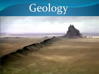
GEOLOGY Geology ( geo -earth, logos -discourse/study) -Physical Geology focuses understanding of earth materials. - Historical Geology study s the origin of earth. - Utilizes concepts & principles from Chemistry , Physics , and Biology Branches of Geology: Archaeological, Engineering, Economic, Forensic, Geochemistry, Geophysics, Hydrology, Hydrogeology, Mineralogy, Oceanography, Paleontology, Petrology, Planetary, Seismology, Sedimentary, Structural, Tectonic, Volcanology
History of Geology + Greeks; 2,000 years ago? - Aristotle (explains fish fossils, stars, earthquakes, ect.) + Catastrophism; 17th/18th century - James Ussher (Archbishop in Ireland) o Developed a chronology of earth s history o Earth was created in 4004 BC; By large events such as floods + Uniformitarianism; the earth is OLDER than 4,004 years old! - James Hutton (Scottish Physician; 1726-1797) - Theory of the Earth (1795) - Past conditions were NOT the same as todays - Charles Lyell (English Geologist; 1797-1875) - Principles of Geology (11 editions) -Convincingly showed evidence for Uniformitarianism
GEOLOGICAL TIME Concepts of Geologic Time Relative Dating events placed in their proper sequence/order. Law of Superposition states that younger layers are on top, older layers on the bottom. **Assumes nothing has turned layers upside-down.** Principle of Fossil Succession fossil organisms succeed one another in a definite and determinable order. Any time period may be recognized by its fossil content. Allows geologists to identify/age rocks in separated places. Geologic Time Scale - Developed during the 19th century - Divides time into Eons, Eras, Periods, and Epochs
4 Earth Spheres Hydrosphere a dynamic mass of water. -Ocean covers 71% of earth s surface -Ocean is 97% of earth s water Atmosphere gaseous envelope. -A relatively thin layer; 90% is within 10 miles of Earth s surface. - Protects us from Sun s radiation Biosphere life on earth. -Within a relatively narrow zone at or near the Earth s surface. Geosphere solid earth. -The largest of the Earth s sphere
Earth System Study of earth as a system, rather than separate studies of geology, atmosphere science, chemistry. Open System- most natural systems are open; both energy & matter flow into and out of the system. Closed System- energy moves in and out, but matter does not enter or leave.
Subsystems -Hydrologic Cycle connects hydrosphere, atmosphere, biosphere, geosphere. -Rock Cycle rock type changed to another rock type. -Carbon Cycle carbon moves through the 4 spheres
Nebular Theory (read NASA web-site for recent developments) Nebular Theory currently the most widely accepted view on the origin of our solar system . -14 billion years ago (bya); THE BIG BANG condenses into the first stars/galaxies. -5 bya; clouds of gases and dust contracts and collapse into a spiraling disk, with the sun in the center. -Gravitational energy after the collapse converted to thermal energy with high temperatures near the center. - Inner Planets formed from dust particle collision - Outter Plantes are more gaseous/iceous
Formation of Earth -Early temperatures; melted iron/nickel (2,647OF -2795oF) Separation into an Inner Core / Outer Core / Mantle / Crust -Releases of gases forming primitive atmosphere
Earth`s structure Crust (low density rock) Both Continental (light;granitic) & Oceanic (dark;basaltic) -Part of the Lithosphere . Mantle (higher density rock; Dark colored, Dense, also called Peridotite ) - Upper Mantle ; 70-660 kilometers deep, Lithosphere & Asthenosphere - Lower Mantle ; 660-2900 kilometers deep, Solid, High Strength -Core (high density material) - Outer Core ; Iron & Nickel LIQUID , earth s magnetic field - Inner Core ; SOLID Iron & Nickel
Planet Earth Lithosphere - Consists of the crust and upper mantle; relatively cool and rigid shell that is 100 km thick on average. Asthenosphere - Has a thin upper layer that experiences melting and is therefore weaker. This upper layer allows the asthenosphere to remain separate from the overlying lithosphere
3 Rock Types Igneous Formed when molten rock (magma) cools. -Extrusive (rock is ejected from the Earth s surface and then cools) -Intrusive (rock remains below the Earth s surface, cooling slowly). Sedimentary Formed when sediment layers that accumulated at the Earth s surface are lithified (compacted and cemented) into a rock mass. Metamorphic - New rocks formed from existing sedimentary or igneous or metamorphic rocks that are subjected to heat and pressure.
PLATE TECTONICS Continental Drift Theory Alfred Wegener (1880 1930) proposed the concepts of Continental Drift and the supercontinent Pangaea in his book The Origin of Continents and Oceans (1915).
Plate Tectonic Concept 1. Identical fossil organisms are evident in both South America and Africa. Glossopteris a fossil subpolar plant with large seeds and tongue-shaped leaves unlikely to become airborne. Mesosaurus - an aquatic reptile that lived during the Permian (about 260 mya). Lystrosaurus- a land-living reptile. 2. Matching mountain ranges in the U.S.A. (Appalachians) and North Atlantic (British Isles and Caledonian Mountains). 3. Paleoclimatic research had showed evidence of glacial striations in bedrock, suggesting a glacial period in the late Paleozoic (300 mya) in S. Africa, S. America, Australia
PALEOMAGNETISM Paleomagnetism - The Earth has a magnetic field, similar to the magnetic field of a bar magnet. Magnetite (a magnetic, ironrich mineral found in basaltic lavas) grains will become oriented with the Earth s magnetic field as the lava cools. Early studies of rock magnetism suggested that either the locations of the magnetic poles moved over time, or the rocks moved.
MAGNETIC REVERSAL Paleomagnetism: Magnetic Reversals Additional rock magnetism studies by geophysicists in the 1960 s found that throughout Earth s history the magnetic field has reversed, with north becoming south, and vice versa. -Today s magnetic field is considered to be normal polarity . By the early 1960 s an oceanic ridge system had been identified and evidence, such as paleomagnetic reversals, gathered by Harry Hess pointed toward seafloor spreading. The concepts of continental drift and seafloor spreading were combined, and by 1968, had become what is known as the Theory of Plate Tectonics.
TECTONIC PLATES Tectonic Plates The lithosphere is segmented into approximately 20 tectonic (lithosperic) plates, with seven major plates that account for 94 percent of the Earth s surface area. Seven Major Plates; African, Antarctic, Australian/Indian, Eurasian, North American, Pacific (the largest plate), South American
Tectonic Boundaries Divergent Boundaries (oceanic crust) -Two plates move away from one another. -Commonly called spreading centers, as the mechanism causing the divergent boundary is seafloor spreading. -Often a deep, down-faulted structure called a rift valley forms along the ridge axis -Most divergent boundaries are located along oceanic ridges such as the Mid-Atlantic Ridge . -The global ridge system is over 43,000 miles long. -New, hot oceanic crust is less dense than old and cold crust, thus causing an elevated rid
Divergent Boundaries (continental crust) Divergent Boundaries (continental crust) - Continental Rifiting : Continental crust is stretched and thinned by opposing tectonic forces; upwelling magma beneath causes the landscape to upwarp; brittle crustal rocks fragment, settle, and form a topographic depression. -The East African Rift is a modern example of an early-stage continental rift. -The Red Sea is an example of a late-stage continental rift
https://encrypted-tbn3.gstatic.com/images?q=tbn:ANd9GcRATK4y9hnIbd7N-Slt-fkFYsgfwfNFni8E-XkPFCbpgII9rW9Cp2sieSD5https://encrypted-tbn3.gstatic.com/images?q=tbn:ANd9GcRATK4y9hnIbd7N-Slt-fkFYsgfwfNFni8E-XkPFCbpgII9rW9Cp2sieSD5
Convergent Boundaries A Convergent Boundary is one where two tectonic plates are coming together. This type of boundary is also called a Subduction zone. Oceanic trenches are the surface representation of a subduction zone. Types of convergent boundaries include: Oceanic Continental Oceanic Oceanic Continental - Continental
https://encrypted-tbn2.gstatic.com/images?q=tbn:ANd9GcSBsTItOHTtXdRVem_QvLWHUd5A4wruWoIZklkO6k0BXHoIxruzhttps://encrypted-tbn2.gstatic.com/images?q=tbn:ANd9GcSBsTItOHTtXdRVem_QvLWHUd5A4wruWoIZklkO6k0BXHoIxruz
Convergent Boundary (Oceanic Continental) When dense oceanic and less dense continental lithospheric plates collide, the oceanic plate will dive beneath the continental plate. Partial melting of the oceanic plate occurs within the upper mantle. The melt (really a mush), being less dense than the surrounding mantle, rises toward the surface, in some instances resulting in continental volcanic arcs. (diagram, previous page
Convergent Boundary (Oceanic Oceanic) When two dense oceanic plates collide one will dive beneath the other. Partial melting will occur, much as with Oceanic Continental boundaries, however, resultant volcanic activity may produce Island Arcs. Islands in an arc tend to be spaced 80 km apart. Island arcs; Aleutian Islands, Mariana Islands, Tonga Islands, Lesser Antilles arc, Japan, islands of Indonesia, and Phillipines
Convergent Boundary (Continental Continental) This type of boundary typically occurs after an Oceanic Continental subduction zone has completely consumed the oceanic lithosphere. The low density of both continental lithospheric masses results in a collision, deforming sediments and rocks along the margins of each land mass, resulting in mountain building. The collision of the Australian-Indian plate with the Eurasian plate caused the formation of the Himalayas Suture where two continental crusts meet.
Transform Fault Boundaries - forms when two tectonic plates slide past one another. This type of boundary was proposed by J. Tuzo Wilson (Canadian Geologist).There is no destruction or production of the lithosphere along a transform fault boundary. Transform faults are most common on the seafloor, in spreading center fracture zones, but there are some that cut across continental crust. Transform faults are only active between the offset ridge segments.
Hot Spots Linear chains of volcanic islands formed as oceanic crust passed over a mantle plume, a rather cylindrical shaped upwelling of abnormally hot rock that originates at the core-mantle boundary and stays anchored in roughly the same location. The mantle plume causes partial melting of mantle rocks and, as these melts rise, melting of the overlying oceanic plate rocks. A hot spot is an area less than a few hundred kilometers across and characterized by volcanism, high heat flow, and subtle crustal uplift
Mantle Convection Convective heat transfer is a major mode of transferring heat, and convection is also a mode of transferring mass. In a cyclical manner, material is heated, rises, eventually cools, sinks down and is re-heated. The mantle is solid, but hot and weak enough to permit convective flow. Convection in the mantle is driven by: Heat loss from the Earth s core Internal heating due to decay of radioactive isotopes Cooling from the top of the mantle
Two models have evolved in an effort to explain why basalt from oceanic ridges is chemically different from hot spot basalt. Layering at 660 kilometers The mantle is split into layers at a depth of 660 km. Cold oceanic lithosphere sinks into a thin upper mantle layer that is well mixed. The cold material is melted, rises, and erupts along mid-ocean ridge spreading centers. A separate, more sluggish and primitive mantle convective regime is present below 660 km. The lower mantle convective process feeds hot spot locations via mantle plumes, thus generating basalt of a different chemical composition than that from midocean ridges. Whole Mantle Convection Cold oceanic lithosphere sinks deep into the mantle before melting, perhaps to the core-mantle boundary. Melted material rises in a mantle plume. Entire mixing of the mantle in a few hundred million years. Con: A homogenized mantle of this sort would not produce chemically distinct magmas, like those seen along ridges.
Plate Tectonics: Driving Forces Horizontal movement of tectonic plates away from a spreading center causes mantle upwelling. Slab Pull A cold, dense slab of oceanic lithosphere sinking into the asthenosphere will exert a pull on the trailing plate. Ridge Push Because the ridge along a spreading center is elevated, gravity causes the newly formed slab to slide down from the crest of the ridge
ROCK An aggregate of two or more minerals Rocks that are composed of one mineral ; [Limestone calcium carbonate] [Dunite almost entirely olivine] [Anorthosite plagioclase feldspar] Rocks composed of non-mineral matter; [obsidian & pumice glassy quartz]
MINERAL -Naturally occurring, -Homogeneous solid, -A definite (but usually not fixed) chemical composition, -Ordered atomic arrangement
Mineralogy - relatively recent science; Early humans used natural pigments of hematite (red) and manganese (black) in cave paintings and flint was highly prized. 5,000 years ago: Tomb paintings in the Nile show people weighing malachite and precious metals, smelting mineral ores, and making lapis lazuli and emerald gems. (372-287 B.C.): The Greek philosopher Theophrastus recorded the first written work on minerals. 1556: German physicist Georgius Agricola published De Re Metallica. Many believe this document signals the emergence of mineralogy as a science. 1669: Nicolaus Steno (Danish) published results of his studies of quartz crystals. 1784: Rene J. Hauy showed that crystals were built by stacking together tiny identical building blocks . 1779 1848: Berzelius (Swedish chemist) studied mineral chemistry and developed chemical classification of minerals.
Physical properties: Such as shape and color Rupa-rupa batu mineral (boh komposit/campuran atawa mineral murni, sok dipak salaku hiasan alatan ka ndahan kelirna. Rupa-rupa mineral. Foto ti Surv y G ologi AS.
Element a group of the same kind of atoms. 8 elements make up about 99% of Earth s crust ; Element Weight Percent Atom Percent Oxygen (O) 46.60 62.55 Silicon (Si) 27.72 21.22 Aluminum (Al) 8.13 6.47 Iron (Fe) 5.00 1.92 Calcium (Ca) 3.63 1.94 Sodium (Na) 2.83 2.64 Potassium (K) 2.59 1.42 Magnesium(Mg) 2.09 1.84 Total 98.59 100.00
Most substances in nature are electrically neutral. Atoms - the smallest subdivision of matter that retains the characteristics of the elements. Each atom consists of protons and neutrons in a nucleus, and electrons surrounding the nucleus. Protons - positive (+) charge, the number of protons in an atom is the atomic number. Neutrons - No charge. Atoms of the same element but with differing numbers of neutrons are called isotopes. Electrons negative (-) charge. The nucleus is surrounded by clouds of electrons called principal shells.The outer-most shell contains valence electrons, which are the electrons that bond with other atoms.


")
")

")


")
")