Mapping Earth: Distortions and Projections
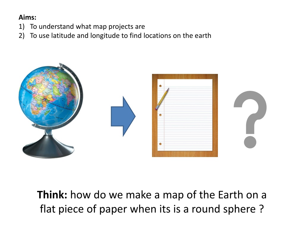


Think:
how do we make a map of the Earth on a
flat piece of paper when its is a round sphere ?

Aims:
1)
To understand what map projects are
2)
To use latitude and longitude to find locations on the earth
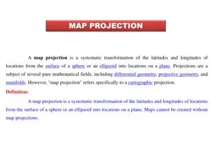
Map Projections
Cartographers (map makers) can’t make a round 3D object like a globe fit on
to a flat 2D surface, such as piece of paper with out distorting some aspect of
the 3D object. So every map of the Earth that you see on a piece in a book or
on a computer screen has something wrong with it.
Different types of maps of the Earth with different distortions are called
map projections.
This is probably the map of the Earth
you are most use to its call a
Mercator projection
. It has become
common because it has features
which allow people to use it for
navigation.
However, it has been criticised for
having a European bias, as places
where Europeans live, such as
Europe and North America look
bigger then they are in real life.
This is
Gall-Peters
projection, this map is not
suitable for navigation but it tries to
represent the area (size) of the land masses
accurately.
On this map places in the northern
hemisphere such as Europe and North
America are shown in true size and appear
much smaller and places such as South
America, Africa and Australia all look much
larger.
Other types of map projections
Map Centric
The part of the world that is Centred on a map can tell us about where the
map is made. European maps tend to be centred on Europe and Africa.
Where as American maps tend to be centred on North and South America. In
Australia we tend to centre maps on the Pacific Ocean.
Map projections distort Earth's round shape onto flat surfaces like paper, affecting how we perceive sizes and shapes of land masses. The Gall-Peters and Mercator projections are commonly used, each with its own advantages and biases. The choice of map projection can influence how different regions of the world are centered and represented.

Download Presentation

Please find below an Image/Link to download the presentation.
The content on the website is provided AS IS for your information and personal use only. It may not be sold, licensed, or shared on other websites without obtaining consent from the author.If you encounter any issues during the download, it is possible that the publisher has removed the file from their server.
You are allowed to download the files provided on this website for personal or commercial use, subject to the condition that they are used lawfully. All files are the property of their respective owners.
The content on the website is provided AS IS for your information and personal use only. It may not be sold, licensed, or shared on other websites without obtaining consent from the author.
E N D
Presentation Transcript
Aims: 1) To understand what map projects are 2) To use latitude and longitude to find locations on the earth Think: how do we make a map of the Earth on a flat piece of paper when its is a round sphere ?
Map Projections Cartographers (map makers) can t make a round 3D object like a globe fit on to a flat 2D surface, such as piece of paper with out distorting some aspect of the 3D object. So every map of the Earth that you see on a piece in a book or on a computer screen has something wrong with it. Different types of maps of the Earth with different distortions are called map projections.
This is Gall-Peters projection, this map is not suitable for navigation but it tries to represent the area (size) of the land masses accurately. This is probably the map of the Earth you are most use to its call a Mercator projection. It has become common because it has features which allow people to use it for navigation. On this map places in the northern hemisphere such as Europe and North America are shown in true size and appear much smaller and places such as South America, Africa and Australia all look much larger. However, it has been criticised for having a European bias, as places where Europeans live, such as Europe and North America look bigger then they are in real life.
Map Centric The part of the world that is Centred on a map can tell us about where the map is made. European maps tend to be centred on Europe and Africa. Where as American maps tend to be centred on North and South America. In Australia we tend to centre maps on the Pacific Ocean.