Integrated Population Health Assessment Curriculum

This curriculum aims to integrate community data, clinical data, and resources to address social determinants of health and enhance patient and population health. The program covers geospatial concepts, community assessment engines, and strategies for improving population health. Targeted at providers, staff, learners, and medical students, the content emphasizes the importance of geographic and data concepts for understanding population health dynamics.

Download Presentation

Please find below an Image/Link to download the presentation.
The content on the website is provided AS IS for your information and personal use only. It may not be sold, licensed, or shared on other websites without obtaining consent from the author.If you encounter any issues during the download, it is possible that the publisher has removed the file from their server.
You are allowed to download the files provided on this website for personal or commercial use, subject to the condition that they are used lawfully. All files are the property of their respective owners.
The content on the website is provided AS IS for your information and personal use only. It may not be sold, licensed, or shared on other websites without obtaining consent from the author.
E N D
Presentation Transcript
1 1 Population Health Assessment Engine 1
2 2 Population Health Assessment Engine Curriculum 01 02 BACKGROUND Introduction to Introduction to Population Health Population Health Introduction to Introduction to Geospatial Concepts Geospatial Concepts 03 04 05 BEGINNER Introduction to the Introduction to the How to use Community How to use Community How to use My How to use My Population Health Population Health HotSpots HotSpots Community Community Assessment Engine Assessment Engine 07 06 ADVANCED Getting the Most out of Getting the Most out of Getting the Most out of Getting the Most out of Community Hotspots Community Hotspots My Community My Community
3 3 Overall goal for the PHATE Curriculum To integrate community data, clinical data, and community resources in order to address social determinants of health and improve the health of patients and populations. 3
4 4 Target audience Anyone interested in learning about improving the health of populations Providers Staff Learners Residents Medical students 4
5 5 GEOGRAPHIC AND DATA CONCEPTS IMPORTANT FOR POPULATION HEALTH BACKGROUND 02
6 6 Background 02: Introduction to Geospatial Concepts Learning Objectives Describe how geography interacts with population health Explain geographic terms like thematic mapping and geocoding Demonstrate how to use online population health tools 6
7 7 Relevant family medicine milestones Family Medicine Milestone Integrates practice and community data to improve population health. Identifies specific community characteristics that impact specific patients health. Identifies health inequities and social determinants of health and their impact on individual and family health. Recognizes social context and environment, and how a community s public policy decisions affect individual and community health.
8 8 Relevant nurse practitioner competencies Competency Demonstrate the conceptual ability and technical skills to develop and execute an evaluation plan involving data extraction from practice information systems and databases. Analyze epidemiological, biostatistical, environmental, and other appropriate scientific data related to individual, aggregate, and population health. Use information technology and research methods appropriately to collect appropriate and accurate data to generate evidence for nursing practice, inform and guide the design of databases that generate meaningful evidence for nursing practice, analyze data from practice, design evidence-based interventions, predict and analyze outcomes, examine patterns of behavior and outcomes, and identify gaps in evidence for practice. Integrates appropriate technologies for knowledge management to improve health care. Uses technology systems that capture data on variables for the evaluation of nursing care.
9 9 Population Health In order to practice population health: Define who your population is Examples: All people in X state or county; all women Measure health outcomes of individuals within that population Examples: Mortality, morbidity Examine the distribution of health and identify disparities Address the disparities to improve population health 9
10 10 Defining Population in a Clinical Context Service area = Where patients who come to see me live Generic = neighborhood, city, county or state name Examples: 10
11 11 Capturing Social and Behavioral Domains and Measures in Electronic Health Records Domains include: Sexual Orientation Race/ Ethnicity Country of Origin Education Employment Financial Resource Strain (Food and Housing Insecurity) Health Literacy Stress Negative Mood and Affect (Depression and Anxiety) Psychological Assets Dietary Patterns Physical Activity Tobacco Use and Exposure Alcohol Use Social Connections and Social Isolation Exposure to Violence Neighborhoods/ Community Compositional Characteristics 11
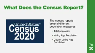
12 12 Census Geography 12
13 13 ZIP Codes Can change at any time No attempts to contain homogenous population Huge size variation (in land mass and population size) Not truly an area so data are not always comparable Easy to get from EHR Use Don t Use 13
14 14 ZIP Code vs ZCTA ZIP Code Tabulation Areas (ZCTAs) are generalized areal representations of United States Postal Service (USPS) ZIP Code service areas ZCTA (ZIP Code Tabulation Area) are more stable than ZIP Codes because they only change every 10 years ZCTA is built from Census Blocks so one can report demographic/ SDoH data at the ZCTA level 14
15 15 Deriving Service Area from Patient Data (Geographic Retrofitting) There are two ways to use patient data to define service area Option 1: Use the address to get census tracts (or other geography) Option 2: Use ZIP Codes and convert to ZCTAs No matter which one you pick, you will then aggregate your data so that you have a compiled list of areas to create your service area 15
16 16 Option 1: Geocoding Patient Addresses Geocoding is the process of comparing address information to a standard database to assign longitude and latitude for that location Once geocoded, you can verify the different geographies that location is in, including Census Tract 1100 S Ocean Blvd Palm Beach, FL 33480 y = 26.677778 x = -80.036066 ct: 12099003504 ZCTA: 33480 Cong. Dist.: FL-21 etc. 16
17 17 Geocoding Caveats HIPAA- Address is PHI Patients with PO Boxes will not be placed in correct location In rural locations where streets/ mapping not fully developed, patients may be placed incorrectly HIPAA- Address is PHI 17
18 18 Option 2: Using Existing Patient Address Data Since ZIP Code is in the EHR, you can extract the data Then convert it to ZCTA (most ZCTA numbers are the same as the five-digit ZIP Code) but if you don t convert before using, you will lose data from ZIP Codes that do not have a direct ZCTA match You can use the ZIP Code to ZCTA Crosswalk (https://www.udsmapper.org/zcta-crosswalk.cfm) to convert your data with no loss of data 18
19 19 Compile and (maybe) Aggregate! After either option 1 or option 2 you will end up with a list of ZIP Codes, ZCTAs, Census Tracts- whatever geography you chose- that you can aggregate into a service area OR You can consolidate the data into counts of patients in each area 19
20 20 Converting Patient Data to Service Area Area # pts Area # pts Area # pts A 432 I 208 S 96 J 199 T 90 B 380 K 181 V 89 C 349 L 167 X 60 D 312 M 146 AA 27 E 301 N 135 BB 21 F 263 O 120 CC 15 G 251 R 99 H 233 20
21 21 Thinking about Patient Panels in a Non-Clinical Context Service area = just based on the areas where my patients live AA T S R Q P BB CC F G A B O DD Z U Y V H E D C N EE X W I J K L M FF 21
22 22 Converting Patient Data to Service Area Area # pts Cum. % Area # pts Cum. % Area # pts Cum. % A 432 10.3% L 167 78.5% W 0 -- B 380 19.5% M 146 82.0% X 60 98.5% C 349 27.8% N 135 85.2% Y 0 -- D 312 35.3% O 120 88.1% Z 0 -- E 301 42.5% P 0 -- AA 27 99.1% F 263 48.8% Q 0 -- BB 21 99.6% G 251 54.8% R 99 90.5% CC 15 100% H 233 60.4% S 96 92.8% DD 0 -- I 208 65.4% T 90 94.9% EE 0 -- J 199 70.1% U 0 -- FF 0 -- K 181 74.5% V 89 97.1% TOTAL 4,174 100% 22
23 23 Thinking about Patient Panels in a Non-Clinical Context Service area = based on the number of patients per area; include the ones with the most patients first/ in core area AA T S R Q P BB CC F G A B O DD Z U Y V H E D C N EE X W I J K L M FF 23
24 24 Why is This Level of Detail Important? Focusing on a statistic with a state average of 24% and a national average of 21% County average = 12.3% City average = 13.2% Neighborhood average = 28% Core service area average = 22.8% Total service area average = 16.0% 24
25 25 Find SDOH Data to Better Understand Contextual Information about Patients What is the income level in this neighborhood? Do most of the adults in this neighborhood have a high school diploma? College education? What is the walkability of this area? Are there sidewalks? Are the parks, if any, usable? What is the prevalence of diabetes in the area? Etc. 25
26 26 Tools with Geospatial SDOH UDS Mapper- www.udsmapper.org Population Health Mapper by County- www.healthlandscape.org/map_PopulationHealth.cfm Social Determinants of Health Mapper by Census Tract- www.healthlandscape.org/map_SDOH.cfm 500 Cities Project Mapping Tool by Census Tract- www.healthlandscape.org/map_Project500Cities.cfm Community Health View by State/ County- www.healthlandscape.org 26
27 27 Background 02: Introduction to Geospatial Concepts Learning Objectives Describe how geography interacts with population health Explain geographic terms like thematic mapping and geocoding Demonstrate how to use online population health tools 27
28 28 Relevant family medicine milestones Family Medicine Milestone Integrates practice and community data to improve population health. Identifies specific community characteristics that impact specific patients health. Identifies health inequities and social determinants of health and their impact on individual and family health. Recognizes social context and environment, and how a community s public policy decisions affect individual and community health.
29 29 Relevant nurse practitioner competencies Competency Demonstrate the conceptual ability and technical skills to develop and execute an evaluation plan involving data extraction from practice information systems and databases. Analyze epidemiological, biostatistical, environmental, and other appropriate scientific data related to individual, aggregate, and population health. Use information technology and research methods appropriately to collect appropriate and accurate data to generate evidence for nursing practice, inform and guide the design of databases that generate meaningful evidence for nursing practice, analyze data from practice, design evidence-based interventions, predict and analyze outcomes, examine patterns of behavior and outcomes, and identify gaps in evidence for practice. Integrates appropriate technologies for knowledge management to improve health care. Uses technology systems that capture data on variables for the evaluation of nursing care.