GPS Technology and Augmentations


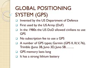
Global Positioning System (GPS)
•
Cloud of 24 GPS satellites orbit the Earth
•
Satellite positions are accurately known
•
GPS device receives satellite signal with
‘time-sent’ information
•
Device calculates distance to satellite
•
Intersection point of multiple satellites
defines device location
GPS Orbital Configuration
•
24 satellites
•
20,000 km (Approximately 12,500 mi)
above Earth
•
Orbits take 12 hours
•
Cover entire Earth
GPS Accuracy
•
Within 100 meters (328 ft)
–
Original GPS
•
Within 15 m (49 ft)
–
Selective availability removed
•
3-5 m (10-16 ft)
–
Differential position (GDPS)
•
< 3 m (10 ft)
–
Wide Area Augmentation System
(WAAS)
GDOP - Geometric Dilution of
Precision
GPS Augmentations
•
Systems to increase GPS accuracy
–
Nationwide Differential GPS System
(NDGPS)
–
Wide Area Augmentation System
(WAAS)
–
Continuously Operating Reference
Station (CORS)
–
Global Differential GPS (GDGPS)
–
International GNSS Service (IGS)
NDGPS – Nationwide Differential
GPS System
•
Accurately surveyed locations used for
reference
•
Corrects GPS for increased accuracy for
users on land and water
•
Developing system for 10-15 cm accuracy
WAAS - Wide Area Augmentation
System
•
Operated by FAA (U.S. Federal Aviation
Administration)
•
Aircraft navigation for all phases of flight
Benefits of WAAS
•
Primary means of navigation
•
More direct routes
•
Approach with vertical guidance
•
Decommission older equipment
•
Simplify onboard equipment
•
Increased capacity
Global Positioning System (GPS) utilizes a constellation of satellites to accurately determine device locations on Earth. The system consists of 24 satellites orbiting the planet, with an orbital configuration ensuring worldwide coverage. GPS offers high accuracy, with advancements like Differential GPS (DGPS) and Wide Area Augmentation System (WAAS) enhancing precision. Augmentation systems like Nationwide Differential GPS System (NDGPS) and International GNSS Service (IGS) further improve accuracy for various applications, including aircraft navigation. Overall, GPS technology continues to evolve for increased reliability and functionality.

Download Presentation

Please find below an Image/Link to download the presentation.
The content on the website is provided AS IS for your information and personal use only. It may not be sold, licensed, or shared on other websites without obtaining consent from the author.If you encounter any issues during the download, it is possible that the publisher has removed the file from their server.
You are allowed to download the files provided on this website for personal or commercial use, subject to the condition that they are used lawfully. All files are the property of their respective owners.
The content on the website is provided AS IS for your information and personal use only. It may not be sold, licensed, or shared on other websites without obtaining consent from the author.
E N D
Presentation Transcript
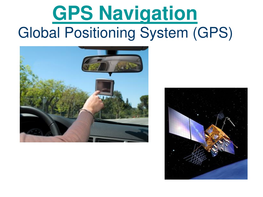
GPS Navigation Global Positioning System (GPS)
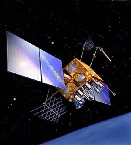
Global Positioning System (GPS) Cloud of 24 GPS satellites orbit the Earth Satellite positions are accurately known GPS device receives satellite signal with time-sent information Device calculates distance to satellite Intersection point of multiple satellites defines device location
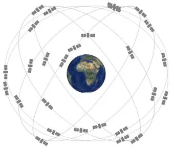
GPS Orbital Configuration 24 satellites 20,000 km (Approximately 12,500 mi) above Earth Orbits take 12 hours Cover entire Earth
GPS Accuracy Within 100 meters (328 ft) Original GPS Within 15 m (49 ft) Selective availability removed 3-5 m (10-16 ft) Differential position (GDPS) < 3 m (10 ft) Wide Area Augmentation System (WAAS)
GDOP - Geometric Dilution of Precision
GPS Augmentations Systems to increase GPS accuracy Nationwide Differential GPS System (NDGPS) Wide Area Augmentation System (WAAS) Continuously Operating Reference Station (CORS) Global Differential GPS (GDGPS) International GNSS Service (IGS)
NDGPS Nationwide Differential GPS System Accurately surveyed locations used for reference Corrects GPS for increased accuracy for users on land and water Developing system for 10-15 cm accuracy
WAAS - Wide Area Augmentation System Operated by FAA (U.S. Federal Aviation Administration) Aircraft navigation for all phases of flight
Benefits of WAAS Primary means of navigation More direct routes Approach with vertical guidance Decommission older equipment Simplify onboard equipment Increased capacity

")