Glacial Geology of Hudson River Gorge: A Detailed Exploration
Detailed study of the glacial geology of Hudson River Gorge based on bridge crossings between Albany Coveville and Newburgh, NY. The research delves into late Pleistocene stratigraphy, preglacial drainage, and physiographic provinces, presenting a comprehensive analysis of the geological history of the region.
Download Presentation

Please find below an Image/Link to download the presentation.
The content on the website is provided AS IS for your information and personal use only. It may not be sold, licensed, or shared on other websites without obtaining consent from the author. Download presentation by click this link. If you encounter any issues during the download, it is possible that the publisher has removed the file from their server.
E N D
Presentation Transcript
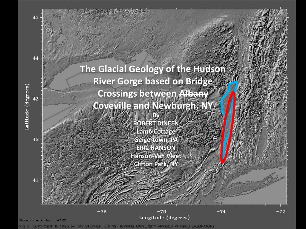
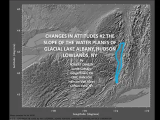
The Glacial Geology of the Hudson River Gorge based on Bridge Crossings between Albany Coveville and Newburgh, NY By ROBERT DINEEN Lamb Cottage Geigertown, PA ERIC HANSON Hanson-Van Vleet Clifton Park, NY
Champlain Lowlands Adirondack Mountains Ontario Lowlands Connecticut Lowlands Erie COVEVILLE Lowlands ALBANY Allegheny Plateau NEWBURGH PHYSIOGRAPHIC PROVINCES
COVEVILLE Study Area NEWBURGH
LATE PLEISTOCENE STRATIGRAPHY EASTERN NYS STRATIGRAPHY LAKE STAGES CHAMPLAIN SEA YOUNGER DRYAS STADE HUDSON RIVER Outflow from Lake Vermont 10.5k LAKE FORT ANN 11,000 Catastrophic floods through Champlain Lowlands (2X+) LAKE COVEVILLE 10.9k LAKE QUAKER SPRINGS TWO CREEKS INTERSTADE 11.8k 12,000 Catastrophic floods through Mohawk Valley (3X) Tide waters in lower Hudson Valley LAKE ALBANY II AGE IN C-14 YEARS LAKE ALBANY I 13,000 MOHAWK TILL: MIDDLEBURGH-ROSENDALE READVANCE PORT HURON STADE 13.2?k MACKINAW INTERSTADE PORT BRUCE STADE 14,000 ?LITTLE FALLS GRAVEL? LAKE HUDSON ?HELL HOLLOW TILL? 15,000 ERIE LITTLE FALLS GRAVEL INTERSTADE 16,000 NISSOURI STADE HELL HOLLOW TILL GLACIAL STRATIGRAPHY
PREGLACIAL DRAINAGE FORT ANN GLENS FALLS THREE MAJOR PREGLACIAL CHANNELS COVEVILLE Mohawk Colonie Batten Kill-Hudson SARATOGA SPRINGS THREE TRIBUTARIES ALBANY Alplaus Batten Kill Hoosic 0 10 RAVENA KM
FORT ANN GLENS FALLS COVEVILLE SARATOGA SPRINGS SARATOGA LAKE MOHAWK RIVER SCHENECTADY TROY ALBANY NORTHERN REACH
FORT ANN BATTEN KILL DELTA COVEVILLE SARATOGA SPRINGS HOOSIC DELTA SCHENECTADY SCHENECTADY DELTA TROY ALBANY NORTHERN REACH
FORT ANN COVEVILLE K K S S Preglacial Batten Kill- Hudson C C W W Cross- Section ALBANY NORTHERN REACH
KROMA KILL K K NORTHERN REACH 200 ft 200 ft LITHOLOGY SL SL STILLWATER S S 200 ft 200 ft LEGEND HOLOCENE ALLUVIUM FORT ANN LAKE ALBANY SAND LAKE ALBANY DELTAICS LAKE ALBANY CLAY and SILT ICE-CONTACT STRATIFIED DRIFT TILL SL SL CAMPBELL ISLAND C C 200 ft 200 ft SL SL WATERFORD W W 200 ft 200 ft View from the South (Upstream) SL SL 0 2,000 10X Vertical Exaggeration FEET
200 ft 200 ft LA II KROMA KILL Preglacial Tributary Preglacial Batten Kill- Hudson SL SL Hoosic Delta 200 ft 200 ft LA II STILLWATER Preglacial Batten Kill- Hudson SL SL Coveville gravel 200 ft 200 ft LA II CAMPBELL ISLAND LA II Preglacial Batten Kill- Hudson SL SL 200 ft 200 ft WATERFORD SL SL 0 2,000 NORTHERN REACH STRATIGRAPHY FEET
200 ft 200 ft KROMA KILL 230 ft SL SL 200 ft 200 ft STILLWATER 180 ft SL SL 200 ft 200 ft CAMPBELL ISLAND 210 ft SL SL 200 ft 200 ft WATERFORD 250 ft SL SL 0 2,000 NORTHERN REACH DEPTH of SCOUR FEET
COHOES SCHENECTADY T T ALBANY I I RENSSELAER A A Preglacial Batten Kill- Hudson G G Cross- Section Cohoes C-14 Site ALBANY REACH
T T ALBANY REACH 200 ft 200 ft TROY-MENANDS LITHOLOGY SL SL I I LEGEND HOLOCENE ALLUVIUM FORT ANN 200 ft 200 ft INTERSTATE I-90 SL SL LAKE ALBANY SAND LAKE ALBANY CLAY and SILT A A 200 ft 200 ft SL ALBANY-RENSSELEAR ICE-CONTACT STRATIFIED DRIFT TILL SL G G 200 ft 200 ft GLENMONT SL SL View from the South (Upstream) SEISMIC ? 0 2,000 10X Vertical Exaggeration FEET
LA I & II 200 ft 200 ft TROY-MENANDS Preglacial Batten Kill- Hudson SL SL 200 ft 200 ft INTERSTATE I-90 SL SL 200 ft 200 ft ALBANY-RENSSELEAR LA I & II Preglacial Batten Kill- Hudson SL SL Loudonville Esker Complex 200 ft 200 ft GLENMONT SL SL Flood-Scoured Bedrock Preglacial Batten Kill- Hudson? SEISMIC 0 2,000 STRATIGRAPHY ALBANY REACH FEET
200 ft 200 ft 270 ft TROY-MENANDS SL SL 200 ft 200 ft INTERSTATE I-90 240 ft SL SL 200 ft 200 ft 270 ft ALBANY-RENSSELEAR SL SL 200 ft 200 ft 270 ft GLENMONT SL SL SEISMIC 0 2,000 ALBANY REACH DEPTH of SCOUR FEET
SCHENECTADY B B C C N RAVENA N S S HUDSON CATSKILL CONFLUENCE REACH
B B CONFLUENCE REACH LITHOLOGY 200 ft 200 ft BERKSHIRE SPUR SL SL LEGEND HOLOCENE ALLUVIUM C C COEYMANS FORT ANN SL SL SEISMIC LAKE ALBANY SAND -200 ft -200 ft N N LAKE ALBANY DELTAICS NEW BALTIMORE LAKE ALBANY CLAY and SILT SL SL SEISMIC ICE-CONTACT STRATIFIED DRIFT -200 ft -200 ft TILL 0 2,000 S S STOCKPORT View from the South (Upstream) SL SL SEISMIC 10X Vertical Exaggeration -200 ft -200 ft
200 ft 200 ft BERKSHIRE SPUR LA I & II SL SL Above the Batten Kill- Hudson/Colonie Confluence Preglacial Batten Kill- Hudson Flood-Scoured Bedrock COEYMANS SL SL SEISMIC At the Batten Kill- Hudson/Colonie Confluence -200 ft -200 ft NEW BALTIMORE Flood-Scoured Bedrock Flood-Scoured Bedrock SL SL SEISMIC STRATIGRAPHY CONFLUENCE REACH -200 ft -200 ft 0 2,000 STOCKPORT SL SL Flood-Scoured Bedrock SEISMIC -200 ft -200 ft
200 ft 200 ft BERKSHIRE SPUR 260 ft SL SL COEYMANS 260 ft SL SL SEISMIC -200 ft -200 ft NEW BALTIMORE >260 ft SL SL SEISMIC -200 ft -200 ft 0 2,000 STOCKPORT SL SL >260 ft SEISMIC -200 ft -200 ft CONFLUENCE REACH DEPTH of SCOUR
RVW HUDSON RVW KR KR KINGSTON POUGHKEEPSIE MHP MHP NB NB NeEWBURGH SOUTHERN REACH
Schenectady Ravena Hudson Catskill RVW RVW SOUTHERN REACH
KR KR Kingston Poughkeepsie MHP MHP Newburgh NB NB SOUTHERN REACH
RPW RPW SOUTHERN REACH 200 ft 200 ft RIP VAN WINKLE LITHOLOGY SL SL LEGEND KR KR HOLOCENE TIDAL MUDS 200 ft 200 ft KINGSTON- RHINECLIFF HOLOCENE ALLUVIUM SL SL QUAKER SPRINGS- COVEVILLE-FORT ANN -200 ft -200 ft LAKE ALBANY CLAY and SILT MHP MHP SL SL MIDDLEBURGH-ROSENDALE OUTWASH TILL MID-HUDSON - POUGHKEEPSIE NB NB 0 2,000 200 ft 200 ft LITTLE FALLS GRAVEL(?) NEWBURGH-BEACON SL SL View from the South (Upstream) -200 ft -200 ft 10X Vertical Exaggeration
200 ft 200 ft Till over ICSD RIP VAN WINKLE SL SL Holocene Tidal Delta 200 ft 200 ft SL SL Transition to Organic Silt KINGSTON- RHINECLIFF -200 ft -200 ft Flood-Scoured Bedrock SL SL MID-HUDSON - POUGHKEEPSIE Boulder Gravel: Head-of-Outwash 0 2,000 200 ft 200 ft NEWBURGH-BEACON SL SL QS-CV-FA Marine Sediment -200 ft -200 ft Little Falls Gravel Boulder Gravel Compact below -200 feet SOUTHERN REACH STRATIGRAPHY
200 ft 200 ft RIP VAN WINKLE 250 ft SL SL 200 ft 200 ft 310 ft SL SL KINGSTON- RHINECLIFF -200 ft -200 ft SL SL 290 ft MID-HUDSON - POUGHKEEPSIE 0 2,000 200 ft 200 ft NEWBURGH-BEACON 315 ft SL SL -200 ft -200 ft SOUTHERN REACH DEPTH of SCOUR
Striae C&S exposure Dineen exposure HOW Well w/ Till over ICSD HOW Head- Of-Outwash R DEM By ML Janet Manchester NYSGS HOW ROSENDALE READVANCE REVISITED
SUMMARY and CONCLUSIONS I The Modern Hudson River s floodplain deposits grade from alluvial sand and gravel at the Kroma Kill section to sand with gravel at the Albany-Troy section, to tidal delta sand at the Rip Van Winkle section. They grade into Organic-matter rich tidal silts from the Kingston Rhinecliff to the Newburgh-Beacon cross sections. The trough eroded through the Lake Albany deposits is 230 ft deep at the Kroma Kill cross section, deepening to 315 ft deep at the Newburgh-Beacon Cross section. KROMA KILL ALBANY X-SECT WATER CAMP TROY GLEN STILL I-90 DEPTH in FEET 230 180 210 250 280 240 220 220 X-SECT NEW BALT COEY STOCK BERK RVW K-R MHP N-B DEPTH in FEET 260 ? ? ? 260 310 290 315 Depth of Scour
SUMMARY and CONCLUSIONS II The Fort Ann catastrophic flood deposits can be traced from the Kroma Kill to the Kingston-Rhinecliff cross sections. The Coveville and Quaker Springs catastrophic flood deposits can be traced from the Coeymans to the Kingston-Rhinecliff cross sections. The Head-of-Outwash for the Middleburgh-Rosendale Readvance is a short distance north of the Mid-Hudson-Poughkeepsie section. The coarse sands and gravels at the base of the Rip Van Winkle and the Kingston-Rhinecliff cross sections are outwash from the retreating Middleburgh-Rosendale readvance. The compact, bouldery sand and gravel at the base of the Newburgh-Beacon cross section is the Little Falls Gravel.
