The Slope of Glacial Lake Albany in Hudson Lowlands, NY
Explore the changing attitudes towards the slope of the water planes of Glacial Lake Albany in Hudson Lowlands, NY through various research findings and references from notable researchers such as Dineen, Hanson, and others. The physiographic provinces, slope measurements, shapes, and timings of ice removal are discussed in detail.

Download Presentation

Please find below an Image/Link to download the presentation.
The content on the website is provided AS IS for your information and personal use only. It may not be sold, licensed, or shared on other websites without obtaining consent from the author.If you encounter any issues during the download, it is possible that the publisher has removed the file from their server.
You are allowed to download the files provided on this website for personal or commercial use, subject to the condition that they are used lawfully. All files are the property of their respective owners.
The content on the website is provided AS IS for your information and personal use only. It may not be sold, licensed, or shared on other websites without obtaining consent from the author.
E N D
Presentation Transcript
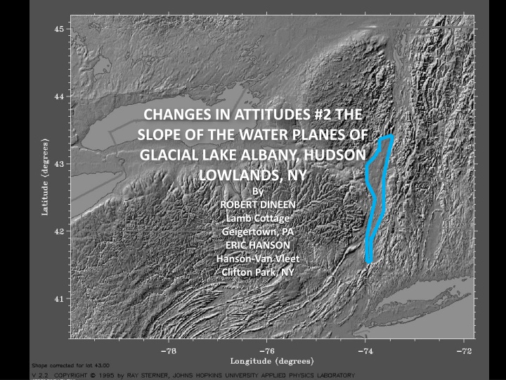
CHANGES IN ATTITUDES #2 THE SLOPE OF THE WATER PLANES OF GLACIAL LAKE ALBANY, HUDSON LOWLANDS, NY By ROBERT DINEEN Lamb Cottage Geigertown, PA ERIC HANSON Hanson-Van Vleet Clifton Park, NY
Champlain Lowlands Adirondack Mountains Ontario Lowlands Connecticut Lowlands 4.6 ft/mile Lake Iroquois Pair and others, 1988 Erie Lowlands RAVENA Allegheny Plateau KINGSTON 4.7 ft/mile Lake Hitchcock Stone and others, 2005 PHYSIOGRAPHIC PROVINCES
GF GF: Glens Falls S: Schenectady T: Troy A: Albany R: Ravena KI: Kinderhook H: Hudson K: Kingston P: Poughkeepsie N: Newburgh S T A R KI LAKE ALBANY H K P N
SLOPE (Ft/Mile) REFERENCE TIMING SHAPE WOODWORTH, 1905 Planar 2.2 FAIRCHILD, 1912, 1917, 1918 Concave- up Delayed until after Schenectady Delta 2.2 to 2.5 2.25 to 2.5 5 CHADWICK, 1928 (northern Hudson) Planar Contemporaneous with ice removal CHAPMAN, 1937, 1942 (Lake Vermont) Concave- up Delayed until after Schuylerville deglaciated CHADWICK, 1944 Contemporaneous with ice removal Not caused by a wave of uplift 2.25 LAFLEUR, 1965, 1979, 1983 (northern Hudson) Planar 2.5 DINEEN, DESIMONE, HANSON, 1988 (southern Hudson) Mixed Contemporaneous with ice removal 2.5
SLOPE (Ft/Mile) REFERENCE SHAPE TIMING CONNALLY and SIRKIN, 1986 (southern Hudson) Planar Rolling rebound 2.4 DINEEN and others 1992 (southern Hudson) Mixed Contemporaneous with ice removal 2.65 DESIMONE and LAFLEUR, 1992 (northern Hudson) Planar Contemporaneous with ice removal 2.7 CONNALLY and Cadwell, 2002 (southern Hudson) Planar Rolling rebound 1.6 STONE and others, 2005 (Lake Hitchcock) Delayed 2000 years after Deglaciation of lower Connecticut Valley Contemporaneous with ice removal Planar 4.7 DESIMONE and others, 2008 (northern Hudson) Planar 3.7 STANFORD, 2009, 2010 Planar Contemporaneous with ice removal >4
STANFORD, 2009 PLANAR GRADIENT of 4 ft/mile
STANFORD, 2009 KAME DELTAS SUGGEST GRADIENT of 2 ft/mile
ELEVATION in FEET NEWBURGH POUGHKEEPSIE KINGSTON HUDSON RAVENA ALBANY SCHENECTADY LATITUDE ESKER DELTA KAME DELTA OUTWASH DELTA Chart thanks to Lisa Elfenbien BEACH DELTA
Deltas SCHENECTADY NEWBURGH POUGHKEEPSIE KINGSTON HUDSON RAVENA ALBANY N= 58 Chart thanks to Lisa Elfenbien
Deltas Schodack Pleasant Valley Lake Albany I Lake Albany II Quaker Springs & Coveville SCHENECTADY NEWBURGH POUGHKEEPSIE KINGSTON HUDSON RAVENA ALBANY Chart thanks to Lisa Elfenbien
Deltas Catskill-Helderberg Narrows Hudson Highlands Schodack Pleasant Valley Lake Albany I Lake Albany II M-R Readvance Quaker Springs & Coveville SCHENECTADY NEWBURGH POUGHKEEPSIE KINGSTON HUDSON RAVENA ALBANY Chart thanks to Lisa Elfenbien
Deltas 3.0 ft/mi Pleasant Valley Schodack 3.0 ft/mi 4.3 ft/mi Lake Albany I Lake Albany II 3.8 ft/mi 1.5 ft/mi Quaker Springs & Coveville SCHENECTADY NEWBURGH POUGHKEEPSIE KINGSTON HUDSON RAVENA ALBANY Chart thanks to Lisa Elfenbien
Deltas Catskill-Helderberg Narrows Hudson Highlands Schodack Pleasant Valley Meadowdale Schenectady- Niskayuna Quaker Springs & Coveville SCHENECTADY NEWBURGH POUGHKEEPSIE KINGSTON HUDSON RAVENA ALBANY Chart thanks to Lisa Elfenbien
Deltas Catskill-Helderberg Narrows Hudson Highlands Schodack 4.4 ft/mi 3.3 ft/mi Meadowdale 3.6 ft/mi Schenectady- Niskayuna Pleasant Valley 5.1 ft/mi 2.1 ft/mi 2.5 ft/mi 2.5 ft/mi SCHENECTADY NEWBURGH POUGHKEEPSIE KINGSTON HUDSON RAVENA ALBANY Chart thanks to Lisa Elfenbien
Deltas Catskill-Helderberg Narrows Hudson Highlands Schodack 4.4 ft/mi 3.3 ft/mi Meadowdale 3.6 ft/mi Schenectady- Niskayuna Pleasant Valley 5.1 ft/mi 2.1 ft/mi 2.5 ft/mi 2.5 ft/mi SCHENECTADY NEWBURGH POUGHKEEPSIE KINGSTON HUDSON RAVENA ALBANY Chart thanks to Lisa Elfenbien
Catskill-Helderberg Narrows Hudson Highlands SCHENECTADY ALBANY NEWBURGH POUGHKEEPSIE KINGSTON HUDSON RAVENA N= 59 Chart thanks to Lisa Elfenbien
Catskill-Helderberg Narrows Hudson Highlands Albany I Albany II Quaker Springs Coveville SCHENECTADY ALBANY NEWBURGH POUGHKEEPSIE KINGSTON HUDSON RAVENA Chart thanks to Lisa Elfenbien
Catskill-Helderberg Narrows Hudson Highlands Albany I 3.4 ft/mi 2.3 ft/mi Quaker Springs 2.3 ft/mi Coveville 1.8 ft/mi SCHENECTADY ALBANY NEWBURGH POUGHKEEPSIE KINGSTON HUDSON RAVENA Chart thanks to Lisa Elfenbien
Catskill-Helderberg Narrows Hudson Highlands Albany II Albany I Quaker Springs SCHENECTADY ALBANY NEWBURGH POUGHKEEPSIE KINGSTON HUDSON RAVENA Chart thanks to Lisa Elfenbien
Catskill-Helderberg Narrows Hudson Highlands Albany II Albany I 7.2 ft/mi 5.2 ft/mi Quaker Springs 3.6 ft/mi 1.5 ft/mi 2.0 ft/mi 0.8 ft/mi SCHENECTADY ALBANY NEWBURGH POUGHKEEPSIE KINGSTON HUDSON RAVENA Chart thanks to Lisa Elfenbien
Catskill-Helderberg Narrows Hudson Highlands Albany II Albany I 7.2 ft/mi 5.2 ft/mi Quaker Springs 3.6 ft/mi 1.5 ft/mi 2.0 ft/mi 0.8 ft/mi SCHENECTADY ALBANY NEWBURGH POUGHKEEPSIE KINGSTON HUDSON RAVENA Chart thanks to Lisa Elfenbien
LAFLEUR, 1965 Albany Schenectady CONCAVE-UP GRADIENT 2.5 ft/mile HUDSON LOWLANDS 5.6 ft/mile CHAMPLAIN LOWLANDS, from CHAPMAN, 1937, 1942 and STEWART, 1960
SLOPE (Ft/Mile) REFERENCE TIMING SHAPE WOODWORTH, 1905 Planar 2.2 FAIRCHILD, 1912, 1917, 1918 Concave- up Delayed until after Schenectady Delta 2.2 to 2.5 2.25 to 2.5 5 CHADWICK, 1928 (northern Hudson) Planar Contemporaneous with ice removal CHAPMAN, 1937, 1942 (Lake Vermont) Concave- up Delayed until after Schuylerville deglaciated CHADWICK, 1944 Contemporaneous with ice removal Not caused by a wave of uplift 2.25 LAFLEUR, 1965, 1979, 1983 Planar 2.5 DINEEN, DESIMONE, HANSON, 1988 Mixed Contemporaneous with ice removal 2.5
SLOPE (Ft/Mile) REFERENCE SHAPE TIMING CONNALLY and SIRKIN, 1986 Planar Rolling rebound 2.4 DINEEN and others 1992 Mixed Contemporaneous with ice removal 2.65 DESIMONE and LAFLEUR, 1992 Planar Contemporaneous with ice removal Rolling rebound 2.7 CONNALLY and Cadwell, 2002 Planar 1.6? STONE and others, 2005 (Lake Hitchcock) Delayed 2000 years after Deglaciation of lower Connecticut Valley Planar 4.7 DESIMONE and others 2008 Planar Contemporaneous with ice removal 3.7 STANFORD, 2009, 2010 Planar Contemporaneous with ice removal >4
SLOPE (Ft/Mile) Albany Stage TIMING SHAPE Pleasant Valley Planar Delayed 4.4 Schodack (Wild & Crazy) Concave-up Delayed 3.3 Albany I (Meadowdale) Concave-up Contemporaneous with ice removal 3.6 Albany I (Schenectady) Concave-up Contemporaneous with ice removal 5.1 Schodack (Traditional) Planar Contemporaneous with ice removal 3.4 Albany I (Schenectady) Planar Contemporaneous with ice removal 2.3 Quaker Springs Planar Ice in Champlain Lowlands 2.3 Coveville Planar Ice in Champlain Lowlands 1.8
WHERE ARE WE? KAME DELTAS SUGGEST A REBOUNDED ICE-CONTACT LAKE PLANE OF ~3.3 TO 5.1 FT/MILE LAKE PLANES STEEPEN NORTH OF ALBANY BOTH PLANAR AND CONCAVE-UPWARDS CURVES FIT THE DATA IN THE MID-HUDSON LOWLANDS THE CONCAVE-UP CURVES SUGGESTS AN ISOSTATIC HINGE LINE FOLLOWED THE RETREATING ICE FRONT THE LAKE OUTLET WAS WITHIN THE HUDSON S BEDROCK GORGE SOUTH OF KINGSTON THE OUTLET MIGRATED FROM: NEWBURGH (ALBANY I) TO KINGSTON(ALBANY II) TO HUDSON (QUAKER SPRINGS)
GENERAL PROBLEMS WITH LAKE ALBANY DELTAS We ve historically connected the ice-contact or kame deltas There is a great deal of scatter in the elevations of ice-contact or kame deltas Especially in the Narrows The large number of deltas make correlation difficult. Exposures of the topset-foreset contact are rare and exposures are short-lived Many LA deltas have very thin topsets (Thanks Carl!) The literature contains few actual descriptions of the LA topset-foreset contact Most delta identifications and elevations are based on surface landforms. The area between the Hudson Highlands and Poughkeepsie is heavily developed Making exposures rare and modifiying the landforms POSSIBLE SOLUTIONS Make more observations in deltas south of Kinderhook Use Ground-Penetrating Radar profiles of deltaforms to ID the topset/Foreset interface Use LIDAR to trace the bathtub rings between deltas This is a good project for a team of geophysicists, glacial geomorphologists, statisticians, and stratigraphers
Geography Uplands vs. Lowlands Physiographic Image Uplands pinch Hudson Lowlands between Ravena & Kingston Wallkill Lowlands open to the southwest Hudson Lowlands held Glacial Lake Albany Lake Albany extended from Newburgh to Glens Falls The water plane of the lake has been measured by various workers Until the 1990s, the consensus slope was approximately 2.5 ft/mile AMQUA & FOP chart Lake Albany was contemporaneous with Lake Hitchcock in the Connecticut Lowlands New England Mafia measured an isostatic tilt of 4+ ft/mile during 80s and 90s Glacial Movement Focused into narrows Spread into Wallkill Lowlands Middleburgh-Rosendale Readvance reached just south of Kingston Where Wallkill sublobe pulled flow away from Hudson LL Ice Movement map M-R Readvance stagnated in the Ravena-Kingston neck As indicated by numerous low-elevation KDs in neck, as noted by Cook & Chadwick.
Check Antevs correlation betwixt Hudson & Connecticut lowlands retreats. Ice front was further south in HLL, because of M-R Readvance. Thus isostatic contours were bent south in HLL. This slowed rebound in the HLL, so the immediate rebound from the retreat through the Hudson Highlands had passed north. In addition, the M-R readvance would have reversed rebound because of the rapid addition of ice. A probable factor in the difference between rebound rates in the southern HLL was differences in the physical characteristics (elasticity, brittleness) between a subduction zone (HLL: west) and a failed rift (CLL: east). The compressed rocks in the HLL would differ from the pulled-apart rocks under the CLL.
LONGITUDINAL PROFILES Based on exposures north of Kingston on the west side of the HR Based on LaFleur (1965) north of Kinderhook. Based on airphotos, topographic map analysis, and soils maps south of Kinderhook (or Kingston) plus work by Connally K+O+E+D+B Scatter Plot You could plot any gradient that you want K+O+E Scatter Plot K+O+E plot focuses on the upper-most kame deltas that were the traditional Plot Note cluster of low-elevation KDs in the Ravena-Kingston neck.
B Scatter Plot shows beaches. Much less scatter than deltas Two concave-up lines are defined by the beaches. Upper line curves up from 250 ft @ 42.55O to 330 ft @ 42.65O (80 ft in 0.1 degree of latitude) Upper line ends with large scatter. Upper line is Defreetsville-Voorheesville, Meadowdale moraine line Lower line curves up from 175 ft @42.55O to 200 ft @ 42.60O to 355 ft @ 42. 75O (25 ft in 0.05 degree of latitude to 155 ft in 0.15 degree of latitude). Lower line is Schenectady Delta line. Difference between the two line is ~75 ft. Suggests a fall in lake level from Albany Ia to Lake Albany Ib (both ice contact) of 75 ft when ice retreated ( to Niskayuna margin?) and unblocked the Mohawk Lowlands. Lake Amsterdam flooded into the HLL