Geography Knowledge in Key Stage 2
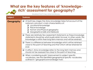
Key knowledge and skills in Key Stage 2 focus on geographical concepts such as locational knowledge, place knowledge, human and physical geography. Students learn about countries, cities, geographical features, climate zones, biomes, and more to develop a holistic understanding of the world around them. Through structured learning, they identify significant geographical elements that shape our world.
Download Presentation

Please find below an Image/Link to download the presentation.
The content on the website is provided AS IS for your information and personal use only. It may not be sold, licensed, or shared on other websites without obtaining consent from the author.If you encounter any issues during the download, it is possible that the publisher has removed the file from their server.
You are allowed to download the files provided on this website for personal or commercial use, subject to the condition that they are used lawfully. All files are the property of their respective owners.
The content on the website is provided AS IS for your information and personal use only. It may not be sold, licensed, or shared on other websites without obtaining consent from the author.
E N D
Presentation Transcript
IDENTIFYING KEY KNOWLEDGE AND SKILLS AT KEY STAGE 2 1
Identifying key knowledge and skills in Key Stage 2 Just as in Key Stage 1, the national curriculum requirements for Years 3 to 6 are presented as one Key Stage. The key knowledge outlined here are therefore presented in national curriculum themes enabling leaders to make choices as to when they are taught. The geography knowledge learning in Key Stage 2 is blocked into the same four units: Locational knowledge Locate the world s countries, using maps to focus on Europe (including the location of Russia) and North and South America, concentrating on their environmental regions, key physical and human characteristics, countries, and major cities. Name and locate counties and cities of the United Kingdom, geographical regions and their identifying human and physical characteristics, key topographical features (including hills, mountains, coasts and rivers), and land-use patterns; and understand how some of these aspects have changed over time. Identify the position and significance of latitude, longitude, Equator, Northern Hemisphere, Southern Hemisphere, the Tropics of Cancer and Capricorn, Arctic and Antarctic Circle, the Prime/Greenwich Meridian and time zones (including day and night). Know the names of and locate at least eight European countries; Know the names of and locate at least eight major capital cities across the world; Know the names of a number of European capitals; Know the names of, and locate, a number of South or North American countries. Know the names of and locate at least eight counties and at least six cities in England; Know where the main mountain regions are in the UK; Know, name and locate the main rivers in the UK. Know the names of four countries from the southern and four from the northern hemisphere; Know where the equator, Tropic of Cancer, Tropic of Capricorn and the Greenwich Meridian are on a world map; Know what is meant by the term tropics ; Know about time zones and work out differences. 2
Identifying Key knowledge and skills in Key Stage 2 Just as in Key Stage 1, the national curriculum requirements for Years 3 to 6 are presented as one Key Stage. The key knowledge outlined here are therefore presented in national curriculum themes enabling leaders to make choices as to when they are taught. The geography knowledge learning in Key Stage 2 is blocked into the same four units: Place knowledge Human and physical geography Understand geographical similarities and differences through the study of human and physical geography of a region of the United Kingdom, a region in a European country, and a region within North or South America. Describe and understand key aspects of physical geography, including: climate zones, biomes and vegetation belts, rivers, mountains, volcanoes and earthquakes, and the water cycle . Describe and understand key aspects of human geography, including types of settlement and land use, economic activity including trade links, and the distribution of natural resources including energy, food, minerals and water. Know at least five differences between living in the UK and a Mediterranean country; Know key differences between living in the UK and in a country in either North or South America. Know what causes an earthquake; Label the different parts of a volcano; Know and label the main features of a river; Know the name of and locate a number of the world s longest rivers; Know the names of a number of the world s highest mountains; Explain the features of a water cycle; Know what is meant by biomes and what are the features of a specific biome; Label layers of a rainforest and know what deforestation is; Know the names of and locate some of the world s deserts; Know the three major climate zones. Know why most cities are located by a river; Know why industrial areas and ports are important; Know main human and physical differences between developed and third world countries. 3
Identifying Key knowledge and skills in Key Stage 2 Just as in Key Stage 1, the national curriculum requirements for Years 3 to 6 are presented as one Key Stage. The key knowledge outlined here are therefore presented in national curriculum themes enabling leaders to make choices as to when they are taught. The geography knowledge learning in Key Stage 2 is blocked into the same four units: Geographical skills and fieldwork Use maps, atlases, globes and digital/computer mapping to locate countries and describe features studied. Use the eight points of a compass, four and six- figure grid references, symbols and key (including the use of Ordnance Survey maps) to build their knowledge of the United Kingdom and the wider world. Use maps to locate European countries and capitals; Use maps and globes to locate the equator, the Tropics of Cancer and Capricorn and the Greenwich Meridian; Know how to use graphs to record features such as temperature or rainfall across the world; Use Google Earth to locate a country or place of interest and to follow the journey of rivers, etc. Know and name the eight points of a compass; Know how to plan a journey within the UK, using a road map; Know what most of the ordnance survey symbols stand for; Know how to use six-figure grid references. The next few pages show how we can break the key knowledge and skills into year group expectations. It is important, however, to remember that the key stage objectives identified for each key stage on this and earlier pages, define the end points for each key stage. It is up to each school to decide when, within each key stage, different aspects are taught. 4
Geography Year 4 Rivers: How is a river formed? Key knowledge and skills: National curriculum requirement: Know, name and locate the main rivers in the UK; Name and locate counties and cities of the United Kingdom, geographical regions and their identifying human and physical characteristics, key topographical features (including hills, mountains, coasts and rivers), and land-use patterns; and understand how some of these aspects have changed over time. Know and label the main features of a river; Know the name of and locate a number of the world s longest rivers. Describe and understand key aspects of physical geography, including climate zones, biomes and vegetation belts, rivers, mountains, volcanoes and earthquakes, and the water cycle. 5
Child M Child G Child O Child C Child A Child N Child D Child H Child K Child B Child E Child F Child J Child L Child I Know, name and locate the main rivers in the UK Know and label the main features of a river Know the name of and locate a number of the world s longest rivers 6
Rivers Year 4 Knowledge Mat Exciting Books Subject Specific Vocabulary Prior Knowledge Expectations estuary An estuary is an area where a freshwater river or stream meets the ocean. Identify a river on a map; mouth A river mouth is the part of a river where the water flows into another river, a lake, a reservoir, a sea, or an ocean. Know that most rivers flow into the sea; Know about the creatures that live in rivers. source The source of a river is where it begins, usually on high ground. Sticky Knowledge meander A meander is a winding curve or bend in a river. The start of a river is called the source and the end is called the mouth. waterfall Waterfalls form where water rushes down steep hillsides in upland areas and erodes the rocks. Key Knowledge erosion Erosion occurs when the fastest currents in the river carve into the banks. A fast flowing river will carry soil and dirt from its banks and bed downstream and drop them when it gets wider and slows down. Know names and locate the main rivers in the UK; deposition Rocks and sediments eroded from one part of the river are deposited in another part. Know and label the main features of a river; The longest river in the world is the Nile in Africa. It is 4,130 miles long. Know the names of and locate a number of the world s longest rivers. tributary When one stream or river meets another and merges together, the smaller stream or river is known as a tributary. Many rivers and streams will join together before they reach the mouth of the river. The smaller rivers and streams are called tributaries. oxbow lake Oxbow lakes are created when the meander is so deep that it cuts off a piece of the river and leaves a lake. delta Deltas are wide areas of water often found at the mouth of large rivers. stream A stream is a small body of flowing water. 7
Year 4 Geography How is a river formed? Issues related to long-term memory and metacognition Focus on children s learning links Think of the important learning The unit starts with finding out what pupils already know about rivers, especially their positive and negative features. Ensure that pupils use the terms, I have a learning link to self, the wider world or to text. Most pupils will have seen a river flow by them at some stage of their lives. Encourage them to talk about this learning link to self. They may read a story where there was a river in the storyline. In this case they should be encouraged to talk about their learning to text link. They should also be encouraged to talk about the learning they did in Key Stage 1 so as to support this cognitive strategy. What inferences can pupils make? Throughout the unit, pupils are being encouraged to come up with their own questions. Activities will be deliberately set that require pupils to ask their own questions based on the learning they have received. They should be encouraged to make a link between rivers flooding and the potential disruption caused to people s lives. Reflect on the learning that has taken place It is important that pupils focus on the important learning as they proceed through the unit. The important point here is that pupils understand fully how a river is formed and about its journey to the sea. Ensure that pupils understand that some rivers are prone to flooding and the impact that it has on people s lives. Teachers should focus on the key knowledge and skills for this unit to help pupils to prioritise. Reflect on rivers in the United Kingdom from the learning completed in Key Stage 1. Help pupils to make sensory links Pupils should be encouraged to think about putting their hands into a river and also seeing sticks, etc, float down the river. Pupils could also make an emotional link with the people who may have lost their homes due to flooding, etc. Dealing with misconceptions At the end of the unit of learning, an activity needs to be organised that helps pupils to recall the learning. This can be in different forms. It could be a PowerPoint presentation, a short video clip or even a display. The main focus is to present their learning to the class as a whole. When the unit of work has finished, there should be opportunities for pupils to revisit the learning via regular review sessions (no more than 15 min). These sessions will be part of the geographical reviews that will take place In addition, at the end of the learning, the staff (with support from pupils) should create a memory board about the key knowledge and skills that have been learnt. It is important that pupils know how a river is formed. They also need to know about the way a river moves from the source to the sea and that it has a downwards flow. Pupils should recognise the fact that the river is a home for so many creatures not just fish. 8
Year 4 Geography How is a river formed? Element 1: Focus on relevance/ location/ timeline/ general overview How is a river formed and where are the most well-known rivers of the UK? Location Use a map of the UK to find the most well-known rivers of the UK. Include the nearest one to the school. Focus on the counties where the rivers start (source), and the counties where the rivers enter the sea (estuary). Find the meaning of words associated with rivers: estuary, mouth, source, meander, waterfall, erosion, deposition, tributary, delta and stream. How is a river formed? Use the following internet clips to help pupils understand how a river is formed: https://www.youtube.com/watch?v=7kgQNRQjIUU https://www.youtube.com/watch?v=ednXhLcwZz0 National curriculum requirements Name and locate counties and cities of the United Kingdom, geographical regions and their identifying human and physical characteristics, key topographical features (including hills, mountains, coasts and rivers), and land- use patterns; and understand how some of these aspects have changed over time . Describe and understand key aspects of physical geography, including climate zones, biomes and vegetation belts, rivers, mountains, volcanoes and earthquakes, and the water cycle. Pupils should understand that a river is freshwater flowing across the surface of the land, usually to the sea. After watching the following internet clip, pupils should understand how a meandering river is formed. https://www.youtube.com/watch?v=8a3r-cG8Wic Pupils should know how rivers flow in channels. They should be aware that rivers begin at their source in higher ground such as mountains or hills, where rainwater or melting snow collect and form tiny streams. They should also know that when one stream meets another and they merge, the smaller stream is known as a tributary. It takes many tributary streams to form a river. Key Knowledge and Skills to be acquired Know, name and locate the main rivers in the UK; Know and label the main features of a river; Know the name of and locate a number of the world s longest rivers. Trip/ Visit to Park Bridge to investigate river formation/ tributaries/ Oxbow lakes etc. 9
Year 4 Geography How is a river formed? Element 2: Focus on relevance/ location/ timeline/ general overview How can you create a model of a river from source to mouth? Working as a group of four, the challenge is to make a model of a mountainous region that shows a river leading to the sea. Their model needs to include at least the following features: source, tributary, meander and mouth. Each of these must be labelled. The examples above are for guidance only. Get pupils to think of the best way they can recreate a river. They need to follow a DT structure to include design, gathering resources and then making. The aim is to create an exhibition of these models. Emphasise that labelling is very important. If time permits, introduce pupils to the upper, middle and lower course of a river. Pupils need to understand that the uppercourse of a river is steep and river channels are narrow. Vertical erosion is greatest in the uppercourse of a river. As the result of this, typical features include steep valley sides, interlocking spurs, rapids, gorges and waterfalls. The middle course of a river has more energy and volume than in the upper course. The gradient is gentler. Lateral (sideways) erosion widens the channel. The river channel also becomes deeper. Meanders are typical landforms found in this stage of the river. The volume of water in a river is at its greatest in the lower course. The river channel is deep and wide and the land around the river is flat. Energy in the river is at its lowest and deposition occurs. Read Wind in the Willows By Kenneth Graham 10
Year 4 Geography How is a river formed? Element 3: Focus on relevance/ location/ timeline/ general overview What impact do rivers have on the lives of people? Many, if not most, of the world s most famous cities are situated by rivers. One of the main reasons for this is historical. In the past, when transport was not as available as it is now, people needed to live close to drinking water and to food sources such as fish. What started out as small conurbations ended up being large cities. (Try and access some old maps of cities close to rivers and look at how they have developed over the years.) Cities near water allow for over seas transportation, which is generally faster than land transportation. This is especially true in older times (before the invention of trains, for instance). Watch the following internet link: https://www.bbc.co.uk/teach/class-clips-video/living-next-to-rivers-belfast-andpune/zh8fbdm National curriculum requirements Name and locate counties and cities of the United Kingdom, geographical regions and their identifying human and physical characteristics, key topographical features (including hills, mountains, coasts and rivers), and land- use patterns; and understand how some of these aspects have changed over time. Describe and understand key aspects of physical geography, including climate zones, biomes and vegetation belts, rivers, mountains, volcanoes and earthquakes, and the water cycle. At one time, living in a dockland area was not fashionable. Today, the reverse is true. Many cities most valuable properties are in old industrial areas close to a river. Here are two images of London. The first is the dockland area in the 1960s. The second is Canary Wharf today (the same area). Key knowledge and skills to be acquired The scene has been replicated in many other large cities in the world. Find the names of the rivers that run through many of the world s capital cities. Also, consider the importance of the river Nile to Egypt. Know, name and locate the main rivers in the UK; Know and label the main features of a river; Know the name of and locate a number of the world s longest rivers. 11
Year 4 Art Introducing watercolour How have artists captured the majesty of many of our rivers? National curriculum requirements Sketchbooks: Use sketchbooks to experiment with different texture. Use photographs to help create reflections. Drawing, Sculpture, Painting: Know how to use marks and lines to show texture in art. Know how to use line, tone, shape and colour to represent figures and forms in movement and know how to show reflections. Study of great artists: Experiment with the styles used by other artists. Explain some of the features of art from historical periods. Know how different artists developed their specific techniques . Introduce pupils to work off famous artists who have captured river scenes. Let pupils talk about what they like and dislike about the work seen. They could look at the work of Monet, Seurat, Turner and Vanderpas. Let pupils watch the following internet link about using watercolours. They can watch this in stages and use their sketch books to experiment. https://www.youtube.com/watch?v=vy2b2DO0HE8 Pupils could use a photograph of a river scene and attempt their own watercolour landscape or riverscape. They need to take account of what they have learnt from the internet link and remember some of the key features. Pupils will need to have water colour paper, water colour paint and a range of brushes, especially small ones. Aim to create an exhibition of the paintings so that everyone can enjoy the outcomes. Ensure that pupils are taught how to create a wash and how to apply wet on wet and well as wet on dry techniques. 12
