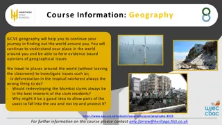
Core Themes and Skills in Year 7 Geography Studies
Explore the key themes of geography - location, place, human-environment interaction, movement, and regions - along with the essential skills and tools geographers use to answer geographical questions. Year 7 students delve into understanding the earth's surface, human interactions with the environment, spatial patterns, and more through engaging reading activities. Discover the foundation of geography studies in this informative material.

Download Presentation

Please find below an Image/Link to download the presentation.
The content on the website is provided AS IS for your information and personal use only. It may not be sold, licensed, or shared on other websites without obtaining consent from the author.If you encounter any issues during the download, it is possible that the publisher has removed the file from their server.
You are allowed to download the files provided on this website for personal or commercial use, subject to the condition that they are used lawfully. All files are the property of their respective owners.
The content on the website is provided AS IS for your information and personal use only. It may not be sold, licensed, or shared on other websites without obtaining consent from the author.
E N D
Presentation Transcript
Year 7 Geography Readings
Year 7 Geog Investigating the World- Lesson 1 Reading Activity . Intro to Year 7 Geography 1. Write down the heading. ____________________________________________________________________ 2. What do you think this piece of writing is about?_________________________________________________ 3. Is it descriptive, informative or persuasive?_____________________________________________________ 4. Read the piece of writing and circle any words whose meaning you are not sure of. 5. Underline the following words: location, place, human environmental interaction , movement, regions 6. How many themes of Geography are there? _________________________ 7. What are the themes __________________________________________________________________________ _____________________________________________________________________________________________ 8. What would you like to learn about in Geography? ______________________________________________________ _____________________________________________________________________________________________ Core themes of Geography 1. LOCATION the meaning of relative (WHERE is it in terms of other places) and absolute (exact) position on the earth's surface Sample terms: latitude and longitude, site and situation, direction, distance, scale Questions: Where is ____? Where is ____ relative to where I am? 2. PLACE The distinctive and distinguishing physical and human characteristics of a place Sample terms: Physical and cultural landscapes, sense of place, population, architecture, language, climate etc. Questions: What does ____ look like? Why? How is it different from ____? 3. HUMAN ENVIRONMENTAL INTERACTION The development and consequences of human-environment relationships Sample terms: Ecosystems, natural resources, environmental pollution Questions: How do people use their environment? How have they changed it? How have people responded to the change? 4. MOVEMENT Patterns and change in human spatial interaction on the earth. As people, goods, and ideas move from place to place, they can change a places characteristics. Sample terms: Migration, diffusion, globalization Questions: How has this spatial pattern developed? Will it continue to change? What does it mean for the places involved? 5. REGIONS A set of places that have similar attributes, and how they form and change. Sample terms: Formal vs. functional regions Questions: How has this spatial pattern developed? Will it continue to change? What does it mean for the places involved?
Year 7 Geog - Investigating the World - Lesson 2 Reading Activity. Geographers Read and do the following activities. 1. Write down the heading. ____________________________________________________________________ 2. What do you think this piece of writing is about?_________________________________________________ 3. Is it descriptive, informative or persuasive?_____________________________________________________ 4. Read the piece of writing and circle any words whose meaning you are not sure of. 5. Underline the following words: citizenship, investigating, questions, tools 6. How do Geographers start? _________________________________________________________________ 7. What are the two main parts of what makes a Geographer tick? __________________________________________ ____________________________________________________________________________________________ 8. What geographical tools and sources do they use? __________________________________________________ ____________________________________________________________________________________________ _____________________________________________________________________________________________ _____________________________________________________________________________________________ What makes a Geographer Tick? ANSWERING GEOGRAPHICAL QUESTIONS Geographers use geographical skills and tools to answer geographical questions. Geographical skills include: Locating, gathering and evaluating information from a variety of sources. Including fieldwork, maps, photographs, books, the media and the internet. Observing and analysing information. Choosing and applying geographical tools. Presenting and communicating information to others. Participating as informed active citizens. Geographical tools include: Maps Fieldwork Graphs and statistics Photographs KEY GEOGRAPHICAL QUESTIONS Geographers start by asking questions. What is it? Where is it? Why is it there? When investigating issues they go on to ask questions, such as: What are the effects of it being there? How is it changing? Should it be like this? Then they consider citizenship. What groups are involved? What do different groups think? What action is appropriate?
Year 7 Geog - Investigating the World - Lesson 3 Reading Activity. Elements of the Environment 1. Write down the heading. ____________________________________________________________________ 2. What do you think this piece of writing is about?_________________________________________________ 3. Is it descriptive, informative or persuasive?_____________________________________________________ 4. Read the piece of writing and circle any words whose meaning you are not sure of. 5. Underline the following words: abiotic, biotic, ecosystem, human, manmade, natural, physical, surroundings, 6. What two kinds does a geographer divide the environment into? _____________________________________ 7. What is the physical environment? ___________________________________________________________ ________________________________________________________________________________________ 8. What is the human environment ______________________________________________________________ ________________________________________________________________________________________ Elements of physical & human environments In geography the word environment is used to describe our total surroundings. This includes the living and non-living features of the earth s surface as well as those features altered or created by people. Geographers divide environments into two kinds: Physical environments Human environments Physical environments are those dominated by natural features, such as landforms and vegetation. Physical environments, which are sometimes referred to as natural environments, include the earth s soil, water, air, sunlight and all living things. Physical elements occur naturally and can be divided into: Biotic living things, such as plants and animals. Abiotic non-living things, such as water, rocks and soil. The way in which all these interact in a particular environment is called an ecosystem. Human environments are best defined as all the elements of the environments created by people. They include the social, cultural, economic and political systems created by humans Human environments are sometimes referred to as Built environments are all the human-alteredlandscapes. They include all those features normally associated withsettlements, industries and agriculture.
Year 7 Geog - Investigating the World - Lesson 4 Reading Activity The Four Spheres. 1. Write down the heading. ____________________________________________________________________ 2. What do you think this piece of writing is about?_________________________________________________ 3. Is it descriptive, informative or persuasive?_____________________________________________________ 4. Read the piece of writing and circle any words whose meaning you are not sure of. 5. Underline the following words: biophysical , dependent, environment, impacts, important, prefixes, resources, serious 6. What is the whole system sometimes referred to as ? __________________________________________________ 7. What are the four spheres? _____________________________________________________________________ 8. Why is it important to understand the four spheres? ___________________________________________________ _____________________________________________________________________________________________ _____________________________________________________________________________________________ The Four Spheres There are four interlocking puzzle pieces that create our environment. The puzzle includes biological (living) pieces and physical (non-living) pieces. These four pieces are dependent upon each other. As a whole, the system is sometimes referred to as an ecosphere To make the study of the biological and physical elements of the Earth easier to understand, scientists separate these biophysical elements into four spheres: 1.Atmosphere 2.Hydrosphere 3.Lithosphere 4.Biosphere To better understand what these terms mean, it is important to understand that '-sphere' in this instance means 'to surround or encompass'. The following prefixes help us understand the meaning of the four spheres: atmo - steam; vapour hydro - water litho - rock; mineral bio life Knowing about the Physical Geography of the planet is important for every serious learner of the planet because the natural processes of the earth (which is what the study of physical geography encompasses) affect the distribution of resources, the conditions of human settlement, and have resulted in a plethora of varied impacts of human populations throughout the millennia. Since the earth is the only home to humans, by studying our planet, we humans and residents of the planet earth can be better informed to help take care of our only home.
Year 7 Geog - Investigating the World - Lesson 5 Reading Activity The Lithosphere 1. Write down the heading. ____________________________________________________________________ 2. What do you think this piece of writing is about?_________________________________________________ 3. Is it descriptive, informative or persuasive?_____________________________________________________ 4. Read the piece of writing and circle any words whose meaning you are not sure of. 5. Underline the following words: asthenosphere, continental, evolved, mantle, oceanic, tectonic 6. What are he two types of lithospheres? __________________________________________________________ 7. Name the 3 types of rocks? ___________________________________________________________________ 8. How do you think wind affects the lithosphere? ____________________________________________________ ___________________________________________________________________________________________ ___________________________________________________________________________________________ The lithosphere The lithosphere, which evolved about 4.6 billion years ago, is composed of an outermost layer of hard rock. This outer rock layer is made up of the crust and the first hard layer of mantle. The lithosphere includes various landforms such as mountains and valleys, as well as rocks, minerals and soil. The lithosphere is constantly being shaped by external forces such as sun, wind, ice, water and chemical changes. There are many different types of rocks that compose the outer crust. These rocks can be grouped into three basic categories based on how they are formed. 1.Igneous rocks are formed by the cooling of hot molten rock (magma). When the hot, flowing magma cools, it begins to harden. Once completely cooled it is then an igneous rock. 2.Sedimentary rocks are formed from pre-existing rocks. Rocks erode, mix with other dirt, clay and particles and settle together. This mix creates a sedimentary rock. 3.Metamorphic rocks are formed by heat and/or pressure from pre-existing rocks. The lithosphere does not wrap perfectly around the Earth. It is in fact about 15 different pieces of crust that sit on top of a softer layer called the asthenosphere. These tectonic plates drift around on top of the asthenosphere and are moving, though too slowly for the human eye to notice. As a result of the plate movement, mountains become taller and valleys grow wider. Scientists believe that the continents, which rest on the various plates, were at one point joined in a single 'super continent' known as Pangaea The Earth's surface is composed of the two types of lithospheres: the oceanic and the continental. The oceanic lithosphere includes the uppermost layers of mantle topped with the thin but heavy oceanic crust. This is where the oceans of the hydrosphere meet the lithosphere. The continental lithosphere includes the uppermost layers of mantle topped with a thick, lighter continental crust. This is where the atmosphere, biosphere and the hydrosphere meet the lithosphere.
Year 7 Geog - Investigating the World - Lesson 6 Reading Activity The Atmosphere 1. Write down the heading. ____________________________________________________________________ 2. What do you think this piece of writing is about?_________________________________________________ 3. Is it descriptive, informative or persuasive?_____________________________________________________ 4. Read the piece of writing and circle any words whose meaning you are not sure of. 5. Underline the following words: colder, ozone, temperature, solar energy, warmer, water vapour, weather 6. What is the bottom layer of the atmosphere? _____________________________________________________ 7. What 3 layers separate the main layers of the troposphere, the stratosphere, mesosphere and the thermosphere? __________________________________________________________________________________________ 8. What is outer space called? ___________________________________________________________________ The atmosphere The bottom layer of the atmosphere is the troposphere. The troposphere is where weather happens. It is warmest near the Earth because of the heat rising from the Earth's surface. It becomes colder with altitude. This layer is separated from the next by the tropopause. The tropopause is the point where temperatures change and begin to increase with altitude. Above the tropopause is the stratosphere. There is a large concentration of ozone gas in the stratosphere. The ozone gases absorb most radiant solar energy, protecting the Earth from harmful ultra violet (UV) rays. The stratosphere becomes warmer with increasing altitude, due to the high absorption of solar energy. Temperatures then start to decrease around the imaginary line known as the stratopause and continue to decrease rapidly into the next layer. The mesosphere is the coldest of the spheres. It is so cold that water vapours often freeze and create clouds made purely of ice. The mesosphere is separated from the thermosphere by the mesopause. This is the point at which the temperature changes again. The topmost layer is the thermosphere. Within this layer, many satellites circle the Earth. Because of the thin air and proximity to the sun, the temperatures in the thermosphere increase and decrease rapidly. Beyond the atmosphere, past the thermosphere, the exosphere stretches out into the vast regions of space.
Year 7 Geog - Investigating the World - Lesson 7 Reading Activity The Hydrosphere 1. Write down the heading. ____________________________________________________________________ 2. What do you think this piece of writing is about?_________________________________________________ 3. Is it descriptive, informative or persuasive?_____________________________________________________ 4. Read the piece of writing and circle any words whose meaning you are not sure of. 5. Underline the following words: encompasses, gases, important, motion, organisms, survival, 6. What is life s most important resource? __________________________________________________________ 7. What forms of water are there on Earth? ________________________________________________________ ___________________________________________________________________________________________ 8. How can we help to preserve the Hydrosphere? _____________________________________________________ ___________________________________________________________________________________________ ___________________________________________________________________________________________ The hydrosphere Water is life's most important resource. Plants and animals rely on water for survival. Many animals live in the water. The hydrosphere encompasses all forms of water in the Earth's environment. This includes the oceans; all water found on the Earth's surface such as lakes, rivers, snow and glaciers; water under the Earth's surface; and water vapour found in the atmosphere. Much like the gases in the atmosphere, the water in the hydrosphere is always in motion. We can see the flow of rivers and streams and the waves at the beach. The middles of oceans and lakes also move due to wind and temperature changes, which create currents. The hydrosphere formed in conjunction with the atmosphere. About 3.6 to 4.3 billion years ago, there were many hot molten rocks containing water and gases. When the rocks cooled down and released hydrogen and water vapours into the air, the atmosphere was formed. The water vapours condensed to form clouds. Precipitation fell to the Earth and the hydrosphere was also formed. Oxygen was produced as a by-product of small organisms and plant life.
Year 7 Geog - Investigating the World - Lesson 8 Reading Activity The Biosphere 1. Write down the heading. ____________________________________________________________________ 2. What do you think this piece of writing is about?_________________________________________________ 3. Is it descriptive, informative or persuasive?_____________________________________________________ 4. Read the piece of writing and circle any words whose meaning you are not sure of. 5. Underline the following words: biophysical, community, living, non-living, surroundings, various 6. What is biotic? ____________________________________________________________________________ 7. What provides homes for all various forms of life? __________________________________________________ 8. Describe an ecosystem in your backyard. _________________________________________________________ ___________________________________________________________________________________________ ___________________________________________________________________________________________ The biosphere The three previous spheres - the atmosphere, the hydrosphere, and the lithosphere - are the abiotic, or non-living, parts of the biophysical environment. The fourth sphere, the biosphere, includes all biotic, or living, parts of the biophysical environment. The biotic elements include all plants and animals. All life exists in the biosphere. The biosphere cannot survive without elements from all the other spheres. Plants and animals need water from the hydrosphere, minerals from the lithosphere and gases from the atmosphere. The air, water, and land provide homes for all the various forms of life. The environment contains all the factors that surround and influence the biotic and abiotic things within it. The environment is our surroundings. Each living thing within the biosphere inhabits and interacts with the things that surround them. This is their biophysical environment. It is in this environment that we find ecosystems. An ecosystem is a smaller function within the environment. It is the unique interaction between the living and non-living elements. An ecosystem is a community functioning together as one unit.
Year 7 Geog - Investigating the World - Lesson 9 Reading Activity Human Environments Big cities 1. Write down the heading. ____________________________________________________________________ 2. What do you think this piece of writing is about?_________________________________________________ 3. Is it descriptive, informative or persuasive?_____________________________________________________ 4. Read the piece of writing and circle any words whose meaning you are not sure of. 5. Underline the following words: activities, agriculture, extract, influences , interrelationship, natural resources, physical 6. What is the human environment? _______________________________________________________________ 7. What are examples of the human environment? _____________________________________________________ ___________________________________________________________________________________________ 8. How can the physical environment affect the human environment? ________________________________________ ___________________________________________________________________________________________ ___________________________________________________________________________________________ ___________________________________________________________________________________________ The human environment An interrelationship exists between people and the environment. The environment influences the way people live and people change the environment according to their needs. Physical environment has been altered with the help of technology. Technology here refers to the skills, knowledge and tools that people use to meet their needs We need the physical environment to meet our needs. We obtain food from plants and animals, wood from trees and water from rivers. Materials we use from the physical environment is called natural resources. When we extract and use these natural resources we often change the physical environment. We say that a human environment is formed when a physical environment is changed as a result of human activities. Examples of human environments include cities, towns, farms and industrial centers. There are very few environments left in the world that are completely natural. In most places humans have had some influence on the landscape. Land has been cleared for agriculture, rivers dammed or to provide water and electricity. Industries have been developed to process raw materials and people have created settlements in which to live.
Year 7 Geog - Investigating the World - Lesson 10 Reading Activity Interaction of physical and human 1. Write down the heading. ____________________________________________________________________ 2. What do you think this piece of writing is about?_________________________________________________ 3. Is it descriptive, informative or persuasive?_____________________________________________________ 4. Read the piece of writing and circle any words whose meaning you are not sure of. 5. Underline the following words: alter, benefit, both, constantly, harm, influenced, isolation, survival 6. What are the two elements of the environment? ____________________________________________________ 7. How do the physical and human elements of the environment interact with each other? ________________________ ___________________________________________________________________________________________ 8. How can the environment be altered that affects the survival of life on earth? ______________________________ ___________________________________________________________________________________________ ___________________________________________________________________________________________ The interaction of the physical and human elements of the environment Physical and human elements of the environment do not exist in isolation. They are constantly interacting with each other, and each is influenced by the other. Physical forces can alter human elements just as humans can alter physical features. This is important in the study of geography as the actions of people -individually and in groups - play a major role in altering the environment. Sometimes people benefit from these changes, but sometimes the actions of people may cause harm. Thus when people talk about caring for the environment they are really talking about looking after both the physical and human aspects. When the environment is altered, we need to ask if this affects the survival of life on Earth and the quality of life of its people.
Year 7 Geog: World Heritage Lesson 2 Reading Activity World Heritage 1. Write down the heading. ____________________________________________________________________ 2. What do you think this piece of writing is about?_________________________________________________ 3. Is it descriptive, informative or persuasive?_____________________________________________________ 4. Read the piece of writing and circle any words whose meaning you are not sure of. 5. Underline the following words: classified, cultural, natural, significance, universal, 6. How many sites did Australia have in 2009? ________________________________________________________ 7. What 4 values gives sites special significance? ______________________________________________________ ____________________________________________________________________________________________ 8. Explain why your house should be listed as a World Heritage site. _________________________________________ ______________________________________________________________________________________________ _____________________________________________________________________________________________ World Heritage sites There are some natural (physical) and cultural (human) parts of the world that have special significance because of their unique natural beauty, their historical and cultural importance, or their religious value. Many of these geographical sites have been classified as World Heritage sites. UNESCO (United Nations Educational Scientific and Cultural Organization) established the World Heritage List in 1972 under the World Heritage Convention. This convention states that the World Heritage Committee will establish, keep up to date and publish a list of natural and cultural properties, submitted by countries and considered to be of outstanding universal value . In 1972, twelve sites were recognised and by 1979 there were forty-four. By early 2009 there were 878 such sites spread across 145 countries: 174 natural sites, 679 cultural sites and 25 sites of natural and cultural significance. Seventeen of these sites were in Australia. When a country nominates a site it must agree to conserve it for future generations. World Heritage listing To be classified by the World Heritage Committee a site must have global significance as a natural and/or a cultural site. There are 660 cultural sites and 166 natural sites with twenty-five sites considered as having both cultural and physical significance. The World Heritage Committee lists new sites each year. Natural sites are generally those that have: great natural beauty distinctive landform features natural habitats where there are endangered animals or plants of unique value Cultural sites are generally those that have: outstanding beauty historical significance architectural significance or unique artistic merit cultural and/or religious value. A site could have both natural and cultural significance, for example Kakadu National Park in northern Australia with its wetland environment and Aboriginal rock art.
Year 7 Geog: World Heritage Lesson 3 Reading ActivityWorld Heritage Responsibility 1. Write down the heading. ____________________________________________________________________ 2. What do you think this piece of writing is about?_________________________________________________ 3. Is it descriptive, informative or persuasive?_____________________________________________________ 4. Read the piece of writing and circle any words whose meaning you are not sure of. 5. Underline the following words: active, funding, future, informed, preserve, protect, responsibility, threats, 6. Which sites are relatively safe from danger? ________________________________________________________ 7. Name 3 sites that are in danger. __________________________________________________________________ ______________________________________________________________________________________________ 8. What can you do to help the preservation of World Heritage sites? _________________________________________ ______________________________________________________________________________________________ ______________________________________________________________________________________________ Managing World Heritage sites Some World Heritage sites are located in inaccessible areas and may be relatively safe from damage. However, most sites face a variety of threats, particularly in today s conditions. Examples of these threats are: climate change the Tower of London in England and the Great Barrier Reef in Australia are among the sites at risk from the effects of global warming wars and internal conflicts in countries the old city of Dubrovnik in Croatia and the city of Jerusalem in Israel attacks on wildlife by hunters and poachers the national parks in Kenya, Zimbabwe and Zaire attacks on the ecosystem from invasive species the Galapagos Islands off the coast of Ecuador human action in altering the built environment the Old Town Centre of Prague visits by large numbers of tourists the Great Wall of China It is the responsibility of each country to nominate its World Heritage sites and then to manage them. Under the convention, each member country is required to do all it can to preserve and protect its sites for future generations to enjoy. The World Heritage Committee provides additional help to those sites regarded as being on the danger list . For example: The Garamba National Park in Zaire is the habitat of the endangered white rhinoceros. Poaching threatened to wipe out the whole rhino population. The World Heritage Committee helped by funding jeeps and radios in the fight against poaching. Kathmandu Valley in Nepal has been severely affected by uncontrolled urban development. UNESCO is working with the Nepalese authorities to help them develop a long-term management plan to conserve the remaining World Heritage values of urban areas and to stop illegal building activities. The historic town of Zabid in Yemen was put onto the Danger List in 2000 as 40 per cent of its original houses had been replaced by concrete buildings.
Year 7 Geog: World Heritage Lesson 4 Reading Activity Sites in Danger 1. Write down the heading. ____________________________________________________________________ 2. What do you think this piece of writing is about?_________________________________________________ 3. Is it descriptive, informative or persuasive?_____________________________________________________ 4. Read the piece of writing and circle any words whose meaning you are not sure of. 5. Underline the following words : assistance, attention, benefits, community, endangered, protect 6. What is the main benefit of bring listed? ________________________________________________________ ___________________________________________________________________________________________ 7. Name 3 dangers to the sites? __________________________________________________________________ 8. Explain in your own words what happened in the Everglades. ____________________________________________ ___________________________________________________________________________________________ ___________________________________________________________________________________________ ___________________________________________________________________________________________ What does World Heritage listing achieve? The main benefit of a World Heritage listing is the attention it focuses on the place. Listing it means that people are aware of how special the place is. It puts pressure on governments to protect the site. When a problem arises there is enough public interest to make it an issue for community debate and action. At certain times, particular sites are endangered by war, pollution, poachers, lack of maintenance, the damming of rivers, illegal logging or similar activities. These sites are often placed on a temporary endangered list and assistance is given to help protect the site. Examples of places that have been listed in recent years are the Old City of Jerusalem because of the Israeli Palestinian conflict and the Ngorongo Crater in Tanzania because of lack of controls on landuses. The crater was taken off the list when management plans were put in place to protect it. The Everglades National Park in Florida, United States, was added to the List of World Heritage in Danger in 1993 after the park s superintendent informed the committee of extensive damage to the Everglades ecology. The Everglades has been called a river of grass because it flows very slowly from the hinterland into the sea. The exceptional variety of its water habitats has made it a sanctuary for a large number of birds and reptiles, as well as for threatened species, such as the manatee. The Everglades ecology has been damaged by nearby urban growth, pollution from fertilisers, mercury poisoning of fish and wildlife and a fall in water levels caused by flood protection measures. Listing, however, does not always guarantee protection. Historic Dubrovnik in Croatia, for example, was partially destroyed during the war in former Yugoslavia.
Year 7 Geog Global Environments 1: Weather and Climate (15 mins) Read and do the following activities 1. Write down the heading. ________________________________________________________________________ 2. What do you think this piece of writing is about?_______________________________________________________ 3. Read the piece of writing and circle any words whose meaning you are not sure of. 4. Underline the following words: atmosphere, geographical, pattern, synoptic, 5. What is the main point of each paragraph? i. ___________________________________________________________________________________________ ii. ___________________________________________________________________________________________ iii. ___________________________________________________________________________________________ iv. ___________________________________________________________________________________________ v. ___________________________________________________________________________________________ 6. In summary what is the difference between weather and climate? __________________________________________ ____________________________________________________________________________________________ What is the difference between weather and climate? The words weather and climate do not mean the same thing. Weather is the day-to-day condition of the atmosphere at a particular place. It includes all the daily changes in temperature, precipitation, wind, sunshine, humidity (the amount of moisture in the air) and atmospheric pressure. Weather maps, or synoptic charts, use symbols to show the pattern of these changes. Climate is the long-term weather pattern for a place or region. The climate of a place depends on its latitude, the season, its aspect, how close it is to the sea, ocean currents and its height above sea level (elevation). Weather and climate affect the type of clothing we wear, our activities, the food we grow, the kinds of houses we live in and the types of transport we use. It also affects the types of plants and animals living in an area. Weather and climate are important indications of changes in the earth s geographical processes. This is because a change in the atmosphere can quickly change the weather. For example, a volcanic eruption can affect weather around the world in a matter of days. How does the weather we experience happen? To understand weather, we need to understand atmospheric pressure. Atmospheric pressure is the weight of the air pressing down on the earth s surface. When air is heated by the energy of the sun, it rises. This forms areas of low pressure. When air cools, it sinks towards the earth s surface. This forms areas of high pressure. The location of high- pressure and low pressure systems helps us predict the weather for a particular place. High-pressure systems are usually associated with settled, or fine, weather. Low-pressure systems are generally associated with unsettled weather. We can also use pressure systems to read and predict wind direction. Moving air, known as wind, always moves from areas of high pressure (highs) to areas of low pressure (lows). In the Southern Hemisphere, the air moves out from the centre of a high in an anticlockwise direction. It moves into the centre of a low in a clockwise direction. Pressure systems are not the same as air masses. Air masses are large bodies of air with similar temperature and moisture content. The line along which two air masses meet is known as a front. The passing of a warm front results in a rise in temperature and more widespread rainfall. Warm fronts are very rare in Australia. Precipitation is any moisture reaching the surface of the earth. Forms of precipitation include rain, sleet, snow, hail, dew and frost.
Year 7 Geog Global Environments 2: Factors affecting temperature (15 mins) Read and do the following activities 1. Write down the heading. ______________________________________________________________________ 2. What do you think this piece of writing is about?______________________________________________________ 3. Read the piece of writing and circle any words whose meaning you are not sure of. 4. Underline the following words: Climate, determine, elevations, energy, seasonal, 5. What is the main point of each paragraph? i. ______________________________________________________________ ii. ______________________________________________________________ iii. ______________________________________________________________ iv. ______________________________________________________________ v. ______________________________________________________________ 6. In summary what are the factors affecting temperature? ____________________ __________________________________________________________________ Climate Climate is the weather experienced by a place over many years. The factors that contribute to this long-term pattern are discussed below. Factors affecting temperature Latitude Solar energy has twice the area to heat at 60 north and 60 south as it does at the Equator. Therefore, average temperatures are lower at higher latitudes. Length of day and night Because the earth s axis is tilted at an angle of 23.5 , there are seasonal differences in the number of daylight hours. The shorter the day, the less opportunity there is for the earth and its atmosphere to absorb heat. The differences in the length of day and night at different latitudes. Seasonal differences The changing seasons not only determine the length of the day but also the angle at which the sun s rays reach the earth s surface. From November to January the Southern Hemisphere is tilted towards the sun. From May to July, the Northern Hemisphere is tilted towards the sun. This is why the Northern Hemisphere has its summer in the middle of the year while Australia is having its winter. Elevation (height above sea level) Because of their height, mountain areas are cooler than areas at lower elevations. Mt Kilimanjaro is Africa s highest mountain. At 5894 metres its top is permanently covered with snow, even though it is just south of the Equator. On average, the temperature drops by approximately 6.5 C for every 1000 metres of elevation.
Year 7 Geog Global Environments 3: Factors affecting both temperature and rainfall (15 mins) Read and do the following activities 1. Write down the heading. ______________________________________________________________________ 2. What do you think this piece of writing is about?____________________________________________________ 3. Read the piece of writing and circle any words whose meaning you are not sure of. 4. Underline the following words: prevailing, temperature, vapour, windward, 5. What is the main point of each paragraph? i. ______________________________________________________________ ii. ______________________________________________________________ iii. ______________________________________________________________ iv. ______________________________________________________________ v. ______________________________________________________________ 6. In summary what are the factors affecting both temperature and rainfall? _______ _________________________________________________________________ _________________________________________________________________ _________________________________________________________________ Factors affecting both temperature and rainfall Mountain barriers Mountains also act as barriers to the movement of moisture-laden air. When warm, moist air is forced to rise, it cools and the water vapour in the air turns into droplets of water. These water droplets fall on the mountain s windward side (the side facing directly into the wind) as either rain or snow. This is known as orographic rainfall. The air flowing over the mountain is much drier. Deserts are often found on the leeward (sheltered) side of large mountain ranges. This is known as the rain-shadow effect. Distance from the sea Distance from the sea influences both temperature and rainfall. Temperature The sea gains and loses its heat much more slowly than the land the sea maintains more even temperatures. Places near the coast therefore have less variation in temperature than inland places. Places away from the coast can have higher temperatures during the day and lower temperatures at night because of the speed at which land gains and loses heat. Rainfall Winds blowing off the sea carry a lot of moisture. Because of this, places near the coast often receive higher rainfall than those further inland. By the time the winds reach inland areas, they have lost most or all of their moisture. Ocean currents The temperature of ocean currents influences both air temperature and rainfall. Temperature Oceans absorb heat during the day and release it slowly during the night. This helps keep coastal areas much warmer than inland areas. Rainfall Water evaporates much more quickly from oceans affected by warm ocean currents. As a result, nearby coastal areas are likely to have higher levels of rainfall. Areas affected by cold ocean currents have much lower evaporation rates. The world s deserts are located in areas affected by cold ocean currents. Prevailing winds The prevailing wind is the direction from which the wind blows most often. The temperature of the prevailing wind is affected by the area it blows from and over. When prevailing winds blow from over warm bodies of water they often bring rain.
Year 7 Geog - Deserts 1: Introduction to Deserts (15 mins) Read and do the following activities 1. Write down the heading. ________________________________________________________________________ 2. What do you think this piece of writing is about?_______________________________________________________ 3. Read the piece of writing and circle any words whose meaning you are not sure of. 4. Underline the following words: continent, developed, exporter, multicultural, support, 5. What are the four major geographical processes ? i. ___________________________________________________________________________________________ ii. ___________________________________________________________________________________________ iii. ___________________________________________________________________________________________ iv. ___________________________________________________________________________________________ 6. In summary students are to learn about _____________________________________________________________ ______________________________________________________________________________________________ From the Syllabus Student learn about At least ONE global environment - Deserts the spatial distribution of the selected global environment the major geographical processes that operate within the chosen environment: atmospheric processes biotic processes geomorphic processes hydrologic processes the way humans, including indigenous groups, interact with the environment At least ONE community (The Bedouins) and the way it interacts with the selected global environment the way the environment influences the community the way the relationship between the community and the environment is changing explain how individuals, community organisations and government actions are contributing to the current management of the environment strategies and processes that individuals, groups and governments use to influence change identify the responsibility of government to the community and its environment the way the community is responding to these changes describe current use of the environment and suggest strategies for future ecological sustainability
(F)The distance along the path from Year 7 Geog - Deserts 2 Skills E)The distance across the assembly the steps at the foot of Block A to 2cm = 50 metres the footpath in Main Street is Use the School plan below to (G) Room 4 is in grid square: (H) Room 1 is in grid square: answer Question 1A to 1H area from room 2 is about: Scale; A3, A3, D4, D4, B3. B3. C5, C5, (c)100 metres, (b) 25 metres, (d) 95 metres. (a) 30 metres, (c) 70 metres, (b)30 metres, (d)50 metres. (a)75 metres, No. 2 about: (b) (d) (b) (d) (a) (c) (a) (c) on the map represents: on the map represents: (B)If you were to be looking for the Industrial Arts Block to 'Block A', in which direction is 'BLOCK A' from the Industrial Arts Block? on the direction indicator in the map given. (A) Correctly place the letters (a)the assembly area, (North) (South) (West) (East) (b)a tennis court, (C) The marking (D)The marking (h) classrooms, (d)a car park. (c)an oval, (d) West. (b)South, (a) paths, (d) steps. (a)North, (c) trees, (c)East, N W S E
Year 7 Geog Deserts 3 -Skills No. 3 Did You Know? The hottest part of the desert is the surface of the sand! No wonder camels have thick leathery pads on the bottom of their feet! The temperature of the surface of the sand can measure up to 167 Fahrenheit! The diagram to the right shows how the temperature changes as you move away from the surface above ground and underground. Directions: Use the information in the diagram to: 1. Make a graph showing different levels of heat in the desert. 2. Solve the problems below: 1. How much many degrees cooler is the temperature near a camel's head than near its feet? _____________________ 2. How many degrees cooler would a gerbil be if it burrowed five feet down into the sand, than if it stood on the surface of the sand?____________________________________________________________________ 3. Which two levels of the desert have the same temperature? ___________________________________________________________________________ 4.Why do the animals in the desert burrow underground during the day? Use temperatures from the chart to help explain your answer. ____________________________________________________________________________________________ ____________________________________________________________________________________________ ____________________________________________________________________________________________ ____________________________________________________________________________________________
(C) To see if this book mentions Willen Van assignment on Indonesia using the Library If there are any other books In which part of the book would you look (D) To see if there is a map of Indonesia (B) To find out what the word 'Sambal' (A) To find out what page the chapter reference book "A Short History of 3. Imagine you were asked to do an List of Illustrations List of Illustrations List of Illustrations List of Illustrations about President Sukarno begins? Table of Contents Table of Contents Table of Contents Table of contents Introduction Introduction Bibliography Bibliography Bibliography Bibliography Bibliography on Indonesian History Glossary Glossary Glossary Glossary Glossary Index Index Index Index Index Indonesia" Barten? means? (E) b) d) b) d) b) d) b) d) b) d) e) e) e) e) e) a) c) a) c) a) c) a) c) a) c) books would you use for each question(A) 2. Imagine you were asked to answer the (C) What were the main achievements of reference books. Which of the following Year 7 Geog - Desrts 4 Skills No. 4 How do you get from Spencer Street (D) How many migrants returned to (F) How high is Mt. Egmont in New (B) In which range of Mountains is England from Australia Last Year? following questions using Library Street Directory Street Directory Street Directory Street Directory Street Directory History Text History Text History Text History Text History Text Encyclopedia Encyclopedia Encyclopedia Encyclopedia Encyclopedia Wilpena Pound situated? Year Book Year Book Year Book Year Book Year Book Station to V.F.L. Park? Atlas Atlas Atlas Atlas Atlas Sir John Monash? Research Skills Zealand? d) d) b) d) b) b) d) b) d) h) e) e) e) e) e) c> c> a) c) a) a) c) a) a) c)
Year 7 Geog Deserts 5 Skills No. 5 1.Follow the directions given to make a picture below. Work neatly with a sharp pencil and rule all lines. Neatly cross off each numbered point as you plot it. Begin at point X. 1.S3,E2 2.E1 3.52 4.S2,E1 9.S4,W2 10.S1,W1 11.S1,W2 12.W1 17.N2,W2 18.N1 19.W1,S1 20.W1 25.N1,W1 26.E1,N1 27.W2,N4 28.N1 33.N1 34.E1,N1 35.E1 36.E1,N2 41.E2,N1 42.E3,S1 43.S2,W1 44.S1,E4 8.S2,W1 16.N1,W1 24.S1,W3 32.E3,N2 40.E1,N2 5.S3,E3 13.N1 21.N2,W2 22.S2,W6 23.S1,W2 29.N1,W1 30.N2 37.E1,N1 38.E1 45.E1,N5 6.S2,E1 14.W1,S1 7.S3,E1 15.W1 31.N2,E2 39.S1,E1
Year 7 Geog - Deserts 6 Skills No.6 Compass Directions Sometimes it is more important to discover what one cannot do than what one can do. Lin Yutana (1895 19761 Find the hidden words they run either vertically, horizontally or diagonally. Then place them in their correct meaning in the passage below. The four main or cardinal p _ _ _ _ _ of the c _ _ _ _ _ _ are n _ _ _ _, s _ _ _ _, e _ _ _, north south east west northeast northwest southeast southwest direction true magnetic grid compass wind needle stars sun degrees from bearing Points from w _ _ _ _. To find d _ _ _ _ _ _ _ _ you can use a c _ _ _ _ _ _, the s _ _ or the s _ _ _ _. A compass n _ _ _ _ _ points to m _ _ _ _ _ _ _ north. Two other types of north are g _ _ _ north and t _ _ _ north. Direction can be given as a b _ _ _ _ _ _ in d _ _ _ _ _ _. When w _ _ _ direction is given, it is the direction from which the wind comes f _ _ _. N X W U N 0 X Q R F J R 0 0 U M R Z F C B 0 D S 0 N T D H B A G D E G R R J R K Q S A C D C E A Q M A P A U T U J G C Y U N U J W F S B P T T I A S E W X S I V N A D A S U E A S T Z A B S T B E A R I N N G R H Y E E 0 T L A L R Y N E E D L E 0 R A E T I T F P D L I D V R I R H C H A C T E B G Z K T D F A L J P 0 I N T S P E H S B F 0 G A T V K T E I V C P 0 T G S T P Y W E E E 0 S A T I R U T U L C 0 I S 0 R T H I C A A T A Y S N H H G U E S C E H S M 0 G E S I S T U H Q M K E E 0 T N S S S H W E S
New York: __________________________ Sydney: ____________________________ Bombay:____________________________ London: ____________________________ HongKong: __________________________ Hawaii: ____________________________ 3. Make a list of the people whose lives may sometimes 2. Using the map fig. 1 give the approximate location in latitude and longitude (0 ) of tile a) ______________________________________ b) ______________________________________ c) ______________________________________ d) ______________________________________ e) ______________________________________ f) ______________________________________ depend on being able to give their location accurately especially in time of distress or emergency. following places: Year 7 Geog Deserts 7 Skills No.7 The States of The Cities of Canberra Sydney Hobart Darwin 1. On the map of Australia mark Perth Latitue and Longitude Western Australia New South Wales Oueensland Tasmania Victoria
Year 7 Geog Deserts 8 - Skills No.8 interpreting keys In the able below. State True or False if a particular mineral is found in that location Study the map and write down TRUE or FALSE for these statements. Some will just require you to look carefully, while others will require a little more thought. (a)Mt Lyell (Tas.) has copper, gold and silver. (b)Opals are found in two places in South Australia. (c)Weipa (Qld) and Gove (N.T.) have the same mineral. (d)Mt Tom Price (W.A.) and Mt Morgan (Old) have the same mineral. (e)The Northern Territory is the chief uranium mining area. (f)Gold is found only in W.A. and Victoria. (g)Oil is found off the Victorian coast. (h)Collie (W.A.), Leigh Creek (S.A.) and Mt Morgan (Old) all have coal. (i)Western Australia is the most important mining State. (j)Gold is Victoria's main mineral. (k)Queensland's south western region has no minerals. (Careful!) (I) Iron ore is quite often found in mountain ranges. (m) Coal is usually found fairly close to the coast. (n) Bauxite is found only in northern Australia. (o) Opals are found in three States. (p) Kalgoorlie (W.A.) is a uranium mining area. (q) Minerals in Tasmania are found on the west coast. (r) The mineral closest to Alice Springs is opals. (s) Oil is found only in the sea. (t) Iron ore and gold are Western Australia's main minerals. Towns States Minerals True/False Gold True Copper False Coal Copper Bauxite Uranium Uranium Gold Bauxite Bauxite Silver Opals Mt Morgan Savage River Collie Ravensthorpe Cobar Rum Jungle Meekatharra Bendigo White Cliffs Weipa Mt Isa Mt Lyell Queensland Tasmania Western Australia Western Australia N.S.W. Northern Territory Western Australia Victoria N.S.W. Queensland Queensland Tasmania (a) (b) (c) (d) (e) (f) (g) (h) (i) (j)
Year 7 Geog Deserts 10 - Skills No. 9 Map Skills 1.What direction does the house face? ______ 2.What is the depth of the house from front to back? ___________metres( A B is the front part ) 3.What is the width of the house? ______ metres 4.How long is the longest part of the lounge room? _____________ metres 5.What direction is the dining room from Bedroom 3? _______ 6.Taking the scale into account, how many maps this size would be needed to cover the floor of this house? _________ 7.Mark in the names of the rooms left blank 8.In the KEY table, use symbols or colours to make up a suitable key for this map. This could refer to furnishings, room use etc. __________ 9.In the space below the map draw the front view of the house. Follow these instructions: Point A is 121 metres above sea level and point A is at 121.5 metres. Draw a light vertical line from A and B to the rectangle below to help you place the ends correctly. The floor of the house is 0.5 metres above the ground at point B. The distance from floor to ceiling is 2.5 metres. The distance from the ceiling to the peak of the roof is 1.5 metres. The windows are 0.5 metres above the floor and are 1.5 metres high. The front door is 2.1 metres high. Design your own roof style. 10.Add any features you think will improve the house ( steps etc ), but make sure the major outlines are clear.
Year 7 Geog Deserts 10 - Skills No.10 In the able below. State True or False if a particular mineral is found in that location Study the map and write down TRUE or FALSE for these statements. Some will just require you to look carefully, while others will require a little more thought. (a)Mt Lyell (Tas.) has copper, gold and silver. (b)Opals are found in two places in South Australia. (c)Weipa (Qld) and Gove (N.T.) have the same mineral. (d)Mt Tom Price (W.A.) and Mt Morgan (Old) have the same mineral. (e)The Northern Territory is the chief uranium mining area. (f)Gold is found only in W.A. and Victoria. (g)Oil is found off the Victorian coast. (h)Collie (W.A.), Leigh Creek (S.A.) and Mt Morgan (Old) all have coal. (i)Western Australia is the most important mining State. (j)Gold is Victoria's main mineral. (k)Queensland's south western region has no minerals. (Careful!) (I) Iron ore is quite often found in mountain ranges. (m) Coal is usually found fairly close to the coast. (n) Bauxite is found only in northern Australia. (o) Opals are found in three States. (p) Kalgoorlie (W.A.) is a uranium mining area. (q) Minerals in Tasmania are found on the west coast. (r) The mineral closest to Alice Springs is opals. (s) Oil is found only in the sea. (t) Iron ore and gold are Western Australia's main minerals. Towns States Minerals True/False Gold True Copper False Coal Copper Bauxite Uranium Uranium Gold Bauxite Bauxite Silver Opals Mt Morgan Savage River Collie Ravensthorpe Cobar Rum Jungle Meekatharra Bendigo White Cliffs Weipa Mt Isa Mt Lyell Queensland Tasmania Western Australia Western Australia N.S.W. Northern Territory Western Australia Victoria N.S.W. Queensland Queensland Tasmania (a) (b) (c) (d) (e) (f) (g) (h) (i) (j)
_______________________________________ _______________________________________ _______________________________________ _______________________________________ _______________________________________ _______________________________________ _______________________________________ drive from within the school grounds to the library. below. Write direct ions for someone who wants to ______________________________________ 2. A school and a library are marked on the map THECOUNTRIES New Zealand England 3. On the map of the world mark Japan India Italy CONTINENTS of North America Australia Europe Africa Asia (B)Which city is 20 farther north (c) Duval (d) Egan continent to answer the questions Year 7 Geog Desert People 1 In a mountain range (A)Where is the point 20 S and 1. Use the map of the imaginary On a peninsula In the ocean On an island Beecher Hume Location skills 95 E located? Skills No.11 than Castle? (b) (d) (b) (a) (c) (a)
Year 7 Geog Desert People 2 Skills No. 12 Latitude and longitude Geographers use lines of latitude and longitude to help locate places (see figure 1). Aeroplanes and ships use and longitude to find their way around the world. Lines of latitude are called 'parallels', lines of longitude are called 'meridians'. Latitude is measured in Degrees________ Or_____________ of the equator (which is at 0 ). All places in Australia are_______ equator. The major lines of latitude In the world are the equator (0 ), the Tropic of______________(23 north), the Tropic of______________(23 south), the _____________Circle (66 north) and the ____________________Circle (66 south) Longitude is, measured in 'degrees (E) or west (W) of the line (meridian) which runs through the town of_____________ in England (0 ). This starting point for measuring longitude is known as the_______________________. All places in_____________ are east of the Greenwich meridian. The world's other major line of longitude is the International Date Line (180 ). One degree of latitude or longitude can be broken Into sixty smaller parts known as minutes (shown by the symbol '). So 24 30' is____________ between 24 and_____. Sydney's latitude is 33 53' south and Its longitude is 151 10' east. Latitude Is always given first, and north, south, east or west is always written after the minutes to show whether the place is north or south of the equator or east or ___________of the Greenwich meridian. of the Arctic , west , Greenwich, latitude, halfway, North, cancer, equator, Greenwich meridian, south, south, Australia, Capricorn, Antarctic.
What are the following distances by road or along the road counting every step as 250m. To measure distance fairly accurately use a straight line, not along roads. What are the .................................................................................. ............................................................................ using tie scale on the map, then walk them b. From the railway station to the village pair of compasses and set them at 250m, a. From the railway station to the quarry b. 2. Half a km North of the lighthouse. ____________________________ c. From the school to the house 'Ho' __________________________ Measurements for direction are in a a. One km East of the farm 2030 following buildings?: d. using the ferry e. going by road 4. Direction 3. Distance (5560) .......... track ?: ......... the bottom number should be read first. To be First complete this key with the symbols used The end of the jetty has the reference 4/1 as Year 7 Geog Desert People 3 Skills No 13. Which objects are situated at these points ?: called the grid, are numbered for reference. The house marked 'Ho' will then have a map between the lines to be divided into tenths. Write the map references of the following: b. The school _____________________ Notice that the straight lines on the map, a. The signal box __________________ given 2515. The quarry at the top is 6775 d. The railway bridges ______________ c. The island _____________________ reference 2.5/1.5 or, as it is more usually (6.7/7.5) and the railway station is 5040. more accurate we can imagine the space Signal Box 5523. _____________________ 1838 _____________________ 5524 _____________________ 5525 _____________________ 6030 _____________________ 2667 _____________________ 5020 _____________________ 5757 _____________________ Quarry School Railway Embankment 2. Map References Ferry Terminus Reading Maps Lighthouse in this map: Churches Marsh Pond.
Year 7 Geog Desert People 4 Skills No. 14 Directions The Lennaville Endurance Horse Race has to go around a group of lakes and a pit, so jockeys are given a map before the day of the big race. Unfortunately, the race organisers ran out of ink before they could finish the maps and only marked in the lakes, the pit and the start. On the map below, using the instructions given to the jockeys, mark in the race course. The map's scale is 1 cm represents 1 km and you are required to draw a linear representation of this on your map. Make sure to include a suitable heading to your map too. Instructions to the jockeys 1 Go 3 km south 2 Then 1 km south east 3 Then 3 km south 4 Then 2.5 km south west 5 Then 6 km due west 6 Then 2.5 km north west 7 Then 6 km north 8 Then 6 km east 9Then 4 km due north 10Then 4.5 km north east 11Then 3.5 km south east 12Then 4.5 km south 13Then 2 km south west 14Then 1 km west 15 Then 3 km north
Year 7 Geog Desert People 5 Skills No. 15. WHAT ARE SYNOPTIC CHARTS? These are the weather maps that you see on television and in the newspaper. WHAT ARE ISOBARS? Isobars are the lines on weather maps. They join areas of equal air pressure. Numbers higher than 1013 hectopascals on an isobar indicate high air pressure. Numbers lower than 1013 hectopascals indicate low air pressure. WHAT ARE LOWS AND HIGHS? Low Air Pressure System - Hot moist air rises. This leaves an area underneath the rising air where there is less air. This area has low air pressure. Low pressure systems indicate cloudy or rainy periods. High Air Pressure System On the other hand, cool dry air sinks. This forms an area where is more air with high air pressure. High pressure systems indicate fine cool dry weather. HOW DO ISOBARS INDICATE WIND? If the isobars are quite close together on the weather map, wind will blow from the higher pressure area to the lower pressure area. The closer the isobars, the faster will be the wind. The further apart the isobars, the gentler will be the wind. www.qldscienceteachers.com WHAT SYMBOLS INDICATE CLOUDS OR RAIN? Low Pressure Area ( L ) Lows indicate clouds or rain. Troughs ( - - - - - - ) Troughs are elongated areas of low pressure where clouds or rain will probably occur. Cold Front ( ) A cold front is an area where a mass of cold air moves very quickly underneath a mass of warm moist air. This causes the warm moist air to suddenly drop its rain. The result is a very sudden thunderstorm. Warm Front ( ) - A warm front occurs when a mass of warm moist air moves slowly over the top of a mass of cold air. The result is drizzling rain that may last a few days. Tropical Cyclone ( T.C. ) In summer in tropical areas near the coast, a lot of hot moist air rises rapidly. This can cause an extremely low pressure system (less than 970 hectopascals) which can begin to spiral upwards. This sucks up even more hot moist air to make rain clouds and winds that create fierce damaging storms. QUESTIONS 1. In the table describe or draw symbols on weather maps that indicate a particular weather type: 2. Look at the two weather maps below. For each map, write the type of weather expected in each city in the table below. Fine dry weather Windy weather Cloudy weather Rainy weather Cairns Brisbane Sydney Melbourne Adelaide Perth Cairns Brisbane Sydney Melbourne Adelaide
Year 7 Geog Desert People 6 Skills No. 16 1.Suggest names for the three dotted lines, 1, ________________________________ 2 ________________________________ 3. ________________________________ By giving both the latitude and longitude of your position you are able to give your exact location on the globe. Notice that it is usual to give the latitude first followed by the longitude. 2.Give the locations of the following places on fig. 1. A.Lat ____________ Long. ____________ B.Lat ____________ Long. ____________ C.Lat ____________ Long. ____________ D.Lat ____________ Long. ____________ E.Lat ____________ Long. ____________ FLat ____________ Long ____________ 3. Drawing isobars Connect the dots to show the pressure system
Year 7 Geog Desert People 7 Skills No. 17 Weather maps Read te rules and answer the questions. 1. Label all the isobars on the Map, e.g. "1008 ". 2. On the Map, mark (a)a high pressure cell (H) (b)a low pressure cell (L). 3.What was the wind speed and direction at (a) Kalgoorlie? (b) Townsville? (c) Darwin? (d) Perth? 4.What is about to happen at Perth? ________________________________________________ ________________________________________________ 5.What effect will this have on the wind direction there? ________________________________________________ ____________________________________________ 6. Name two centres which are experiencing calm conditions (a) _____________________________________________ Some Rules to follow when reading Weather Maps. 1.Lines joining places of equal air pressure are called isobars. All isobars are numbered and they show areas of high or low pressure (cells). The unit of measurement is the hectopascal (hPa) 2.High pressure is shown by high hPa numbers (say more than 1010 ), while low pressure Is shown by low hPa numbers (say below 1000 ). 3.Winds blow clockwise around a low pressure cell and anti clockwise around a high pressure cell. 4.Many dose isobars mean strong winds, few widely spaced isobars mean light winds. 5.Winds tend to blow in the same direction as the isobars. 6.Pressure cells in Australia tend to move in an east to south easterly direction. They usually move about 500 to 700 kms a day. 7.An advancing mass of cold air is called a cold front. 8.Air from the sea brings moisture. Air from inland is usually hot and dry. 9.Mountain barriers cause air to rise and if it is moist then rain results. 10.Mountain barriers stop moist winds from reaching inland. 11.Northern areas are generally hotter than southern areas because of the effect of latitude. Inland areas have greater extremes of temperature. (b)______________________________________________ 7. Which town would have the hottest day and why? ________________________________________________ ________________________________________________ 8.Which area of Australia is most likely to have rain? ______________________________________________ 9.Would it be cloudy or nor at (a) Alice Springs? (b) Townsville? 10. If the pressure cells continued to move in the normal way, what weather could Adelaide expect to have in the next two days? ________________________________________________ Why?____________________________________________ ________________________________________________
Specialised term Class of thing Characteristics Defining verb Year 7 Geog Desert People 8 Skills No. 18 Weather is is water water vapour falling to earth. held in the atmosphere. 1. Choose from the terms below to complete the definitions in the table. is a measurement of heat. A weather forecast lines of latitude Precipitation The Bureau of Meteorology A cloud Humidity Temperature is water vapour that can be seen in the atmosphere. are lines which are imaginary and run around the earth parallel with the equator. 2. Find the words visibility cloudy humid rain sleet cloudy cyclone southerly buster showers snow cold front drizzle long range rainfall squalls is a prediction of the weather over the next few days. barometer easterlies low pressure widespread sunshine beaufort scale heatwave mercury satellite overcast charts high pressure meteorology localised is a place where weather patterns are studied.
Year 7 Geog Desert People 9 Skills 19 Reading weather maps Weather maps (synoptic charts) show isobars which are lines joining places with the same atmospheric pressure. Winds flow around these isobars, clockwise in the case of LOWS and anticlockwise in the case of HIGHS. Just as contour lines show areas of higher or lower landforms, isobars form areas of higher or lower pressure, called cells. The closer the isobars are together, the stronger are the winds, just as contours indicate relative steepness. MAP A: 1. Find the atmospheric pressure at : - Melbourne __________ hPa Alice Springs_________hPa Port Hedland ________ hPa Townsvile ___________hPa 2.Name the two features in the bottom comers of the map. ____________________________________________ 3.Which centre is experiencing the strongest winds? centre________________strength ______________ kph 4. Give the wind direction and strength at the following centres : Perth direction________________ strength _______kph Hobart direction________________ strength _______kph Canberra direction______________strength _______kph 5.Which centres have experienced rain during the past 24 hours? _______________________________________ MAP B: 1. Find the atmospheric pressure at : Sydney__________hPa Port Hedland ___________hPa Perth __________ hPa Darwin ______________ hPa 2.Name the feature in the bottom left comer of the map. 3.Which centre is experiencing the strongest winds? Centre _________________strength ________ kph 4.Give the wind direction and strength at the following centres : Perth direction _________ strength _________ kph Sydneydirection _________ strength _________ kph Canberra direction _________ strength_______ kph 5.Which centres have experienced rain during the past 24 hours? _______________________________________ Mark in the cells of high and low pressure on both maps.


")
The distance along the path from")

 To see if this book mentions Willen Van")