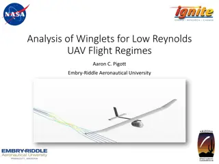
AirSim-W: A Simulation Environment for Wildlife Conservation with UAVs
AirSim-W is a project aimed at using AI and UAV technology to combat wildlife poaching. By utilizing AI for patrol planning and UAVs for surveillance, the system can detect signs of poaching and deter illegal activities. The use of thermal cameras on UAVs addresses challenges such as small targets in UAV footage, nighttime poaching incidents, and the need for realistic datasets. Simulation with Unreal Engine and AirSim enables efficient data augmentation and testing for future autonomous flights in wildlife conservation efforts.
Download Presentation

Please find below an Image/Link to download the presentation.
The content on the website is provided AS IS for your information and personal use only. It may not be sold, licensed, or shared on other websites without obtaining consent from the author.If you encounter any issues during the download, it is possible that the publisher has removed the file from their server.
You are allowed to download the files provided on this website for personal or commercial use, subject to the condition that they are used lawfully. All files are the property of their respective owners.
The content on the website is provided AS IS for your information and personal use only. It may not be sold, licensed, or shared on other websites without obtaining consent from the author.
E N D
Presentation Transcript
AirSim-W: A Simulation Environment for Wildlife Conservation with UAVs Elizabeth Bondi1, Debadeepta Dey2, Ashish Kapoor2, Jim Piavis2, Shital Shah2, Fei Fang3, Bistra Dilkina1, Robert Hannaford4, Arvind Iyer4, Lucas Joppa2, Milind Tambe1 Proceedings of the 1st ACM SIGCAS Conference on Computing and Sustainable Societies 2018 1
Motivation Solve the problem of wildlife poaching Why AI + UAVs? AI can assist park rangers in: Planning their patrols Creating strategies to detect poaching or signs of poaching activities Unmanned aerial vehicles (UAVs) play a role in patrolling by: Deterring poaching through the use of signaling serving a lookout for park rangers acting as a seperate patroller with the ability to detect objects of interest (OOI) 2
Motivation (Cont.) Why UAV + thermal? The size of humans and animals in UAV is small Poaching often happens at night Hard to collect real dataset Previous work: Air Shepherd + Thermal camera 70 2 hr-videos Fly on the pre-programmed paths, fly manuaaly when finding OOI Problem: Additional process time before labeling: Do not have OOI in most videos Cannot detect OOI 800 hours to labeling Money-consuming to fly UAVs 3
Motivation (Cont.) Why simulation? Need more data SPOT: tranind by the collected frames detect poachers or animals Problem Detecting results are not good enough Can not follow OOIs automatically Costly to test autonomous flights With simulation: Augment dataset of labeled thermal infrared videos efficiently Provide a testing environment for future autonomous flight 4
Unreal Engine + AirSim Unreal Engine Support hardware-in-the-loop (ex. Xbox controller) or Python API for moving AirSim Veheicle model for the UAV Environment model made of gravity, magnetic field, and air pressure Density model, a physics engine for the linear and an- gular drag, accelerations, and collisions A sensor model for the barometer, gyroscope and accelerometer, magnetometer, and GPS. Scene, segmentation, and depth images can be collected 5
Related Work Automatic detection of wildlife and humans in UAVs videos RGB images in high resolution Do not consider real-time detection SPOT won! Data augmentation more data Do not account for thermal infrared imagery Do not consider the physical process that are involved in image capture Simulation more data Train models with simulated data, test models with real data improve semantic segmentation Few radiometric models for thermal simulation 6
What they did Creation of an African savanna environment Integration of a new thermal infrared model based on radiometry API code extensions to follow objects of interest or fly in zig-zag patterns to generate simulated training data Demonstrated detection improvement using simulated data generated by AirSim-W 7
Africa Savana Environment Representative biome: wide-open space, dense forest, a mid-density area, a water feature, road access, and poachers and appropriate animals Creating step: Get the model of the correct plants, animals, and humans Create a terrain, and sculpt it in hills and depressions for water Spline-based movement of the actors Dress the scene (textures real-time video cpature) Three generic areas of vegetation density Three sets of poachers 3 characters/set Follow a spline in a large loop Intersected the poacher loops with elephants on spline loops Zebras were scattered across the environment Animals were clustered around the watering hole 8
Physical Modeling Assumptions For thermal imagery Sources of thermal infrared photons (TIP) to the camera on a UAV: Upwelled: direct from atmosphere Downwelled: TIP from atmosphere reflected by the target Direct: direct from the target Background radiance: TIP from nearby objects reflected by the target To simplify model in Africa savanna: Clear, dry, cool atmosphere X Upwelled, downwelled Flat terrain X Background radiance Dominant contribution: Direct Modeled by Planck s Law Assumptions: Objects emit energy uniformly Camera lens has perfect transmission and no falloff 10
L: radiance T: temperature avg: avg emissivity over the bandpass R : peak normalized camera spectral response h: Planck s constant c: the speed of light : the wavelength k: the Boltzman constant Planck s Law How they simulate the thermal sensor Get the pixel locations of OOI Measure the temperature and emissivity of OOI Use Planck s Law to estimate the resulting radiance at the sensor Normalize the result to create an 8-but thermal image 11
Database How they estimate the temperatures and emissivities of OOI Emissity: apply in all seasons Human and animals: skin Truck: oxidized steel Plant: from some studies Temperature: depend on the air temperature Winter vs. Summer Temp. in Winter is more accurate than Summer External temp. in Winter from studies Find a linear fit for the increasing temp in Summer. 12
Blur and Noise Blur The image system will be diffraction-limited Point spread function (PSF): describe the response of an imaging system to a perfect point of radiance Gaussian distribution (can be replaced to real model) Noise Johnson noise: the resistor nature white Gaussian noise Flicker noise: flaws in the material surface Thermal noise: heat exchange with the environment white Gaussian noise Gaussian 1/f noise Fixed pattern noise (FPN): each microbolometer has a slightly different resistance for the same incoming thermal infrared photons uniform random noise 13
Process A segmentation map from the RGB simulation A thermal infrared digital count associated with all of the objects A simple model for blur and noise Segmentaion thermal infrared + noise, blur Summer Winter 14
Utilizing AirSim-W for Poacher and Animal Detection 15
Generating Training Dta with AirSim-W Set up parameters Adjust flight altitude and look angle using Computer Vision Mode Adjust the season to determine which digital counts should be used Balance real dataset Fly Zig-zag pattern Following an object of interest Capture the segmentation image in each time step. Convert this image into the thermal infrared image for the time step 12 flights, 6 summer, 6 winter 30 min/flight 16
Balancing Data (real data) Class: {small, medium, large} x {animal, poacher} Cannot randomly sample full videos for use in traning set Full videos to stay consistently Individual frames that may contain multiple OOI from different classes Mixed-integer linear program (MILP) Targets: Use as many different train videos as possible Provide the algorithm with samples with more variety Frame types: a six-dimensional vector, indicating the number of objects from each class, ex. (1, 0, 0, 2, 0, 1) Method: Randomly select the specified # of frames from each frame type in each video Balanced dataset 17
Parameters Definition i: the index of the video j: the index of the frame type k: the index of the label type cijk: # of the k label in the j frame in the i video Nij: # of the j frame in the i video Llk, Luk: the lower and the upper bound of the desired # of the k label xij: # of the j frame in the i video that are sampled or selected uk, vk: max and min of the k label among videos (X videos without k, k from the videos are all selected) wik: binary indicator, if all k labels in video i are selected 18
Formulations of Data Balancing (2) Objective function: minimize the difference in the # labels of each type selected from videos (3), (4): the definition of the variables in (2) (5), (6): for M wik (7): ensure that the # of sampled frames <= # of frames in a video (8): ensure that we are within the desired # of samples based on our frame choices (9): ensure the # of frames sampled is integer Min (2) vk wk= 1 # of selected label k in video i 19
Real frames thermal infrared simulated frames noisy simulated frames Evaluation --- Qualitative tests Summer Winter Winter 20
Evaluations --- Quantitative Tests Scenario: detect animals and poachers The effects of balancing the real data Initialize using pre-trained ImageNet weights for Faster RCNN Fine-tune using the 651 balanced frames The effects of adding simulated data Types of simulated data: i) regular, and ii) + blur and noise Initialize using pre-trained ImageNet weights for Faster RCNN Fine-tune using the simulated data (only with small-medium OOI) Fine-tune with the real data balanced real dataset SPOT unbalanced dataset Baseline: SPOT, trained with various model and selected the best one SA, MA, LA: fine-tuned by the SPOT animal model MP, LP: fine-tuned by the SPOT poacher model Testing set: 6 real videos (X SP) 21
Evaluations --- Discussion Using simulated data: the best recall in 4 classes and avg + SPOT: the best precision on avg SPOT Without simulated data: Best precisions: SA, MA, LA Selected the best animal models in SPOT Large amounts of real data (18480 frames) Lack of large simulated animal examples With noise: Good to have perfect images for initial training Necessary to have a more sophisticated noise model Recall Precision 22
Evaluations --- Discussion Balanced data (651) performed comparably to SPOT (22663) Variety less data Label only a few frames per video in the future Consider different distinctions Simulate + Real is comparable to real only Generate large amounts of simulated data Reduce labeling burden Better collection, less costly Recall Precision 23
Conclusion Creation of an African savanna environment Integration of a new thermal infrared model based on radiometry API code extensions to follow objects of interest or fly in zig-zag patterns to generate simulated training data Demonstrated detection improvement using simulated data generated by AirSim-W 24
