Weather Map Interpretation
Weather maps provide data on various weather elements at a specific time. They show isobars, wind direction, cloud cover, rainfall, and more. Weather maps differ from synoptic charts which provide additional detailed information. Analyzing weather maps helps predict weather trends.
6 views • 7 slides
The Surface Weather Map
Surface weather maps, symbols, and their meanings. Discover how to interpret weather features and map lines for weather predictions. Learn the efficient plotting of data on maps.
1 views • 11 slides
Week at A Glance for Science
The sun, land, and water affect climate and weather. Analyze Earth's atmospheric layers, energy transfer processes, wind systems, and meteorological events. Investigate the sun's heat transfer and its influence on air, land, and water. Learn about air pressure, weather fronts, and the effects of oce
3 views • 9 slides
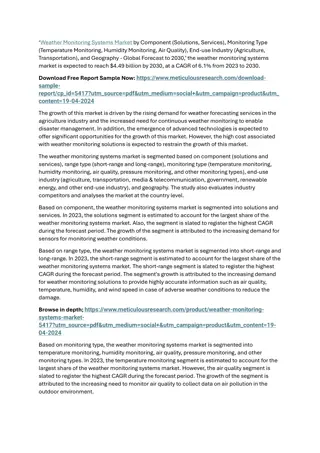
Weather Monitoring Systems Market 2
The increased need for continuous weather monitoring to enable disaster management and the rapid weather fluctuations and climate changes drive the growth of this market. In addition, the increasing adoption of sensors for weather monitoring and the emergence of advanced technologies are expected to
8 views • 2 slides
Understanding the Impact of Weather on Daily Life
Weather plays a crucial role in our everyday lives in various ways. From influencing our activities to affecting our mood, the weather can impact us significantly. Understanding how weather elements like temperature, humidity, air pressure, and precipitation influence our routines is essential for a
1 views • 27 slides
Understanding Air Masses, Fronts, and Severe Weather in Earth Science
In Chapter 20 of Earth Science, we delve into the dynamics of air masses, fronts, and severe weather. Meteorologists study the movement and characteristics of air masses to predict weather changes. Air masses, defined by their temperature and humidity, interact at fronts, leading to precipitation an
0 views • 7 slides
Understanding the Use of Maps in Public Health
Maps play a crucial role in public health by visualizing health data, trends, and locations of health events. They are used to communicate information such as disease rates, outbreaks, and causal factors. Spot maps show individual case locations, while area maps use colors or shades to communicate t
0 views • 15 slides
Eight Types of Maps and Their Uses in Tourism
Explore eight different types of maps and how they are utilized in the tourism industry. From general reference maps to political maps, each type serves a specific purpose in providing valuable information to tourists for better navigation and understanding of different areas. Learn about electronic
0 views • 21 slides
Exploring Weather through Infrared Temperature Detection
Studying everyday weather using infrared temperature detection from the environment can help in understanding the relationship between temperature variations of different objects and weather conditions. This activity involves creating hypotheses and testing them using an infrared temperature sensor.
0 views • 20 slides
Exploring 2nd Grade National Geographic: Weather, Tools, and Natural Disasters
Dive into the fascinating world of weather phenomena with 2nd-grade National Geographic resources. From predicting weather using clouds to learning about thunderstorms, hurricanes, and tornadoes, this educational journey also covers weather tools and being prepared for natural disasters.
0 views • 15 slides
Understanding Climate and Weather: Key Differences and Examples
Climate and weather are closely related but distinct concepts. Weather refers to day-to-day atmospheric conditions, while climate represents the average weather patterns over a long period. Explore the nuances between the two and discover illustrative examples.
0 views • 5 slides
Interactive Learning Activities for Weather Pattern Exploration
Engage students in fun activities like listening and drawing games, exploring weather proverbs, and practicing grammar with weather-related examples. Learn about weather patterns and how to inquire about the weather in English while enhancing language skills.
0 views • 12 slides
Exploring Weather Conditions Through Images in Unit 4 Practice
Explore weather conditions such as sunny, windy, snowy, rainy, and cloudy through a series of images in Unit 4 practice. The content covers various weather scenarios in locations like Hainan, Beijing, Harbin, Taiwan, and Shanghai. Practice game scenarios involve a lion and his friends playing near w
0 views • 13 slides
Weather Alert System and Carline Procedures
Thor Guard Lightning is a lighting alert system that provides visual and auditory signals for different weather conditions. Severe weather such as storms or lightning can trigger alerts, leading to specific actions like taking cover or seeking safety indoors. During inclement weather, students and t
0 views • 4 slides
Understanding Weather Through Infrared Temperature Detection
Explore the use of infrared temperature detection to study everyday weather patterns. Learn how infrared radiation emitted by objects can reveal insights into cloud cover and atmospheric conditions. Through hands-on experiments, discover the relationship between object temperatures and weather pheno
0 views • 20 slides
Transition of Legacy CONUS Area Forecasts in Aviation Weather Modernization
On June 15, 2017, the National Weather Service announced a transition plan to retire legacy CONUS Area Forecasts (FAs) and adopt improved aviation weather products and services. The transition period will last three months, with full implementation expected by October 10, 2017. The goal is to enhanc
5 views • 9 slides
Exploring Weather Phenomena and Meteorological Predictions
Dive into the fascinating world of weather phenomena and the science behind meteorological predictions in this unit of Living By Chemistry SECOND EDITION. Learn about proportional relationships, temperature scales, behavior of gases, and how to interpret weather maps to make accurate predictions. En
0 views • 19 slides
Cold Weather Pit Count Coordinator Module 3 Planning for Success
Cold weather presents challenges for conducting pit counts to address homelessness. Visibility of homelessness decreases in cold weather, making locating individuals more challenging. Planning ahead with contingency dates, volunteer coordination, and route planning is crucial for success in cold wea
0 views • 11 slides
Mainstreaming Weather and Climate in Radio Discussions
Weather and climate significantly influence various aspects of our lives, from our daily activities to business operations and food supply. This content discusses the importance of incorporating weather and climate discussions in radio broadcasts, emphasizing their impact on health, agriculture, bus
1 views • 19 slides
Understanding Weather Fronts: How They Form and Impact Weather Patterns
Weather fronts, including cold fronts, warm fronts, stationary fronts, and occluded fronts, play a crucial role in influencing weather patterns. Cold fronts bring quick storms with heavy rain and thunder, while warm fronts lead to gentle rain followed by milder weather. Stationary fronts result in p
0 views • 17 slides
Understanding Weather: Describing and Observing Weather Patterns
Exploring the fundamentals of weather observation and description, this lesson highlights the importance of using our senses to assess weather conditions such as temperature, wind, and precipitation. Students are encouraged to actively engage with their environment to describe the weather accurately
0 views • 10 slides
Atmosphere, Ocean Currents, Weather Maps, & Air Mass TEKS Review
Explore key concepts related to atmosphere, ocean currents, weather maps, and air mass in this TEKS review. Understand the factors contributing to Earth's uneven heating, the role of convection in ocean currents, the energy sources that drive ocean convection, and the effects of heating on air densi
0 views • 21 slides
Weather Derivatives and Risk Management in Utilities
Explore the impact of weather on businesses, specifically utilities, and how weather insurance products can help mitigate risks. Learn about Pacific Northwest Electric's challenges in the face of changing weather patterns and the use of weather protection products. Discover the utility lingo, possib
0 views • 9 slides
Understanding Air Masses and Fronts in Weather Systems
Air masses play a crucial role in weather patterns, characterized by temperature and moisture content. They form over specific regions and influence weather conditions when they interact at fronts. Fronts are boundaries between air masses, such as cold fronts, warm fronts, occluded fronts, and stati
0 views • 17 slides
Innovative Application Integrating Current Weather & Events for Optimal Route Planning
Weatherways Mapping Application combines real-time weather and event data to predictively model optimal routes, accounting for anticipated weather, traffic, road conditions, events, and more. Integrating Google Maps API and Weather API, the application provides picture views for trouble areas, proje
0 views • 7 slides
Comprehensive Collection of Dubai City Maps for May 2020
Explore a diverse range of Dubai city maps including editable PowerPoint templates, outline maps, sector maps, maps with sectors and districts, as well as blank framed maps. These maps cover various sectors and districts of Dubai, providing detailed insights and information for a comprehensive under
0 views • 19 slides
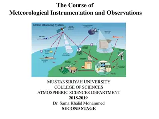
Meteorological Instrumentation and Observations Overview
Overview of weather maps, symbols, and the weather station model used in meteorological instrumentation and observations. Explains the importance of weather charts in forecasting processes. Also introduces the FM System of Code Forms for reporting weather observations. Helpful resources for students
0 views • 42 slides
Understanding the National Weather Service Valid Time Event Code (VTEC)
Explore the evolution of the National Weather Service Valid Time Event Code (VTEC) system introduced in 2005 by Daryl Herzmann at Iowa State University. Learn about the importance of VTEC in weather alerts and how it revolutionized the dissemination of critical weather information. Dive into example
0 views • 10 slides
Evolution in Identifying High-Impact Weather Events since February 1979
Evolution in identifying high-impact weather events since 18-19 February 1979 discusses the advancements in identifying significant weather events. The article highlights the influence of standardized anomalies in recognizing features associated with extreme weather, aiding in the accurate identific
0 views • 22 slides
Understanding Weather Patterns for Predictions
Explore how weather patterns in different locations influence predictions as you review weather data for Detroit and Pomona in January. Learn to make claims about where and when a story takes place using evidence from weather calendars and graphs. Enhance your understanding of weather observation an
0 views • 17 slides
Understanding Air Pressure Through Pressure Maps
Explore the significance of air pressure in understanding weather patterns through pressure maps. Learn to interpret isobars, identify high and low pressure areas, analyze isobar intervals, and understand how air flows from high to low pressure areas. Enhance your meteorological knowledge and grasp
0 views • 6 slides
Severe Weather Project Summary for Week 34
Week 34 of the Severe Weather Project focused on expanding development and evaluation of severe weather potential model guidance. The project aimed to develop experimental forecast tools for severe weather at Week 3-4 time range, utilizing a hybrid model and SCP (Supercell Composite Parameter). The
0 views • 21 slides
Understanding Weather Station Data and Atmospheric Pressure Basics
Explore essential concepts in meteorology including weather station instrumentation, atmospheric pressure determination, weather map basics, and isotherm plotting. Learn about interpreting weather station models, identifying pressure systems, and understanding isotherms for temperature analysis on w
0 views • 5 slides
Progress Towards a Quality-Controlled Historical Weather Data Platform
Comprehensive development progress towards a quality-controlled historical weather data platform led by Dr. Grace Di Cecco, focusing on the challenges of accessing and aggregating weather observations from various sources and the project's goals of cleaning, aggregating, and standardizing hourly wea
0 views • 21 slides
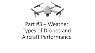
Understanding Weather Impact on Drones and Aircraft Performance
Delve into the influence of weather conditions on drones and aircraft operations. Explore different types of drones, sensors, and aircraft performance in various weather scenarios. Discover how wind, visibility, and FAA tests affect flight safety. Learn about sources of weather information like META
1 views • 23 slides
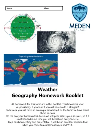
Geography Homework Booklet - Weather and Climate Study
A comprehensive geography homework booklet focused on understanding weather and climate topics, covering concepts such as the key differences between weather and climate, forecasting weather conditions, reasons for tropical storms losing energy, and the UK's experience with extreme weather events. S
0 views • 6 slides
Understanding Air Masses in Weather Prediction
Air masses play a crucial role in weather patterns. They are large bodies of air with consistent temperature and humidity characteristics. Different types of air masses, such as Continental Polar and Maritime Tropical, influence weather conditions based on their properties. Weather fronts form where
0 views • 9 slides
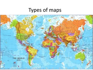
Exploring Different Types of Maps and Their Uses
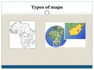
Learn about various types of maps such as thematic, choropleth, isopleth, raised relief, topographic, political, contour-line, natural resource, military, bird's-eye view, artifact, satellite photograph, pictograph, and weather maps. Understand how to read maps and the significance of thematic maps
0 views • 15 slides
Understanding Various Types of Maps
Political maps use colors and symbols to represent countries, regions, and physical features. Physical maps highlight natural patterns and features like vegetation and mountains. Climate maps depict weather patterns, and land use maps show how land is utilized. Contour maps display elevation through
0 views • 18 slides
Norton City Schools Inclement Weather Plan 2023-2024
The Norton City Schools' Inclement Weather Plan for 2023-2024 outlines procedures for decision-making during severe weather conditions, including the use of altered schedules, remote learning days, and early dismissals. The plan includes detailed steps for monitoring road conditions, checking weathe
0 views • 18 slides


