
WISK: A Workload-aware Learned Index for Spatial Keyword Queries
WISK, a workload-aware learned index that combines spatial and keyword queries to efficiently retrieve objects. It integrates spatial and textual indexes and considers query workload information.
6 views • 17 slides

Localised Adaptive Spatial-Temporal Graph Neural Network
This paper introduces the Localised Adaptive Spatial-Temporal Graph Neural Network model, focusing on the importance of spatial-temporal data modeling in graph structures. The challenges of balancing spatial and temporal dependencies for accurate inference are addressed, along with the use of distri
6 views • 19 slides

Introduction to Spatial Data Mining: Discovering Patterns in Large Datasets
Spatial data mining involves uncovering valuable patterns from extensive spatial datasets, offering insights into historical events, environmental phenomena, and predictive analytics. Examples range from analyzing disease outbreaks to predicting habitat suitability for endangered species. The applic
3 views • 20 slides
Spatial Database Systems: An Overview
This presentation by Xiaozhi Yu introduces the fundamentals of spatial database systems, covering topics such as spatial data types, relationships, system architecture, modeling, and organizing underlying spaces. It delves into the importance of integrating geometry into DBMS data models, spatial in
8 views • 30 slides
Performance of Nearest Neighbor Queries in R-trees
Spatial data management research focuses on designing robust spatial data structures, inventing new models, constructing query languages, and optimizing query processing. This study explores the estimation of query performance and selectivity, specifically in R-trees, for efficient access planning.
7 views • 32 slides
Spatial Analysis in GIS for Effective Decision-Making
Spatial analysis in GIS involves modeling geographic problems, processing data, and exploring results to understand spatial relationships, patterns, and suitability for various purposes. GIS tools offer unique capabilities for handling geographically referenced data, data entry, storage, manipulatio
6 views • 21 slides
Spatial Referencing Systems for Mapping
Spatial reference systems play a crucial role in defining geographic parameters and coordinate systems for mapping. They consist of components like orientation, latitude, longitude, and elevation, which help in representing spatial properties on maps. Reference surfaces such as the Geoid and ellipso
10 views • 13 slides

Spatial Analysis & Modeling for Spatial Planning Training in Maputo, Mozambique
Explore spatial analysis techniques for efficient route planning, site selection, pattern identification, and value prediction in the context of spatial planning. Learn about surface modeling, relationships among features, and the importance of spatial modeling in addressing geographical problems.
0 views • 27 slides

GIS Data Models for Spatial Planning Training in Maputo, Mozambique
Explore the concepts of GIS data models including vector vs. raster, spatial relationships, spatial operations, and representation of real-world entities in a spatial database. Understand how spatial data models are used to manipulate spatially-referenced information and define the spatial location
3 views • 32 slides
Spatial Autocorrelation in Geostatistical Analysis
Explore the concept of spatial autocorrelation, its implications in geostatistical analysis, and the importance of detecting and interpreting it correctly. Learn about auto-correlation, signal components, correlation significance, and measuring autocorrelation using tools like Moran's I. Gain insigh
7 views • 12 slides

The Differences Between Web Queries and WRDS-Cloud Queries
Explore the distinctions between web queries and WRDS-Cloud queries, such as the tools used, query limitations, and knowledge requirements. Learn how to access support for WRDS Cloud and enhance your data research skills.
5 views • 5 slides
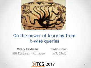
Exploring the Power of Wise Queries in Statistical Learning
Dive into the world of statistical learning with a focus on the impact of wise queries. Discover how statistical problems are approached, the significance of statistical queries, and the comparisons between wise and unary queries. Explore the implications for PAC learning and uncover key insights in
7 views • 8 slides

Spatial Relation Switching Requirements in 3GPP NR RAN Plenary Meeting
The document discusses various spatial relation switching requirements for uplink scenarios in the 3GPP NR RAN Plenary Meeting. It covers agreement points related to UL SRS, PUCCH, P-SRS, and DL-RS, defining delay requirements and known conditions for spatial relation switching. The agreements provi
1 views • 11 slides
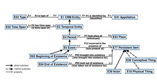
Temporal and Spatial Information Models
This content delves into the intricacies of temporal and spatial information models, covering concepts such as existence, presence, and spatiotemporal relationships. It explores how entities are identified, events are witnessed, and durations are defined within these models. The interplay between ti
6 views • 9 slides
SQL Part II Lecture Summary: Nested Queries, Joins, and Updates for Database Applications
In this SQL lecture, Mohammad Hammoud covers nested queries, insertion, deletion, updates, handling NULL values, join variants, and advanced query techniques. Examples include finding sailors who have reserved specific boats, using nested queries to filter data, and deep nested queries for complex d
1 views • 53 slides
Efficient Spatial Indexing Techniques for Range Queries
Explore spatial indexing methods such as grid file, kd-tree, and quadtrees for efficient range query processing. Learn how these methods partition space, handle multidimensional points, and optimize disk access. Discover the implementation details and search strategies for exact match and range quer
2 views • 56 slides

Coordinated Spatial Nulling (C-SN) Simulations in IEEE 802.11-24/0012r0
The document discusses the concept of Coordinated Spatial Nulling (C-SN) in IEEE 802.11-24/0012r0, focusing on spatial nulling feedback, synchronization needs, advantages of partial nulling, and comparison of half-coordinated versus fully coordinated scenarios. Simulation results are presented, anal
3 views • 19 slides

Enhancing Spatial Data Analysis in QGIS
Explore the integration of relational databases with QGIS to facilitate efficient spatial data analysis. Discover the importance of recognizing spatial relationships within data sets and the solutions to enhance QGIS for relational datasets. Overcome challenges and delve into the intersection and su
1 views • 25 slides

Analysis of MIMO for IMMW Transmission in IEEE 802.11-24
Proposal discusses the suitability of MIMO for IMMW transmission under different scenarios. The analysis focuses on the number of spatial streams based on channel rank and quality, recommending dual-polarization for LOS paths supporting 2 spatial streams and spatial separation for larger devices sup
5 views • 16 slides
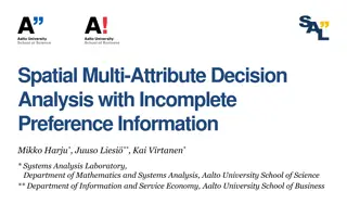
Spatial Multi-Attribute Decision Analysis with Incomplete Preference Information
In this study by Mikko Harju, Juuso Liesi, and Kai Virtanen from Aalto University, the focus is on spatial decision analysis for scenarios where decision alternatives have varying consequences across a geographical region. The research delves into the significance of spatial value functions in repre
3 views • 19 slides

Enhanced Parcel Queries in Kansas by Kristen Jordan
Project aims to provide expanded tools and services for statewide parcel queries in Kansas. Background includes the Kansas Data Access and Support Center's existing project and the implementation of a REST web service. Specific goals involve accessing services through desktop and web applications, p
4 views • 20 slides

ICAR KRISHI Geo-Portal: Spatial Agricultural Research Information
ICAR KRISHI Geo-Portal is a digital platform aiming to facilitate spatial agricultural data generation, compilation, visualization, and analysis. It hosts spatial databases, provides map services, and allows data sharing across platforms. The portal, developed using open-source technologies, offers
3 views • 32 slides
Probabilistic Query Answering and Group Nearest Neighbor Queries
This chapter delves into probabilistic query types, focusing on probabilistic group nearest neighbor queries. Explore the definitions, processing techniques, and applications of such queries. Learn how probabilistic data management plays a crucial role in uncertain databases, spatial queries, and mo
2 views • 34 slides

A Spatial Perspective
Spatial perspective is a crucial aspect in various fields, including geography, architecture, and urban planning. It involves understanding the relationships and patterns of physical spaces and their influences on human activities and environments. By adopting a spatial perspective, professionals ca
5 views • 23 slides
Spatial Reuse in IEEE 802.11 - Overview and Proposal
This document explores the concept of spatial reuse in IEEE 802.11 standards, particularly focusing on the 11ax and 11be amendments. It discusses the benefits of spatial reuse, proposing enhancements for better utilization of spectrum and improved efficiency in wireless communications. The proposed
1 views • 6 slides
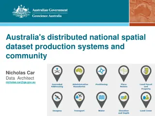
Australia's Foundational Spatial Data Framework Overview
Covering Australia's distributed national spatial dataset production systems and community involvement, the Foundational Spatial Data Framework (FSDF) is a government initiative aimed at streamlining the production of national spatial data products. Coordinated by Geoscience Australia, FSDF plays a
0 views • 40 slides

Collective Spatial Keyword Queries with Inherent Cost Awareness
Spatial-textual data involving points of interest like restaurants and hotels, with a focus on Collective Spatial Keywords Queries (CoSKQ) and the introduction of a new cost function that considers both spatial distances and inherent costs of objects.
2 views • 27 slides

Geostatistical Distances Analysis in Spatial Studies
Geostatistics, a branch of statistics focusing on spatial datasets, plays a crucial role in various disciplines like geology, hydrology, and agriculture. Tobler's First Law of Geography forms the foundation of spatial analysis, emphasizing the relationship between proximity and interaction in spatia
2 views • 6 slides

Enhancing K-12 Geoscience Education with Spatial Thinking Integration
Explore a framework for integrating spatial thinking into K-12 geoscience education, focusing on improving spatial thinking, constructive geography, and spatial-temporal primitives. Discover how a place-based curriculum can enhance spatial understanding across various science disciplines.
1 views • 26 slides
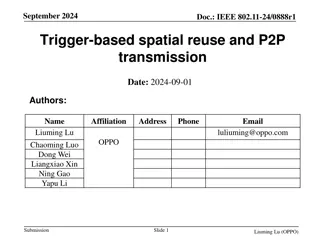
IEEE 802.11-24/0888r1: Coordinated Spatial Reuse for Enhanced WLAN Performance
Explore the proposal for trigger-based spatial reuse in IEEE 802.11-24/0888r1 document dated September 2024, focusing on improving WLAN reliability, throughput, and P2P operations through coordinated spatial reuse. The document discusses modes of spatial reuse, issues with PD/PSR-based operations, a
0 views • 10 slides

Quickest Visibility Queries in Polygonal Domains - Summary & Previous Work
Explore the challenges of quickest visibility queries in polygonal domains, including shortest path queries and subproblems in polygonal cases with holes. Understand the complexities and strategies for solving these queries efficiently based on a study by Haitao Wang from Utah State University. Revi
4 views • 24 slides

Efficient Framework for Processing Ranking Queries
Explore a unified framework for efficient processing of ranking-related queries, including dual mapping, k-lower envelope, and ranking in dual space. Learn how top-k queries and reverse top-k queries can be answered using the k-lower envelope technique. Discover the applications and solutions in thi
0 views • 22 slides

Spatial Data Analysis in R: County Mapping and Operations Overview
Explore the world of spatial data analysis in R with a focus on county mapping and key operations. Learn how to work with spatial data, merge datasets, visualize maps, and perform basic spatial operations. Dive into examples and resources to enhance your spatial analysis skills.
0 views • 11 slides

Boolean and Phrase Queries for Information Retrieval: Exercises and Analysis
Explore Boolean retrieval, phrase queries, and proximity queries in the context of information retrieval. Understand the fundamentals through practical exercises and gain insights into document collection organization, term-document matrices, and inverted index representations. Analyze query results
0 views • 23 slides

Deductive Approach to Processing High-Level Activity Queries in UAV Networks
Explore a deductive approach for processing high-level activity queries in UAV networks, focusing on representing and optimizing queries in an energy-efficient manner for distributed evaluation. The model involves UAVs detecting local activities through sensors, with queries translated into distribu
3 views • 15 slides

Understanding Spatial Data Mining
Learn about spatial data mining, a process of uncovering interesting, useful, and unexpected spatial patterns within large databases. Discover why it is essential for gaining new insights into geographic processes and application domains, such as locating human settlements, identifying cancer cluste
2 views • 37 slides

Spatial Analysis Using Python: Key Tools and Techniques
Dive into spatial analysis using Python with an overview of spatial objects, tools, examples, and case studies. Learn about Shapely for geometric operations and Geopandas for handling spatial datasets. Discover essential sources and learn how to read different file formats for spatial data analysis.
1 views • 20 slides

Understanding Data Entry and Queries in Clinical Studies
Learn about the stages of data entry, resolving queries, and submitting data in clinical studies. Explore how the query module works, accessing queries, and handling patient-specific queries effectively.
0 views • 20 slides

IEEE 802.11-25 Spatial Re-Use & Nulling Interference Cancellation Updates
Explore the latest updates in spatial re-use and spatial nulling interference cancellation requirements within the IEEE 802.11-25 standard. Gain insights into coordinated spatial re-use versus coordinated beamforming, the necessity of spatial nulling in CoBF and CoSR frames, and the flexibility in i
0 views • 8 slides

Spatial Data Management Insights
Explore trajectory data mining, management, spatial queries, indexing structures, and more in this comprehensive overview. Learn about key concepts such as trajectory classification, distance metrics, spatial databases, and spatial indexing structures like R-Tree and Quad-tree.
0 views • 51 slides