WISK: A Workload-aware Learned Index for Spatial Keyword Queries
WISK, a workload-aware learned index that combines spatial and keyword queries to efficiently retrieve objects. It integrates spatial and textual indexes and considers query workload information.
1 views • 17 slides
ARGOS Inventory by Fund Queries Presentation Slides
The presentation slides showcase the ARGOS Inventory by Fund Queries project, featuring detailed information and visuals to help understand the queries and data analysis process. The slides provide insights into inventory management methods based on different funds, highlighting key aspects of the A
2 views • 14 slides
Python If...Else Statements
Python supports various logical conditions for IF statements and loops. It uses indentation to define code scope instead of curly brackets. The ELIF keyword allows for additional conditional checks, while the ELSE keyword provides a fallback for unmet conditions. Shorthand if statements and logical
8 views • 33 slides
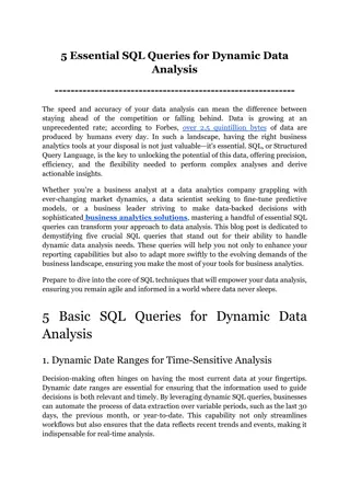
5 Essential SQL Queries for Dynamic Data Analysis
Explore the transformative power of SQL with our latest guide, which highlights five critical SQL queries essential for dynamic data analysis. This post covers how these queries can be utilized by business analytics tools to enable data analysts, scientists, and BI professionals to extract actionabl
6 views • 8 slides
Localised Adaptive Spatial-Temporal Graph Neural Network
This paper introduces the Localised Adaptive Spatial-Temporal Graph Neural Network model, focusing on the importance of spatial-temporal data modeling in graph structures. The challenges of balancing spatial and temporal dependencies for accurate inference are addressed, along with the use of distri
4 views • 19 slides
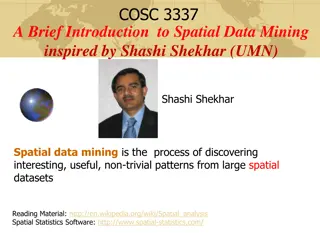
Introduction to Spatial Data Mining: Discovering Patterns in Large Datasets
Spatial data mining involves uncovering valuable patterns from extensive spatial datasets, offering insights into historical events, environmental phenomena, and predictive analytics. Examples range from analyzing disease outbreaks to predicting habitat suitability for endangered species. The applic
2 views • 20 slides
Spatial Database Systems: An Overview
This presentation by Xiaozhi Yu introduces the fundamentals of spatial database systems, covering topics such as spatial data types, relationships, system architecture, modeling, and organizing underlying spaces. It delves into the importance of integrating geometry into DBMS data models, spatial in
2 views • 30 slides
Knowledge Graph and Corpus Driven Segmentation for Entity-Seeking Queries
This study discusses the challenges in processing entity-seeking queries, the importance of corpus in complementing knowledge graphs, and the methodology of segmentation for accurate answer inference. The research aims to bridge the gap between structured knowledge graphs and unstructured queries li
0 views • 24 slides
Performance of Nearest Neighbor Queries in R-trees
Spatial data management research focuses on designing robust spatial data structures, inventing new models, constructing query languages, and optimizing query processing. This study explores the estimation of query performance and selectivity, specifically in R-trees, for efficient access planning.
3 views • 32 slides
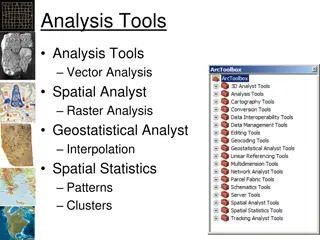
Spatial Analysis in GIS for Effective Decision-Making
Spatial analysis in GIS involves modeling geographic problems, processing data, and exploring results to understand spatial relationships, patterns, and suitability for various purposes. GIS tools offer unique capabilities for handling geographically referenced data, data entry, storage, manipulatio
3 views • 21 slides
Spatial Referencing Systems for Mapping
Spatial reference systems play a crucial role in defining geographic parameters and coordinate systems for mapping. They consist of components like orientation, latitude, longitude, and elevation, which help in representing spatial properties on maps. Reference surfaces such as the Geoid and ellipso
5 views • 13 slides
Spatial Analysis & Modeling for Spatial Planning Training in Maputo, Mozambique
Explore spatial analysis techniques for efficient route planning, site selection, pattern identification, and value prediction in the context of spatial planning. Learn about surface modeling, relationships among features, and the importance of spatial modeling in addressing geographical problems.
0 views • 27 slides
GIS Data Models for Spatial Planning Training in Maputo, Mozambique
Explore the concepts of GIS data models including vector vs. raster, spatial relationships, spatial operations, and representation of real-world entities in a spatial database. Understand how spatial data models are used to manipulate spatially-referenced information and define the spatial location
1 views • 32 slides
Spatial Autocorrelation in Geostatistical Analysis
Explore the concept of spatial autocorrelation, its implications in geostatistical analysis, and the importance of detecting and interpreting it correctly. Learn about auto-correlation, signal components, correlation significance, and measuring autocorrelation using tools like Moran's I. Gain insigh
1 views • 12 slides
The Differences Between Web Queries and WRDS-Cloud Queries
Explore the distinctions between web queries and WRDS-Cloud queries, such as the tools used, query limitations, and knowledge requirements. Learn how to access support for WRDS Cloud and enhance your data research skills.
1 views • 5 slides
Exploring the Power of Wise Queries in Statistical Learning
Dive into the world of statistical learning with a focus on the impact of wise queries. Discover how statistical problems are approached, the significance of statistical queries, and the comparisons between wise and unary queries. Explore the implications for PAC learning and uncover key insights in
2 views • 8 slides
Spatial Relation Switching Requirements in 3GPP NR RAN Plenary Meeting
The document discusses various spatial relation switching requirements for uplink scenarios in the 3GPP NR RAN Plenary Meeting. It covers agreement points related to UL SRS, PUCCH, P-SRS, and DL-RS, defining delay requirements and known conditions for spatial relation switching. The agreements provi
0 views • 11 slides
Art and Information: Connecting Theory and Practice
Explore the intersection of art and information through a framework that emphasizes strategic exploration and keyword strategies in searching for images. Lightning talks and workshops delve into the importance of keywords, cataloging images, and developing search strategies. Learning objectives incl
0 views • 32 slides
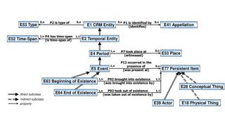
Temporal and Spatial Information Models
This content delves into the intricacies of temporal and spatial information models, covering concepts such as existence, presence, and spatiotemporal relationships. It explores how entities are identified, events are witnessed, and durations are defined within these models. The interplay between ti
4 views • 9 slides
Health Benefits of Dark Chocolate and Effective Keyword Tips
Discover the numerous health benefits of dark chocolate such as lowering blood pressure, improving mood, fighting free radicals, reducing heart disease, and more. Also, learn valuable keyword tips to enhance your search results, like using multiple terms, phrases in quotation marks, truncation, and
0 views • 9 slides
SQL Part II Lecture Summary: Nested Queries, Joins, and Updates for Database Applications
In this SQL lecture, Mohammad Hammoud covers nested queries, insertion, deletion, updates, handling NULL values, join variants, and advanced query techniques. Examples include finding sailors who have reserved specific boats, using nested queries to filter data, and deep nested queries for complex d
0 views • 53 slides
Efficient Spatial Indexing Techniques for Range Queries
Explore spatial indexing methods such as grid file, kd-tree, and quadtrees for efficient range query processing. Learn how these methods partition space, handle multidimensional points, and optimize disk access. Discover the implementation details and search strategies for exact match and range quer
1 views • 56 slides
Sponsored Search Auctions: A Comprehensive Overview
Sponsored search auctions play a crucial role in the digital advertising landscape, with major players like Google generating substantial revenue through this model. Advertisers bid on keywords, with positions awarded based on bid amount. The history of keyword auctions dates back to the mid-1990s,
0 views • 36 slides
k-Ary Search on Modern Processors
The presentation discusses the importance of searching operations in computer science, focusing on different types of searches such as point queries, nearest-neighbor key queries, and range queries. It explores search algorithms including linear search, hash-based search, tree-based search, and sort
0 views • 18 slides
Coordinated Spatial Nulling (C-SN) Simulations in IEEE 802.11-24/0012r0
The document discusses the concept of Coordinated Spatial Nulling (C-SN) in IEEE 802.11-24/0012r0, focusing on spatial nulling feedback, synchronization needs, advantages of partial nulling, and comparison of half-coordinated versus fully coordinated scenarios. Simulation results are presented, anal
0 views • 19 slides
SQL Outer Join in Database Queries
SQL Outer Join is a powerful feature that combines data from multiple tables even when there are no exact matches. It includes Left Outer Join and Right Outer Join, allowing you to retrieve all records from one table and matching records from another. The LEFT JOIN keyword fetches all records from t
0 views • 4 slides
Java Inheritance and Polymorphism
In Java, classes can inherit fields and methods from other classes through inheritance. Constructors are not inherited but can be invoked using the super keyword. Method overriding and overloading allow for customizing behavior in subclasses. The final keyword can prevent subclassing a class or chan
0 views • 17 slides
Enhancing Spatial Data Analysis in QGIS
Explore the integration of relational databases with QGIS to facilitate efficient spatial data analysis. Discover the importance of recognizing spatial relationships within data sets and the solutions to enhance QGIS for relational datasets. Overcome challenges and delve into the intersection and su
0 views • 25 slides
Metadata Cleansing Using SPARQL Update Queries
Learn how to transform and cleanse RDF metadata using SPARQL Update queries to conform to the ADMS-AP for Joinup. This tutorial provides essential knowledge on converting metadata for interoperability solutions and the main queries involved. Discover how to ensure your metadata is compliant and read
0 views • 37 slides
Advanced Techniques for Orthogonal Skyline Counting Queries
Advanced techniques for orthogonal skyline counting queries discuss optimal planar solutions, dividing and conquering for topmost point identification, efficient vertical slab counting, succinct data structures for prefix sums and range maxima, upper bounds on degree and multi-slab queries, as well
0 views • 11 slides
C++ Virtual Keyword and Inheritance Rules Explained
Understand the rules and behavior of virtual functions in C++ inheritance, including pure virtual functions, abstract classes, and runtime method calls. Dive into examples with Mammal, Cat, and Siamese classes to grasp how method implementations are resolved. Explore the nuances of virtual keyword u
0 views • 10 slides
Efficient Network Traffic Queries Handling Strategies
Solve network traffic queries efficiently by ensuring constant memory updates and minimal memory access. Implement strategies such as managing multiple data structures for various query types and coordinating queries to optimize packet processing. Explore the coupon collector problem to enhance quer
0 views • 26 slides
Analysis of MIMO for IMMW Transmission in IEEE 802.11-24
Proposal discusses the suitability of MIMO for IMMW transmission under different scenarios. The analysis focuses on the number of spatial streams based on channel rank and quality, recommending dual-polarization for LOS paths supporting 2 spatial streams and spatial separation for larger devices sup
0 views • 16 slides
The Essentials of Online Advertising in Digital Marketing
Online advertising plays a crucial role in digital marketing, encompassing various types such as network/display, programmatic, retargeting, and more. This chapter delves into the importance of coordinating online advertising campaigns across different platforms, clarifies terms like automated, prog
0 views • 21 slides
Maximizing Google Ad Campaign Success Through Effective Keyword Selection
Google Ads play a significant role in digital marketing strategy, focusing on targeted keywords to reach potential customers. Understanding how Google Ads function, selecting appropriate keywords, and utilizing keyword analysis tools are crucial for optimizing campaign performance. The process invol
0 views • 7 slides
Spatial Multi-Attribute Decision Analysis with Incomplete Preference Information
In this study by Mikko Harju, Juuso Liesi, and Kai Virtanen from Aalto University, the focus is on spatial decision analysis for scenarios where decision alternatives have varying consequences across a geographical region. The research delves into the significance of spatial value functions in repre
0 views • 19 slides
Enhanced Parcel Queries in Kansas by Kristen Jordan
Project aims to provide expanded tools and services for statewide parcel queries in Kansas. Background includes the Kansas Data Access and Support Center's existing project and the implementation of a REST web service. Specific goals involve accessing services through desktop and web applications, p
0 views • 20 slides
ICAR KRISHI Geo-Portal: Spatial Agricultural Research Information
ICAR KRISHI Geo-Portal is a digital platform aiming to facilitate spatial agricultural data generation, compilation, visualization, and analysis. It hosts spatial databases, provides map services, and allows data sharing across platforms. The portal, developed using open-source technologies, offers
1 views • 32 slides
Efficient Keyword-Aware Travel Route Recommendation System
This presentation discusses an efficient keyword-aware travel route recommendation system that leverages user-generated content and location-based social networks to provide diversified and representative travel routes. The system aims to address the challenge of restricting users to limited query o
0 views • 39 slides
Probabilistic Query Answering and Group Nearest Neighbor Queries
This chapter delves into probabilistic query types, focusing on probabilistic group nearest neighbor queries. Explore the definitions, processing techniques, and applications of such queries. Learn how probabilistic data management plays a crucial role in uncertain databases, spatial queries, and mo
0 views • 34 slides


