Hillslopes and Their Significance in Geomorphology
Hillslopes are angular inclinations of terrain between hilltops and valley bottoms, shaped by geological structures, climate, vegetation cover, and denudational processes. They are key geomorphic features in fluvial drainage basins, playing a crucial role in landscape formation and water/sediment tr
6 views • 22 slides
Coastal Monitoring and Lessons Learned in Southwest England
Southwest England's coastal monitoring efforts, including the South West Coastal Monitoring program and lessons learned from the destruction of Hallsands in 1917 due to lack of understanding of coastal processes. The monitoring involves data collection on beach profiles, bathymetry, wave patterns, a
4 views • 15 slides
Diagenesis and Lithification in Sedimentary Rocks
Diagenesis and lithification are crucial processes that transform loose sediment into solid rock through compaction and cementation. Diagenesis involves various chemical, physical, and biological changes while lithification involves the pressure-induced consolidation of sediment. Compaction removes
0 views • 15 slides
Sediment Provenance in Geology
Sediment provenance in geology involves reconstructing the origin of sediments through compositional analyses to determine erosion history and geographical origins. It helps characterize the journey of sediments from source to sink, providing insights into tectonic and paleoclimatic histories. Prove
2 views • 11 slides
Sediment and Sedimentary Rock Textures
Discover the textures and structures of sediment and sedimentary rocks, including clastic and crystalline textures, primary and secondary textures, and the effects of compaction. Learn about sediment texture, differences in sedimentary rock texture, and the classification of grain sizes using the We
1 views • 20 slides
Successful Channel Modification Techniques and Benefits
Channel modification projects aim to accelerate the recovery of stable, sustainable channel forms in dynamic balance with sediment, large wood, and flow regimes. Successful modifications lead to improved habitat quality, stability, and diversity, benefiting sediment transport and riparian zones. Phy
0 views • 15 slides
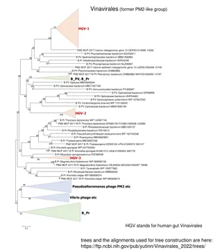
Overview of Vinavirales and Related Viral Groups
Vinavirales is a group of viruses that were previously part of the PM2-like group. The content discusses various species and bacterium within Vinavirales, as well as related groups such as Nucleocytoviricota and Virophages. It explores their presence in marine metagenomes, sediment environments, and
0 views • 7 slides
Latest Updates on MOSART Development and Validation
Updates on MOSART modules including heat, sediment, and lake features presented at the E3SM All-Hands meeting. Development progress, validation results, and ongoing/future work discussed for better water/heat balance coupling in deep water bodies like lakes and reservoirs. Detailed testing and valid
0 views • 9 slides
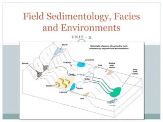
Field Sedimentology: Methods and Tools for Sedimentary Studies
Sedimentology involves interpreting sediments and rocks in terms of transport and deposition processes, distribution in space and time. Field studies require basic equipment like a notebook, hand lens, compass, clinometer, hammer, and GPS. Palaeocurrent indicators provide evidence of flow direction
0 views • 28 slides
Detection and Attribution of Flow and Sediment Fluxes in the Nile Basin
This study aims to detect and attribute climate change impacts on flow and sediment loads in the Nile basin using climate data and hydrological models. The research focuses on historical data and involves evaluating models, completing paper writing, and finishing the detection and attribution analys
0 views • 4 slides
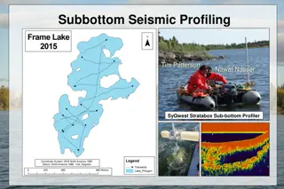
Environmental Impact Assessment of Frame Lake and Recommendations
The subbottom seismic profiling and stratigraphy studies reveal the sediment layers in Frame Lake and the impact of urban development on water quality. Glew coring analysis identifies layers of arsenic contamination. Recommendations include dredging to restore the lake's natural state pre-1975. The
0 views • 13 slides
Multibeam Data Analysis for Seabed Characterization at Deception Island, Antarctic
This work explores the morphological and sedimentary characterization of the seabed at Deception Island, Antarctic, through the analysis of multibeam bathymetric data and geological samples. The study identifies ravines, depressions, and volcanic structures as key features, revealing a seabed predom
0 views • 7 slides
Eastern Mediterranean Centre for Oceanography and Limnology (EMCOL): Research Focus and Facilities
EMCOL, led by M. Namik A. Atay, focuses on natural hazards, environmental changes, and earthquake risk assessment. Their research fields include earthquakes, submarine landslides, tsunamis, sea-level changes, climate change, and paleoclimatology. The center conducts fieldwork using various equipment
0 views • 13 slides
Local Programs for Erosion and Sediment Control: Guidelines and Certifications
Comprehensive information on the importance and implementation of local erosion and sediment control programs, including principles, standards, processes, and certification requirements. Emphasis on the need for local officials and personnel to have the knowledge and authority for effective program
0 views • 45 slides
Washington Department of Forestry Stream Habitat Restoration Guidelines
The guidelines outline restoration efforts including fish passage, spawning gravel cleaning, and placement of instream sediment detention basins. The document lists various anadromous and freshwater fish species found in Washington, highlighting the importance of unimpeded fish passage for their mig
3 views • 35 slides
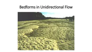
Bedforms in Unidirectional Flow: Characteristics and Formation
Bedforms in unidirectional flow exhibit various characteristics such as sediment layer thicknesses, boundary layer dynamics, presence of ripples and dunes, and the interplay between flow velocity and sediment deposition. These bedforms, including ripples and dunes, form due to interactions between t
3 views • 13 slides
Subcommittee on Minnesota Water Policy Meeting Highlights
The Subcommittee on Minnesota Water Policy meeting held on August 20, 2019, covered various important topics such as updates on Minnesota and Mississippi Rivers, long-term sediment data importance, proposed legislative water policy issues for 2020, and stakeholder meeting discussions. Presentations
1 views • 8 slides
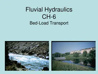
Sediment Transport in Fluvial Hydraulics
Sediment transport equations play a crucial role in predicting sediment capacity under different flow conditions, aiding in various analyses like aggradation, degradation, scour, deposition, and migration. Different formulas cater to varied scenarios, distinguishing between bed load and suspended lo
0 views • 82 slides
Chesapeake Bay Nontidal Monitoring Network Report
This report highlights the measurement of nitrogen, phosphorus, and suspended sediment loads at the Chesapeake Bay Nontidal Network stations, emphasizing trends and analysis conducted by various professionals. It discusses the response to restoration activities and land use changes, aiming to inform
0 views • 25 slides
Clean Water Fund Competitive Program Overview
The Clean Water Fund Competitive Program focuses on stormwater funding strategies and implementation of on-the-ground restoration activities to improve water quality. It prioritizes local resources, targets effectiveness, and measures impact. The program includes non-point priority funding plans, pr
1 views • 10 slides
Sedimentology: An Overview of Sedimentary Processes and Rocks
Sedimentology is the study of modern sediments like sand, mud, and clay, along with the processes involved in their deposition. Sedimentologists use this knowledge to interpret Earth's geologic history through sedimentary rocks and structures. Sediment plays a crucial role in enriching soil with nut
0 views • 27 slides
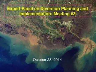
Expert Panel on Diversion Planning and Implementation Meeting Report
A detailed overview of the Expert Panel on Diversion Planning and Implementation Meeting including its purpose, composition, authority, and focus on providing technical advice for freshwater and sediment diversion projects, particularly in the Mississippi River and Louisiana restoration efforts. The
0 views • 10 slides
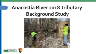
Anacostia River Tributary Sediment Study 2018
This study focuses on analyzing bottom sediment samples from five major tributaries of the Anacostia River to determine concentrations of contaminants of concern (COCs) and identify possible point sources of pollution. The research aims to establish anthropogenic background concentrations, compare t
0 views • 10 slides
Coastal Processes: Erosion, Deposition, and Human Impact
Coastal processes involve a complex interplay of erosion, deposition, and human activities that impact the dynamic equilibrium of coastlines. Energy from tides, waves, wind, and currents shape the land-water interface, while human use of coasts introduces conflicts leading to unstable systems. Sedim
0 views • 44 slides
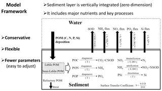
Integrated Sediment Model for Nutrient Processes in Chesapeake Bay
This sediment model framework integrates major nutrients and key processes in a vertically integrated, zero-dimensional scheme. It is characterized by its conservative and flexible nature, with fewer parameters making adjustments easy. The model includes a scheme for POM remineralization and finds a
0 views • 8 slides
Elk Creek Wood Replacement Project Overview
This project, led by the Oregon Watershed Enhancement Board in 2009 and documented by Katie Halvorson, focuses on the replacement of wood structures in Elk Creek to enhance watershed function and habitat complexity for juvenile coho salmon. By addressing the lack of large wood, the initiative aims t
0 views • 20 slides
Multiphase Flows in the Upstream: A Comprehensive Overview
This content delves into the complexities of multiphase flows in the upstream sector, covering topics such as reservoir management, drilling, subsurface imaging, and reservoir modeling. It explores the challenges of multi-scale phenomena, multi-physics interactions, uncertainty, and inversion in the
0 views • 4 slides
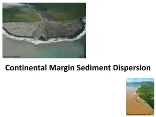
Sediment Dispersion along the Continental Margin
This content explores the influences and types of sediment dispersion systems along the continental margin. Processes affecting sediment supply, depositional environments, and different dispersal systems like Estuarine Accumulations Dominated and Marine Dispersal Dominated are discussed. Walsh and N
0 views • 8 slides
Water Supply Hazards and Management Insights
Understanding catchment hazards for water supplies is crucial for effective management. This report discusses E. coli values, turbidity concerns, fauna impact, and algal blooms. It also suggests measures to address these issues, such as riparian planting, stock management, and sediment control in ag
0 views • 10 slides
Oil and Gas Erosion Control Permit Updates
Updates and timelines for the Erosion and Sediment Control General Permit (ESCGP) in the oil and gas sector, including the transition from ESCGP-3 to ESCGP-4, Post Construction Stormwater Management (PCSM) Manual changes, BMP updates, and consistency with PAG-02 requirements. Details include impleme
0 views • 10 slides
Lake Tahoe's Environmental Challenges
The Lake Tahoe Total Maximum Daily Load (TMDL) program aims to restore Lake Tahoe's clarity by addressing pollution sources such as nitrogen, phosphorus, and fine sediment particles. The program involves a science phase, regulatory strategy phase, and implementation phase to reduce pollutant loading
0 views • 27 slides
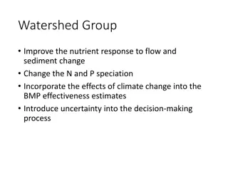
Enhancing Watershed Nutrient Response and Climate Resilience
The Watershed Group aims to enhance nutrient response to flow and sediment changes, improve N and P speciation, and integrate climate change effects into BMP effectiveness estimates. Strategies include spatially varying N relationships, investigating WWTPs and stormwater systems, and reviewing speci
0 views • 7 slides
Pennsylvania's Phase III Watershed Implementation Plan
Pennsylvania's Phase III Watershed Implementation Plan focuses on reducing nitrogen, phosphorus, and sediment loading to meet Chesapeake Bay Total Maximum Daily Load requirements by 2025. The plan involves various sectors like agriculture, urban runoff, and forest areas to achieve necessary reductio
0 views • 30 slides
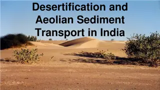
Desertification and Aeolian Sediment Transport in India
Climates in India, particularly in the desert areas like Rajasthan, are heavily influenced by the monsoon season, with 32% of the land facing the threat of desertification. The upward eddie wind currents in the region can lift silt and very fine sand up to 4km. Various factors contribute to desertif
0 views • 17 slides
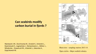
Carbon Modification by Seabirds in Fjords: Implications and Patterns
The study investigates the impact of seabirds on carbon burial in fjords, showcasing factors such as wind stress patterns, terrestrial vegetation biomass, and various carbon sources in the ecosystem. It delves into the distribution and fate of carbon in two fjords, Hornsund and Kongsfjorden, sheddin
0 views • 7 slides
Benthic Substrate Characterization Through Multibeam Bathymetry
Utilizing multibeam bathymetry and backscatter data, this project focuses on mapping potential benthic substrates in marine environments. The history, procedures, and possible classification schemes are discussed, highlighting the importance of analyzing backscatter data for sediment classification.
0 views • 28 slides
Estimation Methodology for Phosphorus and Sediment Loading in Cayuga Lake Watershed
Explore the process of estimating phosphorus and sediment loading at the south end of Cayuga Lake using LOADEST methodology. Learn how to combine synoptic monitoring data with USGS flow measurements and run calculations to obtain yearly load numbers. Get step-by-step instructions and access helpful
0 views • 13 slides
Efficient software for sediment yield minimization by afforestation
Afforestation plays a crucial role in reducing sediment outflow in river catchments. The CAMF software offers an iterative process to select optimal afforestation sites, with adaptations to reduce computational costs. Implementation includes parallelization for multi-core processors, reducing iterat
0 views • 15 slides
Describe what you see in this picture. What do you think is going on here?
Dive into the fascinating world of sediment transport through rivers, marshes, and beaches in this educational journey. Follow the path of a grain of sand as it travels through various stages in the watershed, learning about the impacts of sediments on ecosystems and human activities along the way.
0 views • 5 slides
Soil Rehabilitation Project Sustainability: Hydrological and Sediment Assessment in Afar
This project aims to assess the sustainability of water spreading weirs (WSW) in Afar through hydrological, sediment monitoring, and technical performance evaluation. Critical questions regarding flood impact, sediment transportation, WSW efficiency, and potential improvements will be addressed.
0 views • 11 slides
