Field Sedimentology: Methods and Tools for Sedimentary Studies
Sedimentology involves interpreting sediments and rocks in terms of transport and deposition processes, distribution in space and time. Field studies require basic equipment like a notebook, hand lens, compass, clinometer, hammer, and GPS. Palaeocurrent indicators provide evidence of flow direction during sediment deposition. Graphic sedimentary logs and lithology descriptions aid in analyzing sedimentary rocks in different locations.
Download Presentation

Please find below an Image/Link to download the presentation.
The content on the website is provided AS IS for your information and personal use only. It may not be sold, licensed, or shared on other websites without obtaining consent from the author.If you encounter any issues during the download, it is possible that the publisher has removed the file from their server.
You are allowed to download the files provided on this website for personal or commercial use, subject to the condition that they are used lawfully. All files are the property of their respective owners.
The content on the website is provided AS IS for your information and personal use only. It may not be sold, licensed, or shared on other websites without obtaining consent from the author.
E N D
Presentation Transcript
Field Sedimentology, Facies and Environments UNIT - 5
FIELD SEDIMENTOLOGY A large part of modern sedimentology is the interpretation of sediments and sedimentary rocks in terms of processes of transport and deposition and how they are distributed in space and time in sedimentary environments. To carry out this sort of sedimentological analysis some data are required and this is mainly collected from exposures of rocks.
Field equipment Only a few tools are needed for field studies in sedimentology and stratigraphy A notebook to record data is essential A hand lens (10 magnification) A compass clinometer A geological hammer. For the collection of samples, small, strong, plastic bags and a marker pen are necessary. A small bottle containing dilute hydrochloric acid is very useful to test for the presence of calcium carbonate in the field Camera A GPS (Global Positioning Satellite) receiver
Field studies The organization of a field program of sedimentary studies will depend on the objectives of the project. When an area with sedimentary rock units is mapped the character of the beds exposed in different places is described in terms given below. To describe the lithology the Dunham classification can be used for limestones, and the Pettijohn classification for sandstones . Other features to be noted are bed thicknesses, sedimentary structures, fossils (both body and trace fossils) Rock color and any other characteristics such as weathering, degree of consolidation and so on.
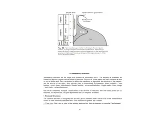
Graphic Sedimentary Log A sedimentary log is a method representing series of beds of sediments sedimentary rocks graphical for a or Examples of patterns and symbols used on graphic sedimentary logs
PALAEOCURRENTS A palaeocurrent indicator is evidence for the direction of flow at the time the sediment was deposited, and may also be referred to as the palaeoflow. Palaeoflow data are used in conjunction with facies analysis and provenance palaeogeographic reconstructions. studies to make
Palaeocurrent indicators Two groups of palae-ocurrent indicators in sedimentary structures can be distinguished Unidirectional indicators are features that give the direction of flow. Flow axis indicators are structures that provide information about the axis of the current but do not differentiate between upstream and downstream directions.
Unidirectional indicators Cross-lamination ripples migrating in the direction of the flow of the current. The dip direction of the cross-laminae is measured. is produced by Cross-bedding migration of aeolian and subaqueous dunes and the direction of dip of the lee slope is approximately the direction of flow. is formed by the Clast imbrication is formed when discoid gravel clasts become oriented in strong flows into a stable position with one of the two longer axes dipping upstream when viewed side-on.
Flow axis indicators Primary current lineations on bedding planes are measured by determining the orientation of the lines of grains. Groove casts are elongate scours caused by the indentation of a particle carried within a flow that give the flow axis. Elongate clast orientation may provide information if needle- like minerals, elongate fossils such as belemnites, or pieces of wood show a parallel alignment in the flow. Channel and scour margins can be used as indicators because the cut bank of a channel lies parallel to the direction of flow.
Measuring Palaeocurrents The most commonly used features for determining palaeoflow are cross stratification, at various scales. As many as possible data points should be collected to carry out palaeocurrent analysis. The statistical validity of the mean will be improved with more data If only a general trend of flow is required for the project in hand, then fewer will be required.
Presentation and analysis of directional data Directional data are commonly collected and used in geology. Palaeocurrents are most frequently encountered in sedimentology. Palaeocurrent data are normally plotted on a rose diagram
COLLECTIONOFROCKSAMPLES Field studies only provide a portion of the information that may be gleaned from sedimentary rocks, so it is routine to collect samples for further analysis. Material may be required for palaeontological studies, to determine the biostratigraphic age of the strata, or for mineralogical and geochemical analyses. Thin-sections are used to investigate the texture and composition of the rock in detail, or the sample may be disaggregated to assess the heavy mineral content or dissolved to undertake chemical analyses. The size and condition of the sample collected will depend on the intended use of the material. For most purposes pieces that are about 50mm across will be adequate.
COLLECTIONOFROCKSAMPLES It is good practice to collect samples that are fresh , i.e. with the weathered surface removed. The orientation of the sample with respect to the bedding should usually be recorded by marking an arrow on the sample that is perpendicular to the bedding planes and points in the direction of younging. Every sample should be given a unique identification number at the time that it is collected in the field, and its location recorded in the field notebook. Samples should always be placed individually in appropriate bags usually strong, sealable plastic bags.
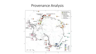
Provenance studies Information about the source of sediment, or provenance of the material, may be obtained from an examination of the clast types present . Provenance studies are generally relatively easy to carry out in coarser clastic sediments because a pebble or cobble may be readily recognized as having been eroded from a particular bedrock lithology. Many rock types may have characteristic textures and compositions that allow them to be identified with confidence. It is more difficult to determine the provenance where all the clasts are sand-sized because many of the grains may be individual minerals that could have come from a variety of sources.
Provenance studies Quartz is often of little value in determining provenance. It has been found that certain heavy minerals are very good indicators of the origin of the sand. Provenance studies in sandstones are therefore often carried out by separating the heavy minerals from the bulk of the grains and identifying them individually. Clay mineral analysis is also sometimes used in provenance studies because certain clay minerals are characteristically formed by the weathering of particular bedrock types. Analysis of mud and mudrocks can also be used to determine the average chemical composition of large continental areas.
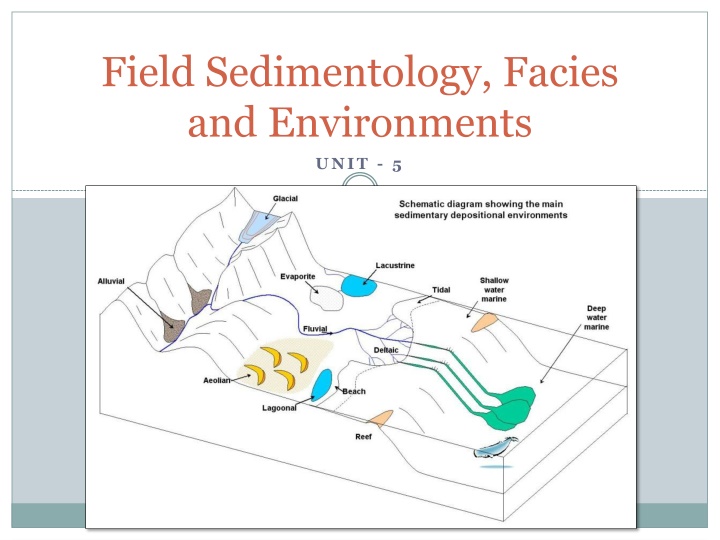
Interpreting Past depositional Environment Sediments accumulate in a wide range of settings that can be defined in terms of their geomorphology, such as rivers, lakes, coasts, shallow seas, and so on. The physical, chemical and biological processes that shape and characterize those environments are well known. A interpretation of sedimentary rocks in terms of the transport and depositional determining the environment in which they were deposited. fundamental part of sedimentology is the processes and then
The concept of Sedimentary Facies The term facies is widely used in geology, particularly in the study of sedimentology in which sedimentary facies refers to the sum of the characteristics of a sedimentary unit. Every depositional environment puts its own distinctive imprint on the sediment, making a particular facies. Thus, a facies is a distinct kind of rock for that area or environment These characteristics include the dimensions, sedimentary structures, grain sizes and types, colour and biogenic content of the sedimentary rock. An example would be cross-bedded medium sandstone : this would be a rock consisting mainly of sand grains of medium grade, exhibiting cross-bedding as the primary sedimentary structure.
The concept of Sedimentary Facies A B = Shale facies (offshore marine environment) C = Limestone facies (far from sources of terrigenous input) = Sandstone facies (beach environment) Each depositional environment grades laterally into other environments. We call this facies change when dealing with the rock record.
The concept of Sedimentary Facies Transgressions and Regressions Transgression = sea level rise Regression - sea level drop Fluctuations in sea level are caused by things such as: Changes in the size of the polar ice caps, due to climatic changes Melting of ice caps leads to sea level rise (transgression) - it has been calculated that complete melting of the Antarctic Ice Sheet would cause a sea level rise of 60 - 70 meters (200 feet). Growth of ice caps leads to drop in sea level (regression) - calculations show that sea level was as much as 100 meters (300 feet) lower than at present at the height of the last Ice Age glaciation. Much of the Continental Shelf area would have been exposed and dry. Rate of sea floor spreading - during times of rapid sea floor spreading and submarine volcanism, the ocean ridge system is enlarged by the addition of lava, displacing water onto the edges of the continents (transgression). Localized subsidence or uplift of the land - In the 8000 - 10,000 years since the melting of the last glacial ice sheet over North America, parts of Canada have risen due to isostatic uplift by up to 300 meters.
The concept of Sedimentary Facies The principle that facies that occur in conformable vertical succession of strata also occur in laterally adjacent environments is known as Walther's law of correlation of facies. Transgressive sequence Deeper water facies overlie shallow water facies. A "deepening upward" sequence.
The concept of Sedimentary Facies Regressive sequence Shallow water facies overlie deeper water facies. A "shallowing upward" sequence.
The concept of Sedimentary Facies If the facies description is confined to the physical and chemical characteristics of a rock this is referred to as the lithofacies In cases where the observations concentrate on the fauna and flora present, this is termed as biofacies. A study that focuses on the trace fossils in the rock would be a description of the ichnofacies
Facies Analysis The facies concept is not just a convenient means of describing rocks and grouping sedimentary rocks seen in the field, it also forms the basis for facies analysis. By interpreting the sediment in terms of the physical, chemical and ecological conditions at the time of deposition it becomes possible to reconstruct palaeoenvironments, i.e. environments of the past. So, from the presence of symmetrical ripple structures in a fine sandstone it can be deduced that the bed was formed under shallow water with wind over the surface of the water creating waves that stirred the sand to form symmetrical wave ripples. The shallow water interpretation is made because wave ripples do not form in deep water but the presence of ripples alone does not indicate whether the water was in a lake, lagoon or shallow-marine shelf environment. The facies should therefore be referred to as symmetrically rippled sandstone or perhaps wave rippled sandstone , but not lacustrine sandstone because further information is required before that interpretation can be made.
Reconstructing paleoenvironment in space and time One of the objectives of sedimentological studies is to try to create a reconstruction of what an area would have looked like at the time of deposition of a particular stratigraphic unit. The first prerequisite of any palaeoenvironmental analysis is a stratigraphic framework, that is, a means of determining which strata are of approximately the same age in different areas, which are older and which are younger. Once it is established that the rocks that we know are of approximately the same age across an area, we can reconstruct the paleo-environment using facies analysis, paleo-current studies and provenance studies. Over thousands and millions of years of geological time, climate changes, plates move, mountains rise and the global sea level changes.
Reconstructing paleoenvironment in space and time The record of all these events is contained within sedimentary rocks, because the changes will affect environments that will in turn determine the character of the sedimentary rocks deposited. Palaeoenvironmental reconstructions therefore provide a series of pictures of the Earth s surface that we can then interpret in terms of large- and small-scale events. When palaeoenvironmental analysis is combined with stratigraphy in this way, the field of study is known as basin analysis and is concerned with the behaviour of the Earth s crust and its interaction with the atmosphere and hydrosphere. As stated above, one of the objectives of facies analysis is to determine the environment of deposition of successions of rocks in the sedimentary record. A general assumption is made that the range of sedimentary environments which exist today have existed in the past.
