Guidelines and Recommendations for Hydrographic Offices CATZOC Allocation
The report highlights guidelines for Hydrographic Offices to allocate CATZOC values based on minimum bathymetry standards, ZOC categories, and best practices from various national methodologies. It covers position accuracy, depth accuracy, and seafloor coverage criteria. The allocation is primarily
6 views • 18 slides
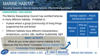
Marine Habitats and Their Diverse Ecosystems
Marine habitats vary in characteristics such as temperature, current, tide, seafloor substrate, and light, influencing the communities of organisms that live within them. The certification of fisheries by the Marine Stewardship Council ensures minimal impact on local habitats, emphasizing the import
0 views • 6 slides
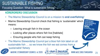
Sustainable Fishing Practices and Conservation Efforts
Sustainable fishing practices are crucial for maintaining healthy marine ecosystems. The Marine Stewardship Council ensures fishing is sustainable by leaving enough fish in the ocean, protecting fish habitats, and supporting fishing communities. Unsustainable fishing practices such as bycatch, shark
2 views • 8 slides
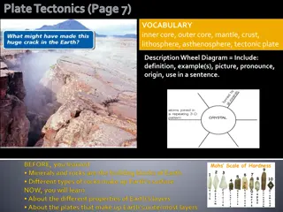
Processes Shaping Earth: Lithosphere, Plate Tectonics, and Effects
Explore the components of our planet, such as the lithosphere, hydrosphere, atmosphere, and biosphere. Learn how the lithosphere, consisting of the Earth's crust and top solid mantle, interacts through plate tectonics, causing movements that shape the Earth's surface. Discover the concept of Pangaea
0 views • 31 slides
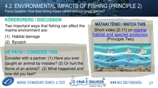
Environmental Impacts of Fishing: Habitat Damage and Bycatch
Fishing can negatively impact the marine environment through habitat damage and bycatch. Habitat damage occurs when fishing gear harms delicate seafloor habitats where endangered species grow. Bycatch, or unwanted catch, involves unintentionally capturing marine species like whales, dolphins, and se
0 views • 4 slides
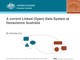
Introduction to Linked Data in Geoscience Australia
Linked Data is a publishing paradigm that elevates both web pages and data to first-class citizens of the Web, enabling a global data space evolution. This concept, as explored in Geoscience Australia, involves the utilization of Semantic Web standards to promote common data formats and exchange pro
1 views • 23 slides
Earth's Oceans: From Formation to Technology
Earth's oceans are interconnected bodies of water covering about 70% of the planet. This chapter delves into the formation of oceans, the composition of seawater, the structure of the seafloor, and the technology used to explore the depths. Learn about the theories behind ocean formation, the differ
0 views • 24 slides

Plate Tectonics: Evolution of the Earth
Explore the dynamic process of plate tectonics shaping the Earth's crust through the movement of tectonic plates, subduction zones, divergent and convergent boundaries. Discover how seafloor spreading creates new oceanic crust, and learn about the geological features formed by these processes.
0 views • 25 slides

High-Resolution 3D Seafloor Topography Enhancement Using Kalman Filtering
Proposing a Kalman Filter approach to refine seafloor topography estimation by integrating various geophysical data types. The method allows for producing regional bathymetry with higher resolution, truncating unnecessary observations, and reducing the matrix dimensions in the inverse problem. Inclu
0 views • 9 slides

Arctic Research Expedition 2024: Mission to Explore Pacific Arctic Ecosystems
Researchers are embarking on a crucial expedition in August 2024 to study the environmental changes in the Pacific Arctic. Led by scientists from NOAA and UAF, the team aims to assess biodiversity, ecosystem status, and ongoing changes in the northern Bering and Chukchi Seas. The expedition will inv
2 views • 8 slides
Earth's Layers and Plate Tectonics Overview
Earth's layers, including the core, mantle, and crust, have different properties and compositions that shape the planet's structure. Scientists study seismic waves to understand Earth's interior. Plate tectonics play a crucial role in shaping the planet's surface features through the movement of lit
0 views • 13 slides
GEBCO Technical Sub-Commission on Ocean Mapping (TSCOM) Overview
Technical Sub-Commission on Ocean Mapping (TSCOM) is a key component of the GEBCO program, established in 2006 to provide expertise in seafloor mapping and discuss emerging technologies. TSCOM serves as an authoritative source for bathymetric and hydrographic data and offers ongoing advice to associ
0 views • 12 slides
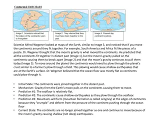
The Theory of Continental Drift and Plate Tectonics
Scientist Alfred Wegener proposed the theory of continental drift, noticing how continents could fit together like pieces of a puzzle. His idea evolved into the concept of plate tectonics, explaining the movement of Earth's lithosphere. This model highlights the dynamic nature of the Earth's surface
0 views • 4 slides