High-Resolution 3D Seafloor Topography Enhancement Using Kalman Filtering
Proposing a Kalman Filter approach to refine seafloor topography estimation by integrating various geophysical data types. The method allows for producing regional bathymetry with higher resolution, truncating unnecessary observations, and reducing the matrix dimensions in the inverse problem. Includes simulated data tests and comparisons, as well as principles of Kalman Filtering in both forward and inverse problems.
Download Presentation

Please find below an Image/Link to download the presentation.
The content on the website is provided AS IS for your information and personal use only. It may not be sold, licensed, or shared on other websites without obtaining consent from the author.If you encounter any issues during the download, it is possible that the publisher has removed the file from their server.
You are allowed to download the files provided on this website for personal or commercial use, subject to the condition that they are used lawfully. All files are the property of their respective owners.
The content on the website is provided AS IS for your information and personal use only. It may not be sold, licensed, or shared on other websites without obtaining consent from the author.
E N D
Presentation Transcript
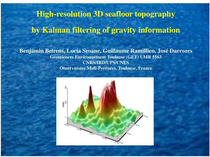
High-resolution 3D seafloor topography by Kalman filtering of gravity information Benjamin Beirens, Lucia Seoane, Guillaume Ramillien, Jos Darrozes G osciences Environnement Toulouse (GET) UMR 5563 CNRS/IRD/UPS/CNES Observatoire Midi-Pyr n es, Toulouse, France
OBJECTIVES We propose a Kalman Filter (KF) approach to integrate different types of geophysical data, i.e. geoid height and free-air gravity anomalies, single beam sounding ship tracks, etc, for refining seafloor topography estimation. This new numerical method enables to invert data onto unregularly-sampled grids for producing regional bathymetry with a finer resolution (~km). Forward problem. Expression of the Newtonian operators have been completely revised from the ones obtained by previous non-linear least-squares developments (Calmant 1994; Ramillien 1998). Inverse problem. Iterative integration of data made by KF permits to truncate large datasets of unncessary observations, and thus reduce the matrix dimensions of the inverse problem.
DENSITY INTERFACE MODEL SEA FLOOR 0m
SIMULATED DATA AND RECOVERY TESTS Generate synthetic topography Forward problem: Simulate observations Inversed problem: Estimate topography Comparison with input topography RMS, inversion parameters sensibility,convergence.
INVERSED PROBLEM: PRINCIPLE OF KALMAN FILTERING (KF) The observation errors are assumed spatially decorrelated A priori covariance of the topographic heights 2 m == kP = 2 d R I 1 0 1 ( / + 2 ) 1 k 0 0= 0.2 Calmant et al., 1994
CHECKING INVERSION PARAMETERS ( d, m) SENSIBILITY d is the standard deviation of observations errors m is the a priori standard deviation of topographic heights (m) (m) (m) (m) (m) (mgal)
GEOID INVERSION FOR THE GREAT METEOR TOPOGRAPHY Adaptive grid used: - Reduction of parameters. - Time of computation decreases - Representing the real data resolution (as ship mesaurements)
HIGHLIGHTS & PERSPECTIVES Each input dataset that could be integrated iteratively in the KF has the possibility to complement - or not, depending upon the data uncertainties - the current regional topography solution. The non-linear formalism was validated and it enabled to recover topography columns of kilometric sizes, and thus to reach higher spatial resolutions, e.g. Great Meteor guyot. The numerical computation is optimized using C++ armadillo libraries. The compensation effects are added to the model but further investigations are needed. Taking the sediment thickness into account. Seoane et al. (in preparation)
