Geographic Information System in Sud Nouvelle Calédonie
The province of Sud Nouvelle Calédonie utilizes an open-source-based Geographic Information System (GIS) to serve its territorial administration, with a focus on applications such as land administration, environment, agriculture, and urban planning. The system is supported by a team of engineers, g
0 views • 15 slides
Groundwater Suitability Mapping Training Overview
The training program focuses on GIS and Remote Sensing for overlay analysis, with an emphasis on generating groundwater suitability maps. Dr. Maarten Waterloo leads the session, covering topics like data processing, automation, and sensitivity analysis. The program includes hands-on activities and e
1 views • 14 slides
Geographic Data Visualization in R and QGIS for Malawi Health Analysis
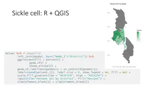
Utilizing R and QGIS, this project focuses on visualizing sickle cell and HIV percentages by district in Malawi, mapping health facility locations, creating Voronoi polygons, and displaying malaria cumulative incidence data. Various geographic data visualization techniques are applied to provide ins
0 views • 8 slides
GIS and Remote Sensing for Overlay Analysis Training Program
This training program focuses on GIS and remote sensing techniques for overlay analysis, covering topics such as data processing, suitability mapping, sensitivity analysis, and introduction to Python. The program includes practical sessions on QGIS, lithology, land use, recharge, TWI, and more. Part
2 views • 24 slides
Enhancing Spatial Data Analysis in QGIS
Explore the integration of relational databases with QGIS to facilitate efficient spatial data analysis. Discover the importance of recognizing spatial relationships within data sets and the solutions to enhance QGIS for relational datasets. Overcome challenges and delve into the intersection and su
0 views • 25 slides
Map Projections and Coordinate Systems in QGIS
Map projections are essential for representing the Earth's surface on a flat plane, with various distortions depending on the projection used. QGIS provides tools to work with different projections like UTM, Lambert Azimuthal Equal Area, and more. Mixing projections in QGIS can lead to errors in dat
0 views • 13 slides
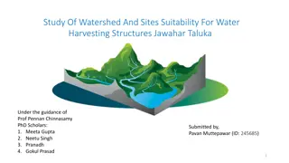
Study of Watershed and Sites Suitability for Water Harvesting in Jawhar Taluka
This project aims to address water scarcity in Jawhar Taluka by studying watershed characteristics and identifying suitable sites for water harvesting structures. The methodology includes DEM analysis using QGIS Grass, watershed delineation, stream extraction, and site suitability assessment based o
0 views • 4 slides
GIS Training: Practising QGIS Exercises
Engage in a series of hands-on exercises with QGIS to create maps, analyze geospatial data, and manipulate project settings. Explore tasks such as setting up symbology, calculating distances, changing coordinate systems, and utilizing XYZ Tiles connections for Google satellite imagery.
0 views • 31 slides
