Exploring Historical Nautical Charts and the Evolution of Seafaring
Discover the significance of nautical charts through history, from the essential information they provide sailors to the evolution of mapping technology. Learn about the challenges faced by early cartographers like Lewis Morris and how their work continues to offer valuable insights into past mariti
0 views • 14 slides
Maritime Examination and Certification Statistics for 2016 - MMD Mumbai and NJ Noida Analysis
A detailed analysis is presented on the examination and certification statistics for the year 2016 by MMD Mumbai and MMD Noida. The data includes the total number of certificates issued by MMD Mumbai, the assessment of eligibility for appearing in COC examinations for different positions, the total
0 views • 18 slides
Fiji Hydrographic Office Overview
Lieutenant Jervis Robinson, a Senior Hydrographic Surveyor at the Fiji Hydrographic Office, provided insights into the roles and responsibilities of the office in collecting, processing, and disseminating georeferenced data related to maritime navigation, marine resources, and environmental preserva
1 views • 23 slides
Maritime and Geographical Overview of Equatorial Guinea
Equatorial Guinea, a country in central Africa, boasts a significant maritime presence and strategic geographical location in the Gulf of Guinea. With a population of over 1.2 million, it shares borders with Cameroon and Gabon while having maritime boundaries extending 320 nautical miles. The countr
0 views • 15 slides
Kiribati National Report on Marine Division Activities
This report sheds light on Kiribati's maritime organization, highlighting challenges faced due to economic vulnerabilities and reliance on foreign aid. It outlines the role of the Marine Division within the Ministry of Infrastructure, outlining its responsibilities as a maritime authority and regula
5 views • 17 slides
Hydrographic Capacity Building Strategies for Sustainable Development
Capacity building in hydrography involves assessing and supporting sustainable development of States to meet international maritime objectives. It is a process that goes beyond training and aims to enhance safety at sea, protect the environment, and boost national economic growth. The strategy is ex
8 views • 25 slides
Experiences of a Nippon Fellow: Byron A. Jara Bautista's Journey
Byron A. Jara Bautista, a Nippon Foundation Alumni, shares insights from his career in nautical cartography, database projects, and lessons learned from the CHART course. He emphasizes the importance of collaboration among Hydrographic Offices and suggests future strategies for enhancing skills in n
0 views • 6 slides
IHO Centenary Celebrations: A Triennium of Milestones
The International Hydrographic Organization (IHO) is gearing up to celebrate its centenary with a series of activities spanning three significant years. Commemorating key events in the organization's history, the celebrations aim to raise awareness about hydrography, nautical charting, and ocean map
0 views • 9 slides
Ante Koli - Career Path and Achievements in Hydrography
Ante Koli, a dedicated professional from Croatia, excels in the field of hydrography as Head of System Support/Nautical Cartographer at the Hydrographic Institute of the Republic of Croatia. With a wealth of experience, Ante has contributed significantly to various projects, including creating navig
0 views • 9 slides
Understanding Time Zones and Celestial Observations for Navigation
Explore the concepts of local mean time and zone time, and learn how to convert between them. Discover how to determine the ZT of sunrise, sunset, moonrise, and twilight phases using the Nautical Almanac. Practice answering questions related to observational timings and positional calculations.
0 views • 10 slides
Understanding the National Hydrographic Coordinating Committee (NHCC)
Explore the purpose and composition of the NHCC, diving into topics such as hydrographic governance, key references, and the essential role it plays in coordinating efforts within the maritime domain to enhance nautical information services. Discover why an NHCC is crucial, who forms part of it, and
0 views • 11 slides
The Yachting Industry: Vital for Island Economies
The yachting industry plays a crucial role in the tourism sector, offering high purchasing power, diversification, and economic growth potential. However, Spain's unique matriculation tax on yachts has raised concerns due to its impact on the nautical industry and legal uncertainties. Efforts are be
1 views • 12 slides
Ship Structural Framing Systems in Nautical Science
Understanding ship structural framing systems is crucial in naval architecture. The text explores transverse and longitudinal framing systems, discussing their advantages, disadvantages, and contributions to ship strength. It highlights how these systems help in overcoming various stresses on a ship
0 views • 16 slides
Proposed Modifications to Deceased Donor Lung Distribution
This proposal aims to address issues with the current distribution of deceased donor lungs in thoracic organ transplantation. By removing DSA and implementing a 250 nautical mile circle around the donor hospital, the policy seeks to resolve inconsistencies, complications, and impracticalities in the
0 views • 26 slides
Results of Future Paper Nautical Chart Survey 2019 - IHO Member States Respondents
Findings from the Future of the Paper Nautical Chart Survey conducted at the Nautical Cartography Working Group NCWG-5 in Stockholm, Sweden, from 5-8 November 2019. A total of 52 IHO member states responded to the survey, revealing insights on carriage requirements for domestic voyages, plans for de
0 views • 21 slides
Insights on the Future of Paper Nautical Charts from NCWG5 Reports
Delve into the perception of IHO Member States regarding the impacts of a paperless world on nautical paper charts based on a survey. Discover responses from 52 member states, including their views on carriage requirements, plans for developing paper chart backups, database management, S-57 encoded
0 views • 27 slides
Capacity Building for Sustainable Development in Hydrography and Nautical Charting
Capacity building in hydrography and nautical charting involves assessing and assisting in sustainable development to meet international objectives and obligations. It is not just training but a strategic process involving Member States, organizations, and individuals, with a focus on awareness, act
0 views • 25 slides
Understanding Hydrographic Surveying in Geomatics Engineering
Hydrographic surveying is a specialized field within geomatics engineering focused on mapping the water floor to produce nautical charts or bathymetric maps. These surveys play a crucial role in navigation, pipeline routing, cable installation, and more, providing essential data for various applicat
0 views • 19 slides
Understanding Latitude and Angular Distance on Earth
This content explains the concepts of latitude, angular distance, and distances on Earth using images and descriptions. It covers topics such as North Pole latitude, parallels of latitude, angular distance calculations, nautical miles, and great circle distances. Explore how these concepts relate to
0 views • 12 slides
Overview of 2019 Amendments to the Croatian Maritime Code
The 2019 amendments to the Croatian Maritime Code aimed to enhance the competitive strengths of Croatian shipping, improve seafarers' positions, reduce administrative barriers, digitize the shipping sector, and harmonize with EU legislation. Key topics covered include vessel definitions, safety, sea
0 views • 15 slides
South East Pacific Regional Hydrographic Commission (SEPRHC) Report Summary
The South East Pacific Regional Hydrographic Commission (SEPRHC) chaired by Rear Admiral Jorge Paz Acosta held various meetings and discussed work programs related to hydrographic activities in the region. The commission focused on important action items to enhance coordination and progress in hydro
0 views • 7 slides
Sight Reduction and Plotting by the NASR Method Quiz
Explore the NASR method of sight reduction through this quiz, covering topics such as using tables from the Nautical Almanac, entering arguments for NASR tables, determining signs of Dec, choosing Assumed Position in NASR method, and more. Test your knowledge on celestial navigation with these insig
0 views • 9 slides
Pirate Eucharist - A Unique Maritime Celebration
Join in the swashbuckling adventure of the Pirate Eucharist where the congregation exclaims "Arrrgh!" in joyous worship. From reciting the Nicene Creed with a pirate twist to standing in reverence for the Gospel reading, this unconventional service blends traditional elements with nautical flair.
0 views • 21 slides
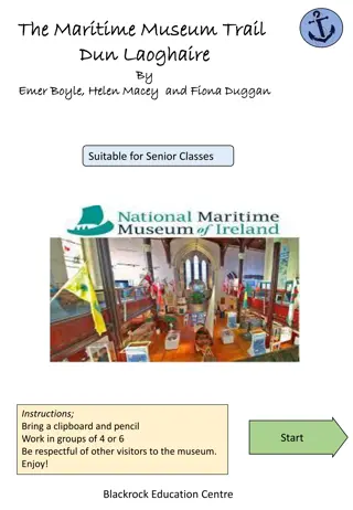
Explore the Maritime Museum Trail in Dun Laoghaire
Immerse yourself in the rich maritime history of Dun Laoghaire by following the Maritime Museum Trail. Discover intriguing facts about the former Mariners Church turned museum, the tragic sinking of the Palme, the commemoration of R.M.S. Leinster, and the unique features of the Great Eastern. Engage
0 views • 7 slides
UKHO Activities and Support in Meso-American and Caribbean Seas
UK Hydrographic Office (UKHO) published its National Report and detailed its activities in chart production, ENC production, paper chart production, publications, support to coastal states, and survey activities in the Meso-American and Caribbean Seas region. The report highlights UKHO's role as the
0 views • 10 slides
Hydrographic Surveying in Saint Vincent and the Grenadines
Saint Vincent and the Grenadines face challenges in hydrographic surveying due to lack of trained personnel, equipment, and compliance with international obligations. Efforts are being made through regional projects to develop hydrographic services and improve nautical chart production.
0 views • 10 slides
Swedish Maritime Administration's Use of AVANTI in Fulfilling SOLAS Requirements
Swedish Maritime Administration (SMA) is implementing AVANTI, a web-based platform, to enhance nautical and general information for ports. AVANTI aims to improve data quality, with plans for industrial launch in 2015. SMA collaborates closely with ports to meet SOLAS Chapter V Reg. 9.2.2. Significan
0 views • 9 slides
Nguyen Manh Duong: Maritime Safety Professional Achievements
Nguyen Manh Duong, a maritime safety professional from Vietnam, has a strong career background in aids to navigation management, inspection of nautical charts, and issuance of Notices to Mariners. His achievements include completing various training programs in technical aspects of maritime boundari
0 views • 8 slides
Understanding Sound and Sonar: Exploring Doppler Shift in Physical Science
Explore the principles of sound, Doppler shift, and sonar in nautical science. Learn about the characteristics of sound in seawater, the Doppler effect, and how sonar technology is used in detecting underwater objects. Key terms like fathometer, fish finder, hydrophone, active sonar, and passive son
0 views • 64 slides
WEND-100 Implementation Guidelines Report to IRCC14 Denpasar, Bali, Indonesia + VTC (Hybrid Meeting)
IHO Resolution 1/2021 introduces the WEND-100 principles, with complementary guidelines detailing their implementation for S-1XX products. The report discusses the applicability of WEND-100 principles for S-100 based products, focusing on specific S-1XX products planned for release before S-101. It
0 views • 12 slides
Ahti Nautical Chart Production and Data Management System Overview
Ahti Nautical Chart Production and Data Management System, led by Kalle Hyyrynen, aims to modernize nautical chart production by utilizing standardized products, improving system technology, and enhancing data management. The project addresses challenges such as outdated technology, integration need
0 views • 7 slides
