
European Maritime Single Window environment
Explore the European Maritime Single Window environment with key definitions, established platforms, and past regulations aiming to simplify and harmonize maritime reporting formalities in the EU. Understand port calls, declarants, reporting obligations, and the purpose behind this regulatory framew
5 views • 14 slides

BTH/OTH Radar and Maritime Surveillance Radar Overview
The article discusses BTH/OTH radar systems and maritime surveillance radars, exploring their functionalities, benefits, drawbacks, and real-world examples. It delves into the working principles of OTH radar, showcasing how it operates through the ionosphere. Additionally, it covers the concept of m
5 views • 12 slides

Professional Development and Maritime Education at US Naval Academy
The Division of Professional Development at the United States Naval Academy in Annapolis focuses on developing professional mariner skills to prepare Midshipmen for their roles as competent Naval officers. The program includes training in seamanship, navigation, summer sessions, fleet cruises, and a
2 views • 11 slides

Localised Adaptive Spatial-Temporal Graph Neural Network
This paper introduces the Localised Adaptive Spatial-Temporal Graph Neural Network model, focusing on the importance of spatial-temporal data modeling in graph structures. The challenges of balancing spatial and temporal dependencies for accurate inference are addressed, along with the use of distri
3 views • 19 slides

Introduction to Spatial Data Mining: Discovering Patterns in Large Datasets
Spatial data mining involves uncovering valuable patterns from extensive spatial datasets, offering insights into historical events, environmental phenomena, and predictive analytics. Examples range from analyzing disease outbreaks to predicting habitat suitability for endangered species. The applic
1 views • 20 slides
Enhancing Local Development Through Integrated Planning: A Critical Analysis
The background paper explores the relevance of integrated development plans for achieving sustainable local development in Zambia. It highlights weaknesses in national development plans, development coordinating committees at provincial and district levels, and district-level spatial plans. The intr
0 views • 13 slides
Understanding Spatial Database Systems: An Overview
This presentation by Xiaozhi Yu introduces the fundamentals of spatial database systems, covering topics such as spatial data types, relationships, system architecture, modeling, and organizing underlying spaces. It delves into the importance of integrating geometry into DBMS data models, spatial in
1 views • 30 slides
Advancing Low Carbon Development in Sustainable Transport
Thierry Nervale, Deputy Director of the Transport SPC EDD Programme, highlights the importance of sustainable transport in achieving economic growth, social equity, and environmental preservation. The UN Conference on Sustainable Development underscores the central role of transportation in sustaina
4 views • 17 slides

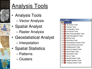
Understanding Spatial Analysis in GIS for Effective Decision-Making
Spatial analysis in GIS involves modeling geographic problems, processing data, and exploring results to understand spatial relationships, patterns, and suitability for various purposes. GIS tools offer unique capabilities for handling geographically referenced data, data entry, storage, manipulatio
2 views • 21 slides
Opportunities in Karnataka's Maritime Sector: Virtual Maritime India Summit 2021
Discover the marine investment opportunities in Karnataka highlighted at the Virtual Maritime India Summit 2021. With a well-developed industrial hinterland and picturesque coastal landscape, Karnataka offers multiple prospects in the maritime sector, including tourism development along its waterway
0 views • 10 slides

Understanding Spatial Referencing Systems for Mapping
Spatial reference systems play a crucial role in defining geographic parameters and coordinate systems for mapping. They consist of components like orientation, latitude, longitude, and elevation, which help in representing spatial properties on maps. Reference surfaces such as the Geoid and ellipso
3 views • 13 slides

Spatial Analysis & Modeling for Spatial Planning Training in Maputo, Mozambique
Explore spatial analysis techniques for efficient route planning, site selection, pattern identification, and value prediction in the context of spatial planning. Learn about surface modeling, relationships among features, and the importance of spatial modeling in addressing geographical problems.
0 views • 27 slides
Development of Visit, Board, Search and Seizure (VBSS) Curricula for the Sulu Zone
The development of VBSS curricula for the Sulu Zone involves creating specialized training programs to enhance maritime security in the region. The aim is to adapt VBSS training to the unique requirements of the Sulu Zone, focusing on aspects such as maritime crime investigation and prosecution. VBS
0 views • 18 slides
Maritime and Geographical Overview of Equatorial Guinea
Equatorial Guinea, a country in central Africa, boasts a significant maritime presence and strategic geographical location in the Gulf of Guinea. With a population of over 1.2 million, it shares borders with Cameroon and Gabon while having maritime boundaries extending 320 nautical miles. The countr
0 views • 15 slides

Understanding the Components of GIS for Spatial Planning
A geographic information system (GIS) is a powerful tool for capturing, storing, analyzing, and presenting spatial data. This training program explores the fundamentals of GIS, including software and hardware components, data considerations, and the importance of people and policies in utilizing GIS
4 views • 16 slides
Kiribati National Report on Marine Division Activities
This report sheds light on Kiribati's maritime organization, highlighting challenges faced due to economic vulnerabilities and reliance on foreign aid. It outlines the role of the Marine Division within the Ministry of Infrastructure, outlining its responsibilities as a maritime authority and regula
5 views • 17 slides

GIS Data Models for Spatial Planning Training in Maputo, Mozambique
Explore the concepts of GIS data models including vector vs. raster, spatial relationships, spatial operations, and representation of real-world entities in a spatial database. Understand how spatial data models are used to manipulate spatially-referenced information and define the spatial location
1 views • 32 slides
International Maritime Organization (IMO) and IMSAS: Ensuring Compliance with Maritime Standards
The International Maritime Organization (IMO) plays a crucial role in promoting maritime safety, protecting the marine environment, enhancing maritime security, and ensuring the human element in shipping. Through the Instrument Implementation Code (III Code) and the Voluntary IMO Member State Audit
0 views • 21 slides
Understanding Spatial Autocorrelation in Geostatistical Analysis
Explore the concept of spatial autocorrelation, its implications in geostatistical analysis, and the importance of detecting and interpreting it correctly. Learn about auto-correlation, signal components, correlation significance, and measuring autocorrelation using tools like Moran's I. Gain insigh
0 views • 12 slides

Spatial Relation Switching Requirements in 3GPP NR RAN Plenary Meeting
The document discusses various spatial relation switching requirements for uplink scenarios in the 3GPP NR RAN Plenary Meeting. It covers agreement points related to UL SRS, PUCCH, P-SRS, and DL-RS, defining delay requirements and known conditions for spatial relation switching. The agreements provi
0 views • 11 slides
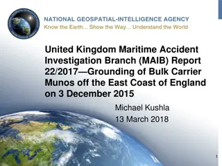
Maritime Investigation Report: Grounding of Bulk Carrier Munos
Investigation report by the UK Maritime Accident Investigation Branch on the grounding of the bulk carrier Munos off the East Coast of England in December 2015. The report includes details on the casualty, vessel parameters, onboard navigational systems, a timeline of events leading to the grounding
1 views • 18 slides

History of Transportation Innovations: Impact on Maritime Travel
Explore the evolution of maritime transportation through the ages, from oared galleys and sailing ships to the revolutionary steam-powered vessels. Learn about the advantages and disadvantages of different ship types, including their impact on trade, exploration, and warfare. Discover how innovation
2 views • 34 slides
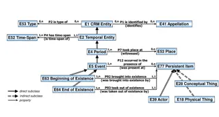
Understanding Temporal and Spatial Information Models
This content delves into the intricacies of temporal and spatial information models, covering concepts such as existence, presence, and spatiotemporal relationships. It explores how entities are identified, events are witnessed, and durations are defined within these models. The interplay between ti
3 views • 9 slides
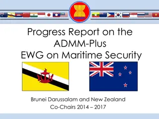
Progress Report on ADMM-Plus EWG on Maritime Security 2014-2017
Progress report on the activities and meetings of the ADMM-Plus EWG on Maritime Security from 2014 to 2017 co-chaired by Brunei Darussalam and New Zealand. The report includes workshops, meetings, exercises, and initiatives focused on enhancing maritime security in the region.
1 views • 19 slides
Teaching Physics at Maritime Academy: Insights from Dr. David P. Ciampa, Ph.D.
Dr. David P. Ciampa, Ph.D., shares his experience teaching physics at a Maritime Academy emphasizing on problem-solving techniques, motivation strategies, and challenges encountered. He discusses the unique aspects of teaching physics in a maritime setting and offers insights into student engagement
1 views • 12 slides
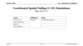
Coordinated Spatial Nulling (C-SN) Simulations in IEEE 802.11-24/0012r0
The document discusses the concept of Coordinated Spatial Nulling (C-SN) in IEEE 802.11-24/0012r0, focusing on spatial nulling feedback, synchronization needs, advantages of partial nulling, and comparison of half-coordinated versus fully coordinated scenarios. Simulation results are presented, anal
0 views • 19 slides
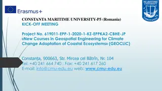
Constanta Maritime University - Empowering Maritime Education
Constanta Maritime University in Romania, established in 1972, is a prestigious public institution offering a diverse range of accredited study programs in maritime and engineering fields. With a focus on quality assurance and international recognition, the university remains a leading choice for st
2 views • 10 slides
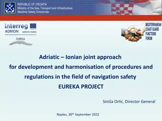
Adriatic-Ionian Maritime Safety Development Project by Republic of Croatia Ministry
The Republic of Croatia Ministry of the Sea, Transport, and Infrastructure is leading the EUREKA project to enhance maritime safety in the Adriatic-Ionian region through harmonization of procedures and regulations. The project aims to address challenges in data exchange, surveillance systems, and tr
1 views • 14 slides

Enhancing Spatial Data Analysis in QGIS
Explore the integration of relational databases with QGIS to facilitate efficient spatial data analysis. Discover the importance of recognizing spatial relationships within data sets and the solutions to enhance QGIS for relational datasets. Overcome challenges and delve into the intersection and su
0 views • 25 slides
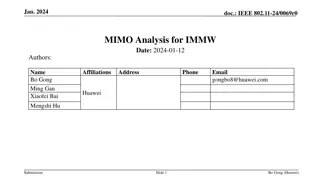
Analysis of MIMO for IMMW Transmission in IEEE 802.11-24
Proposal discusses the suitability of MIMO for IMMW transmission under different scenarios. The analysis focuses on the number of spatial streams based on channel rank and quality, recommending dual-polarization for LOS paths supporting 2 spatial streams and spatial separation for larger devices sup
0 views • 16 slides
Spatial Multi-Attribute Decision Analysis with Incomplete Preference Information
In this study by Mikko Harju, Juuso Liesi, and Kai Virtanen from Aalto University, the focus is on spatial decision analysis for scenarios where decision alternatives have varying consequences across a geographical region. The research delves into the significance of spatial value functions in repre
0 views • 19 slides
Maritime Cloud: Supporting Seamless Information Transfer in E-Navigation
The Maritime Cloud is a technical framework designed to facilitate seamless data exchange in e-navigation, connecting maritime actors onboard and ashore. It addresses identified framework requirements and guiding principles for secure communication and efficient service provision in the maritime ind
0 views • 19 slides
ICAR KRISHI Geo-Portal: Spatial Agricultural Research Information
ICAR KRISHI Geo-Portal is a digital platform aiming to facilitate spatial agricultural data generation, compilation, visualization, and analysis. It hosts spatial databases, provides map services, and allows data sharing across platforms. The portal, developed using open-source technologies, offers
1 views • 32 slides
Maritime Initiatives in St. Vincent and the Grenadines
The report outlines various maritime initiatives in St. Vincent and the Grenadines, including the Commonwealth Marine Economies Program, technical missions from IALA, goals for maritime spatial planning and development, and efforts towards ocean governance. Challenges and areas for improvement in ma
1 views • 5 slides
Emerging Legal Framework for Maritime Governance
The content discusses the amendments made by the Maritime Area and Foreshore (Amendment) Bill 2013 to the Foreshore Act of 1933, outlining clear processes and procedures for development in marine areas. It further explores the Programmes for Government, guidance documents for ORE projects, and expec
0 views • 8 slides
Economic Impact of Washington's Maritime Industry
Washington State's maritime industry, rooted in a rich history of timber production and trade hub location, encompasses core sectors like passenger water transportation, shipbuilding, fishing, and more. With an annual economic impact of $15.2B, the industry thrives through innovation, research, and
0 views • 9 slides
Delimitation of Maritime Boundaries by Negotiation or International Courts
Delimitation of maritime boundaries can be achieved through negotiation or by international courts or tribunals. Maritime boundary agreements have legal effects and obligations for the involved states. International bodies like the International Court of Justice and the International Tribunal for th
0 views • 5 slides

MARINN Maritime Innovation Cluster - Driving Skills Development in the Maritime Industry
MARINN Maritime Innovation Cluster, founded by GITONE Kvarner, is focused on developing skills in the maritime industry amidst a digital and green revolution. Through collaboration, education, and innovation, MARINN aims to enhance operations, promote sustainability, and empower professionals for th
0 views • 6 slides

Celebrate National Careers Week with Maritime Careers Ambassadors!
National Careers Week from 6th-12th March features a Maritime-focused day on 8th March. Ambassadors are invited to share their experiences in a case study template by including a photo, a quote on Maritime careers, their name, role, and UK region. The completed templates can be posted on social medi
0 views • 4 slides
Innovative Approach in Mathematical Education for Maritime Students
Explore the innovative approach in mathematical education for maritime students as presented during the MareMathics Teachers Training and Meeting in Tallinn. The sessions covered topics such as mathematical applications in thermodynamics, including partial derivatives, derivations, and integrals wit
0 views • 11 slides