
Tradeoffs Between Water Savings and GHG Emissions in Irrigated Agriculture
This study examines the tradeoffs between water savings, economic impact, and greenhouse gas emissions resulting from technological changes in the irrigation industry. Key objectives include estimating water savings for different crops, quantifying GHG emissions from new irrigation technologies, and
0 views • 24 slides

Rainfall-Runoff Modelling Using Artificial Neural Network: A Case Study of Purna Sub-catchment, India
Rainfall-runoff modeling is crucial in understanding the relationship between rainfall and runoff. This study focuses on developing a rainfall-runoff model for the Upper Tapi basin in India using Artificial Neural Networks (ANNs). ANNs mimic the human brain's capabilities and have been widely used i
0 views • 26 slides

Evolution of HEC-SSP Analytical Tools and Software Development Team
HEC-SSP, a software developed by the US Army Corps of Engineers, has evolved over the years to meet the statistical needs of the Corps. From its inception in FY2005 to the latest version, the software has seen significant enhancements in capabilities such as General Frequency, Curve Combination anal
9 views • 52 slides
Understanding Natural Disasters and Their Causes
Explore the various types of natural disasters such as meteorological, geophysical, hydrological, climatological, and biological events, each with unique causes like storms, earthquakes, floods, droughts, wildfires, and more. Learn how these disasters impact the environment and living organisms.
9 views • 16 slides

Programmatic items
The programmatic items for the INFCOM-3 Information Session include considerations of WMO Programmes relevant to the Commission, work programmes for the next intersessional period, and subsidiary bodies. Highlighted is the draft Recommendation 5/1 on the Expanded World Weather Watch Programme and th
2 views • 28 slides

Hydropower Plants Market to be Worth $318.3 Billion by 2030
The increasing utilization of the kinetic energy of the flowing water for electricity generation and small hydropower projects are expected to offer significant growth opportunities for the stakeholders in the hydropower plant market. Furthermore, international conflicts over water management and un
0 views • 8 slides
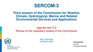
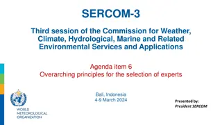
Highlights and Structure of SERCOM-3 Commission Meeting in Bali, Indonesia
SERCOM-3 session of the Commission for Weather, Climate, Hydrological, Marine, and Environmental Services featured reports, discussions on key initiatives like EW4All, and highlighted structural reorganization. With a focus on enhancing service delivery and coordination, the meeting showcased signif
1 views • 10 slides
Update on Drought Monitoring Indicators and Indices at SERCOM-3 Conference
The SERCOM-3 conference held in Bali, Indonesia, discussed the adoption of additional drought indicators and indices for use by National Meteorological and Hydrological Services (NMHS). The update to the Global Drought Classification System (GDCS) included recommendations for the use of standardized
0 views • 4 slides
Factors Affecting the Hydrological Cycle: Understanding Physical and Human Influences
The hydrological cycle is influenced by both physical and human factors. Physical factors such as relief, vegetation, basin size, rock type, soil type, and climate all play a role in shaping the movement of water through the cycle. Human activities like forestry, urbanization, deforestation, mining,
2 views • 20 slides

Understanding Different Types of Disasters and Their Impact
Disasters, whether natural or man-made, can cause massive disruptions leading to human suffering, economic loss, and environmental damage. Natural disasters like earthquakes and cyclones, geological disasters such as volcanic eruptions, hydrological disasters like tsunamis, and climatological disast
0 views • 11 slides
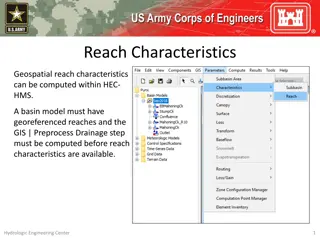
Understanding Reach Characteristics in HEC-HMS Basin Modeling
Reach characteristics play a crucial role in hydrological modeling using HEC-HMS. Georeferenced reaches are essential for computing reach characteristics like slope, sinuosity, relief, and more. The process involves pre-processing drainage data before detailed reach characteristics can be obtained.
0 views • 5 slides
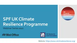
UK Climate Resilience Programme Webinar Series 2022
The UK Climate Resilience Programme is hosting a webinar series featuring prominent speakers discussing key topics related to climate change adaptation, impacts, and decision-making options. Presentations and Q&A sessions will cover insights from the IPCC WGII report, projected risks associated with
1 views • 10 slides
Understanding the Hydrological Cycle: An Introduction by Ayansa T.
Ayansa T., a lecturer at Ambo University Woliso Campus, provides an insightful overview of the hydrological cycle in this introduction. Exploring the stages of the cycle, such as precipitation, infiltration, and evaporation, Ayansa delves into the water budget equation and its importance in hydrolog
0 views • 14 slides
HEC-ResSim Alternatives and Simulations Overview
Explore the functionalities of HEC-ResSim including creating, composing, and setting up alternatives for hydrological engineering simulations. Learn about ResSim alternatives, simulation modules, and the alternative editor in detail.
0 views • 31 slides
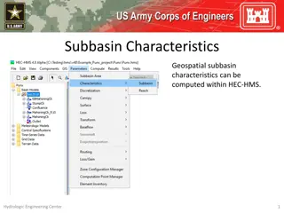
Understanding Subbasin Characteristics in HEC-HMS
Subbasin characteristics play a crucial role in hydrological modeling within HEC-HMS. Before computing these characteristics, the basin model must have georeferenced subbasins in the GIS. Various parameters such as basin slope, relief, elongation ratio, drainage density, and flowpath lengths and slo
0 views • 13 slides

Understanding Drought as a Geohazard in South Texas
South Texas faces chronic water scarcity due to its semi-arid climate, leading to frequent droughts. This lecture explores the unique characteristics of drought as a geohazard, its specific risks, and the societal impacts it can cause, including direct meteorological and hydrological effects, as wel
0 views • 13 slides
Detection and Attribution of Flow and Sediment Fluxes in the Nile Basin
This study aims to detect and attribute climate change impacts on flow and sediment loads in the Nile basin using climate data and hydrological models. The research focuses on historical data and involves evaluating models, completing paper writing, and finishing the detection and attribution analys
0 views • 4 slides

Bayesian Methodology for Soil Parameters Retrieval from SAR Images
Surface soil moisture retrieval is crucial for various applications such as climatic modeling, hydrological studies, and agronomy. This work focuses on developing a soil moisture retrieval algorithm using the SAOCOM L-Band polarimetric SAR system in Argentina. Limiting factors include spatial variab
1 views • 16 slides
Streamflow-Based Analysis for Climate Change Impact Detection and Attribution
This study focuses on detecting and attributing climate change impacts using a multi-basin, multi-model approach. It utilizes the CAMELS dataset, including observed data from 671 gauges across the USA, to analyze streamflow changes and seasonality shifts. The methodology involves updating datasets,
1 views • 7 slides

Baikal Selenga Network (BaSeNet) - Hydrologic Research Program in PEEX
Baikal Selenga Network (BaSeNet) is a subprogram under PEEX focusing on studying waterborne matter transport in the Lake Baikal and Selenga River Drainage Basin. The program aims to quantify hydro-climatic impacts on large scales, utilizing a monitoring and modeling platform. Research objectives inc
0 views • 5 slides
Understanding the Earth's Environmental Systems and Cycles
Explore the interconnected systems of the Earth's biosphere, lithosphere, hydrosphere, and atmosphere, along with biogeochemical cycles like the hydrological cycle. Learn how these systems interact to sustain life and maintain Earth's dynamic environment over billions of years.
1 views • 28 slides
Proposed Restructuring of SERCOM Subsidiary Bodies and Expert Teams
The document outlines the proposed restructuring of the Subsidiary Bodies and Expert Teams of the Commission for Weather, Climate, Hydrological, Marine, and Related Environmental Services. It includes new expert teams, activities to be handled, and changes in leadership roles to align with emerging
0 views • 5 slides

Understanding Spatial Extremes: Complex Time Methods in Hydro-Atmospheric Dynamics
This study explores the use of complex time methods and chameleon scalar fields in understanding and modeling spatial extremes in hydrological and atmospheric systems. By transforming Lagrangian processes and introducing chameleon scalar fields, the research unveils new insights into the mechanism g
0 views • 9 slides
Evaluation of Soil Moisture Estimates from Satellite-Based Products
The study evaluates soil moisture estimates from satellite-based products over two network regions. Soil moisture is crucial for the hydrological cycle, necessitating continuous monitoring due to its spatial and temporal variability. Remote sensing is utilized to gather information without physical
0 views • 5 slides
Understanding Spatio-Temporal Dynamics of Hydrological Processes at IIT Roorkee
This study conducted at the Indian Institute of Technology Roorkee focuses on modeling and understanding hydrological processes, particularly in estimating antecedent moisture in the Runoff Curve Number methodology. The research delves into the historical background of the Soil Conservation Service
0 views • 13 slides
Developing Reward Mechanism for Watershed Services in Indonesia: Reconciling Local and Public Knowledge
This study focuses on reconciling local and public knowledge for developing a reward mechanism for watershed services in Indonesia. It discusses multi-stakeholder knowledge systems, knowledge acquisition methodologies, case studies from three locations in Indonesia, and local insights on landscape-h
0 views • 11 slides
Overarching Principles for Expert Selection in SERCOM Subsidiary Bodies
The document outlines the overarching principles for selecting experts in the Commission for Weather, Climate, Hydrological, Marine, and Related Environmental Services and Applications (SERCOM) subsidiary bodies. It covers the leadership positions, balanced composition criteria, gender representatio
0 views • 5 slides

Exploring the Hydrological Cycle and Aquatic Environments
Dive into the fascinating world of the hydrosphere with a comprehensive look at the hydrological cycle, water properties, hydrology, salinity, aquatic biomes, and ocean facts. Discover how water moves through Earth's spheres, the distribution of freshwater, the significance of oceans, and their role
0 views • 31 slides
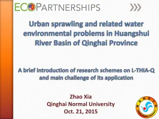
Addressing Urban Sprawling and Water Environmental Problems in Huangshui River Basin, Qinghai Province
This research focuses on the impact of urban sprawling on the water environment in the Huangshui River Basin of Qinghai Province. It examines the challenges faced and the application of L-THIA-Q in addressing these issues. The study highlights the origin of cooperation, research schemes, and the mai
0 views • 17 slides
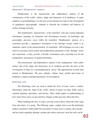
Quantitative Morphometric Analysis in Geomorphology
Quantitative morphometric analysis in geomorphology focuses on measuring and mathematically analyzing the earth's surface configuration and landform dimensions. It involves using GIS techniques to assess terrain parameters and drainage systems, providing valuable insights into watershed characterist
0 views • 8 slides
Overview of SC-DRR and its Activities up to SERCOM-3
The Standing Committee on Disaster Risk Reduction (SC-DRR) is a crucial body within the Commission for Weather, Climate, Hydrological, Marine, and Related Environmental Services. It comprises various expert teams and advisory groups focused on early warning services, severe weather forecasting, and
0 views • 14 slides

Understanding the Hydrological Cycle in Geography Education
Delve into the intricacies of the hydrological cycle within the hydrosphere, learning about the processes, factors, and impacts associated with water movement in urban and rural areas. Explore the concept of hydrology, drainage basins, hydrographs, and the water cycle powered by the sun. Enhance you
0 views • 24 slides
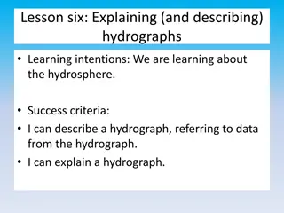
Understanding Hydrographs: Descriptions and Explanations
Learn about hydrographs, describing and explaining their data, and how human activities can impact the hydrological cycle. Practice analyzing hydrographs, identifying peak rainfall, discharge levels, lag time, urban vs. rural influences, and more. Enhance your knowledge of the hydrosphere with pract
0 views • 16 slides
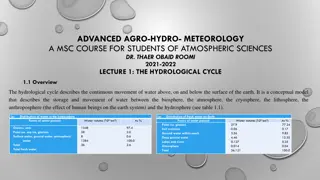
Understanding the Hydrological Cycle in Advanced Agro-Hydro-Meteorology
The hydrological cycle involves the continuous movement of water on, above, and below the Earth's surface, encompassing various realms such as the biosphere, atmosphere, cryosphere, lithosphere, and hydrosphere. This cycle describes the storage and movement of water within different Earth systems an
0 views • 14 slides

Understanding the Hydrological Cycle and Flood Hazards
This session with Dr. Patrick Asamoah Sakyi delves into the hydrologic cycle, causes of flooding, and ways to mitigate flood hazards. Topics covered include the hydrologic cycle, stream systems, flood consequences, factors affecting flood severity, and strategies for reducing flood risks. Recommende
0 views • 37 slides
Factors Affecting Flood Zones in Wake County, North Carolina
Analyze the factors influencing flood impacts in Wake County, North Carolina with a focus on proximity to water bodies, land cover, and impervious surfaces. Explore how county growth affects these factors, potential changes in flood zone areas, and implications for property risks. Consider using hyd
0 views • 15 slides
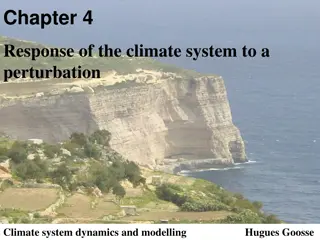
Understanding Climate System Response to Perturbations: Insights from Hugues Goosse's Chapter 4
Hugues Goosse's Chapter 4 delves into the response of the climate system to perturbations, emphasizing radiative forcing, greenhouse gases, aerosols, and their impacts on Earth's radiative budget. The chapter intricately describes physical feedbacks, interactions involving energy balance, hydrologic
0 views • 40 slides
Understanding the Role of Soil Biology in Lawn Care
Soil biology plays a crucial role in maintaining healthy and vibrant lawns. Various organisms, including invertebrates, plant roots, mycorrhizae, and micro-organisms, contribute to functions such as soil structure maintenance, regulation of soil hydrological processes, gas exchange, carbon sequestra
0 views • 27 slides
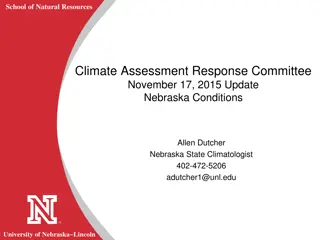
Climate Assessment Update: Nebraska Precipitation Trends and Impacts
Nebraska's recent climate assessment reveals varying precipitation trends across different regions. Positive short-term trends in the western part of the state indicate soil moisture recharge, while negative trends in south-central and southeast Nebraska pose challenges. A persisting dry signal for
0 views • 13 slides
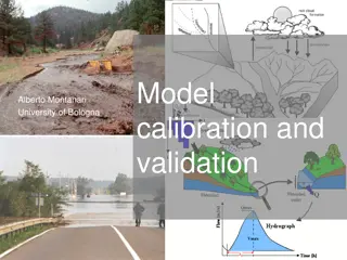
Understanding the Importance of Calibration in Hydrological Modeling
Hydrological models require calibration to adjust parameters for better representation of real-world processes, as they are conceptual and parameters are not physically measurable. Calibration involves manual trial and error or automatic optimization algorithms to improve model accuracy. Objective f
0 views • 12 slides