Exploring CBDC Technology at the Forum - July 26, 2023
Delve into the world of Central Bank Digital Currency (CBDC) technology through discussions, agenda items, and next steps outlined during the CBDC Technology Forum held on July 26, 2023. The event highlighted key areas such as design phase intentions, new member introductions, sub-group workings, an
2 views • 17 slides
Understanding Static GNSS Techniques and Products for Geospatial Applications
This educational material provides insights into static GNSS techniques, products, and their societal benefits. It covers topics such as distinguishing static GNSS techniques, understanding different products, and the capabilities of static GNSS stations. The content explores the Network of the Amer
3 views • 20 slides
NASA Space Technology Research Grants Program Overview
The NASA Space Technology Research Grants Program, managed by Dr. Matt Deans, encompasses various initiatives such as Early Stage Innovation, Technology Maturation, and Technology Demonstration. It aims to support innovative research and partnerships in space technology, fostering collaboration with
14 views • 9 slides
Asia-Pacific Location-based Services Market
Asia-Pacific Location-based Services Market by Component, Technology (GNSS, GPS), Application (Navigation, Mapping & GIS), Location Type, End-use Industry (Transportation & Logistics, Retail & E-commerce), and Geography -Forecast to 2031
1 views • 5 slides
Workshop Report on Implementation of UN Regulations R155 & R156
The report presents key discussions from the 16th workshop on UN Regulations R155 & R156, covering topics such as GNSS spoofing, reporting provisions, software updates, and recertification processes for CSMS/SUMS. It highlights the need for risk assessment, annual reporting, software obligations, an
0 views • 11 slides
Travel Technology Solution
Travelopro is an advanced travel technology company delivering complete end-to-end travel technology solutions and online travel ERP for travel businesses to compete in the ever-evolving digital world. Our travel technology solutions are developed to manage client business achievement and prosperity
2 views • 13 slides
Enhancing Lives with Assistive Technology
Assistive Technology empowers individuals with disabilities by providing tools and solutions for mobility, communication, and daily tasks. This technology, defined as items or systems that improve functional capabilities, helps redefine disability, increase resilience, and enable individuals to enga
1 views • 27 slides
Recent Developments in GAMIT/GLOBK for GNSS Processing
Significant updates and future developments in GAMIT/GLOBK for GNSS processing include processing of multiple constellations independently, transition to secure HTTP for code distribution, addition of azimuth field for station alignment, and regular updates schedule. Higher-order ionosphere and rapi
0 views • 10 slides
Exploring the Impact of Technology on Culture and Behavior
Dive into how technology is shaping our culture and behavior through the absorption of technology into our daily lives. Explore the intertwining relationship between technology and culture with examples of how we interact with technology and its effects on our routines and social connections.
0 views • 18 slides
Technology Assurance Sandbox: Promoting Innovation and Assurances
The Malta Digital Innovation Authority offers a Technology Assurance Sandbox for technology developers. This sandbox aims to provide a safe environment for innovative technology solutions and align them with international standards. Certification is voluntary and ensures quality, user, and investor
0 views • 12 slides
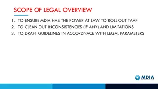
Legal Overview and Powers of MDIA for Innovative Technology Arrangements
This legal overview delves into the powers of Malta Digital Innovation Authority (MDIA) to roll out Technology Arrangements and Innovative Technology services, ensuring legal compliance, drafting guidelines, and covering all forms of innovative technology. The objective is to clean out inconsistenci
0 views • 11 slides
Understanding the Importance of Geoid Models Using GNSS Technology
Explore the significance of geoid models in surveying to determine orthometric heights, monitor sea level changes, and establish stable datum reference frames. The challenges, solutions, and recommendations for geoid development are discussed in the context of Majuro, RMI. Various aspects like geoid
2 views • 14 slides
Standard Data File Formats for Geospatial Instruments
Understanding the importance of standard file formats for GNSS, total stations, automatic levels, and relative gravimeters to facilitate data exchange, processing, and preservation in the geospatial industry. Exploring the significance of RINEX and other XML-based formats, along with examples and th
2 views • 30 slides
Understanding Global Navigation Satellite Systems (GNSS) in Geospatial Data for Public Health
Explore the key terms such as accuracy, GLONASS, GPS, precision, scale, and more in this session on GNSS technology. Understand how GNSS works, the constellation of satellites involved, and the different satellite navigation systems like GPS, GLONASS, BeiDou, and Galileo that provide autonomous geo-
6 views • 23 slides
Technology Considerations for Remote and Virtual Hearings Implementation
This content discusses the technology considerations for implementing remote and virtual hearings in courtrooms. It covers aspects such as courtroom technology framework, technology considerations matrix, and AV devices placement and requirements. The framework includes acoustic treatments, audio/vi
0 views • 7 slides
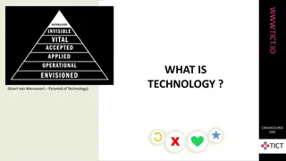
Exploring the Impact of Technology on Society Through Various Perspectives
Delve into the complex relationship between technology and humanity as discussed by experts like Koert van Mensvoort and Rens van der Vorst in the CrashCourse series on www.tict.io. Explore how technology shapes civilization, ethics, and the world, raising questions on whether it truly makes the wor
0 views • 9 slides
Location-Based Services Market: Emerging Technologies and Their Applications
Location-based Services Market by Component, Technology (GNSS, GPS), Application (Navigation, Tracking), Location Type, End-use Industry (Government and Public Sector, Transportation & Logistics, Smart Cities), and Geography - Global Forecast to 2031
0 views • 4 slides
Estimation of Ionospheric Critical Plasma Frequencies Using GNSS Measurements
This research focuses on estimating the critical plasma frequency of the ionosphere, specifically the F2 layer (f0F2), using GNSS measurements. The study reviews past work on ionospheric modeling, discusses neural network training inputs, and presents a single station neural network model (NNT2F2).
0 views • 26 slides
European Deep Space Surveillance and Tracking Collaboration
EU Space Surveillance and Tracking program involves five European nations collaborating to assess and reduce risks to European spacecraft, provide early warnings for re-entries and space debris, and prevent space debris proliferation. Available deep space sensors, such as optical telescopes, are uti
1 views • 8 slides
Understanding GNSS Data Processing with RINEX Formats
Explore the journey of GNSS data from receiver to processing input, focusing on the motivation behind the Receiver INdependent EXchange (RINEX) format and the evolution from RINEX 2 to RINEX 3. Learn about raw data formats, RINEX file conventions, and the significance of RINEX 2 data format in GPS o
1 views • 15 slides
Understanding Core Concepts of Technology Unit 2
Explore the core concepts of technology, the relationship among technologies, and their connection to other fields of study. Delve into the impact of various technologies like medical, agricultural, and information technology. Understand the designed world created by human modifications to meet need
0 views • 18 slides
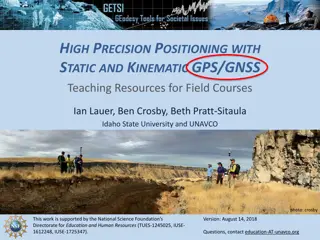
Enhancing Geoscience Field Courses with High-Precision GNSS Teaching Resources
Explore the benefits and challenges of integrating high-precision GNSS tools in field courses for geoscience students. Discover how students can develop valuable skills, apply GNSS surveys to societal issues, and tackle geologic research questions. Uncover strategies to overcome barriers and motivat
0 views • 8 slides
Understanding Assistive Technology and Technology-Enabled Care Services
This content highlights the role of Assistive Technology (AT) and Technology-Enabled Care Services (TECS) in supporting individuals, particularly those with dementia and falls. It discusses the importance of AT, the history of AT implementation in NYCC, and how Technology-Enabled Care can aid in add
0 views • 13 slides
High-Tech Survey Methods for Continuous Cadastral Map Generation
Generation of cadastral maps through advanced survey techniques using ortho-images, DGPS/GNSS, and ETS. The process involves obtaining boundary vectors from ortho-images, surveying obscured areas with DGPS/GNSS and ETS, and integrating datasets in a GIS environment. The objective is to create contin
0 views • 14 slides
The Excitement of Technology Plan Update and Professional Development Goals
The technology plan update involves optimizing technology use at the College through professional development resources. Various goals and objectives are outlined for 2014-2015, including enhancing training opportunities for faculty and staff, assessing technology training needs, and establishing a
0 views • 9 slides
GNSS Ionospheric Study in Korea: Insights and Findings
Explore the status of GNSS ionospheric study in Korea, including details on Korea's GPS permanent network, IGS, KASI Global Data Center, TEC mapping, and ionospheric tomography. Discover how ground-based GPS data is used to study ionospheric electron densities and monitor ionospheric storms in Korea
0 views • 15 slides
Qualcomm: A Leading Innovator in Mobile Technology
Qualcomm, a pioneer in mobile technology, has a rich history of innovations in CDMA technology and chipset development. From founding in 1985 to present success with Snapdragon processors, Qualcomm's key to success lies in powerful mobile chipsets and CDMA technology. Explore Qualcomm's journey from
0 views • 11 slides
Understanding REC and SEC Coordinates in Geodesy
Geodesist Boris Kanazir and NSRS Modernization Manager Dru Smith delve into the definitions, differences, and purposes of Reference Epoch Coordinates (RECs) and Survey Epoch Coordinates (SECs) at the 2021 Geospatial Summit. OPUS coordinates, SEC computation by NGS every four weeks, REC re-computatio
0 views • 17 slides
Understanding GPS Data Processing and RINEX Formats
Learn about the process of transferring GPS data from receivers to processing input, the importance of RINEX formats for universal data exchange, different raw data formats, motivation behind RINEX development, and details about RINEX versions. Explore RINEX 2 data format, its file naming convention
0 views • 13 slides
GNSS 2018 Program and Data Management Guide
Detailed guide on managing GNSS data for the year 2018, covering essential programs, utilities, file structures, and data sources. It includes information on arranging ephemerides, preparing site folders, finding GNSS data, GPS measurements archives, and relevant links for data retrieval.
0 views • 51 slides
Exploring the i-VISA Model for Technology Leadership in Smarter School Development
Dr. Chang, I-Hua, Chairperson of Taiwan Technology Leadership and Instructional Technology Development Association, introduces the i-VISA Model, consisting of Interpersonal and communication skills, Vision, planning and management, Infrastructure and technology support, Staff development and trainin
0 views • 27 slides
GNSS Application in Pedestrian Navigation for Indoor and Outdoor Environments
Communication forms and visual aids play a crucial role in supporting pedestrian wayfinding. Different methods such as maps, floor plans, verbal and textual guidance, images, videos, and 3D presentations are utilized to enhance navigation experiences for users. The use of Location Based Services and
0 views • 19 slides
Implementation of Cornell Ionospheric Scintillation Model in Spirent GNSS Simulator
Researchers from the University of Nottingham and Spirent Communications collaborated to implement the Cornell Ionospheric Scintillation Model into the Spirent GNSS Simulator. The study focuses on the diffractive effects of ionospheric scintillation on GNSS signals, examining small-scale plasma irre
0 views • 24 slides
Stanford GPS/GNSS Matlab Platform Overview
Stanford GPS/GNSS Matlab Platform (SGMP) is an integrated research platform developed at Stanford University for GPS research activities. The platform provides tools for utilizing GPS/GNSS measurements in various formats, converting positioning databases, simulation capabilities, and user interfaces
0 views • 21 slides
Educational Technology at IIT Bombay: Enhancing Thinking Skills
Technology Enhanced Learning of Thinking Skills (TELoTS) is a joint initiative at the Indian Institute of Technology Bombay focusing on innovative educational strategies, including peer discussions, adaptive tutoring systems, virtual reality, and analytics. The program emphasizes research, consultan
0 views • 28 slides
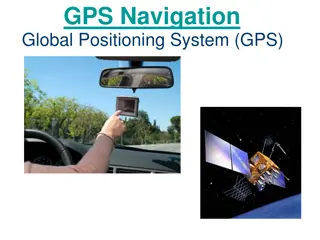
Understanding GPS Technology and Augmentations
Global Positioning System (GPS) utilizes a constellation of satellites to accurately determine device locations on Earth. The system consists of 24 satellites orbiting the planet, with an orbital configuration ensuring worldwide coverage. GPS offers high accuracy, with advancements like Differential
0 views • 9 slides
GPS Applications in Research - GEOL 4408/5508 Course Information
Explore GPS applications in research in the GEOL 4408/5508 course offered by the Department of Geosciences. Taught by Instructor H. Carrie Bottenberg, the course covers topics like satellite positioning, GPS/GNSS theory, mapping, and data analysis. Engage in field trips to enhance practical skills i
0 views • 10 slides
Civilian GNSS Signals Overview: GPS, GLONASS, Galileo
An insightful lecture on civilian GNSS signals by Dr. Ali Albu-Rghaif covers GPS, GLONASS, and Galileo signals. The content delves into GPS signal modulation, generation, receiving, and demodulation processes, highlighting the carrier wave, navigation data, and spreading sequences. It also discusses
0 views • 20 slides
SWOSU Technology Optimization Plan
This plan outlines strategic initiatives aimed at optimizing technology to meet the educational and administrative needs of SWOSU. Key focus areas include upgrading identified computers, enhancing technology staffing and support, improving data mining and learning analytics, ensuring satisfaction wi
0 views • 15 slides
University of Toronto Graduate Nurses Student Society Overview
The Graduate Nurses Student Society (GNSS) at the University of Toronto represents and advocates for graduate nursing students. It provides leadership, social involvement, mentorship activities, and promotes student-faculty engagement. The society's current executive team and council structure are o
0 views • 12 slides

