MTM Certification Process
Market and Area Coaches review roles, responsibilities, and certification process with potential Market Training Managers. Certification is through a 3-step process. Training Certification signed by Area Coach, Market Coach, and Training Team. Performance measured against standards. Repeated failure
5 views • 5 slides
Oklahoma Transportation GIS Cabinet Overview
Oklahoma's Transportation Cabinet consists of three agencies responsible for managing federal aid highways, county roadway data aggregation, Turnpike infrastructure, and aeronautics. The GIS infrastructure includes 18 full-time staff primarily using Esri Enterprise GIS tools for data integration and
1 views • 10 slides
GIS Data Management in Hydrologic Engineering Center (HEC) Software
Efficiently manage GIS data in HEC software by organizing background shapefiles, saving files in relevant directories, and utilizing relative pathnames. Understand the contents of basin files, GIS directories, and the step-by-step process involved in the delineation of elements within a project.
10 views • 5 slides
Applications of GIS in Urban Planning and Spatial Operations
This presentation explores the wide range of applications of Geographic Information Systems (GIS) in urban planning, transportation management, utility management, environmental sciences, political science, civil engineering, business, education, real estate, healthcare, and more. GIS facilitates ta
2 views • 19 slides
ISO 45001 Certificate | Quality Control Certification
Quality Control Certification makes security a seamless journey with the ISO 45001 certificate. Quality Control certification can help you take security off autopilot with ISO 45001. This streamlined standard creates a self-sufficient security system that runs smoothly in the background. QC certific
3 views • 5 slides
Introduction to Enterprise Databases for GIS Professionals
Explore the world of enterprise databases through a GIS perspective with a focus on concurrent clients, database administration, creating databases/tables, checking service names, unique features, numeric data types, data type parameters in ArcGIS, and character data types. Gain insights into managi
1 views • 52 slides
Transforming Buildings with EDGE Certification
Discover how EDGE certification revolutionizes the way buildings are designed and constructed for a smarter, greener world. EDGE provides a comprehensive solution that makes building green faster, easier, and more affordable. Learn about the EDGE standard's focus on resource efficiency, materials, e
1 views • 17 slides
Geographic Information System in Sud Nouvelle Calédonie
The province of Sud Nouvelle Calédonie utilizes an open-source-based Geographic Information System (GIS) to serve its territorial administration, with a focus on applications such as land administration, environment, agriculture, and urban planning. The system is supported by a team of engineers, g
0 views • 15 slides
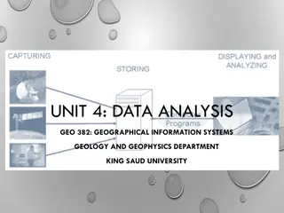
Spatial Analysis in GIS for Effective Decision-Making
Spatial analysis in GIS involves modeling geographic problems, processing data, and exploring results to understand spatial relationships, patterns, and suitability for various purposes. GIS tools offer unique capabilities for handling geographically referenced data, data entry, storage, manipulatio
3 views • 21 slides
Initial Teacher Certification Webinar Overview
This content provides detailed information about an Initial Teacher Certification Webinar hosted by the Office of Certification and Professional Preparation on April 25, 2018. It covers various topics including certification applications, renewal procedures, adding endorsements, TeachWV.com resource
3 views • 34 slides
The Components of GIS for Spatial Planning
A geographic information system (GIS) is a powerful tool for capturing, storing, analyzing, and presenting spatial data. This training program explores the fundamentals of GIS, including software and hardware components, data considerations, and the importance of people and policies in utilizing GIS
6 views • 16 slides
Enhancing Fiji Police Operations with GIS Implementation
The Fiji Police Force is integrating Geographic Information Systems (GIS) to enhance policing operations through improved situational awareness, crime trend analysis, resource deployment, and cost savings. By investing in GIS technology, the force aims to optimize efficiency, decision-making, and ov
2 views • 17 slides
GIS Data Models for Spatial Planning Training in Maputo, Mozambique
Explore the concepts of GIS data models including vector vs. raster, spatial relationships, spatial operations, and representation of real-world entities in a spatial database. Understand how spatial data models are used to manipulate spatially-referenced information and define the spatial location
1 views • 32 slides
Organic Certification and NPOP in India
Organic certification is crucial for ensuring the quality and authenticity of organic products. This involves adhering to strict production standards and undergoing periodic inspections. In India, the National Programme on Organic Production (NPOP) plays a significant role in certifying organic comm
1 views • 10 slides
Pacific Climate Change Centre Seminar on GIS and FOSS4G
The Pacific Climate Change Centre in Apia organized a seminar focusing on the importance of GIS and FOSS4G technology. The event included discussions on open GIS data, user group meetings, and keynote speakers. Various local hubs from the Pacific region were involved in the event, showcasing the gro
0 views • 5 slides
New York Peer Specialist Certification Board Updates and Certification Levels
Updates from the NYPSCB including information on their mission statement, certification levels - NYCPS and NYCPS-Provisional, certification standards for each level, and the distinction between the Academy of Peer Services and the NYPSCB for online training and testing. Learn about the requirements
2 views • 12 slides
Future Directions for GIS in Samoa
Enhancing GIS practices in Samoa involves establishing a Samoa GIS User Group, improving spatial data management, developing a national spatial data infrastructure framework, and implementing GIS applications in various sectors like emergency response, public access, and natural resource management.
3 views • 12 slides
Complete Guide to GIS Professional Certification Portfolio Application
Step-by-step guide on completing the GIS professional certification application process, including submission of a portfolio and passing the Geospatial Core Technical Knowledge Exam. Key components include education, experience, and contributions to the profession. Tips on documentation, requesting
3 views • 30 slides
Wetland Prediction Model Assessment in GIS Pilot Study for Kinston Bypass
Wetland Prediction Model Assessment was conducted in a GIS pilot study for the Kinston Bypass project in Lenoir County. The goal was to streamline project delivery through GIS resources. The study focused on Corridor 36, assessing various wetland types over a vast area using statistical and spatial
0 views • 16 slides
ACSI Certification Process for Early Education: Strengthening Christian Schools
ACSI Certification aims to enhance Christian schools by credentialing educators meeting educational and biblical criteria. Types of certification include Early Education Teacher, Director, Provisional, Standard, Professional, and Lifetime. Requirements vary based on certification type. To apply for
0 views • 14 slides
The Influence of Maryland Green School Certification on Student Achievement Research Study
This research study examines the impact of Maryland Green School Certification on student achievement by analyzing standardized test scores pre and post certification. Research questions focus on correlations between certification and student achievement in various subjects, along with demographic v
2 views • 30 slides
Linking BIM and GIS Standard Ontologies with Linked Data
Introduction to the need for seamless data interpretation between Building Information Model (BIM) and Geographic Information System (GIS), focusing on aligning BIM and GIS standard ontologies for semantic interoperability. Addressing the challenges of data interoperability layers and the characteri
0 views • 15 slides
GIS Data Collection and Sources
Exploring various data sources for GIS projects, this information discusses the importance of data collection, different types of data (primary, secondary, administrative records), formats (digital, hardcopy), and the value of spatial data. Emphasizing the significance of in-house data and major GIS
1 views • 35 slides
GIS Data Preparation and Joining in ArcGIS
Learn the step-by-step process of preparing and joining data in ArcGIS for mapping projects. From eliminating unnecessary fields in Excel to loading and joining data in GIS, this guide provides detailed instructions to ensure accurate data representation. Exporting the finalized data allows users to
1 views • 9 slides
European Framework of Certification for Trustworthy Digital Repositories
This content explores the European framework of certification for Trustworthy Digital Repositories, focusing on topics such as levels of certification, guidelines for data producers and consumers, and the challenges of establishing trust in data sharing. It delves into the concept of Trustworthy Dig
1 views • 37 slides
Regional GIS User Group Meeting & Cooperative Purchase Agreement
Join the Regional GIS User Group Meeting on September 9th to discuss GIS initiatives and attend the Cooperative Purchase Agreement meeting thereafter to delve into project specifics. Learn about GIS training opportunities at ARC and stay updated on important announcements.
0 views • 6 slides
Advancing Laboratory Profession and Networks in Africa: Training and Certification for POC Sites and Testers
This presentation focuses on advancing the laboratory profession in Africa by providing training and certification for point-of-care (POC) sites and testers. It emphasizes the importance of rapid testing competency, personnel, and site certification, as well as the objectives to establish a national
0 views • 19 slides
GIS, IEM, and Other Acronyms in Earth Observation
Daryl Herzmann from Iowa State University delves into GIS, IEM, and other acronyms related to Earth Observation Day. He discusses his background in meteorology, Open-GIS, and the Iowa Environmental Mesonet, shedding light on web traffic, types of GIS requests serviced, and PNG file usage in georefer
2 views • 18 slides
Transforming Education with Technology: Connecting American Students to Broadband and GIS Resources
In 2013, the White House initiated a program to connect 99% of American students to broadband service, supported by companies like FCC, Sprint, Verizon, Microsoft, Apple, and others. Additionally, Esri is offering $1 billion worth of ArcGIS access for K-12 schools, enhancing students' mapping and da
0 views • 4 slides
ASPRS UAS Mapping Certification Process
ASPRS offers accredited certifications in geospatial disciplines such as photogrammetry and GIS. The certification levels include Professional/Scientist, Technologist, and Intern, each requiring specific experience or coursework. Recertification every 4 years is mandatory, with no test required. The
0 views • 16 slides
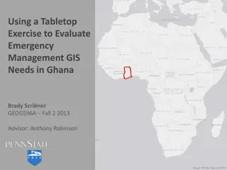
Enhancing Emergency GIS Capacity in Ghana through Tabletop Exercises
This study explores the use of tabletop exercises to evaluate and enhance the emergency management GIS needs in Ghana, focusing on the National Disaster Management Organization (NADMO). The research identifies critical needs for GIS capacity building, stakeholder involvement, personnel training, and
0 views • 21 slides
Northern Utah GIS Workforce Survey 2014 Results Overview
The Northern Utah GIS Workforce Needs Survey Results for 2014 provide insights into the demographics, industry experience, survey respondents by county in Utah, and educational requirements for GIS/geospatial technicians. The survey highlights the distribution of position titles, length of experienc
1 views • 26 slides
GIS Events and Training Updates in Atlanta Region
Learn about upcoming GIS events and training sessions in the Atlanta region, including the ARGIS user group meetings, ESRI Certified Training Program, GISP points system, and various conferences happening in the area. Stay informed about opportunities to enhance your GIS skills and network with prof
0 views • 5 slides
Enhanced Parcel Queries in Kansas by Kristen Jordan
Project aims to provide expanded tools and services for statewide parcel queries in Kansas. Background includes the Kansas Data Access and Support Center's existing project and the implementation of a REST web service. Specific goals involve accessing services through desktop and web applications, p
0 views • 20 slides
NG911 GIS User Group 2018 Q4 Meeting Highlights
The NG911 GIS User Group 2018 Q4 Meeting held during the Kansas Association of Mappers (KAM) Annual Conference discussed updates on GeoMSAG, Geospatial Call Routing, NG911 Toolbox, and PSAP transitions. The meeting also covered Kansas NG911 GIS data submission, imagery QA/QC updates, and news items
0 views • 23 slides
Enhancing GIS Outputs: Visualization, Design, and Advantages
Explore the importance of effective GIS outputs in conveying analysis results in a clear and concise manner to aid decision-makers. Learn about visualizing data, designing map outputs, and the advantages of using GIS technology for dynamic and interactive displays.
0 views • 9 slides
NG911 GIS User Group Meeting Highlights
The NG911 GIS User Group meeting held on May 24, 2018, covered various updates and projects related to geospatial call routing, GIS data preparation, and NG911 system enhancements. Discussions included project submissions, PSAP migrations, hosted solutions, mapping software updates, imagery acquisit
0 views • 20 slides
Maximizing Efficiency Through GIS in the 2013 Population and Housing Census
The 2013 Population and Housing Census in The Gambia marked the first implementation of Geographic Information Systems (GIS) technology, streamlining data collection processes and ensuring comprehensive coverage of populated areas. GIS tools facilitated easy access to enumeration areas, data process
0 views • 5 slides
NG9-1-1 GIS Data Model Workshop Overview
This workshop provides an in-depth look into the Kansas NG9-1-1 GIS Data Model, covering standards, data remediation, and the essential components of Next-Generation 9-1-1 systems. Topics include the role of GIS in NG9-1-1, the differences from traditional 9-1-1 systems, the use of GIS databases for
0 views • 36 slides
SunGuide Software Users Group Meeting Summary
SunGuide Software Users Group Meeting on November 3, 2022, discussed current system behavior, proposed enhancements using GIS mapping, considerations related to GIS implementation, implications for system changes, and support queries. The meeting highlighted the need to migrate event records, addres
0 views • 19 slides
