Oklahoma Transportation GIS Cabinet Overview
Oklahoma's Transportation Cabinet consists of three agencies responsible for managing federal aid highways, county roadway data aggregation, Turnpike infrastructure, and aeronautics. The GIS infrastructure includes 18 full-time staff primarily using Esri Enterprise GIS tools for data integration and
1 views • 10 slides
Geospatial Technology Services at University of Edinburgh
The University of Edinburgh, through its Information Services, specializes in developing and delivering projects involving geospatial technology. They offer the Digimap Service, providing online access to maps and geospatial data. The university subscribes to the Eduserv Chest Agreement for Esri pro
1 views • 29 slides
Transforming Education with Technology: Connecting American Students to Broadband and GIS Resources
In 2013, the White House initiated a program to connect 99% of American students to broadband service, supported by companies like FCC, Sprint, Verizon, Microsoft, Apple, and others. Additionally, Esri is offering $1 billion worth of ArcGIS access for K-12 schools, enhancing students' mapping and da
0 views • 4 slides
Stormwater Asset Management System (SAMS) Proof of Concept Overview
This project focuses on developing a Statewide Stormwater Asset Database and a GIS-based Stormwater Asset Management System (SAMS) for efficient inspection and reporting. It involves creating methodologies for database development, utilizing existing district data, implementing inspection protocols,
1 views • 27 slides
Visualizing Choropleth Maps in R with tmap using CSO ESRI Shapefiles and StatBank Data
Learn how to create thematic choropleth maps in R using the tmap package. This tutorial covers importing ESRI shapefiles from CSO, loading StatBank data, plotting map data, and customizing map appearance with color palettes. Follow step-by-step instructions with visuals for effective spatial data vi
0 views • 22 slides
GIS Events and Training Updates in Atlanta Region
Learn about upcoming GIS events and training sessions in the Atlanta region, including the ARGIS user group meetings, ESRI Certified Training Program, GISP points system, and various conferences happening in the area. Stay informed about opportunities to enhance your GIS skills and network with prof
0 views • 5 slides
Watershed Delineation Comparison: USGS vs ESRI Ready-to-Use Method
Explore the comparison between USGS and ESRI Ready-to-Use methods for watershed delineations. Detailed analysis showcases the advantages and drawbacks of each approach, highlighting factors like accuracy, reliability, and efficiency. Get insights into workflow processes, time requirements, and overa
1 views • 27 slides
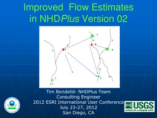
Enhanced Flow Estimates in NHDPlus Version 02 Presentation
Presentation by Tim Bondelid at the ESRI International User Conference discussing the Enhanced Runoff Method (EROM) in NHDPlus Version 02 for improved stream flow estimates. Highlights the importance of accurate flow estimates for various water-related goals and the methodology used to enhance flow
0 views • 18 slides
Teachers Union of Ireland Education Conference Highlights
The Teachers Union of Ireland Education Conference held at Marino Institute of Education covered topics such as industrial relations, education policies, and curriculum development. The event highlighted the commitment to ongoing education policy development, involvement in academic councils, and th
0 views • 8 slides

