The Surface Weather Map
Surface weather maps, symbols, and their meanings. Discover how to interpret weather features and map lines for weather predictions. Learn the efficient plotting of data on maps.
Download Presentation
Please find below an Image/Link to download the presentation.
The content on the website is provided AS IS for your information and personal use only. It may not be sold, licensed, or shared on other websites without obtaining consent from the author. Download presentation by click this link. If you encounter any issues during the download, it is possible that the publisher has removed the file from their server.

Presentation Transcript
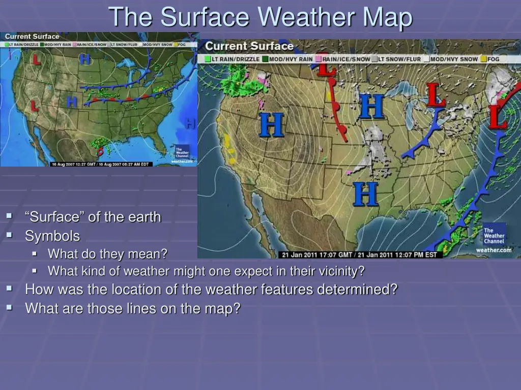
The Surface Weather Map Surface of the earth Symbols What do they mean? What kind of weather might one expect in their vicinity? How was the location of the weather features determined? What are those lines on the map?
The Surface Weather Map Again, this map is for the surface level, but there are weather maps for many other levels /elevations above the ground too Contour Plot Lines of constant values, color coded Heat Index in this case, but can be temperature, pressure, wind speed, anything!
The Surface Weather Map Surface data comes from thousands of weather monitoring stations across the country, and the rest of the world- this is a map showing only a few of those available in the Mid-Atlantic and Ohio Valley Efficient way of plotting lots of important data in a small space
The Surface Weather Map- Weather Station Model Efficient way of plotting lots of important data in a small space
Isopleths (Contours) Most common weather maps will contain some type of isopleth Common examples include Isotherm: temperature Isobar: pressure Isotach: wind speed Isodrosotherm: dew point
Isoplething Example Contouring to visualize spatial data.


")