Creating a Coastal Flood Risk Web Application in New Brunswick
Addressing flood risk reduction in New Brunswick, this project utilizes LiDAR data and sea level rise predictions to identify flood hazards, plan for community resilience, and communicate mitigation strategies. With a focus on coastal zones, the initiative aims to provide accurate flood hazard maps and support decision-making processes for sustainable development.

Download Presentation

Please find below an Image/Link to download the presentation.
The content on the website is provided AS IS for your information and personal use only. It may not be sold, licensed, or shared on other websites without obtaining consent from the author. Download presentation by click this link. If you encounter any issues during the download, it is possible that the publisher has removed the file from their server.
E N D
Presentation Transcript
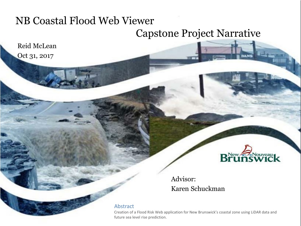
NB Coastal Flood Web Viewer Capstone Project Narrative Reid McLean Oct 31, 2017 Advisor: Karen Schuckman Abstract Creation of a Flood Risk Web application for New Brunswick s coastal zone using LiDAR data and future sea level rise prediction.
Overview Project Overview Sea Level Rise HHWLT and Coastal Zones Flood Estimates Flood Modeling LiDAR Specification LIDAR QA Workflow Flood Extent and Depth to Water Workflow Building Extraction Visualizing and Communication Timeline Challenges
Project Overview This project looks to address aspects of New Brunswick s Flood Risk Reduction Strategy. Strategies main objectives: o Accurate Flood Hazard Identification Where does coastal flooding occur? o Planning for Communities and Infrastructure to Avoid Flood Risk Who and what infrastructure is at risk? o Informed Mitigation of Existing Flood Risk How best to communicate this information?
2009 and 2014, NB has seen a sharp increase in the number of residents applying for disaster financial assistance (DFA) as a result of property damage due to coastal and inland flooding this trend is expected to continue with sea levels projected to rise during the 21st century at an accelerated due to increased ocean warming and a loss of ice cover in Greenland and Antarctica (IPCC, 2013) To allow decision makers and the greater public to plan for and decide where development can and shall occur along New Brunswick s coastal areas.
Research indicates that that actions taken to reduce flood risk yield long term benefits that far exceed their cost. In terms of coastal flooding, what is needed is a set of predictive maps for coastal sections of New Brunswick that will delineate the horizontal extent and depth of flooding based on predicted future flood elevations that include consideration of future sea level rise. These maps can then be used as an important tool for communicating flood risk to decision makers and the public. Sea Level Rise Report Lidar DEM and flood model
Sea Level Rise Daigle, R. (2017). Sea-Level Rise and Flood Estimates for New Brunswick Coastal Sections. Moncton: ACASA. Components of Sea-Level Rise: o IPPC AR5 Representative Concentration Pathway 8.5 (Business as Usual) o Glacial Meltwater Fingerprinting o Glacial Isostatic Adjustment o Regional Oceanographic Effects
HHWLT and Coastal Zones - each zone shares a quasi-homogenous HHWLT elevation and storm-surge flooding climatology
Flood Estimates For each section of NB Coast, an Extreme Total Sea-Level table was created: o HHWLT o Regional Sea-Level Rise component o Storm Surge Return Level o Levels for 2010, 2030, 2050 and 2100 o Return Periods 1, 2, 5, 10, 25, 50 and 100-Year.
LIDAR QA Workflow Gross Radiometric Check (Subjective, look at intensity) Fundamental Vertical Accuracy (Nov 1-3: survey team to collect RTK points to verify FVA) Supplemental Vertical Accuracy (Nov 1-3: survey team to collect RTK points to verify SVA) Local Accuracy (swath alignment) Point Density (All hits and Ground)
Flood Extent and Depth to Water Workflow Compile files into ArcGIS with LP360 extension to be used Hydro Flatten and hydro condition (LP360) Extract buildings (LP360) Extract 1 m raster DEM and run through custom Python script Create Rest service for Depth to Water and Flood Extents Create Web App (time slider, swipe tool)
Building Extraction Classification code 6 buildings LP360 point cloud task to extract building foot prints ArcGIS Regularize Building footprints. Join building footprint to SNB property assessment data (assessed value and use) Join building footprint to Census block data to determine average pop per household. Spatially analyze which building are affected by each flood elevation to determine population at risk and assessed property value at risk. Potentially use Medicare data through New Brunswick Institute for Research, Data and Training (NB-IRDT )
Visualizing and Communication Once the coastal flood hazards (water level and depth to water raster) are created, they can be combined with the flood risk data (buildings, infrastructure) for communicating the potential flood risk to GNB staff and the public allowing them to identify and prepare for potential flooding in the future. Traditional GIS would be a technological barrier so ArcGIS online will be used. Create REST service Create feature layer for download to users application ELG has an Enterprise ESRI License and technical training SNB GeoNB Portal is being completely rewritten using ArcGIS online web app builder.
Timeline Build Web App Nov 15 Nov 31 Building extraction/ Demographics Nov 1 - Nov 15 Python Script Nov 1 Nov 10 Hydro Conditioning / Flattening Oct 2 - Oct 31 QA Lidar Point Cloud Oct1 - Nov 20
Challenges Visualizing raster datasets in ArcGIS online (Mosaic, Tile Cache, Raster catalogue, Image server) Building attributes (Multiple buildings, SNB/Census block versus Medicare information) Visualizing levels of uncertainty ( +/- and median, 95% CI, 1% return) Processing 6 pt/m2 LIDAR data (260 GB)
Questions? Thank You http://www.coastalzonecanada.org/czc-2018-conference/ The conference will focus on the broad theme of Coastal Communities: Seeking Practical Solutions to Real Issues . Under this broad theme, we will address sub- themes of Collaboration, Engagement, and Technologies.
Bibliography Ashleigh B. Turner, J. D. (2013, 09 13). Flood Modeling Using a Synthesis of Multi-Platform LiDAR Data. Water, pp. 1533-1560. Basic, F. (2009, 11). Geographic Visualization Tools for Communicating Flood Risk To The Public. Retrieved 09 11, 2017, from Research gate: https://www.researchgate.net/publication/228880054_Geographic_visualization_tools_for_communicating_the_risk_of_floods Daigle, R. (2010). Sea-Level Rise and Flood Estimates for New Brunswick Coastal Sections. Moncton: ACASA. Daigle, R. (2014). Updated Sea-Level Rise and Flooding Estimates for New Brunswick Coastal Sections. Moncton. Retrieved from http://www2.gnb.ca/content/dam/gnb/Departments/env/pdf/Flooding-Inondations/SeaLevelRiseAndFloodingEstimates.pdf IPCC. (2013). Climate Change 2013 The Physical Science Basis - Summary for Policymakers. Switzerland: IPCC. Koerth-Baker, M. (2017, 08 30). It's Time To Ditch The Concept Of The '100-Year Floods'. Retrieved 09 01, 2017, from fivethirtyeight.com: https://fivethirtyeight.com/features/its-time-to-ditch-the-concept-of-100-year-floods/ Meyer, R. (2017, 09 10). How Hurricane Irma Is Sucking Florida s Beaches Dry. Retrieved 09 12, 2017, from The Atlantic: https://www.theatlantic.com/science/archive/2017/09/irma-sucks/539325/ National Academy of Science. (2009). Mapping the Zone: Improving Flood Map Accuracy. Washington, D.D.: The National Academies Press. Natural Resources Canada, Public Safety Canada. (2016). Canadian Hydrologic and Hydraulic Procedures for Floodplain Delineation (DRAFT). Ottawa: Government of Canada. Natural Resources Canada: Earth Science Sector. (2017). Federal Airborne LiDAR Data Acquisition Guideline (DRAFT). Ottawa: Government of Canada. NB Institute for Research, Data and Training. (nod). Retrieved 09 13, 2017, from New Brunswick Research, Data and Training: http://www.unb.ca/fredericton/arts/nbirdt/index.html Province of New Brunswick. (2014). New Brunswick's Flood Risk Reduction Strategy. Fredericton: Province of New Brunswick. T.L. Webster, D. F. (2005). USING AIRBORNE LIDAR TO MAP EXPOSURE OF COASTAL AREAS IN MARITIME CANADA TO FLOODING FROM STORM-SURGE EVENTS: A REVIEW OF RECENT EXPERIENCE. Canadian Coastal Conference 2005. Dartmouth. Retrieved from http://agrg.cogs.nscc.ca/gallery2/main.php?g2_view=core.DownloadItem&g2_itemId=821 T.S. James, J. H. (2014). Relative Sea-Level projections in Canada and the Adjacent mainland United States. Ottawa: Geological Survey of Canada Open File 7737. Retrieved from http://publications.gc.ca/site/archivee- archived.html?url=http://publications.gc.ca/collections/collection_2016/rncan-nrcan/M183-2-7737-eng.pdf