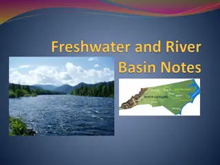
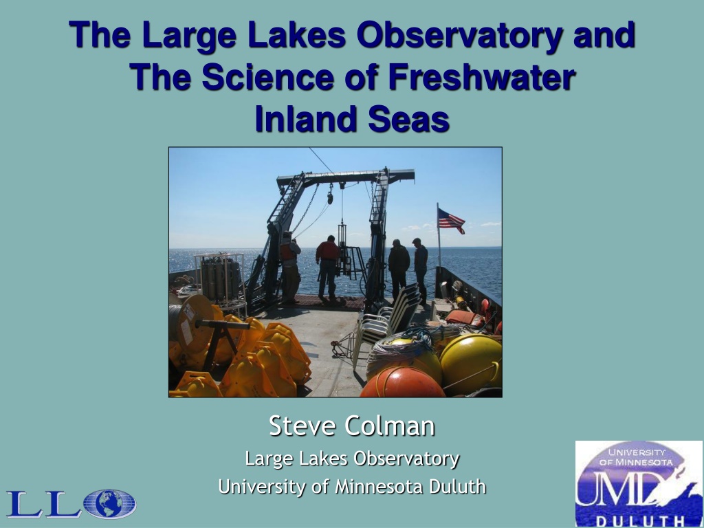
The Large Lakes Observatory and The Science of Freshwater Inland Seas

T
T
h
h
e
e
L
L
a
a
r
r
g
g
e
e
L
L
a
a
k
k
e
e
s
s
O
O
b
b
s
s
e
e
r
r
v
v
a
a
t
t
o
o
r
r
y
y
a
a
n
n
d
d
T
T
h
h
e
e
S
S
c
c
i
i
e
e
n
n
c
c
e
e
o
o
f
f
F
F
r
r
e
e
s
s
h
h
w
w
a
a
t
t
e
e
r
r
I
I
n
n
l
l
a
a
n
n
d
d
S
S
e
e
a
a
s
s
Steve Colman
Large Lakes Observatory
University of Minnesota Duluth


LLO and its Multiple Missions
Founded in 1994, largest academic program in
limnology in the country
Unit of the Swenson College of Science and
Engineering, UMD
Faculty have split appointments with LLO and other
academic departments
Missions:
Research dedicated to the science of inland seas
Graduate program in limnology and oceanography,
Undergraduate education, in partnership with UMD departments


LLO is Unique
Focus on oceanographic research
methods applied to inland seas
Global perspective: Large lakes of
the world


The Blue Heron


Largest university-owned
Largest university-owned
research vessel on the
research vessel on the
Laurentian Great Lakes
Laurentian Great Lakes
Berths for 11
Berths for 11
Part of the University
Part of the University
National Oceanographic
National Oceanographic
Laboratory System
Laboratory System
Multiple types of SONAR,
Multiple types of SONAR,
Seabird CTD & niskin bottle
Seabird CTD & niskin bottle
carousel, flow-through water
carousel, flow-through water
system, corers, plankton
system, corers, plankton
nets, trawling capability
nets, trawling capability
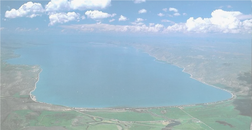
LLO’s Research Sites
Interdisciplinary Research at LLO
M
a
t
h
e
m
a
t
i
c
s
-
-
T
h
e
f
o
u
n
d
a
t
i
o
n
o
f
a
l
l
Satellite photo, why basic
Why
basic
research?
We need to understand
We need to understand
how large lakes work
how large lakes work
To be effective
To be effective
guardians
guardians
To anticipate and
To anticipate and
respond to
respond to
surprises
surprises
To use them
To use them
effectively
effectively
Transportation
Transportation
Fisheries, commercial
Fisheries, commercial
and sport
and sport
Recreation
Recreation
Water supply
Water supply
Great Lakes agencies and GLOS
GLOS: part of IOOS
Focused on monitoring
LLO maintains moorings
and deploys an
autonomous glider as
part of this effort
Also does modeling work
Coastal Observatories
Sediment traps similar to
Sediment traps similar to
this one deployed in Lake
this one deployed in Lake
Superior are being
Superior are being
moored in Lake Malawi
moored in Lake Malawi
for several years
for several years
Sedimenting particles
Sedimenting particles
from phytoplankton
from phytoplankton
productivity are collected
productivity are collected
sequentially
sequentially
Some techniques for
Some techniques for
assessing lake
assessing lake
productivity
productivity
In-situ fluorometry used to
In-situ fluorometry used to
estimate phytoplankton
estimate phytoplankton
composition & productivity
composition & productivity
Some of the instruments we use
Some of the instruments we use
include FluoroProbe, Fast
include FluoroProbe, Fast
Repetition Rate Fluorometer, Flow
Repetition Rate Fluorometer, Flow
Cytometer and Inverted
Cytometer and Inverted
Microscopy
Microscopy
Sediment geochemistry in
Sediment geochemistry in
Lake Superior
Lake Superior
Physics and geochemistry of stratified tropical lakes
Physics and geochemistry of stratified tropical lakes
L. Kivu (Rwanda)
L. Kivu (Rwanda)
L. Matano (Indonesia)
L. Matano (Indonesia)
L. Malawi (Malawi)
L. Malawi (Malawi)
Some recent discoveries
Understanding the heat, carbon, and nutrient
budgets of Lake Superior
Circulation and ice modeling
Radiocarbon budgets
Fluxes at the sediment surface
Using Crenarchaeota lipids to investigate past
lake temperatures
Mapping of lake floor features
Lake Superior temperature trends
Lake Superior temperature trends
What about Ice?
Mean ice cover decreasing steadily over period
of record:
~0.42%/yr
Slide courtesy of Johan Weijers
marine Crenarchaeota (<1
marine Crenarchaeota (<1
μ
μ
m)
m)
bacteria
Crenarchaeota
Crenarchaeota
TEX
86
Global Lake Calibration
Mean Square Error =
+
2
o
C
Powers et al. 2004
McNichol and Aluwihare, 2007
Atmospheric
Δ
14
C (2009) = 38
‰
Lake Superior surface DIC
Δ
14
C (2009) = 56.2 to 60.9‰
Radiocarbon and Lake Superior’s carbon cycle
Radiocarbon and Lake Superior’s carbon cycle
2009 corn
Δ
14
C = 38±2
2009 corn
Δ
14
C = 38±2
Sea Floor Mapping Tools
Surficial and Sub-bottom Systems
Sidescan-sonar
Seismic Reflection
Swath Bathymetry
Blue Heron Trough
Sidescan sonar images, off Superior Entry
Current LLO projects include
Studying the role of zooplankton migration and
its effects on Lake Superior’s chlorophyll
maximum
Looking at the effects of climate change on
Lake Malawi’s productivity
Investigating the climate change history of the
Tibetan Plateau
Identifying methane resources and hazards in
Lake Kivu
LLO facilities
Itrax XRF scanner
Flow cytometer
(BD FACSCaliber)
LC-MS(Agilent triplequad)
IR-MS (ThermoFinnegan
Delta Plus XP)
Lake Effect
Thank you!
Title slide
The Large Lakes Observatory (LLO) at the University of Minnesota Duluth is a leading academic program focused on limnology, oceanography, and research dedicated to inland seas. LLO's unique focus on oceanographic research methods applied to large lakes worldwide is supported by the Blue Heron research vessel and interdisciplinary research in mathematics. The need for basic research in understanding large lakes is crucial for effective management and utilization in transportation, fisheries, recreation, and water supply. LLO also collaborates with Great Lakes agencies and Coastal Observatories for monitoring and modeling efforts.

Download Presentation

Please find below an Image/Link to download the presentation.
The content on the website is provided AS IS for your information and personal use only. It may not be sold, licensed, or shared on other websites without obtaining consent from the author. Download presentation by click this link. If you encounter any issues during the download, it is possible that the publisher has removed the file from their server.
E N D
Presentation Transcript
The Large Lakes Observatory and The Science of Freshwater Inland Seas Steve Colman Large Lakes Observatory University of Minnesota Duluth
LLO and its Multiple Missions Founded in 1994, largest academic program in limnology in the country Unit of the Swenson College of Science and Engineering, UMD Faculty have split appointments with LLO and other academic departments Missions: Research dedicated to the science of inland seas Graduate program in limnology and oceanography, Undergraduate education, in partnership with UMD departments
LLO is Unique Focus on oceanographic research methods applied to inland seas Global perspective: Large lakes of the world
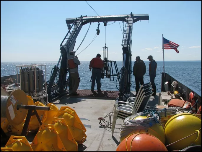
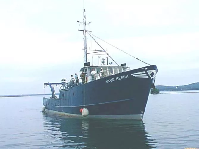
The Blue Heron Largest university-owned research vessel on the Laurentian Great Lakes Berths for 11 Part of the University National Oceanographic Laboratory System Multiple types of SONAR, Seabird CTD & niskin bottle carousel, flow-through water system, corers, plankton nets, trawling capability
Interdisciplinary Research at LLO Mathematics-- The foundation of all
Why basic research? We need to understand how large lakes work To be effective guardians To anticipate and respond to surprises To use them effectively Transportation Fisheries, commercial and sport Recreation Water supply Satellite photo, why basic
Great Lakes agencies and GLOS GLOS: part of IOOS Focused on monitoring LLO maintains moorings and deploys an autonomous glider as part of this effort Also does modeling work
Some techniques for assessing lake productivity Sediment traps similar to this one deployed in Lake Superior are being moored in Lake Malawi for several years Sedimenting particles from phytoplankton productivity are collected sequentially
In-situ fluorometry used to estimate phytoplankton composition & productivity Some of the instruments we use include FluoroProbe, Fast Repetition Rate Fluorometer, Flow Cytometer and Inverted Microscopy
Sediment geochemistry in Lake Superior
Physics and geochemistry of stratified tropical lakes L. Kivu (Rwanda) L. Matano (Indonesia) L. Malawi (Malawi)
Some recent discoveries Understanding the heat, carbon, and nutrient budgets of Lake Superior Circulation and ice modeling Radiocarbon budgets Fluxes at the sediment surface Using Crenarchaeota lipids to investigate past lake temperatures Mapping of lake floor features
What about Ice? Mean ice cover decreasing steadily over period of record: ~0.42%/yr
Crenarchaeota marine Crenarchaeota (<1 m) bacteria Hydrophilic head groups Hydrophilic head groups Hydrophobic interior Slide courtesy of Johan Weijers
TEX86 Global Lake Calibration Mean Square Error = + 2 oC Powers et al. 2004
Radiocarbon and Lake Superiors carbon cycle McNichol and Aluwihare, 2007 Atmospheric 14C (2009) = 38 Lake Superior surface DIC 14C (2009) = 56.2 to 60.9
D D14C (June 2009) 100 50 0 WM CM EM SM NM ONT BR NB -50 per mille -100 -150 DIC (surf) DIC (mid) zoop POC (surf) POC (mid) -200 -250 -300 -350 2009 corn 14C = 38 2
D D14C (August 2009) DIC (surf) DIC (mid) zoop POC (surf) POC (mid) 80 65 50 35 per mille 20 5 WM CM EM SM NM ONT BR NB -10 -25 -40 2009 corn 14C = 38 2
Sea Floor Mapping Tools Surficial and Sub-bottom Systems Sidescan-sonar Seismic Reflection Swath Bathymetry
Sidescan sonar images, off Superior Entry N Sand wave field Glacial deposit outcrop 100m N 100m Anchor drag marks
Current LLO projects include Studying the role of zooplankton migration and its effects on Lake Superior s chlorophyll maximum Looking at the effects of climate change on Lake Malawi s productivity Investigating the climate change history of the Tibetan Plateau Identifying methane resources and hazards in Lake Kivu
LLO facilities Flow cytometer (BD FACSCaliber) Itrax XRF scanner IR-MS (ThermoFinnegan Delta Plus XP) LC-MS(Agilent triplequad)
Lake Effect Thank you!


")
")