Overview of VIIRS Cloud Properties Products and Requirements
The VIIRS Cloud Properties Products discussion covers beta maturity, product teams, user groups, EDR maturity definitions, and cloud property requirements including base height measurement, cloud cover uncertainties, effective particle size precision, optical thickness, and top height specifications. The summary also delves into the VIIRS Cloud EDR and its generation from various algorithms, emphasizing the importance of accuracy in cloud property data for scientific applications.

Download Presentation

Please find below an Image/Link to download the presentation.
The content on the website is provided AS IS for your information and personal use only. It may not be sold, licensed, or shared on other websites without obtaining consent from the author. Download presentation by click this link. If you encounter any issues during the download, it is possible that the publisher has removed the file from their server.
E N D
Presentation Transcript
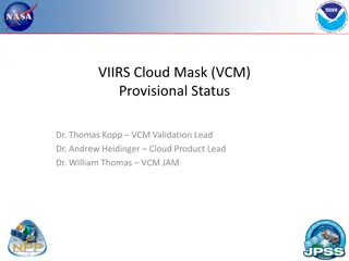
Request for VIIRS Cloud Properties Beta Maturity DR # 7154 CCR # 1075 DRAT discussion: 4/17/2013 AERB presentation: June 12, 2013 Cloud Properties Products Team Andrew Heidinger, NOAA/NESDIS/STAR, Team Lead Eric Wong, NGAS Cloud Algorithm Lead Robert Holz, SSEC/PEATE Validation co-Lead Janna Feeley, Cloud Products JAM
VIIRS Cloud Properties Product Cal/Val Core Team NESDIS/STAR - A. Heidinger (Cloud Product Lead) UW/CIMSS R. Holz, A. Walther, M. Oo, D. Botambekov Northrop Grumman E. Wong NASA/DPE J. Feeley (JAM) Raytheon K. Brueske ARM (Uni. Of Utah) J. Mace, Q. Zhang University Colorado St./CIRA S. Miller, Dan Lindsey, Curtis Seeman, Y. Noh
Cloud Product Users U.S. Users AFWA Air Force Weather Agency (John Eilander) NOAA NWP (Stan Benjamin, Brad Ferrier) FNMOC NWS through JPSS PG User Community Navigation, Transportation Operational Weather Prediction Climate Research through NOAA CLASS. DOD 3
Beta EDR Maturity Definition Early release product. Minimally validated. May still contain significant errors. Versioning not established until a baseline is determined. Available to allow users to gain familiarity with data formats and parameters. Product is not appropriate as the basis for quantitative scientific publication studies and applications. 4 Goto: outline, p.2
Summary of Cloud Properties Product Requirements Based on JPSS L1RD Thresholds Cloud Base Height Measurement Uncertainty = 2 km Cloud Cover/Layers Total Cloud Cover Uncertainty (not applicable to layers) 0.1 + 0.3*sin(sensor zenith Angle) of HCS Area Cloud Effective Particle Size Precision & Accuracy: 22% for Water; 28% for Ice ( or 1 m whichever larger) Cloud Optical Thickness ( ) Precision = 33%; Accuracy = 24% ( or =1 whichever larger for both Prec. & Acc.) Cloud Top Height Precision = 1 km; Accuracy = 1 km ( both increased to 2 km for thin clouds, i.e. ) Cloud Top Pressure Precision & Accuracy: 100 mb (0-3km); 75 mb (3-7 km); 50 mb (> 7km) Cloud Top Temperature Precision & Accuracy = 3 K ( both increased to 6 K for thin clouds, i.e. ) 5 NGAS - E. Wong
Summary of the VIIRS Cloud EDR VIIRS Cloud Products generated from 6 algorithms. Daytime Cloud Optical Properties Daytime and Night Cloud Top Properties Perform Parallax Correction Cloud Cover Layers Cloud Base Height Products are optical depth effective particle size, top-temperature, top-pressure top-height cover by layer (up to 5 values) base height Channels used (7 M-bands, M5,M8,M10,M12,M14,M15,M16) Important sensitivities Surface albedo and emissivity Clear-sky radiative transfer Cloud mask and phase errors are hard to recover from 6 Goto: outline, p.2
VIIRS Daytime Cloud IP Flow COP LUT NWP Moisture Profiles VIIRS SDR Upstream Input Day Cloud Optical and Properties Algorithm Optical Depth IP, VIIRS Cloud Mask Algorithm Particle Size IP Ancillary Data Output VIIRS Cloud Phase Cloud Top Temperature IP Day Cloud Top Properties Algorithm (includes day water module) Cloud Top Height and Pressure IP Temperature to Height/Pressure Conversion Logic Parallax Correction Algorithm NWP Profiles Cloud Cover Layers Algorithm Cloud Cover Layers IP OSS Clear-sky & Cloud RTM (day water only) Cloud Base IP Cloud Base Algorithm
VIIRS Nighttime Cloud IP Flow IR Parameterizations IR Clear-sky PFAAST RTM VIIRS SDR Upstream Input Night Cloud Optical & Top Temperature Algorithm Cloud Optical Depth, Particle Size, Cloud Top Temperature IP VIIRS Cloud Mask Algorithm Ancillary Data Output VIIRS Cloud Phase Cloud Top Temperature, Top Height and Top Pressure IP Night Cloud Top Properties Algorithm GFS Profiles Temperature to Height Conversion Logic Parallax Correction Algorithm Cloud Cover Layers Algorithm Cloud Cover Layers IP Cloud Base Algorithm Cloud Base IP
Methods to Compare IDPS to NOAA and NASA Products (Impact of Phase Filter) We conducted three types of analysis 1. Colocated IDPS/VIIRS and NASA/MODIS over many days (left) 2. IDPS/VIIRS and NOAA/VIIRS for one day where we excluded pixels with different phases (right image). Note we also include NOAA vs. NASA on MODIS for reference. 3. CALIPSO/CALIOP comparison to IDPS CTP. (shown later) We feel #2 is a better judge of the algorithm in isolation and is the basis for our beta decision. #1 represents the impact of all components and will be looked at more in future validation decisions. Filtered by Phase Agreement No Filter by Phase Agreement 7 180 6 160 5 140 120 VIIRS COT 4 100 3 80 60 2 40 1 20 0 10 20 30 40 MODIS COT 50 60 70 80 90
Comparison to NOAA VIIRS Products Data analyzed was from April 28, 2013 two days after COP LUT update. NOAA products generated from IDPS VCM data (mask and phase errors are excluded). NOAA VIIRS data based on modifications of GOES-R AWG code. QF flags ignored. No penalty for failed retrievals. Granules mapped to globe at 0.1o resolution. Most nadir view taken in regions of orbital overlap. Snow and ice covered areas ignored. Same analysis applied to MODIS and NOAA algorithms applied to TERRA/MODIS data. Useful reference in gauging NOAA vs IDPS results. MODIS is C5 ATML2 (C6 is coming) L1RD accuracy specification made relative to NOAA, not an independent validation source. 10
Optical Depth Comparison Plots show a scatterplot. Color represent density. Red is high, dark blue is low density. Good correlation of IDPS with NOAA. 68% of IDPS within L1RD spec relative to NOAA. Tighter but less symmetric scatter seen between IDPS and NOAA, than NOAA and NASA 11
Cloud Effective Particle Size Comparison Good correlation of IDPS with NOAA. 64% of IDPS within L1RD spec relative to NOAA. Cluster of points with very small CEPS from IDPS is still a problem and is being investigated. These are failed IDPS retrievals over land (QF would catch this) Higher correlation of NOAA with NASA than IDPS and NOAA. C5 CEPS < C6 CEPS 12
Comparison of Night Ice COT with MODIS Night COT Implied from Cloud Emissivity Product VIIRS Night Ice cloud COT performance estimate: Average Accuracy ~ 20% Average Precision ~ 40% Night water cloud COT performs poorly due the 2 errors found in code: (1) sensor zenith angle not accounted for; (2) a factor used during algorithm testing not removed 13
Cloud Top Pressure Comparison Good correlation of IDPS with NOAA. 64% of IDPS within L1RD spec relative to NOAA. IDPS shows a cluster of Tropopause solutions that is being investigated. Both IDPS and NASA show lower pressures for marine clouds than NOAA. NOAA implemented marine stratus fix, NASA and IDPS will do this. NASA is likely much better than NOAA which uses VIIRS channels from MODIS (no CO2) 14
Global Cloud Top Height Evaluation of VIIRS with CALIOP CTH product The global distribution of CTH differences between CALIOP and VIIRS IP retrievals is presented. The results from VIIRS retrievals indicate a significant negative CTH bias for ice clouds. The mean and standard deviation of biases relative to CALIOP separated by retrieval type. Negative values occur when VIIRS underestimates CALIOP. COT < 1.0 12 % COT >1.0 63 % 3 months of VIIRS/CALIOP matchups Accuracy (mean km) % in spec Precision (STD) (km) % in spec 43 % 49 %
Global Cloud Top Temperature Evaluation of VIIRS with CALIOP CTT product NPP CTT shows a negative bias indicating CTH being overpredicted DR 4740 (Marine Layer cloud Update) to be Operationalized for MX 7.0 will reduce or eliminate this CTT cold bias 16
Comparison of NPP Global Cloud Cover with MODIS Product MODIS Cloud Cover NPP Cloud Cover NPP Cloud Cover is qualitatively similar to MODIS 17
Comparison of VIIRS and CloudSat Cloud Base Height Sample comparison of VIIRS cloud top and base heights with CloudSat cloud mask from 11:59:16 UTC to 12:00:40 UTC on 17 February 2012 CloudSat reflectivity with VIIRS CBH IP (blue asterisks) overlaid. The colored histograms represent errors for clouds in various optical thickness bins (see color scale). The thick black curve represents the histogram for all clouds. VIIRS CBH overall Performance Estimate: Uncertainty = 2.8 km
Remaining Algorithms No issues with Cloud Cover Layers. Performance is linked to CTP and VCM and appears to achieved beta maturity. Parallax Correction appears to be working. IP to EDR conversion is working with a few open issues. Open DR on exclusion of high quality cloud products over land in the specular glint zone Some quality flag changes we would like to make for clarity to the users. 19
Future Plans and Issues We have gotten these changes into IDPS A day COP LUT derived from the NOAA GOES-R AWG COP LUT (implemented April 26, 2013). A code fix to implement NOAA marine stratus temperature to height/pressure conversion. (not implemented yet). We plan to implement these fixes Nighttime COP bugs identified by NGAS. MODIS (latitude dependent) marine stratus T to Z,P conversion Nighttime COP ice cloud scattering (k-ratio) parameterization based on latest theory. CBH modification of LWC/IWC values used for the various cloud types Modification of quality flags. Future Work Several issues remain without identified causes. Nighttime COP and cloud base continued work 20
Conclusions VIIRS Cloud EDRs have made significant improvement over the past year. Adoption of new COP NOAA-based LUTS has mitigated many artifacts. VIIRS Cloud EDRs have met the beta stage based on the definitions and the evidence shown We are confident all products except Nighttime COP and cloud base meet or exceed beta. Nighttime COP bugs have been identified and we expect full beta compliance once implemented. Nighttime COP is not a common product (not available from MODIS) and we think the community has less expectations for nighttime COP than daytime COP. Cloud base performance is also expected to improve. The specifications are low therefore we urge beta approval for this product. For these reasons, we support beta for all cloud products. 21
Direct Comparison to NASA MODIS Products The UW NPP Atmospheric PEATE has developed tools to co- locate VIIRS and MODIS. These comparisons as shown do not stratify by phase and therefore show a true comparison. These comparisons include errors in phase assignment. As a consequence, the agreement is much less than that seen in the previous NOAA vs IDPS analysis but same features are evident. Full presentation includes stratification by Cloud Top Temp.
VIIRS-MODIS COT comparison 7 180 Number of sample= 234 million Both Ice and water cloud Color bar shows number density in log scale ( example: 3 =1,000) 6 160 5 140 120 VIIRS COT 4 100 3 80 60 2 40 1 20 0 10 20 30 40 MODIS COT 50 60 70 80 90
Direct Comparison to NASA MODIS Products VIIRS-MODIS EPS comparison 7 Number of sample= 213 million Both Ice and water cloud Color bar shows number density in log scale ( example: 3 =1,000) 180 6 160 VIIRS Effective Particle Size 5 140 120 4 100 3 80 60 2 40 1 20 0 10 20 30 40 50 60 70 80 90 MODIS Effective Radius