Slope, Gradient, and Intervisibility in Geography
GRADIENT & INTERVISIBILITY
Mr. Ramchandra Bhivaji Bhaskar
Assist. Professor & Head
Department of Geography
The New College, Kolhapur
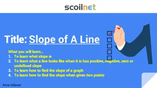
SLOPE
DEFINITION
:
A surface of which one end or side is at a higher level
than another, a rising or falling surface.
Slope is calculated by finding the ratio of the vertical
change to the horizontal change between two distinct
point on a line.
Slope is define left to right.
SLOPE TYPES
SLOPE
A Positive
A Negative
Zero
Undefined
A POSITIVE SLOPE
•
If you run from left to right slope will rise up, it is a positive slope
A NEGATIVE SLOPE
•
If you run from left to right slope will reduce, it is negative slope
ZERO SLOPE
•
If you run from left to right and you don't rise or fall, it is zero slope.
UNDEFINED SLOPE
•
when you are not moving or run horizontally at all. In other words, the
run is zero
GRADIENT
Gradient is the amount of steepness of slope, gradient is the amount of vertical rise of land
in relation to horizontal distance. The gradient may be expressed as an angular measurement
between the horizontal plane & the line of slope.
study of gradient is essential for road, railway, canals and engineering purpose.
Gradient is expressed- Fraction, Percent, Mill or Degree
Fraction : C
Ground distance
Vertical Interval
A B
Horizontal Equivalent
Vertical Interval
Gradient =
Horizontal Equivalent
Gradient
By percent :
Vertical Interval
Percent (%) =
Horizontal Equivalent
Degree :
Vertical Interval
Degree = 57.3
Horizontal Equivalent
Vertical Interval
Mill = 1000
Horizontal Equivalent
INTERVISIBILITY
The visibility of one point on the ground from another point and vice versa is
intervisibility.
FACTORS
:
•
Two points located ground level
•
If the slope is concave
•
No intervisibility convex slope and undulating slope
•
of opposite banks of a valley
•
No intervisibility opposite spur
•
Dead ground
IMPORTANCE
:
•
A knowledge of terrain for military purpose
•
Surveyors
•
Tourists
•
Drivers
•
Geologists
•
Explorers
METHOD
:
•
By line of sight
•
By inspecting contour
•
By identifying slopes
THANKING YOU
Explore the concepts of slope, gradient, and intervisibility in geography through detailed descriptions and visual representations. Learn about positive, negative, zero, and undefined slopes, the calculation of gradient, and the significance of understanding these aspects in various engineering and geographical applications.

Download Presentation

Please find below an Image/Link to download the presentation.
The content on the website is provided AS IS for your information and personal use only. It may not be sold, licensed, or shared on other websites without obtaining consent from the author.If you encounter any issues during the download, it is possible that the publisher has removed the file from their server.
You are allowed to download the files provided on this website for personal or commercial use, subject to the condition that they are used lawfully. All files are the property of their respective owners.
The content on the website is provided AS IS for your information and personal use only. It may not be sold, licensed, or shared on other websites without obtaining consent from the author.
E N D
Presentation Transcript
GRADIENT & INTERVISIBILITY Mr. Ramchandra Bhivaji Bhaskar Assist. Professor & Head Department of Geography The New College, Kolhapur
SLOPE DEFINITION: A surface of which one end or side is at a higher level than another, a rising or falling surface. Slope is calculated by finding the ratio of the vertical change to the horizontal change between two distinct point on a line. Slope is define left to right.
SLOPE TYPES SLOPE A Positive A Negative Zero Undefined
A POSITIVE SLOPE If you run from left to right slope will rise up, it is a positive slope
A NEGATIVE SLOPE If you run from left to right slope will reduce, it is negative slope
ZERO SLOPE If you run from left to right and you don't rise or fall, it is zero slope.
UNDEFINED SLOPE when you are not moving or run horizontally at all. In other words, the run is zero
DEGREES 0.6 1 1.15 1.19 2.86 4.76 7.13 10 14.04 15 26.57 30 45 56.31 60 63.43 78.69 89.43 GRADIENT 1 : 95.49 1 : 57.29 1 : 50 1 : 48 1 : 20 1 : 12 1 : 8 1 : 5.67 1 : 4 1 : 3.73 1 : 2 1 : 1.73 1 : 1 1: 0.67 1 : 0.6 1 : 0.5 1: 0.2 : 0.1 PERCENT 1.0% 1.7% 2% 2.08% 5% 8.3% 12.5% 17.6% 25% 26.8% 50% 57.7% 100% 150% 173.2% 200% 500% 1000%
GRADIENT Gradient is the amount of steepness of slope, gradient is the amount of vertical rise of land in relation to horizontal distance. The gradient may be expressed as an angular measurement between the horizontal plane & the line of slope. study of gradient is essential for road, railway, canals and engineering purpose. Gradient is expressed- Fraction, Percent, Mill or Degree Fraction : C Ground distance Vertical Interval Gradient A B Horizontal Equivalent Vertical Interval Gradient = Horizontal Equivalent
By percent : Vertical Interval Percent (%) = Horizontal Equivalent Degree : Vertical Interval Degree = 57.3 Horizontal Equivalent Vertical Interval Mill = 1000 Horizontal Equivalent
INTERVISIBILITY The visibility of one point on the ground from another point and vice versa is intervisibility. FACTORS : Two points located ground level If the slope is concave No intervisibility convex slope and undulating slope of opposite banks of a valley No intervisibility opposite spur Dead ground IMPORTANCE : A knowledge of terrain for military purpose Surveyors Tourists Drivers Geologists Explorers METHOD : By line of sight By inspecting contour By identifying slopes