Product Feedback Forum at NWS: Provisional PS-PVR User Feedback on ABI, CMI, and L1b
A comprehensive feedback system managed by PRO at NWS, focusing on user input for GOES-R products such as ABI, CMI, and L1b. The forum gathers feedback through surveys and weekly calls, addressing product quality issues and ensuring effective communication with field sites. Noteworthy discussions involve black pixel issues, striping, and stray light problems identified by forecasters. The feedback loop plays a crucial role in enhancing product usability and addressing pressing matters for user satisfaction.
Download Presentation

Please find below an Image/Link to download the presentation.
The content on the website is provided AS IS for your information and personal use only. It may not be sold, licensed, or shared on other websites without obtaining consent from the author.If you encounter any issues during the download, it is possible that the publisher has removed the file from their server.
You are allowed to download the files provided on this website for personal or commercial use, subject to the condition that they are used lawfully. All files are the property of their respective owners.
The content on the website is provided AS IS for your information and personal use only. It may not be sold, licensed, or shared on other websites without obtaining consent from the author.
E N D
Presentation Transcript
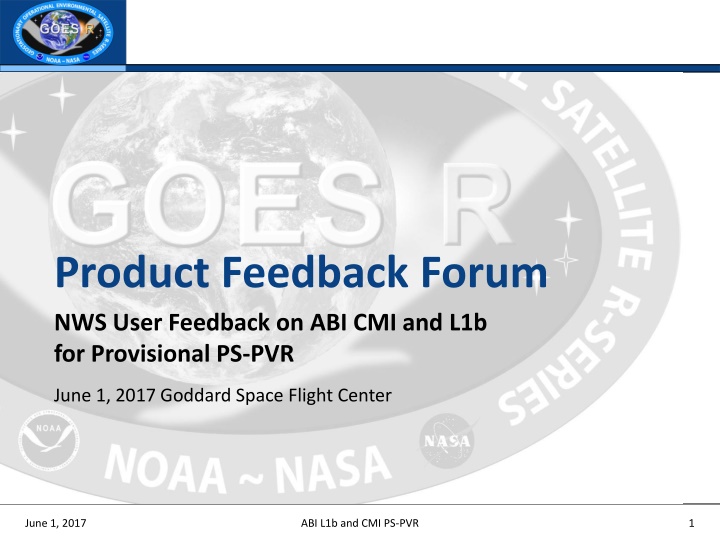
Product Feedback Forum NWS User Feedback on ABI CMI and L1b for Provisional PS-PVR June 1, 2017 Goddard Space Flight Center June 1, 2017 ABI L1b and CMI PS-PVR 1
Product Feedback Forum (PFF) Managed by PRO as part of Provisional and Full Validation declarations during PS-PVRs. Objective: Ensure GOES-R products meet user needs by providing a mechanism to obtain user input on pressing matters and issues, especially those involving interfaces and data quality. PRO worked with the NWS Operations Proving Ground (Chad Gravelle and Kim Runk) to design a voluntary survey for the NWS forecasters. This survey is in addition to the NWS OT&E process and objectives. PRO hosts weekly calls with the NWS OPG, NWS TOWR-S, NWS Operational Test & Evaluation team leads, and National Center Satellite Liaisons to discuss feedback from this survey and from the other groups on the call. From weekly calls, we are able to troubleshoot if feedback concerns are related to NESDIS ground segment or NWS distribution channels or displays (i.e. AWIPS), and discuss resolution mechanisms. Feedback has been very beneficial to ensure two-way communication with NWS field sites for NESDIS understanding of product usage, and to communicate plans for addressing issues so concerns do not go unheard June 1, 2017 ABI L1b and CMI Provisional PS-PVR 2
Product Feedback Forum (PFF) Accepts product feedback for ABI L2+ (including CMI) and GLM L2+ June 1, 2017 ABI L1b and CMI Provisional PS-PVR 3
Product Feedback Forum (PFF) Accepts product feedback for ABI L2+ (including CMI) and GLM L2+ June 1, 2017 ABI L1b and CMI Provisional PS-PVR 4
As of May 31, 2017, 53 surveys have been submitted (survey submissions began March 7, 2017): Feedback Entity # of surveys submitted WFO 48 RFC 2 CWSU 3 View Area # of surveys that utilized view area Full Disk 6 CONUS 47 MESO 14 June 1, 2017 ABI L1b and CMI Provisional PS-PVR 5
Product Feedback Forum (PFF) Most common product quality issues brought forth by forecasters: Everyone noticed the black pixel issue in the VIS and Near IR channels in SCMI via SBN when values exceeded the 0-1 dynamic range. A message was sent to NWS regional focal points to disseminate, highlighting the known issues of ABI from the Beta PS-PVR and this issue in particular with planned solution explanations and WR promotion build schedule. Striping is noticed which has been determined to be a function of frequent mode changes due to post-launch product testing. This was communicated to NWS. Stray light issue brought forth on next slide. This is a known event to occur before and after an equinox. This will be predicted in the future and communicated. June 1, 2017 ABI L1b and CMI Provisional PS-PVR 6
Product Feedback Forum (PFF) There is a "stripe" or "band" of stray light(?) that appears in the CONUS-scale imagery in bands 1- 7, beginning around 0537 in the west, and continues moving east until about 0617 UTC in the east. It negatively affected the performance of spectral difference products and an experimental RGB composite that had been put together. This affected the forecaster's awareness of the cloud and fog situation, and could potentially affect forecasters' assessments of hot spots at night. This may have been a factor with legacy GOES imagery but it was not so readily apparent with 15-minute imagery. WFO Huntsville. 20 April 2017 CONUS June 1, 2017 ABI L1b and CMI Provisional PS-PVR 7
Product Feedback Forum (PFF) AWC feedback provided by Amanda Terborg. OPC and WPC supplied feedback in a similar way, to their satellite liaison Michael Folmer. Forecasters were instructed to either enter GOES-16 related issues into the AWC Shiftlog or pass them along verbally. This feedback was then entered into a master spreadsheet by three POCs: Bruce Entwistle (SOO), Amanda Terborg, and Adam Stout (evening/night shift forecaster). Example below June 1, 2017 ABI L1b and CMI Provisional PS-PVR 8
Product Feedback Forum (PFF) Dark grey highlights indicate the issue has been addressed. Image quality issues noted by multiple AWC forecasters: Navigation wobble Both N-AWIPS and AWIPS-2, all domains. Noticeable wobble in navigation, particularly when zoomed in. There is also a more significant jerk after the completion of each PLT. WV jitter Both N-AWIPS and AWIPS-2, CONUS domain. The three WV channels seem to jitter if looped or fluctuate slightly. It is thought that this is due to a calibration issue in the imager. Speckles in visible Both N-AWIPS and AWIPS-2, all domains. Visible imagery overflows causing speckles or zero values for high brightness temperatures. Fixes are in the works for this issue. imagery Streaks in imagery Both N-AWIPS and AWIPS-2, all domains. On a normal day (i.e. not during PLTs), they are most noticeable in visible imagery as well as sometimes the ozone channel. Horizontal streaks through the imagery. Blocky artifacts in the Clear Sky mask N-AWIPS (from PDA), CONUS and FD. There were several artifacts in the CSM from PDA, including blocky features and various lines. This has improved, but some artifacts are still noticeable at times. GLM data artifacts increase in daytime More speckles or artifact data as the day progresses; i.e. an increase in this artifact data as the sun rises. June 1, 2017 ABI L1b and CMI Provisional PS-PVR 9
Product Feedback Forum (PFF) Excerpts of how imagery was useful in forecaster decision making: Massive wildfires over southwest and south central KS. We were able to not only track but detect wildfire initiation. Dodge City, KS WFO 7 March 2017 CONUS and MESO June 1, 2017 ABI L1b and CMI Provisional PS-PVR 10
Product Feedback Forum (PFF) Excerpts of how imagery was useful in forecaster decision making: Timing of frontal system arrival and thunderstorm development along the boundary. The quality of the IR and VIS products is phenomenal not only can we distinguish the frontal boundary but were able to differentiate between dust, clouds and wild land fires. Fort Worth, TX CWSU 3/7/17 The low-level WV band (channel 10) appears to detect increased water vapor over the Great Lakes upstream of where lake effect clouds form. At this time, it is evident over western Lake Superior. This has helped in the determination of where lake effect snow bands are forming well before any visual aspect is available (i.e. visible satellite and radar). For MQT, this is very important as the lack of radar coverage and beam blockage combined with the shallow nature of lake effect snow limits the amount of data we have for lake effect snow detection across NW (Keweenaw Peninsula) and NE Upper Michigan. Marquette, MI WFO 3/9/17 June 1, 2017 ABI L1b and CMI Provisional PS-PVR 11
Product Feedback Forum (PFF) Excerpts of how imagery was useful in forecaster decision making: Helping determine where downsloping/drying was beginning in the wake of a shortwave passing through the area. Being able to determine the amount (or lack of) low level moisture can be important in many situations. In this case, it gave a really good idea of where low level moisture was decreasing as downsloping ensued east of the mountains in the wake of a passing shortwave. With snowpack and other higher clouds in the area, the low level water vapor channel seemed to show this even more clear than just using legacy IR imagery (only using IR at the time since it was early in the morning). Great Falls, MT WFO 3/9/17 Meso low across the western arm of Lake Superior depicted exceptionally well. Earlier in the day this was also visible using the clear air IR channel. Outstanding! With the lack of radar coverage from WSR-88D, the ability to see temporal resolution, along with ability to see low-level moisture developing off of Lake Superior. Marquette, MI WFO 3/13/17 June 1, 2017 ABI L1b and CMI Provisional PS-PVR 12
Product Feedback Forum (PFF) Excerpts of how imagery was useful in forecaster decision making: Example of fire detection (training). Fires were very clearly shown by the shortwave detection of the hot spot and the blue channel smoke plume. Los Angeles, CA WFO 3/23/17 Forecasters noted this in a post-event write-up: "GOES-16 1- minute imagery was incredibly useful when watching for overshooting tops and where the strongest storms were developing. This allowed us to pinpoint focus our attention when working radar and possibly get a jump on warning issuance by a few minutes knowing that there was such strong vertical development in the storms. " Note that the local radar was diminished due to a waveguide issue (could only run in VCP 21), so the satellite was able to supplement radar since it was updating far faster than the Doppler. Huntsville, AL WFO 3/24/17 June 1, 2017 ABI L1b and CMI Provisional PS-PVR 13
Product Feedback Forum (PFF) Excerpts of how imagery was useful in forecaster decision making: Analysis for sequencing air traffic into our southwest arrival gate impacted by cloud/echo tops. Sampling cloud tops enabled us to advise air traffic managers at Fort Worth Air Traffic Control Center to continue to use the arrival fix using small deviations. Fort Worth, TX CWSU Composite Reflectivity 10.3 m 5 April 2017 CONUS and MESO Echo Tops June 1, 2017 ABI L1b and CMI Provisional PS-PVR 14
Product Feedback Forum (PFF) Excerpts of how imagery was useful in forecaster decision making: Received a call from dispatch requesting current winds for a fire near Wilton, ND. Shortly thereafter a strong heat signature was noted in band 7 and a notable smoke plume in bands 1 and 2. Based on these signatures a follow up call was placed to the Burleigh county EM to inquire if additional weather support was needed. This data was extremely helpful on being able to know where the fire was that we received a wind request for since many times we are only told a very general location. This helps us tremendously should we need to prepare a more formal Spot Forecast. It was also great to be able to monitor the behavior of the fire and possible reignition. Bismarck, ND WFO 4/13/17 June 1, 2017 ABI L1b and CMI Provisional PS-PVR 15
Product Feedback Forum (PFF) Excerpts of how imagery was useful in forecaster decision making: Determine extent of areal flooding (spring snow melt). This is something we could not do with old satellite technology. To be able to provide decision makers information on the extent of flooding is very valuable information. Grand Forks, ND WFO 13 April 2017 CONUS June 1, 2017 ABI L1b and CMI Provisional PS-PVR 16
Product Feedback Forum (PFF) Excerpts of how imagery was useful in forecaster decision making: Monitoring of a fire on the Wells and Sheridan county line. This fire was called in by one of our partners and they asked if we saw anything interesting on our new satellite. Knowledge of GOES16 is spreading and we plan on doing a webinar with our fire partners showing GOES16 examples of fires so far across North Dakota, and working with them to develop best practices on how to use the data. Bismarck, ND WFO 5 May 2017 CONUS June 1, 2017 ABI L1b and CMI Provisional PS-PVR 17
Product Feedback Forum (PFF) Excerpts of how imagery was useful in forecaster decision making: The structure and location of the EML was clear and distinct when the three WV bands were used in combination. (Band 10 upper left, Band 9 upper right, Band 8 lower left, Band 13 lower right in the provided image). Bismarck, ND WFO 13 May 2017 CONUS June 1, 2017 ABI L1b and CMI Provisional PS-PVR 18
