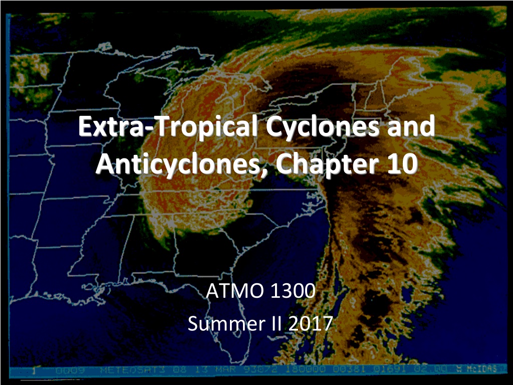
Extra-Tropical Cyclones and Anticyclones

Extra-Tropical Cyclones and
Extra-Tropical Cyclones and
Anticyclones, Chapter 10
Anticyclones, Chapter 10
ATMO 1300
Summer II 2017


Extra-Tropical Cyclones and
Extra-Tropical Cyclones and
Anticyclones, Chapter 10
Anticyclones, Chapter 10
ATMO 1300
Summer II 2016

•
Norwegian Cyclone Model
•
Midlatitude Cyclone Lifecycle
•
Strengthening and failure mechanisms
p
.
2
9
8
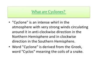
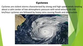
Extratropical Cyclones (ETC)
Extratropical Cyclones (ETC)
•
Describes a cyclone outside of tropical regions.
–
Cyclone: Low pressure regions around which winds blow
counterclockwise in the Northern Hemisphere and
clockwise in the Southern Hemisphere.
–
Cyclones are usually associated with fronts. Hurricanes,
which are cyclones inside of tropical regions, do not have
fronts. This is mostly because there a no temperature
gradients in the tropics.
•
Lifecycle of an ETC is described by the
Norwegian cyclone model (Bjerknes)
Norwegian Cyclone Model
Norwegian Cyclone Model
•
We begin by looking at the polar front: Our virtually
continuous boundary that separates cold polar air
masses from the warm tropical air masses to the
south.
Norwegian Cyclone Model
Norwegian Cyclone Model
•
We will then
assume the polar front is a stationary
front along a trough of low pressure with higher
pressures on either side of it
•
Cold air is located to the north, warm air to
the south
•
The wind flow is parallel to the front, but
opposite directions
•
This creates an axis of wind shear.
–
Shear: Change in wind speed or direction over
some distance (usually height).
•
In our case, the shear is cyclonic (counter-
clockwise flow) and horizontal, not vertical
Norwegian Cyclone Model
Norwegian Cyclone Model
Visualizing Shear
Visualizing Shear
•
If we stick a rotor in the middle of the flow, will it
turn? Clockwise (anticyclonically) or
counterclockwise (cyclonically)?
•
This shear gives rise to a wave-like kink along the
front. This is known as a frontal (open) wave
•
Formation is very similar to how waves form and
break in the ocean
•
This is the beginning (birth) of the cyclone, or
cyclogenesis.
Norwegian Cyclone Model
Norwegian Cyclone Model
•
At this point we call
the system a
frontal
wave.
•
Moves with the
upper level winds
Cyclone Source Regions
Cyclone Source Regions
•
Any development or strengthening of a
cyclone is called cyclogenesis
•
There are several regions across the US that
are favorable for cyclogenesis to occur
–
Eastern Slope of the Rockies,
–
Great Basin
–
Gulf of Mexico
–
Just off the coast of the Carolinas
3
r
d
E
d
i
t
i
o
n
:
F
i
g
.
1
0
-
6
a
,
p
.
2
8
1
P
a
n
h
a
n
d
l
e
H
o
o
k
s
:
C
y
c
l
o
n
e
s
t
h
a
t
d
e
v
e
l
o
p
i
n
t
h
e
O
K
/
T
X
p
a
n
h
a
n
d
l
e
s
.
A
l
b
e
r
t
a
C
l
i
p
p
e
r
s
:
F
a
s
t
m
o
v
i
n
g
c
y
c
l
o
n
e
s
t
h
a
t
d
e
v
e
l
o
p
i
n
t
h
e
l
e
e
o
f
t
h
e
C
a
n
a
d
i
a
n
R
o
c
k
i
e
s
.
F
r
e
q
u
e
n
t
l
y
“
C
l
i
p
”
t
h
e
G
r
e
a
t
L
a
k
e
s
r
e
g
i
o
n
N
o
r
’
e
a
s
t
e
r
s
:
W
i
n
t
e
r
c
y
c
l
o
n
e
s
t
h
a
t
d
e
v
e
l
o
p
o
f
f
t
h
e
e
a
s
t
e
r
n
U
S
c
o
a
s
t
.
3
r
d
E
d
i
t
i
o
n
:
F
i
g
.
1
0
-
6
b
,
p
.
2
8
1
3
r
d
E
d
i
t
i
o
n
:
F
i
g
.
1
0
-
6
c
,
p
.
2
8
1
3
r
d
E
d
i
t
i
o
n
:
F
i
g
.
1
0
-
6
d
,
p
.
2
8
1
•
The cyclone grows and strengthens (called
deepening,
as the pressure gets lower). Energy for
this process comes from:
–
Temperature gradients (
baroclinic instability)
–
Strong jet stream winds
–
Mountains
•
Strong cold and warm fronts
have developed, but an
occluded front hasn’t developed
yet
open wave.
Norwegian Cyclone Model
Norwegian Cyclone Model
•
The region of lowest
pressure is now located at
the intersection of the
warm and cold fronts
•
Precipitation forms along
the warm front –
overrunning
•
Cold air displaces the warm,
less stable air upwards
along the cold front
•
The region between the
warm and cold front is
called the
warm sector
Norwegian Cyclone Model
Norwegian Cyclone Model
The growth of a cyclone is dependent upon the central
pressure decreasing. So how can we lower the
central pressure of the cyclone?
–
Convergence along the frontal boundaries
convergence
leads to rising motion, which leads to lower pressure
–
As we lower pressure more air gets pulled inward (PGF,
tighter pressure gradients = more wind = more
convergence = more rising motion = more pressure falls)
Norwegian Cyclone Model
Norwegian Cyclone Model
–
Condensation supplies energy to the system in the form of
LATENT HEAT.
The additional heat released allows air
parcels to become more unstable. Increasing rising motion
leads to a decrease in pressure at the surface.
–
This is especially true in the warm sector…this region
typically has the most warm, moist unstable air.
–
We can also get help from the jet stream (later…)
Norwegian Cyclone Model
Norwegian Cyclone Model
•
At this point, the cyclone
can take on a classic
“comma” shape.
Norwegian Cyclone Model
Norwegian Cyclone Model
•
At the surface…
•
As the system matures, an occluded front forms as
the cold front outruns the warm front.
•
This usually marks the lowest pressure and strongest
winds of the system.
Norwegian Cyclone Model
Norwegian Cyclone Model
•
Now cooler air resides on both sides of the occluded
front
•
The surface low pressure center has lost its supply of
warm moist air
•
The rising motion begins to decrease and surface
pressures start to rise, and the system eventually
dissipates
•
Occasionally a secondary low will form at the triple
point and intensify into another cyclone
Norwegian Cyclone Model
Norwegian Cyclone Model
•
The Norwegian Cyclone model is a conceptual
model.
•
Few systems follow the model exactly but
most exhibit many characteristics of the
model.
•
It serves as a good foundation for the
understanding of mid-latitude storms.
Norwegian Cyclone Model
Norwegian Cyclone Model
Mid-Latitude Cyclones
Mid-Latitude Cyclones
•
Some storms make it all the way through the
growth cycle.
•
Frontal waves that develop into huge storms
are called unstable waves
•
These storms can last nearly a week
•
Other frontal waves that do not intensify are
said to be stable waves
•
Why do some waves develop and other
don
’
t???
Mid-Latitude Cyclones and the Jet
Mid-Latitude Cyclones and the Jet
Stream
Stream
•
The key to understanding which wave will develop
and which will not lies in the upper-level wind
pattern
•
We know we have a wavelike pattern in the upper-
atmosphere (Remember Rossby waves and
shortwaves)
•
Also, we have to think of the atmosphere in 3-D. Not
only is there a low pressure center and fronts at the
surface
(surface low)
, but we also have low pressure
centers aloft (
upper low/trough).
L
L
Upper Level
Surface
•
Suppose the upper-low (or trough)
is located right above the surface
low (frontal wave)
•
Air at the surface converges and
basically piles up. The mass
increases and so does the pressure
•
There is no divergence aloft to
spread out the air moving upward
•
The system will dissipate, or
fill.
We
are adding mass, thus increasing the
pressure.
•
Same idea applies for anticyclones
Failure to Intesify
Failure to Intesify
•
Divergence: The horizontal spreading
out of wind. Will lead to sinking air if it
occurs at the surface, but it will lead to
rising air if it occurs aloft.
1)
Diffluence: Divergence that
occurs due to the spreading
out of horizontal wind
direction.
2)
Speed Divergence: Divergence
that occurs due to a downwind
horizontal speed increase, but
no change in wind direction.
•
Convergence: The horizontal
coming together of air that can
lead to rising motion at the
surface.
Mid-Latitude Cyclones and the Jet
Mid-Latitude Cyclones and the Jet
Stream
Stream
•
We know that troughs in the upper-
troposphere are generally associated with
cold air
•
We have cold air at the surface behind a cold
front and cold aloft
•
The upper-low is typically located behind the
surface low (or to the west)
•
Directly above the surface low the air flow
spreads out or diverges
–
Need this for deepening of the surface low!
•
The diverging air aloft
allows more air to flow
upward from the
surface
•
The divergence aloft
acts as an exhaust
system for the surface
low
•
This is a mechanism for
storm intensification
Mid-Latitude Cyclones and the Jet
Mid-Latitude Cyclones and the Jet
Stream
Stream
•
When
divergence aloft
exceeds
convergence at the
surface
more air is removed at the top of the
troposphere than can be moved upward
•
Surface pressure drops in response as mass is
removed from the column of air
•
The surface low will intensify or deepen
•
When
divergence aloft is less than the convergence
at the surface, air cannot be removed quickly enough
•
Surface pressures rise and the system will weakens
or fill.
Mid-Latitude Cyclones and the Jet
Mid-Latitude Cyclones and the Jet
Stream
Stream
•
Same applies to anticyclones as well, just in reverse
•
If divergence at the surface exceeds convergence
aloft, the surface high will weaken
•
If convergence aloft exceeds surface divergence, the
high pressure area at the surface will strengthen
•
These high pressure systems can also be extreme –
stagnant motion, heat waves during summer, tend
to be “large and blobby”
S
u
p
e
r
g
e
o
s
t
r
o
p
h
i
c
S
u
b
g
e
o
s
t
r
o
p
h
i
c
L
H
convergence
divergence
Faster winds
Slower winds
Get super / sub
geostrophic flow
Mid-Latitude Cyclones
Mid-Latitude Cyclones
•
Winds aloft help steer surface pressure
systems
•
Surface lows tend to move in the direction of
the winds at 500 mb, but at about half the
speed.
•
As the trough / ridge pattern changes, the
steering flow will change. As a cyclone
strengthens, it will sometimes “
dig
” or push
further southward.
Mid-Latitude Cyclones
Mid-Latitude Cyclones
What we know:
What we know:
•
We can have deep pressure systems at the surface
and aloft
•
When the surface pressure system does not lie
beneath the upper level system, the atmosphere can
redistribute mass and help intensify the pressure
system
•
Intensifying pressure systems tilt toward the west
with increasing height
•
Surface cyclones are steered by winds aloft and
move away from their development region
Upper-Level Waves and Surface Storms
Upper-Level Waves and Surface Storms
•
Typically between 4 and 6 longwaves circling
the globe at one time
•
Wavelength typically of 4000 – 8000 km
(2400 – 5000 miles)
•
The fewer the number of waves the longer
the wavelength
•
Mountain ranges can disrupt the air flow
through longwaves
Upper-Level Waves and Surface Storms
Upper-Level Waves and Surface Storms
•
Due to the unequal heating of the Earth and
its rotation we see a cycle of waves in the
troposphere
•
Waves appear as troughs and ridges
•
We know we have long wave troughs and
shortwave troughs
Upper-Level Waves and Surface Storms
Upper-Level Waves and Surface Storms
•
Imbedded in the longwaves are shortwaves
•
Small ripples in the large-scale flow
•
The smaller the wavelength the faster they move
•
Shortwaves typically move at a speed proportional to
the flow at the 700 mb level
•
Longwaves can move very slowly or remain
stationary
•
Sometimes if the wavelength of a longwave is large
enough, it can retrograde or move back westward
Upper-Level Waves and Surface Storms
Upper-Level Waves and Surface Storms
•
Shortwaves typically deepen or intensify when
they approach a longwave trough and weaken
when they approach a longwave ridge
•
Shortwaves can also help deepen existing
longwave troughs
Role of the Jet Stream
Role of the Jet Stream
•
Jet streams play an additional role in
developing a wave cyclone
•
Remember the polar jet lies very near the
polar front
•
The region of strongest winds within the jet
stream is called a
jet streak
•
Jet streaks often form in the curved part of
the flow through an upper trough where
pressure gradients are tight
Role of the Jet Stream
Role of the Jet Stream
•
The curving of the jet stream coupled with the
changing wind speeds near a jet streak
produces regions of strong convergence and
divergence
•
The region of divergence draws surface air
upward
•
This helps decrease surface pressures
•
Regions of convergence push air downward,
which will increase surface pressures.
Role of the Jet Stream
Role of the Jet Stream
•
Remember that the polar jet is strongest
during winter
•
This is why we see more developed storms in
the winter time
•
Polar jet helps remove air from the surface
cyclone and supply it to the surface
anticyclone
Vorticity – Another way to
Vorticity – Another way to
diagnose vertical motion
diagnose vertical motion
•
The measure of rotation is called vorticity
•
Spin of small air parcels
•
Remember the ice skater…
•
We can use vorticity to see where areas of
convergence and divergence are in the atmosphere
•
Air spinning cyclonically (counter clockwise) has
positive vorticity
•
Air spinning anticyclonically has negative vorticity
Vorticity
Vorticity
•
Because the Earth spins it has vorticity, called
planetary vorticity
.
•
The Earth
’
s vorticity is always positive
because the Earth is spinning counter
clockwise about its north pole axis
•
The amount of planetary vorticity varies by
latitude
•
Planetary vorticity is zero at the equator and a
maximum at the poles
Vorticity
Vorticity
•
Moving air also has vorticity (Example:
Tornado)
•
This is called
relative vorticity
•
Relative vorticity is the combination of two
effects:
1)
Curving of the air flow
2)
Changing of the wind speed over a
horizontal distance
Vorticity
Vorticity
•
Air moving through a trough tends to spin
cyclonically, which increases its relative
vorticity
•
The spin in a ridge is typically anticyclonic
•
Whenever the wind blows faster on one side
of an air parcel than the other, a shear force is
applied to the parcel
•
The parcel of air will spin and gain or lose
vorticity
H
L
At this position, the spin is anticyclonic
It counter acts the Earth
’
s rotation
At this position, the
curvature is zero
Vorticity is simply
due to the Earth
’
s
rotation
At this position, the spin is cyclonic
And acts in addition to Earth
’
s rotation
Convergence
Divergence
Vorticity
Vorticity
•
Absolute vorticity
is the sum of Planetary
Vorticity and Relative Vorticity
•
Divergence and convergence are related to
the change in Absolute Vorticity / Change in
Time
•
Allows us to identify areas of convergence and
divergence from upper-air maps
•
Remember why storms intensify!
Vorticity
Vorticity
•
When relative/absolute vorticity decreases
downstream we diverge
•
When relative/absolute vorticity increases
downstream we converge
•
Upward motion and divergence
at upper levels
are associated with the region of
maximum
vorticity advection.
•
Downward motion and convergence
at upper
levels are associated with the region of
minimum
vorticity advection.
Summary
Summary
•
For a storm to intensify we need:
1)
Upper trough to lie to the west of the surface low
2)
Shortwave helps intensify the upper longwave
trough
3)
Polar jet exhibits waves and swings just south of
the developing storm system
Zones of vertical motion provide energy
conversions for the system
’
s growth
Summary
Summary
•
In regions where there is no upper trough or
shortwave or strong jet streak, the motions at
the surface are not sufficient enough for a
frontal wave to intensify
F
i
g
.
1
0
-
1
2
,
p
.
3
1
5
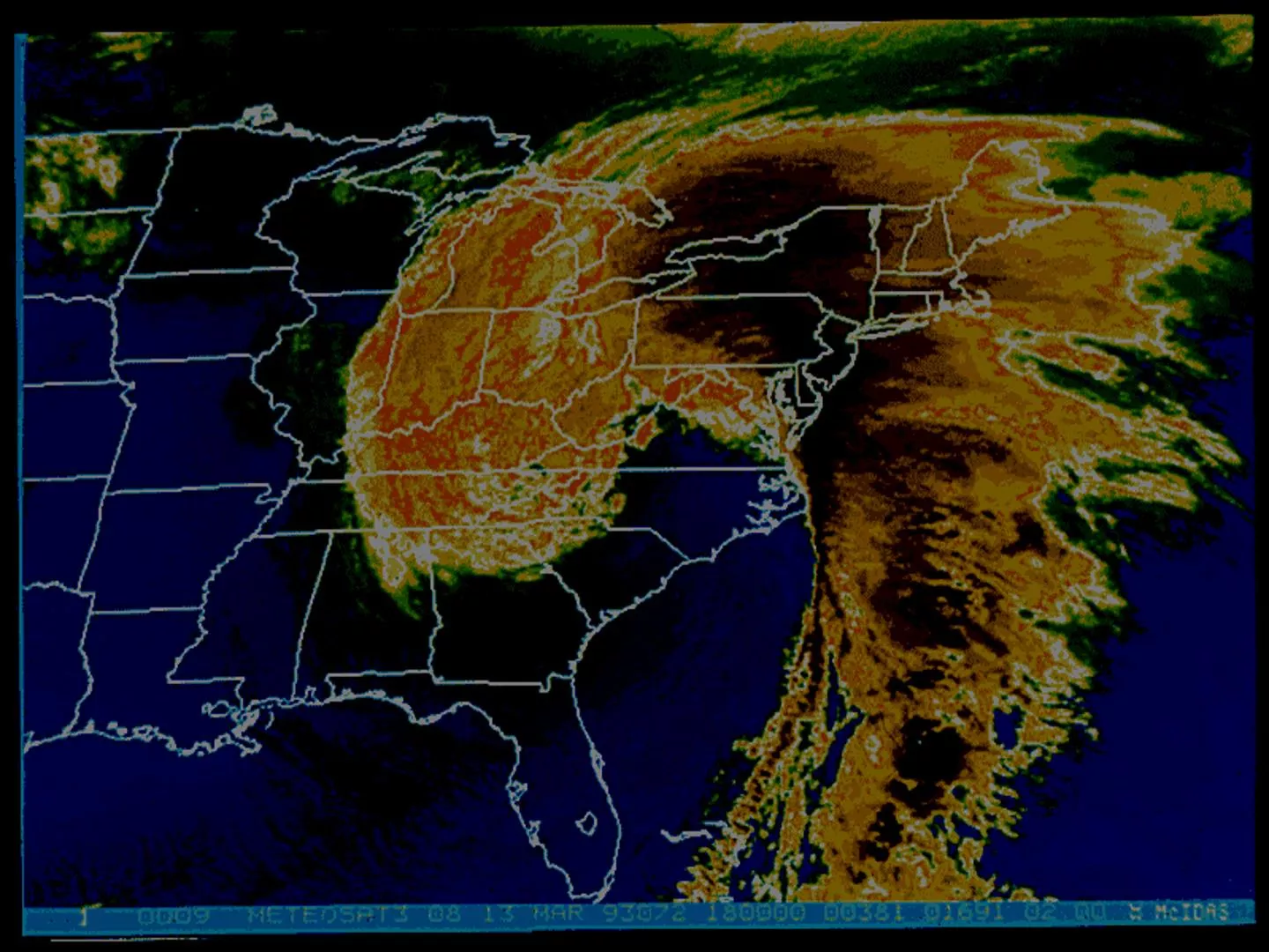
Super Storm 1993
Super Storm 1993
•
Produced nearly a foot of snow from Alabama
all the way to Maine
•
11 Tornadoes in Florida
•
Hurricane Force winds were reported from
Florida to New Hampshire
Super Storm 1993
Super Storm 1993
•
Surface low developed as a
frontal wave along a stalled
front in the northern Gulf of
Mexico
•
Strong trough approached
from the west
•
Arctic air mass dove south
over the Great Plains in
association with the trough
Super Storm 1993
Super Storm 1993
•
This single mid-latitude storm system killed
270 people
•
Insured losses exceeded $3 Billion
•
26 States were impacted
•
Nearly half of the country
’
s population felt
the effects of this storm
Norwegian cyclone model
•
AKA Bjerknes or Polar Front Theory
•
Birth/Cyclogenesis
–
Cyclonic wind shear along zonal front causes kink in flow
–
F
r
o
n
t
a
l
w
a
v
e
–
Know the regions in the US where this happens and the
common paths we covered
•
Deepening / Young Adult
–
F
r
o
n
t
s
a
r
e
s
t
r
o
n
g
b
u
t
n
o
o
c
c
l
u
s
i
o
n
:
o
p
e
n
w
a
v
e
–
Baroclinic instability, strong jet, mountains
–
W
a
r
m
s
e
c
t
o
r
b
e
t
w
e
e
n
c
o
l
d
a
n
d
w
a
r
m
f
r
o
n
t
–
L
o
w
e
r
i
n
g
p
r
e
s
s
u
r
e
o
f
t
h
e
c
y
c
l
o
n
e
Norwegian cyclone model
•
Mature
–
O
c
c
l
u
d
e
d
F
r
o
n
t
–
Lowest pressure and strongest winds
•
Death
–
Occlusion cuts off the center from warm sector air
–
Pressure begins to rise
•
Know the four lifecycle stages
•
Upper level influence:
–
If surface low pressure is directly underneath upper level low
pressure then surface low will weaken
–
Divergence (spreading of air aloft) increases the surface low
pressure
–
If upper low is west of the surface low the surface low typically can
strengthen
–
Similar processes can impact surface highs
Other Concepts
•
Jet streak – region of strongest winds in the jet
•
Vorticity – measure of spin in the atmosphere
(positive = cyclonic = counterclockwise)
•
A location experiencing an increase in vorticity
also experiences divergence (at upper level =
upward motion)
Extra-Tropical Cyclones (ETC) occur outside tropical regions and are associated with fronts, unlike hurricanes. The Norwegian Cyclone Model explains the lifecycle of ETCs, starting at the polar front and describing cyclogenesis through wind shear patterns.

Download Presentation

Please find below an Image/Link to download the presentation.
The content on the website is provided AS IS for your information and personal use only. It may not be sold, licensed, or shared on other websites without obtaining consent from the author.If you encounter any issues during the download, it is possible that the publisher has removed the file from their server.
You are allowed to download the files provided on this website for personal or commercial use, subject to the condition that they are used lawfully. All files are the property of their respective owners.
The content on the website is provided AS IS for your information and personal use only. It may not be sold, licensed, or shared on other websites without obtaining consent from the author.
E N D
Presentation Transcript
Extra-Tropical Cyclones and Anticyclones, Chapter 10 ATMO 1300 Summer II 2017
Extra-Tropical Cyclones and Anticyclones, Chapter 10 Norwegian Cyclone Model Midlatitude Cyclone Lifecycle Strengthening and failure mechanisms ATMO 1300 Summer II 2016
Extratropical Cyclones (ETC) Describes a cyclone outside of tropical regions. Cyclone: Low pressure regions around which winds blow counterclockwise in the Northern Hemisphere and clockwise in the Southern Hemisphere. Cyclones are usually associated with fronts. Hurricanes, which are cyclones inside of tropical regions, do not have fronts. This is mostly because there a no temperature gradients in the tropics. Lifecycle of an ETC is described by the Norwegian cyclone model (Bjerknes)
Norwegian Cyclone Model We begin by looking at the polar front: Our virtually continuous boundary that separates cold polar air masses from the warm tropical air masses to the south.
Norwegian Cyclone Model We will then assume the polar front is a stationary front along a trough of low pressure with higher pressures on either side of it
Norwegian Cyclone Model Cold air is located to the north, warm air to the south The wind flow is parallel to the front, but opposite directions This creates an axis of wind shear. Shear: Change in wind speed or direction over some distance (usually height). In our case, the shear is cyclonic (counter- clockwise flow) and horizontal, not vertical
Visualizing Shear If we stick a rotor in the middle of the flow, will it turn? Clockwise (anticyclonically) or counterclockwise (cyclonically)?
Norwegian Cyclone Model This shear gives rise to a wave-like kink along the front. This is known as a frontal (open) wave Formation is very similar to how waves form and break in the ocean This is the beginning (birth) of the cyclone, or cyclogenesis. At this point we call the system a frontal wave. Moves with the upper level winds
Cyclone Source Regions Any development or strengthening of a cyclone is called cyclogenesis There are several regions across the US that are favorable for cyclogenesis to occur Eastern Slope of the Rockies, Great Basin Gulf of Mexico Just off the coast of the Carolinas
Alberta Clippers: Fast moving cyclones that develop in the lee of the Canadian Rockies. Frequently Clip the Great Lakes region Nor easters: Winter cyclones that develop off the eastern US coast. Panhandle Hooks: Cyclones that develop in the OK/ TX panhandles. 3rd Edition: Fig. 10-6a, p. 281
Norwegian Cyclone Model The cyclone grows and strengthens (called deepening, as the pressure gets lower). Energy for this process comes from: Temperature gradients (baroclinic instability) Strong jet stream winds Mountains Strong cold and warm fronts have developed, but an occluded front hasn t developed yet open wave.
Norwegian Cyclone Model The region of lowest pressure is now located at the intersection of the warm and cold fronts Precipitation forms along the warm front overrunning Cold air displaces the warm, less stable air upwards along the cold front The region between the warm and cold front is called the warm sector
Norwegian Cyclone Model The growth of a cyclone is dependent upon the central pressure decreasing. So how can we lower the central pressure of the cyclone? Convergence along the frontal boundaries convergence leads to rising motion, which leads to lower pressure As we lower pressure more air gets pulled inward (PGF, tighter pressure gradients = more wind = more convergence = more rising motion = more pressure falls)
Norwegian Cyclone Model Condensation supplies energy to the system in the form of LATENT HEAT. The additional heat released allows air parcels to become more unstable. Increasing rising motion leads to a decrease in pressure at the surface. This is especially true in the warm sector this region typically has the most warm, moist unstable air. We can also get help from the jet stream (later )
Norwegian Cyclone Model At this point, the cyclone can take on a classic comma shape.
Norwegian Cyclone Model As the system matures, an occluded front forms as the cold front outruns the warm front. This usually marks the lowest pressure and strongest winds of the system.
Norwegian Cyclone Model Now cooler air resides on both sides of the occluded front The surface low pressure center has lost its supply of warm moist air The rising motion begins to decrease and surface pressures start to rise, and the system eventually dissipates Occasionally a secondary low will form at the triple point and intensify into another cyclone
Norwegian Cyclone Model The Norwegian Cyclone model is a conceptual model. Few systems follow the model exactly but most exhibit many characteristics of the model. It serves as a good foundation for the understanding of mid-latitude storms.
Mid-Latitude Cyclones Some storms make it all the way through the growth cycle. Frontal waves that develop into huge storms are called unstable waves These storms can last nearly a week Other frontal waves that do not intensify are said to be stable waves Why do some waves develop and other don t???
Mid-Latitude Cyclones and the Jet Stream The key to understanding which wave will develop and which will not lies in the upper-level wind pattern We know we have a wavelike pattern in the upper- atmosphere (Remember Rossby waves and shortwaves) Also, we have to think of the atmosphere in 3-D. Not only is there a low pressure center and fronts at the surface (surface low) , but we also have low pressure centers aloft (upper low/trough).
Failure to Intesify Upper Level L Suppose the upper-low (or trough) is located right above the surface low (frontal wave) Air at the surface converges and basically piles up. The mass increases and so does the pressure There is no divergence aloft to spread out the air moving upward The system will dissipate, or fill. We are adding mass, thus increasing the pressure. L Surface Same idea applies for anticyclones
Divergence: The horizontal spreading out of wind. Will lead to sinking air if it occurs at the surface, but it will lead to rising air if it occurs aloft. 1) Diffluence: Divergence that occurs due to the spreading out of horizontal wind direction. 2) Speed Divergence: Divergence that occurs due to a downwind horizontal speed increase, but no change in wind direction. Convergence: The horizontal coming together of air that can lead to rising motion at the surface.
Mid-Latitude Cyclones and the Jet Stream We know that troughs in the upper- troposphere are generally associated with cold air We have cold air at the surface behind a cold front and cold aloft The upper-low is typically located behind the surface low (or to the west) Directly above the surface low the air flow spreads out or diverges Need this for deepening of the surface low!
http://www.atmos.illinois.edu/~snodgrss/Midlatitude_cyclone_files/image018.jpghttp://www.atmos.illinois.edu/~snodgrss/Midlatitude_cyclone_files/image018.jpg
The diverging air aloft allows more air to flow upward from the surface The divergence aloft acts as an exhaust system for the surface low This is a mechanism for storm intensification
Mid-Latitude Cyclones and the Jet Stream When divergence aloftexceedsconvergence at the surface more air is removed at the top of the troposphere than can be moved upward Surface pressure drops in response as mass is removed from the column of air The surface low will intensify or deepen When divergence aloft is less than the convergence at the surface, air cannot be removed quickly enough Surface pressures rise and the system will weakens or fill.
Mid-Latitude Cyclones and the Jet Stream Same applies to anticyclones as well, just in reverse If divergence at the surface exceeds convergence aloft, the surface high will weaken If convergence aloft exceeds surface divergence, the high pressure area at the surface will strengthen These high pressure systems can also be extreme stagnant motion, heat waves during summer, tend to be large and blobby
Supergeostrophic Subgeostrophic
Mid-Latitude Cyclones Winds aloft help steer surface pressure systems Surface lows tend to move in the direction of the winds at 500 mb, but at about half the speed. As the trough / ridge pattern changes, the steering flow will change. As a cyclone strengthens, it will sometimes dig or push further southward.
Mid-Latitude Cyclones What we know: We can have deep pressure systems at the surface and aloft When the surface pressure system does not lie beneath the upper level system, the atmosphere can redistribute mass and help intensify the pressure system Intensifying pressure systems tilt toward the west with increasing height Surface cyclones are steered by winds aloft and move away from their development region
Upper-Level Waves and Surface Storms Typically between 4 and 6 longwaves circling the globe at one time Wavelength typically of 4000 8000 km (2400 5000 miles) The fewer the number of waves the longer the wavelength Mountain ranges can disrupt the air flow through longwaves
Upper-Level Waves and Surface Storms Due to the unequal heating of the Earth and its rotation we see a cycle of waves in the troposphere Waves appear as troughs and ridges We know we have long wave troughs and shortwave troughs
Upper-Level Waves and Surface Storms Imbedded in the longwaves are shortwaves Small ripples in the large-scale flow The smaller the wavelength the faster they move Shortwaves typically move at a speed proportional to the flow at the 700 mb level Longwaves can move very slowly or remain stationary Sometimes if the wavelength of a longwave is large enough, it can retrograde or move back westward
Upper-Level Waves and Surface Storms Shortwaves typically deepen or intensify when they approach a longwave trough and weaken when they approach a longwave ridge Shortwaves can also help deepen existing longwave troughs
Role of the Jet Stream Jet streams play an additional role in developing a wave cyclone Remember the polar jet lies very near the polar front The region of strongest winds within the jet stream is called a jet streak Jet streaks often form in the curved part of the flow through an upper trough where pressure gradients are tight
Role of the Jet Stream The curving of the jet stream coupled with the changing wind speeds near a jet streak produces regions of strong convergence and divergence The region of divergence draws surface air upward This helps decrease surface pressures Regions of convergence push air downward, which will increase surface pressures.
Role of the Jet Stream Remember that the polar jet is strongest during winter This is why we see more developed storms in the winter time Polar jet helps remove air from the surface cyclone and supply it to the surface anticyclone
Vorticity Another way to diagnose vertical motion The measure of rotation is called vorticity Spin of small air parcels Remember the ice skater We can use vorticity to see where areas of convergence and divergence are in the atmosphere Air spinning cyclonically (counter clockwise) has positive vorticity Air spinning anticyclonically has negative vorticity
Vorticity Because the Earth spins it has vorticity, called planetary vorticity. The Earth s vorticity is always positive because the Earth is spinning counter clockwise about its north pole axis The amount of planetary vorticity varies by latitude Planetary vorticity is zero at the equator and a maximum at the poles
Vorticity Moving air also has vorticity (Example: Tornado) This is called relative vorticity Relative vorticity is the combination of two effects: 1) Curving of the air flow 2) Changing of the wind speed over a horizontal distance


")