Applied Geostatistics Course Overview
This course introduces basic concepts and applications of applied geostatistics, focusing on spatial interpolation methods commonly used in various disciplines like geology, engineering, and geography. Students with a background in statistics or GIS can enhance their skills through hands-on learning with ArcGIS Pro. Prerequisites include knowledge of univariate statistics, and students will apply geostatistical interpolation to a data set during the semester. The course aims to equip students with practical skills for their academic and professional endeavors.

Download Presentation

Please find below an Image/Link to download the presentation.
The content on the website is provided AS IS for your information and personal use only. It may not be sold, licensed, or shared on other websites without obtaining consent from the author.If you encounter any issues during the download, it is possible that the publisher has removed the file from their server.
You are allowed to download the files provided on this website for personal or commercial use, subject to the condition that they are used lawfully. All files are the property of their respective owners.
The content on the website is provided AS IS for your information and personal use only. It may not be sold, licensed, or shared on other websites without obtaining consent from the author.
E N D
Presentation Transcript
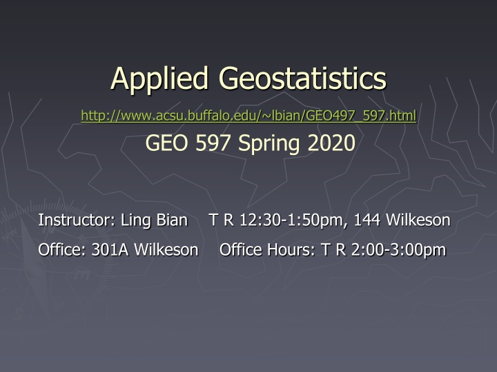
Applied Geostatistics http://www.acsu.buffalo.edu/~lbian/GEO497_597.html GEO 597 Spring 2020 Instructor: Ling Bian T R 12:30-1:50pm, 144 Wilkeson Office: 301A Wilkeson Office Hours: T R 2:00-3:00pm
What is it The course is intended to introduce the basic concepts and applications of applied geostatistics, which address optimal spatial interpolation.
What is it Geostatistics are considered to be one of the most sophisticated spatial interpolation methods. The method is commonly used in many disciplines such as geology, engineering, hydrology, geography, ecology, urban studies, and medical geography. Geostatistics are closely related to statistics and GIS.
What is it Students with basic knowledge of statistics or GIS can take a step further to learn how to use geostatistics. The course emphasizes the applied side of geostatistics, and the method can be useful in students' immediate and future needs such as students' own theses and dissertations, tasks for their current or potential employers, or projects of personal interests.
What is it The course uses a well received textbook for the lectures and a popular GIS software package ArcGIS Pro for the lab exercises. Three lab sections and associated assignments will provide students with hands-on experience in using the geostatistical tool.
Text An Introduction to Applied Geostatistics. Oxford University Press, New York, by Isaaks, Edward. H., and R. Mohan. Srivastava, 1989. The Ed and Mo book
Prerequisites The course is open to graduate students who have knowledge of univariate statistics. Multivariate will help but is not required.
Requirements During the semester, each student should apply the geostatistical interpolation to a data set. Past students projects
Requirements A term paper Introduction Literature review Study area Data and methods (incorporate the labs, plus ) Results and discussion conclusions 10-15 double-spaced pages of text, plus tables, figures, references
Grading Lab 1 Lab 2 Lab 3 Project Report -------------------------------------------------------------- Total 100% 10% 10% 10% 70%
Grad cut-off A A- B+ B B- C+ C C- D+ D F 93.33-100.0 90.00-93.32 86.67-89.99 83.33-86.66 80.00-83.32 76.67-79.99 73.33-76.66 70.00-73.32 66.67-69.99 60.00-60.66 <60
Tentative Schedule 1/28 1/30 2/04 2/06 2/11 2/13 2/18 2/20 2/25 Introduction Spatial Interpretation Spatial Description Spatial Description Spatial Continuity Estimation Random Function Models Random Function Models Random Function Models
Tentative Schedule 2/27 3/03 3/05 3/10 3/12 Spring Break Lab section 1 Global Estimation Point Estimation Ordinary Kriging Ordinary kriging
Tentative Schedule 3/24 3/26 3/31 4/02 4/14 4/16 4/21 4/23 Co-Kriging 4/28, 30, 5/05 Presentations 5/07 Conclusions Block kriging and Search Strategy Cross Validation Modeling Sample Variogram Modeling Sample Variogram Lab Section 2 Lab Section 3 Co-Kriging
Software ArcMap Pro Geostatistics Analyst ESRI tutorial for Geostatistical Analyst
1. What is GIS? G: maps I: spreadsheets S: the system that puts the maps and spreadsheets together
Formal Definition of GIS A GIS is a computer-based system that provides for the collection, storage, analysis, and display of geo-referenced data A decision support system involving the integration of spatially referenced data in a problem solving environment
GIS Is Important Locations Networks Areas Because most information has a spatial component ESRI, GE SmallWorld
GIS Integrates Various Information Social Factors Biodiversity Engineering Land Use Environmental Considerations It allows us to see the whole Courtesy: USGS
Components in GIS Spatial locations Attributes Topology
Spatial Locations Specified with reference to a common coordinate system Geographic coordinate system (lat and long) UTM (Universal Transverse Mercator) State Plane
Geographic Coordinate System 900 latitude Lines of Latitude (East/West - parallels) Prime Meridian 00 Lines of Longitude (North/South - meridians) Central Parallel 00 courtesy: Mary Ruvane, http://ils.unc.edu/
UTM Zones courtesy: http://www.colorado.edu/geography/gcraft/
State Plane Zones courtesy: http://www.cnr.colostate.edu/class_info/nr502/lg3/datums_coordinates/spcs.html/
Difference between Systems UTM and many other coordinate systems are defined based on the geographic coordinate system
Attributes Attributes = variables, properties, etc. Four types of attribute values Nominal (river, grass, ..) Ordinal (high, medium, low) Interval (10oC, 20oC) Ratio (2.19, -96.57, ..)
Topology Spatial relationship between geographic features (points, lines, polygons) Adjacency Containment Connectivity and so on
GIS Data Models Vector points lines polygons networks Raster grids courtesy: Mary Ruvane, http://ils.unc.edu/