A Presentation on Atmosphere-Ocean Interaction
Water covers 71% of the earth\\\\u2019s surface and contains 97% of the earth\\\\u2019s water. 60% of the world\\\\u2019s population live within 60 miles of the coast. This means that a significant amount of the earth\\\\u2019s population uses the oceans and other large bodies of water for recreational (e.g., swimming, fishing) and commercial (e.g., transportation, fishing, etc.) purposes
Download Presentation

Please find below an Image/Link to download the presentation.
The content on the website is provided AS IS for your information and personal use only. It may not be sold, licensed, or shared on other websites without obtaining consent from the author.If you encounter any issues during the download, it is possible that the publisher has removed the file from their server.
You are allowed to download the files provided on this website for personal or commercial use, subject to the condition that they are used lawfully. All files are the property of their respective owners.
The content on the website is provided AS IS for your information and personal use only. It may not be sold, licensed, or shared on other websites without obtaining consent from the author.
E N D
Presentation Transcript
The Oceans A Presentation on Atmosphere-Ocean Interaction Presented by: National Weather Service Shreveport, LA
Why study major bodies of water? Water covers nearly of the earth s surface More than 50% of the world s population lives within an hour of the coast Plays a role in both climate and day-to- day weather FOOD! Cost of your food could depend on it
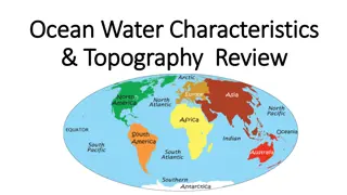
The Basics There are FOUR oceans ATLANTIC PACIFIC INDIAN SOUTHERN
Around the World in 4 Slides Arctic Sea Mediterranean Sea Gulf of Mexico Caribbean Sea Begins at 60 S
Around the World in 4 Slides Bering Sea Gulf of Alaska Sea of Japan Begins at 60 S
Around the World in 4 Slides Persian Gulf Red Sea Arabian Sea Begins at 60 S
Around the World in 4 Slides NEW! NEW! Defined in 2000 Begins at 60 S NEW!
Ocean or Sea, Whats the Big Deal? SEAS Delineated by land masses Doesn t matter if they re largely enclosed Also communicate with the ocean Europe Strait of Gibralter United States Black Sea Gulf of Mexico Mediterranean Sea Africa Mexico
Bragging Rights Which ocean is the biggest? OCEAN SURFACE AREA [km2] OF ALL OCEANS Atlantic 90,818,000 27.1% Indian 68,556,000 20.4% Pacific 155,557,000 46.4% Southern 20,327,000 6.1%
Bragging Rights Which ocean has the most coastline? OCEAN COASTLINE LENGTH [km] Atlantic 111,866 Indian 66,526 Pacific 135,663 Southern 17,968
Water is Wateror is it?! FRESHWATER Rivers Streams Lakes SALTWATER Oceans Gulfs Seas But wait, there's more!
Water is Wateror is it?! QUESTION: Is saltwater the same everywhere? ANSWER: Nope. In general, the Atlantic Ocean is the saltiest.
Please Pass the Salt Run-of-the-mill concentration? 3.5 grams/liter Like weather, there are areas of HIGH salinity LOW salinity So, where are these highs and lows ?
Please Pass the Salt L H H H L H H L
MmmmmSalty! DEAD SEA FACTS: Really a large lake Water gets in, but not out! Fed by River Jordan Evaporation only way out Has nearly 10 times the salinity of the oceans! Leads to increased density CAPT. OBVIOUS SAYS: Dead Sea was named because it had no life!
So?? The increased density means just about anything will float! We can see this through the use of eggs!
Were Goin Down, Down, Down Just like the atmosphere, the ocean has layers!
The Epipelagic Zone Sunlight Zone Most solar heating Lots of temperature change Surface to 200m Influenced by wind
Bridge Over Troubled Waters A transition layer Temperature decreases rapidly Relevance to you? Higher bass concentrations (oxygen is just right)
The Mesopelagic Zone Twilight Zone Most temperature change near top of layer Between 200 and 1000m Animal characteristics begin to change
The Bathypelagic Zone Midnight Zone No light at all Only light comes from animals Very little temperature change Pressure reaches over 5800 p.s.i.
The Abyssopelagic Zone The Abyss Greek word meaning no bottom Between 4000 and 6000m Water temperature near freezing
The Hadalpelagic Zone The Trenches Anything below 6000m Worth repeating: Deepest trench is the Mariana Trench Weight : >8 t.s.i. Life still exists here! That s TONS per square inch!
Our Mr. Sun Driving Force Solar radiation affects the ocean differently More on this later Ultimate cause of wind
Ocean Currents Just the Facts Two types: Wind-driven Currents Deep Water Currents 40% of the global heat transport Move slower than surface winds Kilometers per day vs. kilometers per hour Long-term climate impacts Gulf Stream most important in our region
Ocean Currents -- Development Oceans near equator heat up more than the poles Sets up Temperature imbalance Semi-permanent pressure areas Constant push of wind on water
Dust in the Wind During the Day Beach heats faster than ocean Air rises onshore Slightly cooler, denser air moves onshore to replace the lost air Results: Onshore breeze Possible storm development
Dust in the Wind At Night Beach cools faster than ocean Air rises offshore Slightly cooler, denser air moves offshore to replace the lost air Results: Offshore breeze Possible storm development
Wave Action Another byproduct of wind Size depends on THREE things: Speed Duration Distance Longer the wave, the faster it moves Here s a cool fact: You can estimate the wind speed using the size of waves
Battle of the Bulge Tides are another type of wave action Definition: A change in the ocean water level, which results from the gravitational pull of the moon
POP QUIZ Where are the largest ranges from high to low tide in the world?
Battle of the Bulge Why the moon? Sun s gravitational pull is greater But the moon is closer Mariners have known for a long time that tides were related to the moon
Battle of the Bulge Famous dead people who have studied tidal motion: Galileo Descartes Newton Laplace Lord Kelvin Kepler
POP QUIZ Where are the largest ranges from high to low tide in the world? Have an answer yet? HINT: It s in North America
Two tides? Four tides? Number of tides per day related to Shape of the coastline Sea floor elevation Some places have one high/low tide cycle Called a diurnal tide Examples: Lake Charles, LA Gulfport, MS Gulf Shores, AL Pensacola, FL
Two tides? Four tides? Number of tides per day related to Shape of the coastline Sea floor elevation Other places have two high/low tide cycles Called a semi-diurnal tide Examples: Galveston, TX Apalachicola, FL
Largest Tidal Range in the World Bay of Fundy! High Tide Low Tide
The Knights Who Say Neap Occur when the pull of the moon and sun partially cancel each other RESULT: Very little change between high and low tides
Springing Onward Occurs when the pull of the sun and moon act together RESULT: Greater than normal tidal range experienced
About the Cost of Your Food Normally Warm waters over Central Pacific Cooler waters off Peruvian coast Colder, nutrient-rich waters pulled up from western coast of South America
About the Cost of Your Food El Nino: Equatorial Countercurrent strengthens Nutrient-rich water supply lessens RESULT: Waters warm off Peruvian Coast
About the Cost of Your Food La Nina: Weaker Equatorial Countercurrent Nutrient-rich water supply increases RESULT: Warm waters pile up in the western Pacific
What Does This Mean Weatherwise? For El Nino Events
What Does This Mean Weatherwise? For La Nina Events
So??? A lot of fishing takes place off the coast of Peru Anchovy fish thrive in the nutrient-rich waters of this area Anchovies are caught and used to make chicken feed But I don't like anchovies on
So??? During big El Nino events: Waters are not full as nutrients Not as many anchovies Cost of chicken feed increases Therefore, the cost of chicken increases
Thank You!!! Douglas Butts Senior Forecaster WFO Shreveport 5655 Hollywood Ave. Shreveport, LA 71109 318.631.3669
