WISK: A Workload-aware Learned Index for Spatial Keyword Queries
WISK, a workload-aware learned index that combines spatial and keyword queries to efficiently retrieve objects. It integrates spatial and textual indexes and considers query workload information.
2 views • 17 slides
Localised Adaptive Spatial-Temporal Graph Neural Network
This paper introduces the Localised Adaptive Spatial-Temporal Graph Neural Network model, focusing on the importance of spatial-temporal data modeling in graph structures. The challenges of balancing spatial and temporal dependencies for accurate inference are addressed, along with the use of distri
5 views • 19 slides
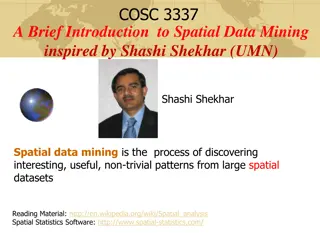
Introduction to Spatial Data Mining: Discovering Patterns in Large Datasets
Spatial data mining involves uncovering valuable patterns from extensive spatial datasets, offering insights into historical events, environmental phenomena, and predictive analytics. Examples range from analyzing disease outbreaks to predicting habitat suitability for endangered species. The applic
2 views • 20 slides
Spatial Database Systems: An Overview
This presentation by Xiaozhi Yu introduces the fundamentals of spatial database systems, covering topics such as spatial data types, relationships, system architecture, modeling, and organizing underlying spaces. It delves into the importance of integrating geometry into DBMS data models, spatial in
4 views • 30 slides
Query Optimization in Database Management Systems
This content covers the fundamentals of query optimization in Database Management Systems (DBMS), including steps involved, required information for evaluating queries, cost-based query sub-system, and the role of various components like query parser, optimizer, plan generator, and cost estimator. I
2 views • 51 slides
Performance of Nearest Neighbor Queries in R-trees
Spatial data management research focuses on designing robust spatial data structures, inventing new models, constructing query languages, and optimizing query processing. This study explores the estimation of query performance and selectivity, specifically in R-trees, for efficient access planning.
3 views • 32 slides
Spatial Analysis & Modeling for Spatial Planning Training in Maputo, Mozambique
Explore spatial analysis techniques for efficient route planning, site selection, pattern identification, and value prediction in the context of spatial planning. Learn about surface modeling, relationships among features, and the importance of spatial modeling in addressing geographical problems.
0 views • 27 slides
GIS Data Models for Spatial Planning Training in Maputo, Mozambique
Explore the concepts of GIS data models including vector vs. raster, spatial relationships, spatial operations, and representation of real-world entities in a spatial database. Understand how spatial data models are used to manipulate spatially-referenced information and define the spatial location
1 views • 32 slides
Spatial Autocorrelation in Geostatistical Analysis
Explore the concept of spatial autocorrelation, its implications in geostatistical analysis, and the importance of detecting and interpreting it correctly. Learn about auto-correlation, signal components, correlation significance, and measuring autocorrelation using tools like Moran's I. Gain insigh
4 views • 12 slides
Spatial Relation Switching Requirements in 3GPP NR RAN Plenary Meeting
The document discusses various spatial relation switching requirements for uplink scenarios in the 3GPP NR RAN Plenary Meeting. It covers agreement points related to UL SRS, PUCCH, P-SRS, and DL-RS, defining delay requirements and known conditions for spatial relation switching. The agreements provi
1 views • 11 slides
Identifying Completeness of Query Answers in Incomplete Databases
The study delves into how to assess the completeness of query answers when dealing with partially complete databases. By analyzing data from a telecommunication company’s data warehouse, the query results are examined to determine if all warnings generated by maintenance objects with hardware team
0 views • 23 slides
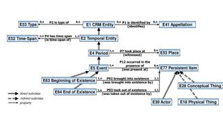
Temporal and Spatial Information Models
This content delves into the intricacies of temporal and spatial information models, covering concepts such as existence, presence, and spatiotemporal relationships. It explores how entities are identified, events are witnessed, and durations are defined within these models. The interplay between ti
5 views • 9 slides
Quantum Query Complexity Measures for Symmetric Functions
Explore the relationships between query complexity measures, including quantum query complexity, adversary bounds, and spectral sensitivity, in the context of symmetric functions. Analysis includes sensitivity graphs, the quantum query model, and approximate counting methods. Results cover spectral
0 views • 19 slides
Introduction to Priority Search Trees in Computational Geometry
This lecture outlines the structure and query process of Priority Search Trees (PST) in computational geometry. It covers heap-based point queries, range trees for windowing queries, handling query ranges in 1D and 2D spaces, and using heaps to efficiently handle query ranges. The content discusses
1 views • 18 slides
Optimizing Join Enumeration in Transformation-based Query Optimizers
Query optimization plays a crucial role in improving database performance. This paper discusses techniques for optimizing join enumeration in transformation-based query optimizers, focusing on avoiding cross-products in join orders. It explores efficient algorithms for generating cross-product-free
0 views • 18 slides
Enhancing Spatial Data Analysis in QGIS
Explore the integration of relational databases with QGIS to facilitate efficient spatial data analysis. Discover the importance of recognizing spatial relationships within data sets and the solutions to enhance QGIS for relational datasets. Overcome challenges and delve into the intersection and su
1 views • 25 slides
Overview of BlinkDB: Query Optimization for Very Large Data
BlinkDB is a framework built on Apache Hive, designed to support interactive SQL-like aggregate queries over massive datasets. It creates and maintains samples from data for fast, approximate query answers, supporting various aggregate functions with error bounds. The architecture includes modules f
1 views • 26 slides
Analysis of MIMO for IMMW Transmission in IEEE 802.11-24
Proposal discusses the suitability of MIMO for IMMW transmission under different scenarios. The analysis focuses on the number of spatial streams based on channel rank and quality, recommending dual-polarization for LOS paths supporting 2 spatial streams and spatial separation for larger devices sup
0 views • 16 slides
Unsupervised Relation Detection Using Knowledge Graphs and Query Click Logs
This study presents an approach for unsupervised relation detection by aligning query patterns extracted from knowledge graphs and query click logs. The process involves automatic alignment of query patterns to determine relations in a knowledge graph, aiding in tasks like spoken language understand
0 views • 29 slides
Query Processing in Relational Algebra: Transforming, Estimating Costs, and Generating Plans
This content delves into the intricacies of query processing at the relational algebra level. It covers transformations, estimation of costs, detailed query plan generation, and plan comparison. The process involves estimating the cost and size of query plans, calculating the number of IO operations
0 views • 20 slides
Query Decomposition and Data Localization
This content discusses the process of query decomposition and data localization in databases. It covers topics such as analysis of query graphs, elimination of redundancy in queries, and rewriting queries for better efficiency. The examples provided illustrate the importance of semantic correctness
0 views • 25 slides
Converting Logical Query Plans to Physical Query Plans in DBMS
Illustrations and steps involved in the process of converting logical query plans (LQP) to physical query plans (PQP) in database management systems (DBMS), focusing on optimization, algorithm implementation, and handling security issues. The images provide a visual guide to constructing physical qu
1 views • 36 slides
Report Writers Meeting with Query Performance Tips
A meeting was held on 12/08/2015 with Gary Yates to discuss query performance tips for report writers. The session covered important aspects such as retrieving necessary fields, using single list views or crosstabs effectively, and keeping query calculations simple. Additionally, insights on partiti
0 views • 14 slides
Efficient Query Execution on Raw Data Files
This research explores NoDB, a database system designed to eliminate the bottleneck of data-to-query time by querying raw data files in their original location. By redesigning the query processing layer to query raw data in situ state while automatically creating auxiliary structures, NoDB aims to m
0 views • 34 slides
A Spatial Perspective
Spatial perspective is a crucial aspect in various fields, including geography, architecture, and urban planning. It involves understanding the relationships and patterns of physical spaces and their influences on human activities and environments. By adopting a spatial perspective, professionals ca
0 views • 23 slides
Spatial Reuse in IEEE 802.11 - Overview and Proposal
This document explores the concept of spatial reuse in IEEE 802.11 standards, particularly focusing on the 11ax and 11be amendments. It discusses the benefits of spatial reuse, proposing enhancements for better utilization of spectrum and improved efficiency in wireless communications. The proposed
0 views • 6 slides
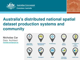
Australia's Foundational Spatial Data Framework Overview
Covering Australia's distributed national spatial dataset production systems and community involvement, the Foundational Spatial Data Framework (FSDF) is a government initiative aimed at streamlining the production of national spatial data products. Coordinated by Geoscience Australia, FSDF plays a
0 views • 40 slides
Relational Database Query Execution
In the world of relational databases, query execution is a crucial process involving steps like compilation, optimization, and physical plan generation. This involves converting SQL queries into logical query plans, selecting algorithms, and optimizing operations for efficient performance. Different
0 views • 9 slides
Data Integration with Dependent Sources: Query Answering System
An exploration of a system called IDS for integrating dependent sources in data processing. The paper addresses theoretical challenges, focusing on query answering with dependent sources. Investigates source selection, computation, coverage, configuration, cost, and more. Proposes solutions for choo
0 views • 36 slides
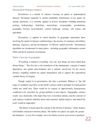
Understanding Geostatistical Distances Analysis in Spatial Studies
Geostatistics, a branch of statistics focusing on spatial datasets, plays a crucial role in various disciplines like geology, hydrology, and agriculture. Tobler's First Law of Geography forms the foundation of spatial analysis, emphasizing the relationship between proximity and interaction in spatia
0 views • 6 slides
Enhancing K-12 Geoscience Education with Spatial Thinking Integration
Explore a framework for integrating spatial thinking into K-12 geoscience education, focusing on improving spatial thinking, constructive geography, and spatial-temporal primitives. Discover how a place-based curriculum can enhance spatial understanding across various science disciplines.
0 views • 26 slides
AQWA: Adaptive Query Workload Aware Partitioning of Big Spatial Data
Learn about AQWA, a mechanism that optimizes query processing time for spatial data by adapting to workload changes. It supports range and kNN queries efficiently, improving data scanning during processing.
0 views • 30 slides
Efficient Query Processing Techniques in Database Systems
Explore the innovative approach of plan bouquets for robust query processing in databases, along with the challenges and solutions in declarative query execution. Dive into cost-based query optimization strategies to enhance SQL query performance significantly by selecting the most efficient executi
0 views • 51 slides
Handling Geometries in RDBMS for Spatial Data Processing
Learn how relational database management systems handle geometries for spatial data processing, including the use of abstract data types, specialized query processing methods, and support for multiple coordinate reference systems. Explore implemented systems and research prototypes in this field, su
0 views • 21 slides
Probabilistic Query Answering Techniques and Applications
Explore the definition and query processing methods of probabilistic query types like Probabilistic Group Nearest Neighbor Query. Learn about Group Nearest Neighbor Queries in Uncertain Databases, their applications in scenarios like selecting a restaurant, and other GNN applications in fields such
0 views • 34 slides
Logic Query Plan Optimization Techniques for Database Systems
Explore cost estimation for query plans, query optimization via logic and size, and improving logic plans using commutative and associative operators. Learn about efficient algorithms, optimizing logic laws, and proof techniques for optimizing database query performance.
0 views • 55 slides
Enhancing Graph Query Languages for Industrial Applications
Explore the proposal for G-CORE, a graph query language designed by the LDBC GraphQL Task Force to enhance industrial graph query languages. The approach involves deep academic analysis to ensure both power and practicality in query execution.
0 views • 65 slides
Edge-Centric Ensemble Scheme for Query Assignment
Explore an ensemble scheme for queries assignment in the Internet of Things era. Research focuses on managing data streams at the edge, utilizing Edge Nodes as distributed data repositories. Learn about query allocation, Query Controllers, complexity classification, and decision-making for load dist
0 views • 21 slides
IEEE 802.11-24/0888r1: Coordinated Spatial Reuse for Enhanced WLAN Performance
Explore the proposal for trigger-based spatial reuse in IEEE 802.11-24/0888r1 document dated September 2024, focusing on improving WLAN reliability, throughput, and P2P operations through coordinated spatial reuse. The document discusses modes of spatial reuse, issues with PD/PSR-based operations, a
0 views • 10 slides
Query-Driven Streaming Network Telemetry with Flexible Telemetry for Management
Explore the innovative Sonata project led by Jennifer Rexford and team, focusing on query-driven streaming network telemetry. Learn about the spark-like query language, query-driven collection and analysis, and compiling individual operators to enhance network management and security. Discover the p
0 views • 15 slides

