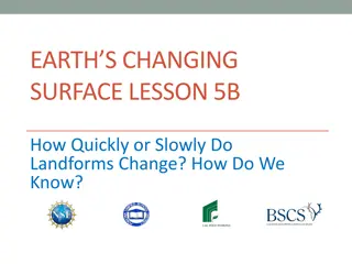
Understanding the Pace of Landform Changes
Exploring how landforms transform over time, this lesson delves into the speed at which geological features evolve. By comparing examples like the Grand Canyon and the Mississippi River delta, students learn how scientists collect data to determine the rate of change through measurements and photogr
5 views • 18 slides
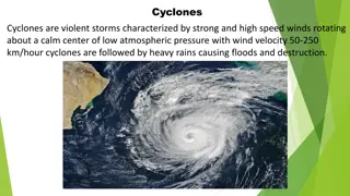
Understanding Cyclones and Tsunamis: Causes, Effects, and Management
Cyclones and tsunamis are natural disasters that can have devastating effects such as strong winds, heavy rains, floods, and destruction. Cyclones are violent storms with high-speed winds rotating around a calm center of low pressure, while tsunamis are seismic sea waves caused by earthquakes or und
0 views • 9 slides

Understanding Earthquakes: Causes, Effects, and Intensity Factors
Earthquakes are sudden shaking movements of the Earth's surface caused by various factors like tectonic plate movements, volcanic eruptions, mining, and construction. They result in ground shaking, rupture, tsunamis, and landslides, with intensity influenced by factors such as distance from the epic
0 views • 10 slides
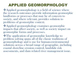
Understanding Applied Geomorphology and Its Importance in Society
Applied Geomorphology is a vital field of science focusing on how geomorphic landforms and processes impact society and vice versa. It provides solutions to problems such as coastal erosion, landslides, and river management. By applying geomorphic knowledge, scientists, engineers, and decision-maker
1 views • 7 slides
Understanding Mass Wasting: Geomorphic Processes and Causes
Mass wasting, a geomorphic process driven by gravity, involves the movement of soil, rocks, and debris downslope. Landslides are common triggers, caused by factors like erosion and gravitational pull. Different types of mass movements, from gradual creep to rapid landslides, shape the Earth's surfac
1 views • 32 slides
Eastern Mediterranean Centre for Oceanography and Limnology (EMCOL): Research Focus and Facilities
EMCOL, led by M. Namik A. Atay, focuses on natural hazards, environmental changes, and earthquake risk assessment. Their research fields include earthquakes, submarine landslides, tsunamis, sea-level changes, climate change, and paleoclimatology. The center conducts fieldwork using various equipment
0 views • 13 slides
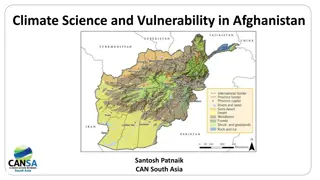
Climate Science and Vulnerability in Afghanistan
Afghanistan is facing significant climate change challenges, with increasing temperatures and changing precipitation patterns leading to droughts, floods, landslides, and other hazards. The extreme geography of Afghanistan exacerbates these impacts, with vulnerable communities experiencing devastati
0 views • 16 slides
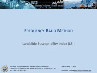
Understanding Landslide Susceptibility Using Frequency-Ratio Method
This informative content delves into the Frequency-Ratio Method for Landslide Susceptibility Index (LSI), supported by the National Science Foundation. It explains how Frequency-Ratio (FR) methods are used for analyzing landslide susceptibility, the mathematical calculations involved in determining
0 views • 15 slides
Early Warning System for Landslides in Sri Lanka
The National Building Research Organisation in Sri Lanka has implemented an Automated Rainfall Monitoring System to issue early warnings for landslides. The system consists of rain gauges installed in vulnerable districts, collecting real-time data and triggering alerts based on rainfall thresholds.
0 views • 12 slides
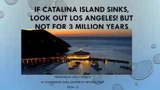
Potential Sinking of Catalina Island Raises Concerns for Los Angeles
Santa Catalina Island may be sinking, posing a future risk of a tsunami to the mainland. Scientists are studying the island's tilt and potential landslides to determine its geological changes. The presence of ancient fossils could confirm whether Catalina is sinking or rising, with implications for
0 views • 5 slides
Understanding Earthquakes: Causes, Effects, and Intensity Factors
Earthquakes are sudden shaking movements of the Earth's surface caused by various factors like volcanic eruptions, tectonic plate movements, mining, and construction. They result in ground shaking, ruptures, tsunamis, and landslides, with intensity affected by distance, depth, population density, ge
0 views • 10 slides