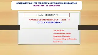
Understanding the Cycle of Erosion: Applied Geomorphology Perspective
The Cycle of Erosion model, developed by Davis in the 1880s, explores the process of landmass upliftment, river erosion, and landscape transformation. The Normal Cycle of Erosion focuses on fluvial processes as the primary geomorphic agent, leading to the formation of peneplains. This cycle progress
0 views • 23 slides
Insights into India: Geography and History
Discover the captivating blend of geography and history that defines India, from the ancient formation of the landmass to the diverse cultural and linguistic tapestry of the region. Uncover how geographical features have influenced human settlement patterns and shaped the course of history, highligh
0 views • 7 slides
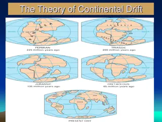
The Theory of Continental Drift and Wegener's Evidence Explained
The Theory of Continental Drift proposes that continents were once part of a single landmass known as Pangaea, which eventually broke apart and drifted to their current positions. Alfred Wegener provided evidence supporting this theory, including the fit of continents like puzzle pieces, fossil simi
0 views • 27 slides
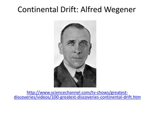
The Theory of Continental Drift: Alfred Wegener and Pangaea
Alfred Wegener proposed the theory of continental drift, suggesting that the continents were once part of a single landmass called Pangaea. Evidence such as fossils and rock formations on different continents supports this theory. The concept of plate tectonics further explains the movement of conti
0 views • 6 slides
The Fascinating Theory of Continental Drift Explored
In the early 1900s, Alfred Wegener introduced the groundbreaking hypothesis of continental drift, suggesting that the continents were once part of a single landmass before drifting apart to their current locations. This theory is supported by evidence such as the alignment of continents, shared foss
0 views • 25 slides
Geography of China: Territory and Administrative Units Overview
Explore the geography of China with a focus on its territory, provincial administrative units, and geographic location. Learn about the vast landmass, national borders, and key geographical features such as latitudes and coastal areas. This presentation serves as a foundational resource for understa
0 views • 16 slides
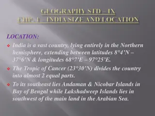
Geography and Boundaries of India
India, a vast country in the Northern hemisphere, is divided by the Tropic of Cancer into two almost equal parts. With an area of 3.28 million sq kms, it has a strategic central location connecting West Asia, Africa, Europe, and East Asia. India's landmass, with its diverse terrain and long coastlin
0 views • 7 slides