Understanding Hillslopes and Their Significance in Geomorphology
Hillslopes are angular inclinations of terrain between hilltops and valley bottoms, shaped by geological structures, climate, vegetation cover, and denudational processes. They are key geomorphic features in fluvial drainage basins, playing a crucial role in landscape formation and water/sediment tr
6 views • 22 slides
Engineering Considerations in Applied Geomorphology and Land Use Planning
Engineering works in geomorphology and land use planning involve evaluating geologic factors for projects like road construction in varied terrains such as karst regions, glacial terrains, and areas with considerable relief. Factors like soil composition, drainage, and topographic conditions play cr
2 views • 24 slides
Understanding Penck's Cycle of Erosion in Geomorphology
Walther Penck introduced an alternative model to Davisian cycle, emphasizing the interplay between upliftment and erosion rates in landscape formation. Penck's concept focuses on relative intensity of degradation processes, phase of upliftment, and rates of erosion, rejecting the idea of stages in l
2 views • 32 slides
Understanding Slope Development Theories by Walther Penck in Geomorphology
Explore the Slope Development Theories by Walther Penck in Geomorphology, focusing on concepts like Pendiplanation, Pedimentation, and the relation between endogenic and exogenic forces in shaping landscapes. Learn about the evolution of landforms and the criticism of the Davisian theory of Erosion
1 views • 28 slides
Understanding the Cycle of Erosion: Applied Geomorphology Perspective
The Cycle of Erosion model, developed by Davis in the 1880s, explores the process of landmass upliftment, river erosion, and landscape transformation. The Normal Cycle of Erosion focuses on fluvial processes as the primary geomorphic agent, leading to the formation of peneplains. This cycle progress
0 views • 23 slides
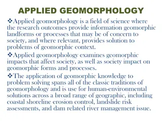
Understanding Applied Geomorphology and Its Importance in Society
Applied Geomorphology is a vital field of science focusing on how geomorphic landforms and processes impact society and vice versa. It provides solutions to problems such as coastal erosion, landslides, and river management. By applying geomorphic knowledge, scientists, engineers, and decision-maker
1 views • 7 slides
Understanding Applied Geomorphology for Sustainable Environmental Management
Applied geomorphology plays a crucial role in urban planning, natural hazard mapping, land use planning, and environmental management. By applying geomorphic knowledge, problems related to land occupancy, resource exploitation, and environmental planning can be analyzed and solved effectively. Geomo
0 views • 26 slides
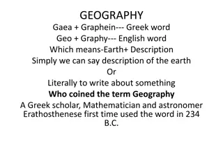
Understanding Geography: Earth's Description and Study
Geography, coined by Greek scholar Eratosthenes, encompasses the description and explanation of Earth's surface differentiation. It involves physical and human aspects, with branches like geomorphology, climatology, and economic geography. Physical geography studies the lithosphere, atmosphere, hydr
0 views • 6 slides
Slope Development Theories in Applied Geomorphology
Slopes are formed through different processes as described by Wood's slope development theories, such as the Four Unit Slope Model and the 9-Unit Slope Model. These models illustrate various manifestations of slope profiles based on factors like rock composition and water movement. Different slope t
0 views • 10 slides
Grade 12 Geography Examination Preparation: Paper Structure, Questions, and Cognitive Levels
Prepare for your Grade 12 Geography examination with insights into the paper structure, question types, and weighting of cognitive levels. Explore examples of questions on topics like settlement, climate, and geomorphology. Understand how to tackle different question types and improve your performan
0 views • 31 slides
Coastal Vulnerability Audit Tool (CVAT) for Curacao, Netherlands Antilles
This document outlines the stages of the Coastal Vulnerability Audit Tool (CVAT) for assessing the physical system and human system & engineering infrastructure of Curacao, Netherlands Antilles. It covers key aspects such as coastal setting, climatic and tectonic settings, topographic profile, coast
0 views • 10 slides
Educational Lesson on Bearings and Navigation for Students
Students will apply their knowledge of bearings to a real-world navigation scenario, including measuring and constructing bearings, and calculating distances using scale. The lesson is part of a series focused on Mysteries of the Deep Earth, specifically planning a research voyage to Australia's und
0 views • 21 slides
Fundamental Concepts of Geomorphology: Exploring Earth Forms and Evolution
Geomorphology, derived from Greek roots for earth and study, focuses on the origin and evolution of Earth's surface features. Geomorphologists study landforms above sea level and the interface between solid Earth, Hydrosphere, atmosphere, and Lithosphere. The fundamental concepts of geomorphology in
0 views • 12 slides
Understanding Physical Geography: Branches and Concepts Explored
Physical geography is a field that studies natural processes on Earth's surface, providing the backdrop for human activities. It encompasses various branches like geomorphology, climatology, oceanography, biogeography, soil geography, and environmental geography. Geomorphology investigates landforms
0 views • 10 slides
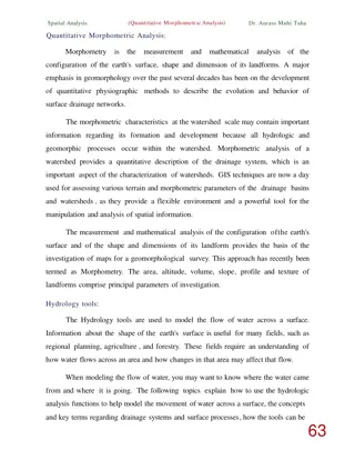
Quantitative Morphometric Analysis in Geomorphology
Quantitative morphometric analysis in geomorphology focuses on measuring and mathematically analyzing the earth's surface configuration and landform dimensions. It involves using GIS techniques to assess terrain parameters and drainage systems, providing valuable insights into watershed characterist
0 views • 8 slides
Ecological Consequences Assessment for Conservation Areas
Determining the ecological consequences of various scenarios is crucial for conservation efforts. The assessment focuses on changes in geomorphology, physico-chemical properties, fish populations, macroinvertebrates, and riparian vegetation. By evaluating scenarios based on ecological significance,
0 views • 11 slides
Formation of Lake Michigan Paleo-Shores and the Grand Kankakee Marsh
Lake Michigan's geomorphology and the development of paleo-shores, such as Glenwood Beach, Calumet Beach, and Toleston Beach, are discussed in detail, showcasing the impact of glacial retreat, drainage changes, and isostatic rebound on the formation of these ancient shorelines. The evolution of the
0 views • 8 slides
Comprehensive Overview of Oceanography
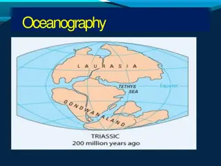
Oceanography is a fascinating and interdisciplinary scientific field that encompasses the study of seas and oceans. It covers topics such as geography, geology, chemistry, physics, biology, climatology, and engineering. Oceanography is subdivided into geological, physical, chemical, and biological b
0 views • 24 slides
