Map Projections: Types and Applications
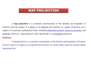
Map projection is a systematic transformation of latitudes and longitudes from a curved surface to a flat plane. There are various classifications based on construction methods, tangent surface position, view point of light, and qualities like equal area and equi-distance. Zenithal Polar Equidistanc
1 views • 9 slides
Geometric Constructions and Perpendicular Bisectors
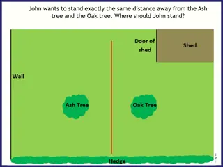
Explore geometric constructions involving equidistance, perpendicular bisectors, and circle drawing using compasses. Learn how to find the midpoint between two points, determine the path to stay equidistant from two objects, and construct perpendicular bisectors accurately. Enhance your understandin
3 views • 11 slides
concepts of equidistance and angle bisector in geometry
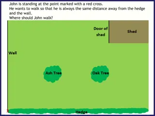
Explore the concepts of equidistance and angle bisectors in geometry through practical examples like determining the path for John to walk equidistant from a hedge and a wall, understanding the ideal flight path for a plane to land, constructing angle bisectors, and verifying constructions for accur
1 views • 23 slides
Coordinate Systems, Map Projections, and GIS Applications
Explore the intricacies of Geographic Coordinate Systems, Projected Coordinate Systems, and different types of map projections as part of the Remote Sensing and GIS Application course taught by Lecturer Ruba Yousif Hussain in the third year. Dive into the properties of map projections like conforman
2 views • 13 slides
Perpendicular and Angle Bisectors Theorems
Explore the Perpendicular and Angle Bisector Theorems through images and explanations. Understand the concepts of equidistance, distance from a point to a line, and the implications of these theorems in geometry problems.
0 views • 12 slides
Year 9 Loci: Exploring Points and Distances
Delve into the world of loci in mathematics with Year 9 students, understanding how to analyze sets of points based on certain conditions. Explore concepts such as equidistance, angle bisectors, and fixed distances, illustrated through engaging exercises with practical applications. Enhance your spa
0 views • 12 slides


