Understanding Global Distribution Patterns of Animals in Climatology and Biogeography
Studying the distribution patterns of animals globally involves complex factors such as environmental conditions, zonal patterns, and latitudinal influences. Animal distribution is influenced by factors like sunlight availability, vegetation diversity, and evolutionary origins. Different animal zone
3 views • 20 slides
Understanding Atmosphere Composition and Structure in Climatology
The study of climatology, focusing on the atmosphere, is presented by Dr. Banashree Saikia, covering topics such as atmospheric composition, insolation, temperature variations, atmospheric pressure, wind systems, atmospheric moisture, climatic classification, cyclones, and monsoons. The atmosphere,
1 views • 9 slides
Understanding Physical Climatology and Agrometeorology
Exploring the relationship between physical climatology and agrometeorology, this branch of meteorology delves into the effects of weather and climate on agriculture. Through studying processes occurring from soil depths to atmospheric levels, agricultural meteorologists play a crucial role in ensur
0 views • 8 slides
Understanding Geography: Earth's Description and Study
Geography, coined by Greek scholar Eratosthenes, encompasses the description and explanation of Earth's surface differentiation. It involves physical and human aspects, with branches like geomorphology, climatology, and economic geography. Physical geography studies the lithosphere, atmosphere, hydr
0 views • 6 slides
Overview of the COAWST Toolbox and its Components
The COAWST Toolbox is a suite of MATLAB tools, scripts, and functions that offers standard functionalities for creating grids, initial conditions, atmospheric forcing, boundary conditions, and climatology files for COAWST. It includes tools for creating tidal forcing files, and ROMS expects specific
0 views • 51 slides
Understanding Climate Classification Systems
Climatology explores the classification of climates based on vegetation distribution, average temperatures, precipitation patterns, and seasonal variations. This system categorizes climates into groups like tropical, dry, mild temperate, continental, and polar. Each group further delineates specific
0 views • 8 slides
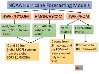
NOAA Hurricane Forecasting Models Overview
The NOAA hurricane forecasting models include HWRF, POM, HYCOM, HMON, covering regions like the Pacific, Indian Ocean, North Atlantic, and Gulf of Mexico. These models utilize a combination of climatology data, feature models, and real-time RTOFS inputs for initialization and forecasting. Various co
0 views • 14 slides
Understanding Physical Geography: Branches and Concepts Explored
Physical geography is a field that studies natural processes on Earth's surface, providing the backdrop for human activities. It encompasses various branches like geomorphology, climatology, oceanography, biogeography, soil geography, and environmental geography. Geomorphology investigates landforms
0 views • 10 slides
Understanding Climatology for Building Design: Essentials and Applications
Explore the fundamentals of climatology for designing sustainable and comfortable built environments. Learn about the influence of climate on architecture, elements of climate, thermal comfort, natural ventilation, site climate, day lighting, shading devices, and more. Delve into the study of weathe
0 views • 9 slides
Understanding Ecology: Interactions in the Environment
Ecology, originating from the Greek words "Oikos" and "Logos," is the study of interactions between living and non-living components in the environment. It encompasses the relationships between plants, animals, microorganisms, and abiotic factors like light, water, nutrients, and atmosphere. Studyin
0 views • 16 slides
Enhancing Disaster Preparedness with Indonesia's Seismic Monitoring Network
Indonesia's Digital Seismic Network, operated by the Indonesian Agency for Meteorology, Climatology, and Geophysics (BMKG), comprises 164 stations strategically located across the country. The network provides critical seismic data for the Seismic Integration System of InaTEWS, supporting real-time
0 views • 11 slides
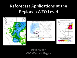
Enhancing Meteorological Forecasting Through Reforecast Applications: Challenges and Solutions
Reforecast applications at the regional/WFO level provide crucial benefits in improving model forecast accuracy and reliability, particularly for challenges like resolution in complex terrains, climatology in desert regions, and addressing model biases. Challenges include resolution limitations in m
0 views • 7 slides
Statistical Modelling of Thunderstorms in Present and Future Climates
Workshop on Severe Convection and Climate at Columbia University discussed modelling thunderstorm climatology in Europe using reanalysis data and predicting future climate changes. Lightning observations, additive logistic regression, and probability analysis in different parameter spaces were explo
0 views • 21 slides
Comprehensive Overview of Oceanography
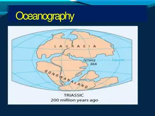
Oceanography is a fascinating and interdisciplinary scientific field that encompasses the study of seas and oceans. It covers topics such as geography, geology, chemistry, physics, biology, climatology, and engineering. Oceanography is subdivided into geological, physical, chemical, and biological b
0 views • 24 slides

