The Good Samaritan 2022 Android Project for Locating People at Risk and Lost Pets
This Android project utilizes Bluetooth Low Energy beacons to aid in finding people at risk and lost pets. Users can detect these beacons with their phones, store their locations, and later report the information if needed, all while prioritizing privacy and data security. The project structure involves beacon technology, an Android application, and Google Firebase for data storage. Interaction with cloud components and various application screens enhance user experience and functionality.
Uploaded on Oct 04, 2024 | 1 Views
Download Presentation

Please find below an Image/Link to download the presentation.
The content on the website is provided AS IS for your information and personal use only. It may not be sold, licensed, or shared on other websites without obtaining consent from the author.If you encounter any issues during the download, it is possible that the publisher has removed the file from their server.
You are allowed to download the files provided on this website for personal or commercial use, subject to the condition that they are used lawfully. All files are the property of their respective owners.
The content on the website is provided AS IS for your information and personal use only. It may not be sold, licensed, or shared on other websites without obtaining consent from the author.
E N D
Presentation Transcript
Android two-semestrial project The Good Samaritan 2022 Project Manager Project Instructor Developers Meir Hayman Eran Katzav Guy Geller Alexey Kim Andrew Shneiderman
Introduction This project aims to assist in finding people at risk and lost pets. In this project we re using Bluetooth Low Energy beacons that transmit heartbeat impulses, which are then detected by nearby phones with our application installed. The phones are then able to store the location of the beacon and later report where the beacon was located if needed. Such crowdsourcing method will allow covering vast populated areas relatively cheaply and provide accurate location information on nearby beacons.
Privacy concerns In this project there are major implications for the privacy of both the people who would like to help, and in case where the beacon is placed on a person who might get lost their privacy and safety. For this reason we chose to keep the minimum amount of information in the cloud and instead most of the information is stored locally on the phones and only transmitted when needed. This also helps reduce the power (and cost) needed in the cloud solution and provides less risk of a data leak to hurt privacy of the users.
Project structure The project uses the beacon provided by ERM Advanced Telematics, this beacon is powered by 3V lithium battery which transmits a heartbeat pulse detected in approximately 10 meter radius. Our team has built an android application which can then detect these beacons (and several other beacon products) using the Bluetooth API, and use the phone s location information to estimate the beacon s location. The project uses Google Firebase, which is a cloud solution for storing data in the project: Which beacons are currently sought after For beacons which are currently searched for we store the time + location information
Interaction with cloud components Beacon Google Cloud Passerby Phone Firestore Internet Firebase Links Phone Looking for beacon
Application screens flow Main Locate Connect new tag Tag Details QR scanner Share Expiry selection
Main Screen This is the main application screen. The user will be able to see his registered tags here; battery status, distance, alias and icon for each tag. The switch at the bottom allows turning off scanning to save battery. Clicking on each tag navigates to tag details screen. Clicking on Add tag will navigate to screen that allows adding a new tag.
Connect New Tag Screen This is the screen that allows connecting to new tags. The main area in this screen lists the tags detected nearby. Clicking on one of the tags will add it to the application and navigate to tag details screen to allow editing or taking a photo for icon. Scan QR Code button will navigate to the QR scanner screen.
Tag Details Screen This screen allows looking at tag details and modify the tag. The user is able to see and modify the tag s name. The screen lists a few details such as distance to tag if available, battery status and MAC address. Clicking the photo will allow taking a new photo for the tag s icon. Reset battery estimate button will reset the battery status stored in the application, this can be done by the user at battery replacement to allow rough estimate of battery remaining. Locate button will navigate to screen that allows looking at a map of tag past locations. Share button will allow sharing the tag information to another device via QR code or a URL.
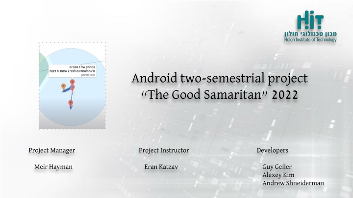
Tag Locate Screen This screen will allow to see a map of past tag positions. Each location will be marked by a marker that denotes position and clicking such marker will show the details - how far away it is and when was it seen at that position. Clicking on Navigate to marker will allow selecting one of the popular navigation applications for navigating to that location. Clicking the + button will expand a few buttons to ease viewfinding on the tags - moving the map s camera to first/last positions, your own location, zooming out to show them. Also inside the + is the option to set custom notification text, if a device spots that tag the application on that device will show this notification text to the user, for example asking to call a number or call for help locating the tag.
QR Scanner Screen This QR scanner screen will allow a user to scan a QR code generated by another application to share tags. This should be useful when two users are nearby and able to see each other s devices, then one of the devices opens the Share screen, and the other scans the QR code using this screen. If a valid QR code is detected the tag is automatically added and the application navigates to the tag details screen.
Share Screen This screen is part of the flow to share a tag. The duration here will allow limiting the tag s lifetime on other devices. This is useful for example when sharing the tag to other devices, but limiting the duration of the tag to the search, so picking 48 hours will then make the application on other devices to delete this tag 48 hours after generating the QR code or URL.
Expiry Selection Screen This is the main application screen. The user will be able to see his registered tags here; battery status, distance, alias and icon for each tag. The switch at the bottom allows turning off scanning to save battery. Clicking on each tag navigates to tag details screen. Clicking on Add tag will navigate to screen that allows adding a new tag.
Architecture Overview We used popular design patterns - MVVM and Repository to clean up the code. UI fragments are observing LiveData where applicable. Repository centralizes access to various storage technologies and they re easily replaceable if need arises. We use Firebase and Firebase Links to store data in the cloud, and Room (SQLite) to store data locally on the device.
Database structure (Android Room) Room is a library that offers convenient syntax for accessing a local SQLite database. Our application uses it to store data about tags and their locations locally. TagEntity - this table stores unique identifier as MAC address, description the user added, address for the picture taken, dates, last locations the beacon was found and the distance from them. It also stores battery status so the application can estimate when the battery should be replaced. Lastly we store expiry date for the beacon, this is selected by tag owner when the tag shared via link/QR and used to delete the token from non- owner devices once it expires.
Database structure (Android Room) cont. TagPingLocal - This table contains location and date/time of beacon detections. Only beacons listed in TagsSearch Firestore collection (this collection represents which tags are currently searched for), the data from this local database is sent to the cloud. We can then use this data to build a route the tag has been travelling over time on a map.
Database structure (Google Firestore) Firestore contains two collections: TagsSearch - this collection stores MAC addresses for all beacons which are currently sought after. Phones query this information and use it to only upload the beacon information for beacons that are currently sought after. The data elements in this collection are a timestamp and a MAC address, once the search is stale (a week old) the search is considered finished, unless requested again.
Database structure (Google Firestore) cont. TagsPing - This is the main collection which contains information about beacon location. It contains information such as timestamp, location and MAC address. When a user wants to see a beacon s route it queries this collection for particular MAC address and receives multiple positions and timestamps which can then be used to build a route and estimate the area for searching.
Sharing beacon information To locate a beacon a request is made to Google Firebase based on the beacon s broadcasted MAC address. To share this beacon contact we chose to use QR code generator and scanner in our app instead of user accounts, so that family members or anyone that s available to search can share information about beacons, this works similar to sharing a contact via QR code. This both reduces complexity, privacy concerns and provides the most proof of ownership as this requires fairly close contact with the beacon.
