LAND DEGRADATION AND SUSTAINABLE LIVELIHOODS
The study focuses on the sustainable management of land resources in the Northwest region of Tunisia, examining the impacts of socio-economic factors on land degradation and livelihood strategies. By evaluating the dynamics of various exposures, sensitivities, and adaptive measures within households, the research aims to identify pathways for sustainable development and natural resource conservation. The case study of Wadi Beja sheds light on agricultural practices, biodiversity, and environmental challenges faced by local communities, offering insights for enhancing livelihoods and land management in the Mediterranean context.

Download Presentation

Please find below an Image/Link to download the presentation.
The content on the website is provided AS IS for your information and personal use only. It may not be sold, licensed, or shared on other websites without obtaining consent from the author.If you encounter any issues during the download, it is possible that the publisher has removed the file from their server.
You are allowed to download the files provided on this website for personal or commercial use, subject to the condition that they are used lawfully. All files are the property of their respective owners.
The content on the website is provided AS IS for your information and personal use only. It may not be sold, licensed, or shared on other websites without obtaining consent from the author.
E N D
Presentation Transcript
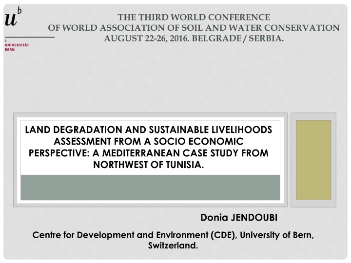
THE THIRD WORLD CONFERENCE OF WORLD ASSOCIATION OF SOIL AND WATER CONSERVATION AUGUST 22-26, 2016. BELGRADE / SERBIA. LAND DEGRADATION AND SUSTAINABLE LIVELIHOODS ASSESSMENT FROM A SOCIO ECONOMIC PERSPECTIVE: A MEDITERRANEAN CASE STUDY FROM NORTHWEST OF TUNISIA. Donia JENDOUBI Centre for Development and Environment (CDE), University of Bern, Switzerland.
INTRODUCTION The northwest region of Tunisia poses the biggest Tunisian regional paradox: this agricultural area deemed one of the most privileged and the richest of Tunisia; - The area contains the largest dams in the country mobilizing almost 82 % of surface water resources (rainfall exceeding 1000 m3 / year and snow water falling in Mountain areas. ). - The area has the largest forest areas of the country with 50.5% of the total forests. - > 75 % presents the Cereal LUS, which is the strategic sector in the Tunisian Agriculture. is also the poorest human region relative to other regions of Tunisia: - The highest poverty and unemployment rates in the country. - Difficult agricultural and deterioration of natural resources (DG/ACTA, 2007) environmental conditions and
PROBLEMATIC To adapt to these conditions, people have adopted some practices and strategies such as agricultural intensification, livelihood diversification, and agricultural biodiversity. The Tunisian Northwest stills the most repulsive region of the country despite the development efforts undertaken within the last decades. The development issue is thus expressed in terms of natural resources management and improvement of living standards and income of the population to ensure a sustainable development of the region in harmony with the rest of the country.
GOALS In order to identify the options of sustainable land management, an assessment of the involvement of people in the phenomena of land degradation seems necessary. The research outcome is to apply an analytical framework that promotes a better recognition of the dynamic interaction of various exposures, sensitivities and adaptive strategies followed by households in a typical case study from Northwest of Tunisia.
MATERIALS & METHODS Case study: The watershed of Wadi Beja located in south of the delegation of Beja South, Governorate Beja, Northwest of Tunisia. is This agro-ecological zone covers an area of about 33766 ha and it is one of the most agriculturally productive areas in Northwest of Tunisia, with favorable soil and climatic conditions. Figure 1. Geographical location of Watershed of Wadi Beja, Northwest of Tunisia
MATERIALS & METHODS 5 % Agriculture is the main economic sector, and it includes both crop and livestock production. Agriculture 19 % Livestock 34 % Salary 21 % Small trades 21 % others Figure 2. Sources of income of the households in wadi Beja region, Source: INS, 2014 Agriculture remains the main source of household income, as 55 % of income is from agricultural activity in general. 78 % of rural households live entirely from their farms. There are 3 types of farming systems: Extensive (83 %), intensive (6 %) and mixed (11 %). The field crops is the most dominant LUS, which represent 71% of the area. Most soils are threatened by water erosion, which is trained by land topography, 64 % of soils with high to steep slope and 36 % of soil with moderate slope.
MATERIALS & METHODS The adopted research approach: (1) preparation phase, (2) analytical framework, (3) land degradation and SLM analysis.
MATERIALS & METHODS Preparation phase In this phase and in order to identify the range of households and stakeholders that should be involved in this exercise, a focus group discussion involving households, local leaders and reference people such as local coordinators, is organized. This group is intended to identify general characteristics relating to livelihoods. In order to define wealth strata, the households are stratified according to their wealth ranking through their access to the different assets (human, natural, physical, financial and social). In this regard, matrix scoring is applied to establish a wealth-ranking system. Three categories are detected, translated as better-off , average , and poor . As a result, 28 % of households are assigned to the better-off category, 34 % to the average category, and 39 % to the poor category.
MATERIALS & METHODS Analytical framework The second phase consisted of four analytical combined steps: (1) Analysis of the causes of vulnerability, (2) Situation of livelihoods, (3) Analysis of livelihoods strategies, (4) Drawing the analytical framework from analysis.
MATERIALS & METHODS Figure 3. Sustainable livelihoods framework (adapted from Carney et al. 1999)
MATERIALS & METHODS Land degradation and SLM perception analysis : At the end of each interview, we proceed to ask about land degradation and sustainable land management to define their perception vis- -vis of this context. Through the analysis of the perception of each category of households regarding land degradation and sustainable land management, we can locate them in both thematic contexts.
MATERIALS & METHODS Figure 4. Analytical framework for assessing livelihoods in Wadi Beja agro- ecosystem (adapted from Turner et al. 2003)
RESULTS & DISCUSSIONS Table 1. Socio-professional categories of the household members (in %) Categories Farmer Agricultural workers Total Small trades EmploymentStudents Unemployed Numbers 31.9 7.7 4.4 41.8 8.8 5.5 39.6 ? According to the distribution of the different socio-professional categories of the household members, there is a high dependence of households in front of the results of their livelihood strategies. Giving to the regional statistics, high pressures on rural landscapes as 58 % of rural households live entirely from their farms and 51 % of farms are exploited at least by one household.
RESULTS & DISCUSSIONS Table 2. Distribution of farms by household size in % Size classes (ha) 0- 5 5-10 10-2020-50 >50 Surveyed households27,75 22,2 16,6 27,7 ? A high fragmentation of land tenure was shown from table 2, as around 55% of surveyed households own small farm that covers an area less than 20 ha.
RESULTS & DISCUSSIONS Table 3. Distribution of livestock per household size Size classes (heads) 0 20 20 40 >40 Livestock size 55,5 5,5 38,8 604 heads Households (%) ? The cattle herd is further divided into smaller lots which majority is owned by small farmers with small farms. Farmers with less than 50 hectares occupy 72 % of usable land and own 91 % of the total cattle. Pastoralists who have 1 to 20 heads occupy 62 % of the study area. As a result, livestock density is generally higher per unit of surface of land use, therefore rangelands are overgrazed.
RESULTS & DISCUSSIONS Physical capital 12.0 10.0 8.0 6.0 4.0 Social capital Financial capital 2.0 0.0 Human capital Natural capital Figure 5. Pentagon average of household capitals The human, natural and social capitals are quite developed due to their availability and accessibility for all households. This accessibility is related to the demographic change, the fragmented character of land tenure and the strong socio-cultural values.
The carried vulnerability analysis takes into account a focus on the differences in socio-economic groups for their basic resources (assets), livelihoods strategies and their standard of living. Livelihoods assets and vulnerability analysis Livelihood group called better-off households; represents households with higher scores, good access levels to capital assets in general. Physical capital an almost balanced structure. A pretty good combination of activities and choices made by this households group but also a change in land use (Intensification). 10 8 6 Financial capital 4 Social capital 2 0 better-off households Human capital Naturel capital Figure 6. Pentagon means of better-off households Through the pentagon, a consolidation of physical and natural assets was observed. Financial asset is maintained due to the functioning of the institutional context (credits and grants). That means also that this group holds goods and resources that allow dealing with the shocks, hazards and vulnerability of long-term trends and also a strong involvement in new modes of production and land use.
Livelihood group called average households; this group represents households with low average scores, unequal levels of capitals accessibility in general The average households has an unbalanced structure; with a distortion to the social, human natural assets. pentagon of Physical capital 8.0 7.0 6.0 5.0 4.0 3.0 Social capital Financial capital 2.0 1.0 Average households 0.0 and Human capital Naturel capital Figure 7. Pentagon means of average households This household category adapts their strategies through following a mixed production mode with predominance of extensive pastoral mode focused on the natural resources use (grazing lands). A relative weakness of financial assets can be explained on the way that there is no significant involvement in the new land use strategies and no diversification in term of incomes available for the household. This situation led the average households to work as members of staff, shopkeepers, and labor for others The livelihoods strategies are a bit coherent and precarious due to the under use of other assets.
Livelihood group called poor households; this group represents households with very low averages scores, low to very low accessibility levels to physical, financial and natural assets, Physical capital The pentagon of poor households has a definitely structure, with a strong distortion towards human capitals. Based on this situation, poor households vulnerable to external shocks and long-term trend factors than rich and average households, 8.0 unbalanced 6.0 4.0 Financial capital Social capital and social 2.0 Poor households 0.0 are more Human capital Naturel capital Figure 8. Pentagon means of poor households firstly because they have no control over these factors (pseudo balance) and then because they have few resources / assets. This situation characterizes an extensive pastoral mode of production focused mainly on the use of human and natural resources. The financial and physical assets remained low; households do not have the capacity to develop relevant livelihood strategies. This underlies that these households will maintain pressure on the fragile resources of their environment and they will continue to suffer from more vulnerability constraints and also from a low relational capital.
As an adaptation to this vulnerable situation, some of poor households uses to hire and sell their lands, migrate and working as bricklayers and laborers for others. Discussion It appears from the findings of this analysis that the available possibilities to poor households to exit or reduce their vulnerability are restricted. One of the developed strategies by these households is the overuse of natural capital. These households are evolving in an uncertain environment that may challenge their situation at any time. They live in an environment where their activities are subject to various constraints. Here we can say that these households are disconnected from developments modes and production connections and this disconnection is explained by two factors: subjective factors related to the lack of dynamism of these households (poverty, low education levels ) and objective factors relating to the non-adequacy between the motivation of the government change and the severity of the structures and institutions responsible for implementation.
Household perceptions of land degradation and sustainable land management : A very limited perception of land degradation, which is always attributed to natural factors (rain, wind, and drought). The imperceptible signs of land degradation such as the loss of fertility and soil productive potential are not recognized. Only the visible and spectacular signs are recognized, as ravines, badlands... In general, households make no connection between their management practices and land degradation and therefore fail to understand the economic significance of this degradation in terms of impact on the current and future ecosystems productivity. In this case, the non-awareness of the importance of sustainable land management is not necessarily related to the level of household wealth or their poverty as even rich households do not manage sustainably their lands and do not invest in the sustainable land management despite they have access to credit and subsidies.
CONCLUSION According to the obtained interpretations, we affirm that the situation reveals the centralist practices of decision-making in term of resources planning and the lack and / or weakness of the associative tissue and supervision and outreach structures at the local scale. Obviously the disconnection between perception levels of environmental issues and current practices of making decisions do not create the suitable conditions for sustainable resource management.
To this end, it is strongly recommended to change sectorial unilateral approaches, by global participatory approaches, which focus on rural households as focal points for better understanding the socio-economic realities and analyze their current livelihoods strategies related to resources management. This is only in this way we hope to seriously involve households in the processes of making decision and sustainable land management. With this combination of exposure-sensitivity-resilience system, under land degradation and sustainable land management context, this study can contribute to better recognition of the dynamic interaction of various exposures, sensitivities and adaptive strategies over time in term of sustainability.