Challenges and Opportunities in Nepal's Road Development
Nepal faces significant challenges in developing its road network due to its rugged geography. The Himalayan range in the north and frequent river course changes in the lowlands pose obstacles. Weather conditions, especially during the monsoon season, further hinder road usability. Despite these challenges, efforts are being made to improve road infrastructure to better connect cities, towns, and villages in Nepal.
Download Presentation

Please find below an Image/Link to download the presentation.
The content on the website is provided AS IS for your information and personal use only. It may not be sold, licensed, or shared on other websites without obtaining consent from the author.If you encounter any issues during the download, it is possible that the publisher has removed the file from their server.
You are allowed to download the files provided on this website for personal or commercial use, subject to the condition that they are used lawfully. All files are the property of their respective owners.
The content on the website is provided AS IS for your information and personal use only. It may not be sold, licensed, or shared on other websites without obtaining consent from the author.
E N D
Presentation Transcript
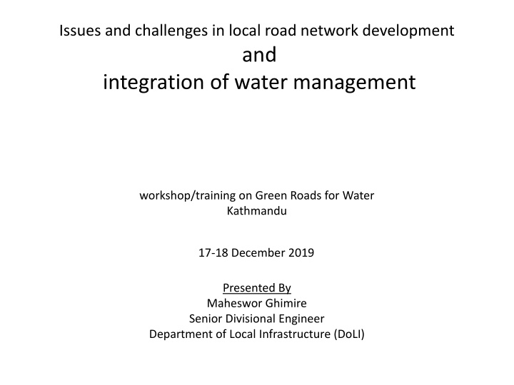
Issues and challenges in local road network development and integration of water management workshop/training on Green Roads for Water Kathmandu 17-18 December 2019 Presented By Maheswor Ghimire Senior Divisional Engineer Department of Local Infrastructure (DoLI)
Road development and Geography Nepal s geography poses a significant barrier for the country s aim to improve transport. The Himalayan range lies in the north of the country, including 8 of the world s 10 highest mountains, and these present huge physical obstacles.
Contd.. In the southern lowland plains of the country, rivers descending from the mountains change course frequently, presenting another challenge. Meanwhile Nepal s Hill Region includes altitudes ranging from 800-4000 m itself providing difficulties for road builders.
Contd.. As a result of the technical issues resulting from the country s geography as well as a shortage of construction machinery, building roads between cities, towns and villages in Nepal can be an expensive and almost painfully slow process
Weather and Roads Water flow rates can be enormous due to run-off from mountain glaciers, becoming worse still during the monsoon season due to intense bursts of heavy rainfall. 80% rainfall within 4 months (average 1600mm) Varies by eco-climatic zones(Pokhara3345mm,Mustang 300mm) More than 6000 watercoarses Of the existing roads (surfaced and unsurfaced), up to 60% become unusable during the monsoon season and that includes most of the rural road connections.
Nepal Road Networks (2 AH,4EWH,8NSCH)
Classification of Nepal Roads Strategic road network (SRN) Local road network (LRN)
Road Density Road building started to gain momentum in Nepal with the advent of multiparty democracy in the early 1990s, intensified further after the Maoist insurgency ended in 2006 and continues to be one of the country s main priorities 13.7 km per 100 km2 in 1998 (Lowest in the world) By 2016, it had increased to 49.6 km per 100 km2 and continues to increase at a very rapid pace Increase in LRN 1200%
Issues in Nepal Roads Nepal s roads are in a treacherous state, subject to frequent rock fall, landslides and accidents main causes of road accidents is road design, including very steep gradients, lack of safety features and poor road conditions. Local road construction or so-called dozer roads are most often initiated and constructed by bulldozer owners in collaboration with politicians without basic gradients and drainage
Contd.. Dozer roads are usually constructed or upgraded during the dry season During the monsoon, road segments are frequently washed out because a majority of these roads lack proper engineering (WB-GON, 2013). Road failures are cleared up at high cost after the monsoon and the failure-and-clearance process is repeated for years until there is no loose soil to block roads (Leibundgut et al., 2016).
Contd.. Such rapid and ineffective road construction throughout the country, but particularly in the middle hill and mountain areas, is placing increasing pressure on fragile ecosystems, wasting government resources, and increasing risk to road passengers and roadside dwellers (DOR, 2013a; Singh, 2018).
Contd.. Roads in Nepal at a new crossroads greatest anthropogenic drivers of environmental degradation, erosion and landslides in Nepal This situation is worsening due to the intensifying rainfall during the monsoon, largely attributed to climate change (Petley et al., 2007; Bharti et al) possibility of an earthquake of even greater magnitude than the 2015 Gorkha earthquake.
Roads Legisliative Plans 20 years Masterpaln, DTMP, MTMP,PTMP Acts Public roads acts 2031 Policy 2hours walking distance to get public vehicles Standrads NRS2070, NRRS2071 New Responsibilities R/MCs, DoLI, DoR, Province govt
Real Scenario Local governments are not following require proper road engineering practices, various levels of environmental assessments and approval greater emphasis on regular maintenance of roads,
As results in built roads Category Potential Problem Appropriate environmental mitigation measures -landslides or other forms of mass instability on the slopes -development of erosion or gullying. -Avoid such sites at the time of alignment selection -Use of simple retaining structures and bio-engineering -Minimize earthwork in rainy season -Measures to avoid undercutting of slope toes -No quarrying in river beds, where increased flood discharge velocity could give rise to subsequent damage -Provide slope protection measures.i.e. check dams and bio-engineering works as necessary Slope stability -spoil tipped away from designated areas -spoil falling or being wasted on to farmlands -Minimize spoil by cut and fill operations wherever required -Identify safe tipping and enforce best practice like compaction, grading and provide drainage -Construct spoils traps, provide drainage or compensate land owner. -Check dams and other measures as necessary, constructing cascades, as long as necessary Spoil disposal Water management -scour and erosion below unprotected drainage outfalls
Contd.. -loss of forest land -large numbers of trees being removed - wildlife disturbance -Avoid forest areas while selecting route -Strengthen and support Community Forest User Groups (CFUGs) -Afforestation in nearby degraded area/protect the affected forest -Replant wherever trees have been cut down and wherever land is available, using the same species as possible and -Avoid damage to wildlife habitats, habitats recreated on marginal roadside land and prohibit hunting -Site away from settlements -Quarries made safe by re-grading slopes and installing -structures as necessary -Quarry and burrow areas rehabilitated to productive plantations using bioengineering techniques. Forests, plants and wildlife - pollution and disturbance from quarry operations - safety risks from borrow pits and abandoned quarries - land seriously disturbed or lost from production - disruption to irrigation canal, water, supply lines, trail and bridges Quarries and borrow pits -Measures to resolve these problems incorporated into project works -Inventory of affected infrastructures -Relocate affected infrastructure facilities and compensate for relocation cost Community Infrastructures
Contd.. -dust generated from construction works or by traffic. -dust from earthen road -Speed controlled by speed bumps. If water is available, the road surface can be sprayed on a frequent schedule -Permanent speed bumps installed in villages and bazaars to reduce traffic speeds in inhabited areas. -Bitumen surface constructed in bazaars with speed controls -Planting roadside vegetation Dust and noise -degradation or loss of local worship sites, or graveyard/ burial ground -loss or degradation of private houses and agricultural land -project work excluding local people -Avoid during centre line fixing, -Facilitate local consultation for a justifiable and agreeable negotiation, pay compensation -Designs incorporate methods within the skills of local people -Use local labor wherever possible, training to local people -Check that camps are not polluting neighbors from sewerage and rubbish disposal -Kerosene stoves and kerosene provided to labors -checks to ensure camp areas are fully restored, including re-top soiling and planting where necessary. Social and cultural issues -pollution from work and labor camps -cutting trees for fire hood -damaged land after construction
Why are Result & Impact Indicators Needed? To better understand the positive/negative results of road. The main questions are: 1. What change is needed? 2. For whom? 3. How to measure this change?
Common Indicator of Success May 2018 Road board training Surkhet 24
Examples - Real Indicators of Success Educati on Other Factors Trade Kilometres of Road Time two kids playing doctor GIF Animation Health Jobs/Prof its Cost Environme nt Poverty May 2018 Road board training Surkhet 25
Intervention Logic Specific Impacts Global Impacts Output Clusters Results (Outcomes) Intermediate Impacts Lower Road Transport Time Greater Economic Accessibility Improved Conditions for Economic Growth Infrastructure (construction/ maintenance) Lower Road Transport Costs Greater Accessibility to Social Services Economic Growth Improved Institutional Management of Road System Institutional Reform Poverty Reduction SDG Increased Employment Economic Social Environmental Impacts of Roads Minimised SDG Development Environment Enhanced Human Capacity Enhanced Safety & Health Linked to Roads Social SDG
ISSUES OF TRANSPORT AND ECONOMIC DEVELOPMENT Transport is the Infrastructure of Infrastructures Transport Investment 4%-8% of GDP in most of the countries (Mody, World Bank, 1997). Strategic Road Network (SRN) 1.2% of GDP in 2007/8 increased to 2.3% in 2011/12(GON, 2013). Transport and Macroeconomic Impact Development of Low-carbon Transport System.
Integration of water mgmt in road Design (Peak)discharge Calculation Less precipitation measurement stations. Few flood mesurements gauge in streams and rivers. Chezy s formulla Q = C i A i = rainfall intensity (in/hr) for a critical time period, tc A = drainage area (acres). The runoff coefficient, C
Contd.. Manning's formula Q = n-1 A R2/3 S1/2 where: Q = discharge (m3/s) A = cross sectional area of the stream (m ) R = hydraulic radius (m), (area/wetted perimeter of the channel) S = slope of the water surface n = roughness coefficient of the channel.
Design of roadside and Cross drainage Structures Frequently used type designs Ignored critical depths and freeboard Sediment loads are overlooked (check dams, d/s protection structures) Not considered min and max. velocities Off road drainage facilities (French drains) Improvements of natural drainages Uses of drain out waters (agricultural fields, water mills)
Contd.. Types of camber Minimum gradients Shoulder materials Smooth transition of carriageway drainage from shoulders to side drain Formation levels of roads in inundation areas Choice of pavements materials
Construction Design slope Workmanship Hairpin bends Cascades principles in series of loops Long ways to carry discharges
Dewatering elements : Cross fall Road shoulders Impermeable road surface materials A typical drainage system consists Outlet ditches Side ditches Culverts Inner/outer slopes Road structures Underdrains
Operations and maintenance Length Workers Road Maintenance Groups (RMG) Performance based contracts Routine, Recurrent, periodic maintenance Rehabilitation
Conclusion There are possibilities of new economic opportunities, ultimately reducing economic vulnerability. However,Local roads, especially when poorly constructed, present particular challenges to sustainability, risk and governance Finally, the issue of poorly designed and risk-filled roads in Nepal is a political rather than technical issue. As Nepal moves towards greater constitutionlization of Federialism power, there is considerable opportunity for its local, province and national administrations to turn the tide toward safer and more sustainable road development.
Driving vehicles on wet road surface can easily damage the road! The furrows made by motor tyres should immediately be filled up.
A landslide on the road surface that needs to be immediately cleared. clearing a landslide act as a preventive The small landslides remaining after measure against other landslides. Things to Remember
Damaged shoulders that call for recurrent repair and maintenance
Thanks Any Quarries
