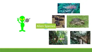
Addressing Invasive Plant Species in California
Executive Director Doug Johnson of Cal-IPC discusses the challenge of 200 invasive plant species across California's vast land, requiring spatial prioritization for eradication and containment. The solution involves aggregating digital datasets, collecting expert knowledge, assessing priorities based on distribution, and using range modeling to predict spread. Funding sources and strategies for utilizing phone apps, email alerts, prioritization, management tracking, and more are also outlined.

Download Presentation

Please find below an Image/Link to download the presentation.
The content on the website is provided AS IS for your information and personal use only. It may not be sold, licensed, or shared on other websites without obtaining consent from the author.If you encounter any issues during the download, it is possible that the publisher has removed the file from their server.
You are allowed to download the files provided on this website for personal or commercial use, subject to the condition that they are used lawfully. All files are the property of their respective owners.
The content on the website is provided AS IS for your information and personal use only. It may not be sold, licensed, or shared on other websites without obtaining consent from the author.
E N D
Presentation Transcript
Wildlife Agriculture Recreation Water Infrastructure Fire
Diseases Rangeland weeds Animal pests Mussels Aquatic weeds Forest pests
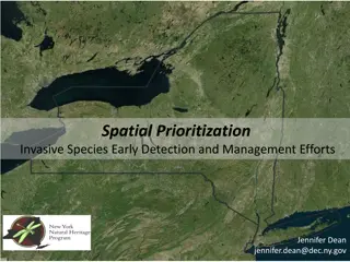
The challenge: 200 invasive plant species Entire state of California (100 million acres) Need spatial prioritization for early eradication and strategic containment
The solution: Aggregate all existing digital datasets Collect expert knowledge to fill in the gaps Assess priorities based on distribution Add range modeling to anticipate spread
$400K (state) $300K (federal) $150K (foundation) $100K (federal) $75K (federal) $25K (state) $400K (state) $90K (federal) $400K (state) $25K (state)
Phone apps Email alerts Priori- tization Mgmt tracking WY WA SD OR NV NM ND MT ID CO CA plus ODA models weed habitat suitability.
14 12 10 8 6 4 2 0 Critically important Moderately important Not important


")